Murray River Camping South Australia – Top River Camps And Tips
Murray River Camping South Australia – Top River Camps And Tips
Discover Murray River camping in South Australia, with details on popular riverfront camps, free sites, caravan parks, booking rules, and what to expect for facilities and fishing.
Murray River camping in South Australia runs along the border strip from Renmark up to the South Australian side of the river near Morgan and beyond. Campers can choose between town‑based caravan parks, riverfront recreation reserves, and remote bush camps. Sites often lean towards basic facilities so self containment is common.
Table Of Contents
- Murray River Camping South Australia
- Where To Camp In South Australia
- Free And Low Cost Riverfront Camps
- Caravan Parks On The South Australian Murray
- Key Comparison Types For Murray River Camping South Australia
- What To Expect For Facilities And Fees When Murray River Camping South Australia
- Practical Tips For Murray River Camping South Australia
- Choosing The Right Camp For Your Style
- Frequently Asked Questions About Murray River Camping South Australia
- Which South Australian Murray River camps allow caravans?
- Are South Australian Murray River camps pet friendly?
- Do most South Australian Murray River camps have power points?
- How far are the camps from town shops and services?
- How much do Murray River camps in South Australia cost?
- Can I fish at Murray River camps in South Australia?
Murray River Camping South Australia
Murray River camping in South Australia covers a long stretch of river between towns such as Renmark, Berri, Loxton, and Morgan. The river here feels more open and remote than the crowded stretches near Albury or Echuca which suits caravanners who want space and quiet.
Most South Australian river camps sit on the east side of the river, opposite New South Wales or Victoria. You can drive into town for fuel, fresh food, and medical services, then head back to a river camp that feels more like bush camping. The river banks are usually lined with red gums, regrowth, and some open grassy areas suitable for caravans and motorhomes.
Murray River Camping South Australia
Where To Camp In South Australia
Renmark is one of the main hubs for Murray River camping in South Australia. The town has several caravan parks and recreation areas that back right onto the river. These sites mix basic amenity blocks, powered sites, and some riverfront unpowered spots. Campers can walk to town shops or drive into town for a short errand and then return to the river.
Further along, Berri and Loxton each have at least one main riverfront caravan park plus nearby recreation reserves. Berri’s parks suit families and older travellers, while Loxton’s sites work well for caravans and motorhomes that need a bit of level space. Some sites book out in peak season, so checking availability early makes sense.
North of Adelaide, Morgan sits on the river’s south bank and offers a more remote feel. The town is small, but its riverfront reserves and nearby bush tracks suit campervans and swag campers. You can still find basic services, but you should plan for self‑containment if you stay for a few days.
Free And Low Cost Riverfront Camps
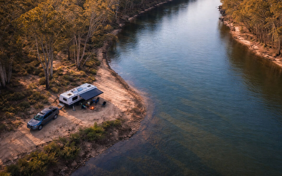
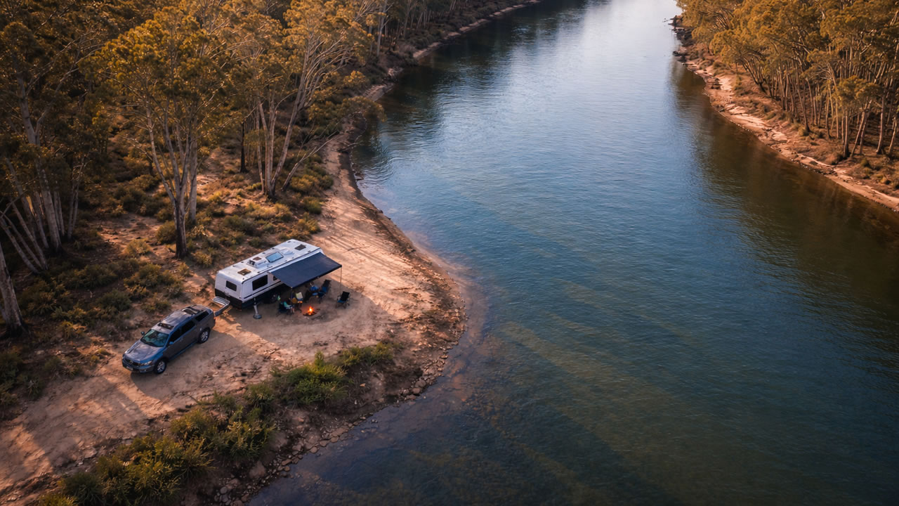
South Australia has several free or low‑cost riverfront camps along the Murray. Many fall under local council recreation reserves or State River Murray reserves. These sites usually offer basic toilets, picnic tables, and sometimes fire rings.
Most free camps are unpowered and have no showers. You must bring your own drinking water and separate greywater and sewage. Always check the specific site rules before you arrive, as some reserves ban fires or ban dogs in certain areas.
Other low cost sites sit on private land or farm stays near the river. These places often limit the number of vehicles or ban drive off camping. You can book some through platforms like Hipcamp or local booking boards.
Caravan Parks On The South Australian Murray
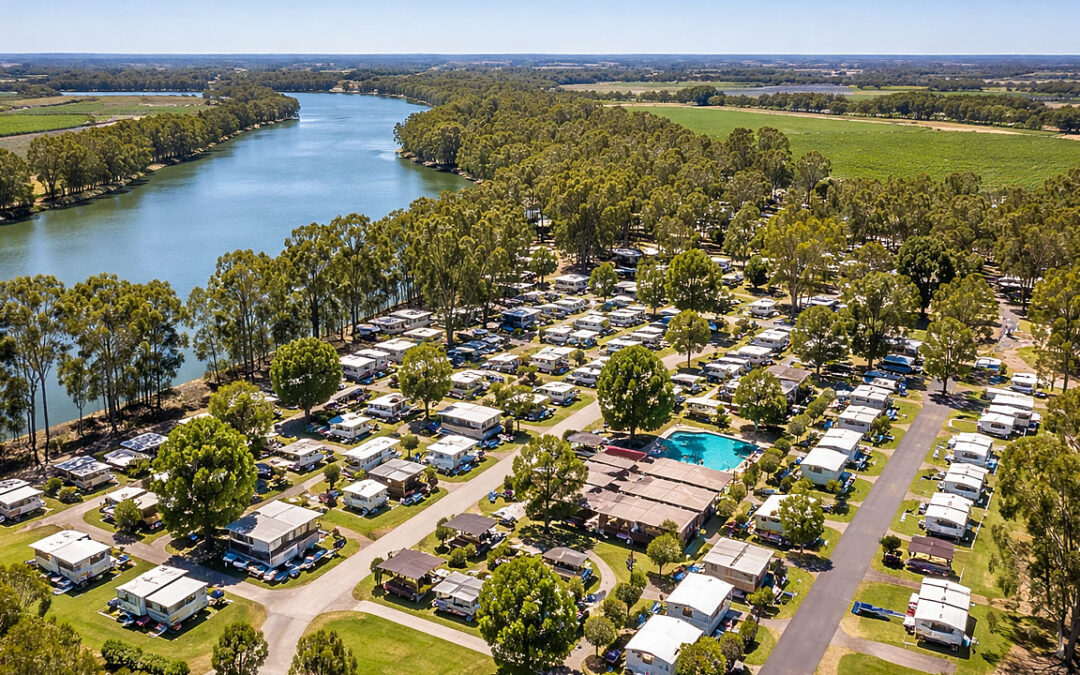
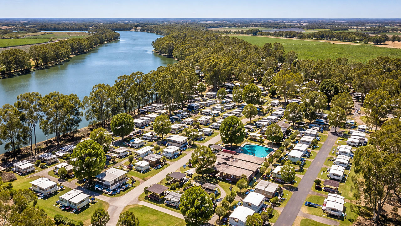
Caravan parks along the South Australian stretch of the river give you more comfort and services. Popular parks near Renmark, Berri, and Loxton often offer powered sites, cabin options, and amenities blocks with hot showers and laundry. Some also have playgrounds, jumping pillows, and indoor outdoor recreation rooms.
These parks suit families with kids, older travellers who want extra comfort, or couples who want a longer stay in one place. You can still walk to the river, but you are closer to town, shops, petrol, and medical services. The trade‑off is that nightly rates are higher than free recreation reserves or basic state parks.
When you book a caravan park, you usually choose powered or unpowered, check‑in and check‑out times, and whether you can bring a dog. Some parks allow dogs on leash in certain zones, while others keep pets away from shared areas.
A major benefit of using caravan parks instead of free camps is that caravan parks are usually 2WD accessible in most weather.
Key Comparison Types For Murray River Camping South Australia
| Site Type | Power Available | Typical Fee | Dogs Allowed | Notes |
|---|---|---|---|---|
| Renmark Riverfront Recreation Reserves | No | Low or free | Varies by reserve | Basic toilets, picnic tables, close to town, often unpowered |
| Berri & Loxton Caravan Parks | Powered and unpowered | Per night, higher in peak | Usually yes, on leash | Full facilities, cabins, and easy access to town services |
| State River Murray Bush Camps | No | Low or free | Varies by site | Remote, basic, self‑containment essential, good for small rigs |
| Private Riverfront Stays And Bush Camps | Some sites, not all | Per night, varies by host | Host rules apply | Range from basic to near‑powered, often on private land |
This table shows that South Australian Murray River camps sit between low‑cost riverfront sites and more serviced caravan parks. If you want a quieter bush feel, the free or low‑cost state and riverfront sites work well. If you want comfort and repeatable amenities, the caravan parks balance extra cost with more services.
What To Expect For Facilities And Fees When Murray River Camping South Australia
Most South Australian river camps keep facilities simple. You can expect basic toilets, picnic tables, and sometimes fire rings. Some sites offer rainwater, but you should not rely on it for drinking. Dump points are usually in nearby towns, not at every camp.
Fees vary by location. Many council run recreation reserves charge a small fee per night or per vehicle, while some remain free. Caravan parks set per night rates, which can rise in peak season. Extra fees may apply for powered sites, cabins, or late check‑out.
If you plan to fish, you need a South Australian fishing licence. You can buy this online or at local tackle shops and service stations. Many riverfront camps sit near known snag lines and deeper pools, so you can cast from the bank or use a small boat on the water.
Practical Tips For Murray River Camping South Australia
- Book caravan parks in Renmark, Berri, or Loxton early if you travel in peak season.
- Assume most free riverfront sites are unpowered and plan for self‑containment.
- Carry your own drinking water and plan dump stops at town services.
- Check fire rules before you light a campfire, especially in dry months.
- Visit a Pet Friendly Murray River campsite if bringing your dog along.
- Read local council or park rules before you book, including rules for rubbish and noise.
Another useful step is to check mobile coverage. Some riverfront camps sit in areas with patchy phone signal. If you work on the road or need stable internet, you can plan short stops in larger towns along the river.
Choosing The Right Camp For Your Style
Your best camp in South Australia depends on your travel style and what you bring. Families with kids often prefer a caravan park with a playground, easy access to town, and a bit more space. Couples in a small rig or campervan can move into quieter bush or riverfront camps that feel more remote.
If you fish a lot, you might prioritise a camp with direct river access and a few good snag lines. If you like to walk or birdwatch, you can look for a site near walking tracks or a riverfront trail. Some parks along the South Australian stretch have short walks, bird hides, or quiet red gum stands that keep the trip varied.
All up, Murray River camping in South Australia lets you mix comfort and bush. You can stay close to town when you need services, then move back to the river for a quieter, more relaxed pace. With a bit of planning, you can find a setup that suits your rig, your budget, and your style on the road.
Frequently Asked Questions About Murray River Camping South Australia
Which South Australian Murray River camps allow caravans?
Are South Australian Murray River camps pet friendly?
Do most South Australian Murray River camps have power points?
How far are the camps from town shops and services?
How much do Murray River camps in South Australia cost?
Can I fish at Murray River camps in South Australia?