Oodnadatta Track Fuel Stops 2026 – Complete Guide

Oodnadatta Track Fuel Stops 2026 – Complete Guide

Oodnadatta Track Fuel Stops 2026 – Complete Guide

Complete list of Oodnadatta Track fuel stops and contacts for your outback adventure along one of Australia’s most iconic tracks.

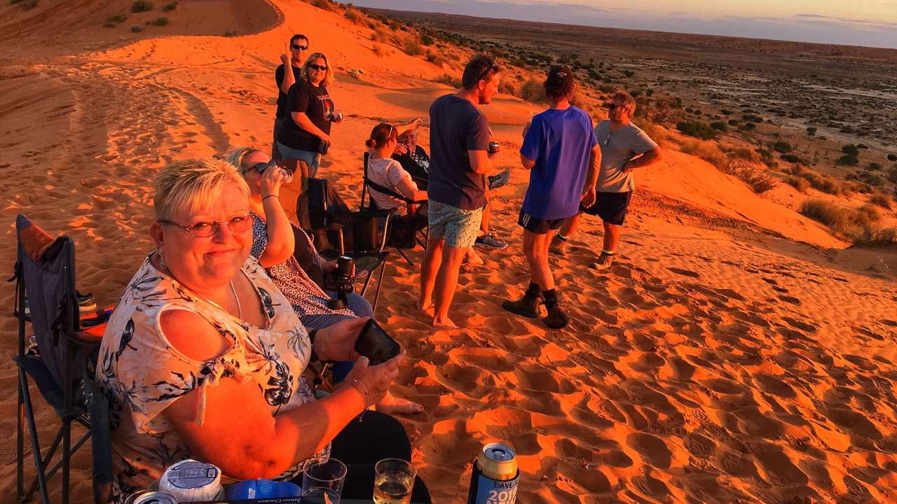
Fuel planning is absolutely critical for this journey as services are limited and distances between fuel stops can be substantial. We’ve been to and used all of these stops many times. Here’s our complete guide to fuel availability along the track.

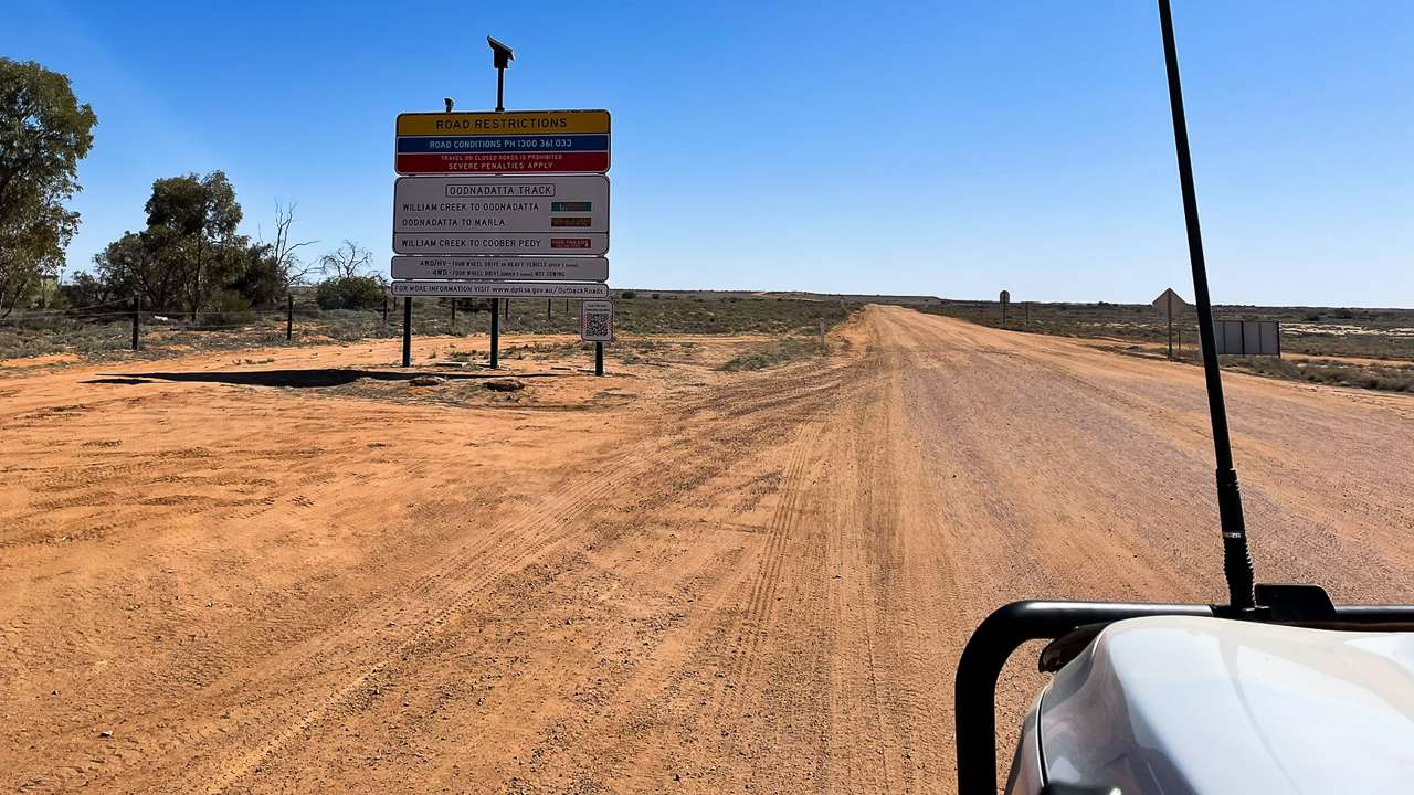
Given the current circumstances in 2026 fuel availability along the Oodnadatta Track can change without notice. Some outlets may have limited supplies or altered opening hours due to demand, weather or logistics. Use any details in this guide as a general indication only, not a guarantee. Before you travel you should always phone each service station or roadhouse to confirm current fuel availability, opening hours and what fuel types they have on the day. Phone numbers for all fuel stops mentioned are listed for you in the blog post below so you can check ahead and plan safely.

Oodnadatta Track Fuel Stops Map Infographic

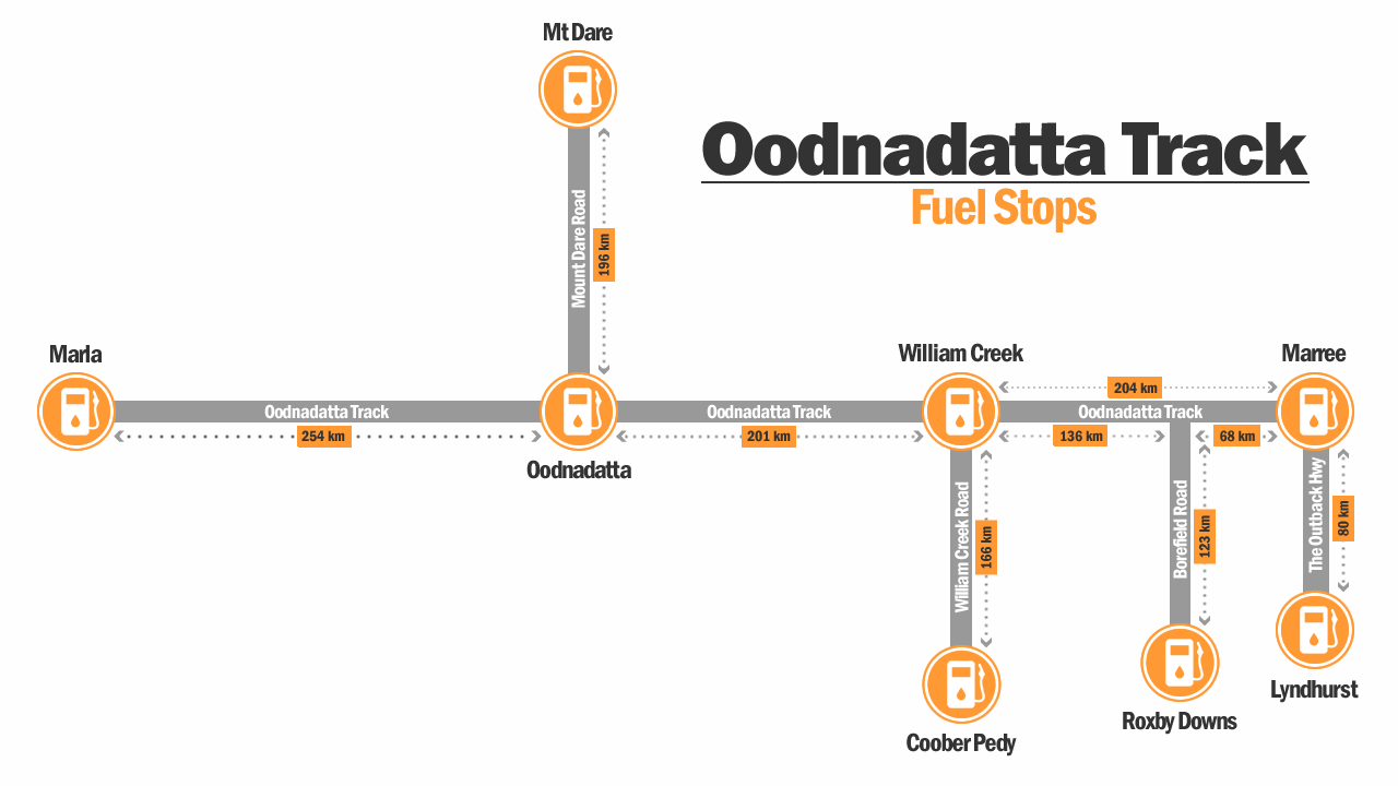
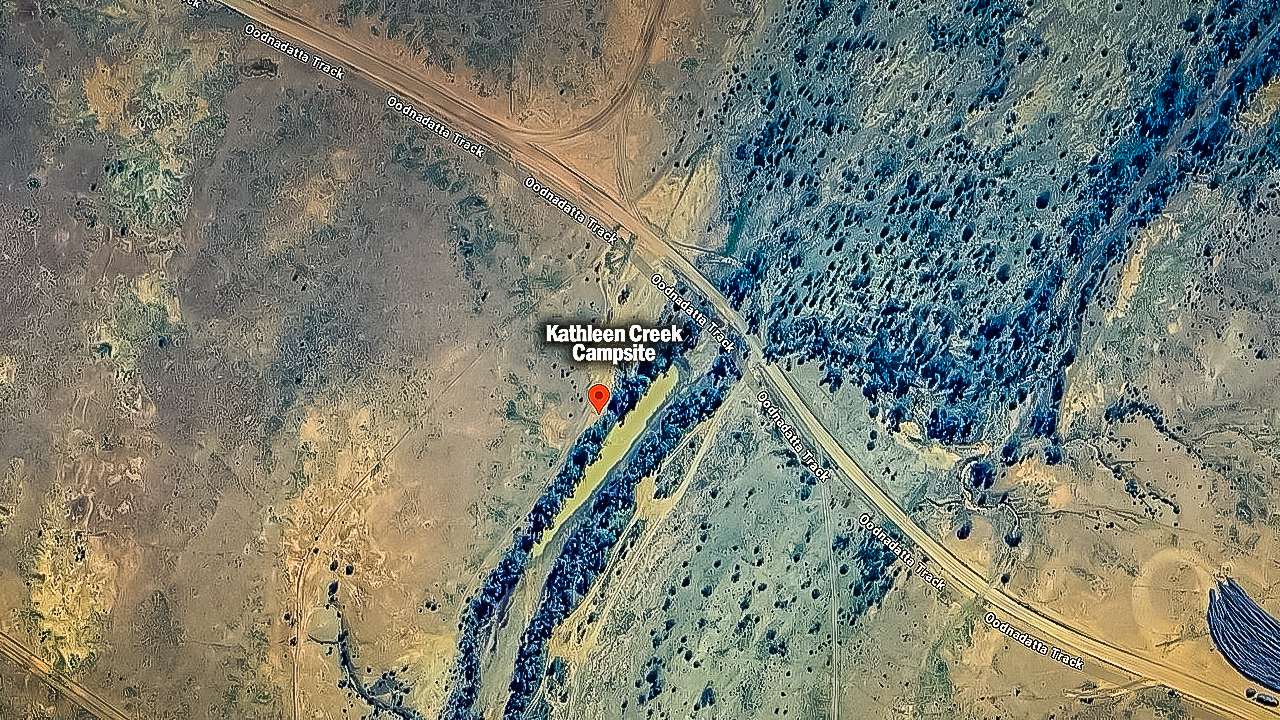
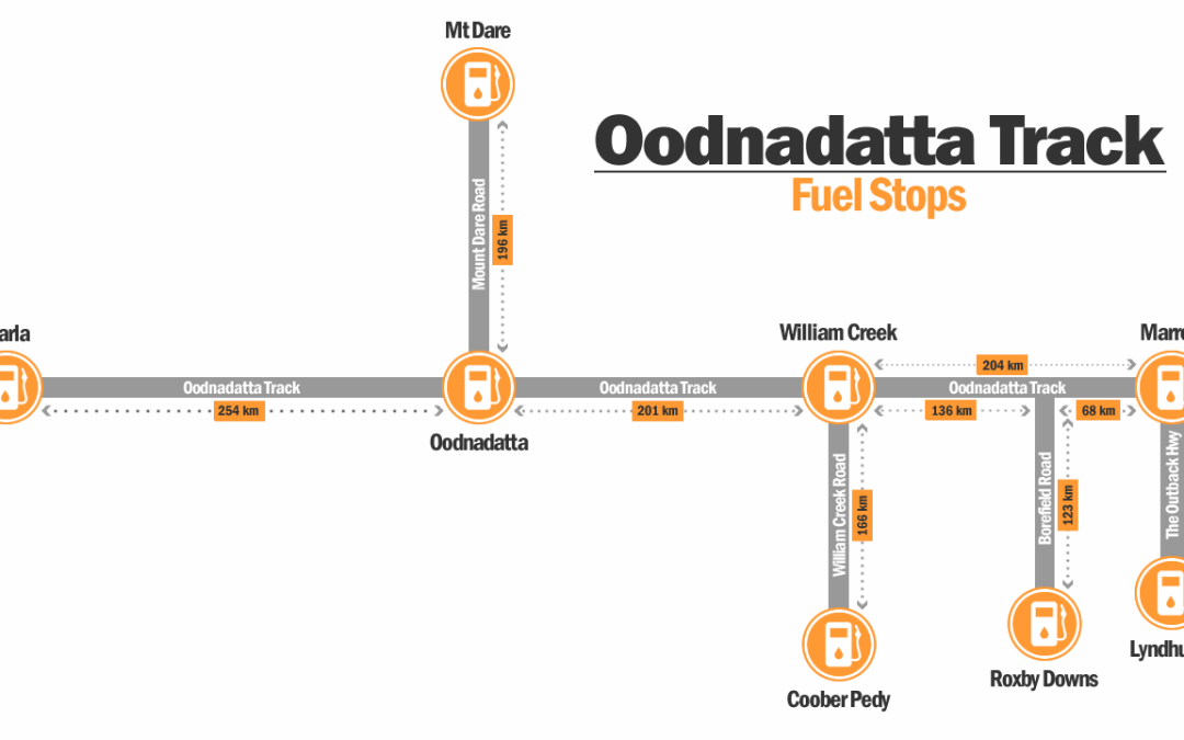
Oodnadatta Track Fuel Stops Map (Not To Scale)

Distance Summary & Fuel Planning

Route Section Distance Fuel Strategy
MarreeWilliam Creek 196km Fill at Marree, top up at William Creek
William Creek → Oodnadatta 201km Mandatory fuel stop at William Creek
Oodnadatta → Marla 254km Fill at Oodnadatta for final stretch

List Of Oodnadatta Track Fuel Stops Grouped In Order Of Location

1. Marree General Store & Fuel

Marree is the south eastern beginning of the Oodnadatta Track. The Marree Roadhouse, Oasis Cafe/Bistro is open 7 days a week from 7.30am till 6.30pm for all your general needs, take away meals, coffee, cold drinks, ice, groceries, fresh fruit and vegetables, souvenirs, camping equipment and tools. EFTPOS is available. This is one our favourite Oodnadatta Track fuel stops and we ALWAYS call in here for fuel and to stock up. I’ve been wearing a hat I bought here 10 years ago whenever I go outside!

Address: Oodnadatta Track, Marree, South Australia 5733
GPS Coordinates: -29.6497°S, 138.0413°E
Types Of Fuel Available: Diesel, Unleaded Petrol
Phone: (08) 8675 8352 – (08) 8675 8360
Opening Hours: 7 Days 7:30 AM – 6:30 PM
Fuel Availability Hours: Same as opening hours
Services Available: General store, camping supplies, ice, basic groceries, mechanical services, accommodation bookings
Website: https://marreemotel.com.au

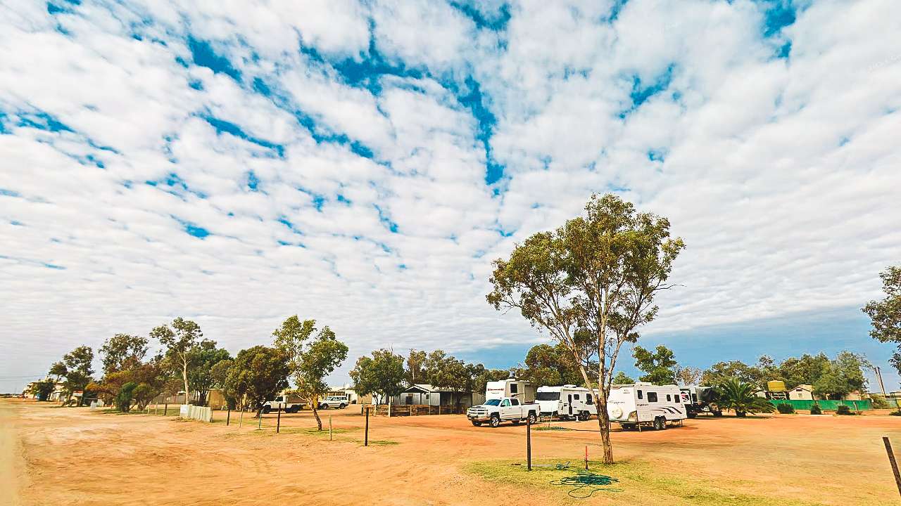
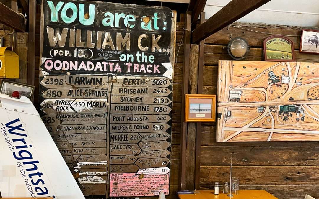
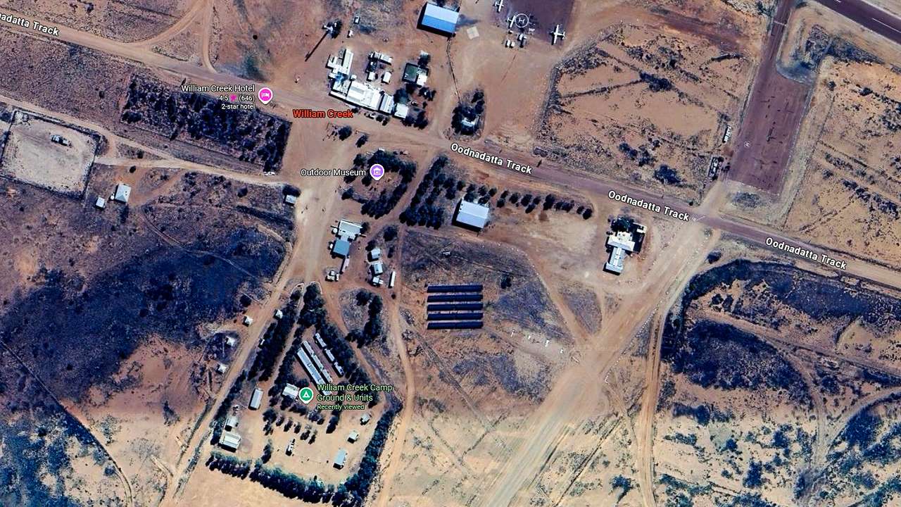
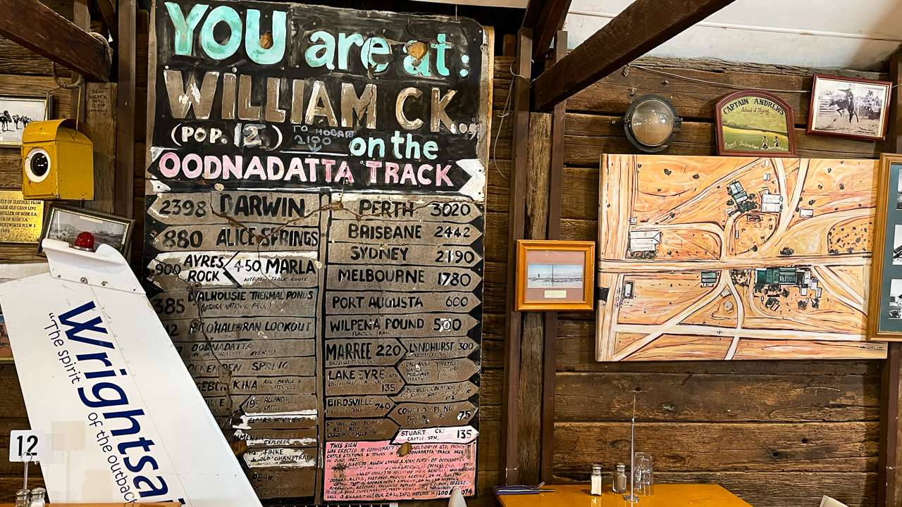
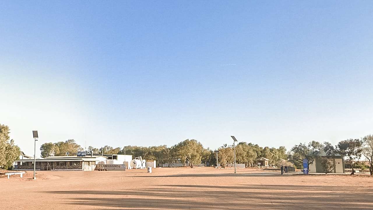
2. William Creek Hotel & Roadhouse

William Creek is just about right on the halfway mark if you’re driving the full length of the track. William Creek is the smallest town in South Australia. This is the only fuel stop between Marree, Coober Pedy and Oodnadatta – making it absolutely essential for track travelers. There is both Unleaded and Diesel at the bowser located outside the William Creek Hotel. Fuel is available 24hrs a day at the self service bowser and there’s always plenty of fuel available all year round.

Address: Oodnadatta Track, William Creek, South Australia, 5710, Australia
GPS Coordinates: -28.9333°S, 136.3500°E
Types Of Fuel Available: Diesel, Unleaded Petrol
Phone: (08) 8670 7880
Opening Hours: Daily 7:00 AM – 8:00 PM
Fuel Availability Hours: 24-hour fuel available (self serve after hours)
Services Available: Hotel accommodation, restaurant, bar, camping ground, general store, mechanical repairs, scenic flights booking
Website: https://www.williamcreekhotel.com/

3. Pink Roadhouse – Oodnadatta

The iconic Pink Roadhouse is a legendary outback stop famous for its Oodnaburgers. This is your last fuel stop before heading northwest to Marla or south back toward civilization.

Address: Oodnadatta, SA 5734
GPS Coordinates: -27.5553°S, 135.4467°E
Types Of Fuel Available: Unleaded petrol, Diesel
Phone: (08) 8670 7822
Opening Hours: 7 Days 8:00 AM – 6:00 PM (extended hours during peak season)
Fuel Availability Hours: Same as opening hours
Services Available: Accommodation (cabins and camping), restaurant (famous Oodnaburgers), general store, mechanical services, camping supplies, ice, tourist information
Website: https://pinkroadhouse.com.au/

4. Marla Travellers Rest

Located on the Stuart Highway Marla serves as the northwestern access point to the Oodnadatta Track. Marla Traveller’s Rest is a sprawling roadhouse, hotel/motel, restaurant, service station, supermarket and more all in one place.

Address: Stuart Highway, Marla, SA 5724
GPS Coordinates: -27.3000°S, 133.0833°E
Types Of Fuel Available: Unleaded Petrol, Premium unleaded, Diesel, LPG
Phone: (08) 8670 7001
Opening Hours: Daily 6:00 AM – 10:00 PM
Fuel Availability Hours: 24-hour fuel available (card payment after hours)
Services Available: Accommodation (motel units), restaurant, takeaway food, general store, camping ground, ATM, mechanical services
Website: https://www.marla.com.au/

5. Lyndhurst Fuel Options

Lyndhurst is at the end of the Strzelecki Track and you will pass through it coming from south to join the OOdnadatta. While not directly on the Oodnadatta Track it’s a great fuel stop for those approaching from the south or connecting to other outback routes.

5a. Perrys Lyndhurst

Address: The Outback Hwy, Lyndhurst, SA, 5731
GPS Coordinates: -30.28719903045753, 138.34923743900703
Types Of Fuel Available: Diesel
Phone: (08) 8636 2274 – Perrys Head Office
Opening Hours: 24 Hours (self serve card only)
Fuel Availability Hours: 24 Hours
Services Available: Fuel
Website: https://perrys.com.au/

5b. IOR Lyndhurst

Address: 3 Short Street, Lyndhurst SA 5731, Australia
GPS Coordinates: -30.287481786739995, 138.35235109667667
Types Of Fuel Available: Diesel
Phone: 1300 457 467 – IOR Head Office
Opening Hours: 24 Hours (payment using Fuel Charge App https://www.fuelcharge.com.au/)
Fuel Availability Hours: 24 Hours
Services Available: Fuel
Website: https://www.ior.com.au/

6. Coober Pedy Fuel Options

Coober Pedy famous for its opal mines and underground houses has multiple fuel options.

6a. Shell Coober Pedy

Address: 454 Hutchison St, Coober Pedy SA 5723
GPS Coordinates: -29.0147°S, 134.7544°E
Types Of Fuel Available: Unleaded petrol, Premium unleaded, Diesel
Phone: (08) 8672 5350
Opening Hours: 7 Days 24 Hours
Fuel Availability Hours: 7 Days 24 Hours
Services Available: Convenience store, food options, ATM
Website: https://find.shell.com/au/fuel/10111493-shell-coober-pedy-roadhouse/en_AUhttps://find.shell.com/au/fuel/10111493-shell-coober-pedy-roadhouse/en_AU

6b. Perrys Coober Pedy

Address: Flat Hill Rd, Coober Pedy SA 5723
GPS Coordinates:
Types Of Fuel Available:
Phone: (08) 8636 2274 – Perrys Head Office
Opening Hours: 24 Hours (self serve card only)
Fuel Availability Hours: Same as opening hours
Services Available: Fuel
Website: https://perrys.com.au/

7. Mount Dare Hotel

Mount Dare is north of Oodnadatta near the border with the Northern Territory. This remote location is a gateway for those continuing north to Alice Springs and for exploring the western MacDonnell Ranges.

Address: Mount Dare, SA 5734
GPS Coordinates: -26.6833°S, 135.1833°E
Types Of Fuel Available: Unleaded Petrol, Diesel
Phone: (08) 8670 7835
Opening Hours: Daily 8:00 AM – 8:00 PM (seasonal variations)
Fuel Availability Hours: Same as opening hours
Services Available: Hotel accommodation, restaurant, bar, camping ground, general store, mechanical services
Website: https://www.mtdare.com.au/

8. Roxby Downs

Borefield Road (Borefield Track) is a popular entry point to the Oodnadatta Track. Borefield Road starts in Roxby Downs and meets the Oodnadatta Track 68km west of Marree, or 136km east of William Creek. Roxby Downs and Olympic Dam just north of Roxby are the last available fuel before either william Creek or Marree when travelling Borefield Road.

8a. BP Roxby Downs

Address: 26 Olympic Way, Roxby Downs SA 5725
GPS Coordinates: -30.553387473299107, 136.89372145435607
Types Of Fuel Available: Diesel, Unleaded Petrol, Premium Unleaded Petrol
Phone: (08) 8419 4683
Opening Hours: 7 Days 4:00 AM – 11:00 PM
Fuel Availability Hours: Same as opening hours
Services Available: Convenience Store, Food, Toilets
Website: https://map.bp.com/en-AU/AU/gas-station/roxby-downs/ampm-roxby-downs/5500

8b. Lavricks Roadhouse

Address: Olympic Way North, Olympic Dam
GPS Coordinates: -30.48424453960465, 136.89301790788122
Types Of Fuel Available: Diesel, Unleaded Petrol, Premium Unleaded Petrol, LPG
Phone: (08) 8671 0554
Opening Hours: 7 Days 6:00 AM – 9:00 PM
Fuel Availability Hours: Same as opening hours
Services Available: Convenience Store, Food, Roadhouse, Toilets
Website: https://www.facebook.com/p/Lavricks-Roadhouse-Olympic-Dam-61556682005282/

Main Track Fuel Stops (South to North)

Location & Facility Address & GPS Distance From Previous
MARREE
Marree Roadhouse & Oasis Cafe
Railway Terrace, Marree SA 5733
29°39’01″S, 138°02’29″E
Starting Point
WILLIAM CREEK
William Creek Hotel
William Creek SA 5710
28°56’00″S, 136°21’00″E
215km from Marree
OODNADATTA
Pink Roadhouse
Main Street, Oodnadatta SA 5734
27°33’19″S, 135°26’48″E
207km from William Creek
MARLA
Marla Traveller’s Rest
Stuart Highway, Marla SA 5724
27°18’00″S, 133°13’00″E
220km from Oodnadatta

Last Updated: August 2025 – Information subject to change. Always verify current details before travel.

Small Hills Near Angle Pole Campsite – Oodnadatta Track

Small Hills Near Angle Pole Campsite – Oodnadatta Track

Small Hills Near Angle Pole Campsite – Oodnadatta Track

Small Hills Near Angle Pole Campsite offers free camping near Oodnadatta. Perfect for self-contained campers wanting peace, views and quiet. Most people driving the Oodnadatta Track either push through to Marla or stop in town at the Pink Roadhouse. But there’s another option that many campers miss – a small free camping area tucked behind some weathered hills just north of Oodnadatta.

Small Hills Near Angle Pole Campsite Location Map

Small Hills Near Angle Pole Campsite Location And Info At A Glance

Cost: Free
Type: Free Camping / Bush Camping
Location: Small hills near angle pole, South Australia
GPS: -27.490360°, 135.418222°
Pet Friendly: Yes
Distance From Marree: 413km
Distance From Oodnadatta: 7km
Distance From Marla: 247km

Angle Pole Memorial Sign

Angle Pole Memorial Sign Courtesy Of The Pink Roadhouse

Finding Small Hills Near Angle Pole Campsite

You’ll see vehicle tracks heading towards some low rocky hills. Sometimes someone will have left a branch marking the turn-off, sometimes not. The drive in takes a few minutes following wheel ruts for around 700 metres.

Watch out for one steep dip that can catch low vehicles off guard. Most standard caravans handle it fine, but check your clearance first. Don’t attempt entry after heavy rain – the clay soil turns into the caravan equivalent of a venus flytrap and you could be there for days.

The Camping Area

You’ll find yourself in a sheltered spot between small hills and a dry creek. The ground is mostly gravel and gibber stones, which makes for good drainage. There’s room for three or four rigs without crowding, plus space to turn around even with a big setup.

Old fire pits dot the area from previous campers. The real draw is scrambling up one of the nearby hills for the view. Takes maybe five minutes to reach the top and you can see for kilometers in every direction. Oodnadatta looks tiny from up there.

What To Bring

Everything. Water, food, fuel, toilet paper – the works. No bins either, so pack out your rubbish. The nearest supplies are back in Oodnadatta and the Pink Roadhouse closes early.

Phone signal is patchy at best. Climb a hill and you might get one bar of Telstra coverage if you’re lucky. Forget about streaming anything or video calls.

The Downsides

  • Flies swarm during the day in warmer weather. Bring fly nets or you’ll go mad. When evening comes the flies disappear.
  • Wind can be strong funneling between the hills. Make sure your awning is properly pegged down.

Why Choose Small Hills Near Angle Pole Campsite Over Town?

  • Simple – peace and quiet. Oodnadatta camping can get very busy at times. The only sounds here is the wind and maybe a distant dingo.
  • Plus it costs nothing. Hard to argue with free when you’re on a tight travel budget.

Railway History

Bits of the old Ghan line are scattered around if you look. Sections of rail and wooden sleepers slowly weathering away. Don’t move anything – it’s part of the area’s character.

The railway used to run right through here before they moved it east. These remnants are all that’s left of that era.

Who Should Stay At The Small Hills Near Angle Pole Campsite

Experienced campers who don’t need facilities will love it. First-timers or those wanting hot showers and flushing toilets should stay in town.

If constant flies annoy you, or if dust bothers you, or if you need reliable phone coverage – this isn’t your spot. But if you want genuine outback solitude with great views it’s hard to beat.

Small Hills Near Angle Pole Campsite On Google Earth

Small Hills Near Angle Pole Campsite On Google Earth

Keep It Clean

This place works because people respect it. Take your rubbish with you.

Bottom Line

It’s basic bush camping at its finest. No frills, no facilities, just you and the outback. The hills provide shelter from wind, the views are spectacular.

Most commercial campgrounds along the Track charge upwards of $25 per night. This costs nothing and offers something money can’t buy – complete silence and a genuine connection to one of Australia’s most remote regions.

List Of All Birdsville Track Campsites

List Of All Birdsville Track Campsites

List Of All Birdsville Track Campsites

Complete Birdsville Track camping guide – 23 campsites from Birdsville QLD to Marree SA with GPS coords, costs & facilities. Free bush camps to caravan parks for your outback trip.

Are you driving the Birdsville Track on your way to the Birdsville Races or the Big Red Bash? Maybe you’re on way to travel across the Simpson Desert? You’ll need somewhere to camp along the way. We’ve put together this list of all Birdsville Track campsites on the 620km stretch between Birdsville and Marree. Some are free bush camps. Others are caravan parks with hot showers and powered sites.

We’ve included GPS coordinates, what it’ll cost you and what facilities you can expect. This Birdsville Track camping guide will help you plan where to pull up for the night with the confidence that come from knowing what to expect.

Map Of All Birdsville Track Campsites

List Of Camp Sites On The Birdsville Track

1. Birdsville Common

This Free Campground offers drinking water. Pets are allowed. It is accessible to RV’s and caravans.

Cost: Free
Type: Free Camping
Location: Eyre Developmental Rd, Birdsville, Queensland
GPS: -25.8998140, 139.3612240
Pet Friendly: Yes
Distance From Birdsville: 0km
Distance From Marree: 519km

2. Alternate “Common” For Wet Weather

Just past the wash bay on the other side of the road. This area is an alternative to the common during busy periods and is on higher ground.

Cost: Free
Type: Free Camping
Location: Eyre Developmental Rd, Birdsville, Queensland
GPS: -25.8951870, 139.3527720
Pet Friendly: Yes
Distance From Birdsville: 0km
Distance From Marree: 519km

Up On Big Red Birdsville Watching The Sunset

Up On Big Red Birdsville Watching The Sunset

3. Birdsville Free Camping

This is a Free Campground. Pets are allowed. it is accessible to RV’s and caravans.

Cost: Free
Type: Free Camping
Location: Eyre Developmental Rd, Birdsville, Queensland
GPS: -25.9014100, 139.3607390
Pet Friendly: Yes
Distance From Birdsville: 0km
Distance From Marree: 519km

4. Karrawa Camping

Stunning riverside location along the Diamantina River right in central Birdsville. Self-sufficiency required for camping. Excellent bird watching opportunities with diverse species. Easy stroll to local pub and bakery. Run by Traditional Owners from the area (same people behind the local coffee shop). Perfect chance to connect with locals and discover the rich cultural heritage and ancient history of Birdsville and the surrounding region.

Cost: $25 Per Night
Type: Paid Campground
Location: Access via Hardware store on Waddi DriveBirdsville, Queensland
GPS: -25.9036380, 139.3520210
Pet Friendly: Yes
Distance From Birdsville: 1km
Distance From Marree: 520km

5. Diamantina Camp Beside River

This Free Campground offers drinking water. Pets are allowed. It is accessible to RV’s and caravans. Camping in tents is allowed.

Cost: Free
Type: Free Camping
Location: Eyre Developmental Rd, Birdsville, Queensland
GPS: -25.9072480, 139.3731100
Pet Friendly: Yes
Distance From Birdsville: 3km
Distance From Marree: 520km

6. Birdsville Diamantina River Wind Mill

This Free Campground offers drinking water. Pets are allowed. It is accessible to RV’s, caravans and big rigs. Camping in tents in is allowed. This is one of only two caravan parks on this list of Birdsville Track campsites.

Cost: Free
Type: Free Camping
Location: Eyre Developmental Rd, Birdsville, Queensland
GPS: -25.9050750, 139.3744580
Pet Friendly: Yes
Distance From Birdsville: 2km
Distance From Marree: 516km

7. Birdsville Tourist Park

The Birdsville Caravan Park has 50 sites with power. Even the biggest vehicles can be accommodated, including large motorhomes, tour buses and fifth-wheel trailers. Staff are on hand to assist with parking if needed.

Unpowered camping extends across 30 acres of grounds. Drive-through options suit larger outfits and caravans, while dedicated areas cater for campervans and tent camping. Quality facilities and amenities ensure comfortable stays for all guests. Site selection is typically flexible, though availability becomes limited during major events like the famous Birdsville Races.

Cost: Powered $35 Per Night / $65 Per Night July Through September
Type: Caravan Park
Location: Florence St, Birdsville, Queensland
GPS: -25.8993360, 139.3542650
Pet Friendly: Yes
Distance From Birdsville: 0km
Distance From Marree: 519km

Birdsville Track Camping At Birdsville Tourist Park Aka The Birdsville Caravan Park

Birdsville Track Campsites At Birdsville Tourist Park Aka The Birdsville Caravan Park

8. Pre Border Camp (Cool Name!)

A nice quiet sheltered spot before the border. Unofficial camp. Leave no trace.

Cost: Free
Type: Free Camping
Location: Birdsville Track, Pandie Pandie, South Australia
GPS: -26.0277170, 139.3873140
Pet Friendly: Yes
Distance From Birdsville: 14km
Distance From Marree: 502km

9. Geak Hill

This is a free campground. Pets are allowed. It is accessible to RV’s, caravans and big rigs. Camping in tents is allowed.

Cost: Free
Type: Free Camping
Location: Birdsville Track
GPS: -26.5942920, 139.6313580
Pet Friendly: Yes
Distance From Birdsville: 85km
Distance From Marree: 433km

10. Dune Camp North

This is a free campground. Pets are allowed. It is accessible to RV’s, caravans and big rigs. Camping in tents is allowed.

Cost: Free
Type: Free Camping
Location: Birdsville Track
GPS: -26.9192310, 139.4397560
Pet Friendly: Yes
Distance From Birdsville: 133km
Distance From Marree: 386km

11. Lake Surprise Creek

This is a free campground. Pets are allowed. It is accessible to RV’s, caravans and big rigs. Camping in tents is allowed.

Cost: Free
Type: Free Camping
Location: Birdsville Track
GPS: -26.9389480, 139.4171220
Pet Friendly: Yes
Distance From Birdsville: 136km
Distance From Marree: 383km

12. Tippipila Creek Bush Camp

This is a free campground. Pets are allowed. It is accessible to RV’s, caravans and big rigs. Camping in tents is allowed.

Cost: Free
Type: Free Camping
Location: Birdsville Track, South Australia
GPS: -26.9953750, 139.0165400
Pet Friendly: Yes
Distance From Birdsville: 182km
Distance From Marree: 337km

13. Bloods Creek

This is a free campground. Pets are allowed. It is accessible to RV’s, caravans and big rigs. Camping in tents is allowed.

Cost: Free
Type: Free Camping
Location: Birdsville Track, Clifton Hills Station, South Australia
GPS: -27.1135050, 138.8223610
Pet Friendly: Yes
Distance From Birdsville: 206km
Distance From Marree: 313km

14. Camp Behind Sand Dune

This is a free campground. Pets are allowed. It is accessible to RV’s, caravans and big rigs. Camping in tents is allowed.

Cost: Free
Type: Free Camping
Location: Birdsville Track, Clifton Hills Station, South Australia
GPS: -27.2496480, 138.7577430
Pet Friendly: Yes
Distance From Birdsville: 223km
Distance From Marree: 296km

15. Mt Gason Creek

This is a free campground. Pets are allowed. It is accessible to RV’s, caravans and big rigs. Camping in tents is allowed.

Cost: Free
Type: Free Camping
Location: Birdsville Track, Clifton Hills Station SA
GPS: -27.2618860, 138.7567460
Pet Friendly: Yes
Distance From Birdsville: 224km
Distance From Marree: 295km

16. Mungerannie Hotel & Camp Area

This paid campground offers toilets and showers. It is dog friendly. It is accessible to motorbikes, RVs, camper trailers, caravans and big rigs. Camping in tents is allowed.

This is my favourite on this list of Birdsville Track campsites. I loved camping here back in 2019 with a big group of mates – a wild old time was had in the pub when Phil owned it.

Cost: $15 Per Person Per Night
Type: Paid Campground
Location: Birdsville Track, South Australia
GPS: -28.0194160, 138.6637570
Pet Friendly: Yes
Distance From Birdsville: 315km
Distance From Marree: 205km

Mungerannie Hotel & Camp Area

Mungerannie Hotel & Camp Area

17. Cooper Creek Ferry

This is a free campground. Pets are allowed. It is accessible to RV’s, caravans and big rigs. Camping in tents is allowed. Slow 14km in and out on the same track to the ferry on Cooper Creek. Interesting site to see the ferry raised on the bank.

Cost: Free
Type: Free Camping
Location: Etadunna, South Australia 5733
GPS: -28.5800590, 138.8144160
Pet Friendly: Yes
Distance From Birdsville: 388km
Distance From Marree: 160km

18. Cooper Creek Camp

This Donation Applies Campground has good flushing toilets and a tap for dish washing water. Pets are allowed. It is accessible to RV’s and caravans. It’s a great large campsite with plenty of trees. It’s worth donating to ensure the site continues to be available.

Cost: Donation
Type: Donation Campsite
Location: Birdsville Track, Etadunna, South Australia
GPS: -28.6233300, 138.7107380
Pet Friendly: Yes
Distance From Birdsville: 383km
Distance From Marree: 136km

Clayton Station Birdsville Track Camping

Clayton Station Birdsville Track Camping

19. Clayton Wetlands Campground

Clayton Station operates as a recognised pastoral enterprise located at the southern terminus of the renowned Birdsville Track in remote South Australia. The station maintains a public camping area that serves as a welcome refuge for travellers journeying along the challenging Birdsville Track. Camping options are unpowered and accommodate all camping styles. Available amenities include shower facilities, flush toilets and natural hot artesian pools.

  • Chainsaws prohibited – visitors must supply their own firewood to protect vegetation
  • Firearms banned
  • All waste must be removed by visitors
  • Camping restricted to designated zones only
  • Consideration for fellow campers required – no excessive noise or circle work.
  • Natural hot artesian bathing available
  • Dogs welcome

Cost: $20 Per Night
Type: Paid Campground
Location: Clayton Station, Birdsville Track, South Australia
GPS: -29.2742720, 138.3746420
Pet Friendly: Yes
Distance From Birdsville: 465km
Distance From Marree: 54km

20. Lake Harry Ruins

This is a free campground. Pets are allowed. It is accessible to RV’s, caravans and big rigs. Camping in tents is allowed. The ruins of Lake Harry Station is what remains of an abandoned date palm plantation on the southern end of Lake Harry.
Read Our Detailed Blog Post

Cost: Free
Type: Free Camping
Location: Birdsville Track, Muloorina SA 5733, South Australia
GPS: -29.4342650, 138.2467820
Pet Friendly: Yes
Distance From Birdsville: 488km
Distance From Marree: 31km

21. Unofficial Campsite

On both sides of the track just out of Marree. You have to be self contained. Leave no rubbish including toilet paper. Take it all with you back to bin in town or burn it.

Cost: Free
Type: Free Camping
Location: Birdsville Track Marree, South Australia
GPS: -29.6300560, 138.0903870
Pet Friendly: Yes
Distance From Birdsville: 514km
Distance From Marree: 5km

22. Marree Hotel Campground

Camping behind the Marree Hotel. Very friendly location. Great meals. Pet friendly.
Read Our Detailed Blog Post

Cost: Free if you have a meal in the pub.
Type: Pub Camping
Location: Marree, South Australia
GPS: -29.649041°, 138.064652°
Distance From Birdsville: 518km
Distance From Marree: 0km

23. Marree Oasis Caravan Park & Cabins

Powered and unpowered sites. Showers and toilets. Laundry facilities.
Read Our Detailed Blog Post

Cost: Powered $45. Unpowered $35.
Type: Caravan Park
Location: Marree, South Australia
GPS: -29.646530°, 138.061902°
Distance From Birdsville: 518km
Distance From Marree: 0km

Conclusion To This List Of Birdsville Track Campsites

There’s some awesome camping spots along the Track – from the busy Birdsville Common to the hot springs at Clayton Station. Twenty-three different places to choose from spread across 620km.
Pack heaps of water and fuel. Tell someone where you’re headed and when you reckon you’ll get there. And don’t be a grubby goose – take out your rubbish and leave these spots better than you found them. Birdsville Track camping has got something for everyone. Whether you’re after a free camp all to yourself or somewhere with all the mod cons this is the list of Birdsville Track camping for you.

William Creek Hotel Accommodation & Campground

William Creek Hotel Accommodation & Campground

William Creek Hotel Accommodation & Campground

Anyone who’s driven the Oodnadatta Track knows the William Creek Hotel Accommodation & Campground. It’s that much needed stop where you can get a hot shower and a cold beer. Right across from the famous William Creek Hotel this campground has saved plenty of travellers from sleeping rough in the middle of nowhere.

William Creek Hotel Accommodation & Campground Location And Info At A Glance

Cost: About $45 per night powered and $35 per night unpowered. Varies depending upon season.
Type: Caravan Park / Paid Campground
Location: -28.909119°, 136.338610°
Pet Friendly: Yes
Distance From Marree: 204km
Distance From Oodnadatta: 202km
Distance From Marla: 456km

William Creek Campground On Google Earth

William Creek Campground On Google Earth

What You Get at William Creek Hotel Campground

The campground’s got powered and unpowered sites scattered across a decent-sized area. Big rigs fit fine. The amenities block is where this place really shines. Hot showers that actually work, toilets that flush and washing machines that don’t eat your coins.

Powered sites go for about $40-45 a night and come with water but here’s the catch – they fill up by midday during busy periods. Hotel staff aren’t joking when they tell you to get there early. The unpowered area out back has heaps more room and costs around $30 which is good value for what you get and where you are.

Most people camp in the unpowered section behind the main area. More space, less crowded and you’re not crammed in.

Inside The Dining Room At William Creek Hotel Pay for Your William Creek Hotel Campground Accommodation In Here

Inside The Dining Room At William Creek Hotel Pay for Your William Creek Hotel Campground Accommodation In Here

William Creek Hotel Accommodation Beyond Camping

If you’re sick of swags and camp chairs the William Creek Hotel accommodation includes proper rooms and cabins. There’s “The Camel House” cottage that sleeps up to six people, plus regular hotel rooms with different bathroom arrangements.

This place has been operating since 1887, which tells you something. They’ve figured out what works in the middle of nowhere. The rooms aren’t fancy, but after days on corrugated roads, you won’t care about thread counts.

Services That Actually Matter

  • Fuel’s available on site although it’s not at city prices. diesel goes about $3 a litre. It beats running out of fuel in the scrub.
  • Staff know their stuff about breakdowns. Multiple people mention getting help with tyre repairs and even emergency parts deliveries. When your trip depends on keeping your vehicle running, that kind of backup matters.
  • The free desalinated water fill-up is brilliant. Top up your tanks before heading back onto the track.

Leaving William Creek And Heading Towards Oodnadatta In 2024

Leaving William Creek And Heading Towards Oodnadatta In 2024

Food And Drink At William Creek Hotel

The pub does decent feeds, though you’ll pay tourist prices. Chicken schnitzel seems popular and portions are generous enough that people take leftovers back to camp. The key is booking ahead – this place gets packed, especially when tour groups roll through.

Staff are very helpful. Multiple people mention getting good local advice and assistance with vehicle problems.

Lake Eyre Flights And Access

Wright’s Air runs scenic flights from the adjacent airstrip. Currently as of 2025 starting at around $390 per person it’s spectacular. The timing worked out perfectly for recent visitors who have seen the lake full. We’ve been to William Creek loads of times but never done the flight as Amanda is not good with heights. We did a helicopter flight at Kings Canyon on a recent trip so I’m hopeful of getting her on a plane over Lake Eyre next time we’re there.

Many people use William Creek Hotel Campground as base camp for the rough drive out to Halligan Bay. Makes sense – leave your caravan here and take just the vehicle for the challenging 60km track to Lake Eyre’s edge.

William Creek Hotel Accommodation Campground Entrance

William Creek Hotel Accommodation Campground Entrance

What You Need to Know About William Creek Hotel Campground

  • Register at the hotel first, pay upfront, then find your spot. The system works well enough. Unpowered sites behind the main area offer better value and more space, especially important when the wind picks up and everything gets dusty.
  • Campfires are allowed, which is good because evenings can get cold. The camping area has some wind protection, though you’re still in open country where weather happens fast.
  • Dogs are welcome, both in camp and surprisingly in the hotel dining room. That’s unusual for outback pubs and makes this place more appealing for people travelling with pets.

William Creek Hotel Driving School Dave Could do With A Lesson!

William Creek Hotel Driving School Dave Could do With A Lesson!

Why William Creek Hotel Campground Works So Well

After hours of corrugated roads and dust, William Creek Hotel Campground delivers what you actually need – clean facilities, reliable services and genuine outback character. Whether you’re just passing through or using it as base for Lake Eyre exploration, it does the job.

The William Creek Hotel accommodation options work for people who want a break from camping without losing the authentic outback feel. After 130-plus years in business, they’ve earned their reputation as an essential Oodnadatta Track stop.

This isn’t about luxury – it’s about reliable services in unreliable country. Sometimes that’s exactly what matters most.

William Creek Hotel Some New Stubby Holders

William Creek Hotel Some New Stubby Holders

Kathleen Creek Campsite – Oodnadatta Track

Kathleen Creek Campsite – Oodnadatta Track

Kathleen Creek Campsite – Oodnadatta Track

Kathleen Creek campsite is a popular free camp site on the Oodnadatta Track. It’s about 84 kilometres from Oodnadatta heading towards Marla. The creek runs right alongside the track making it easy to spot.

Kathleen Creek Campsite Location And Info At A Glance

Cost: Free
Type: Free Camping / Bush Camping
Location: -27.204822°, 134.752916°
Pet Friendly: Yes
Distance From Marree: 489km
Distance From Oodnadatta: 84km
Distance From Marla: 170km

Kathleen Creek Camp Site Oodnadatta Track On Google Earth

Kathleen Creek Camp Site Oodnadatta Track On Google Earth

Finding Kathleen Creek Campsite

There’s no sign telling you where to turn – you just pull off when you see the creek. You can camp on either side, east or west. Most people don’t drive too far in, maybe 100 to 500 metres at most. We’ve seen plenty of big caravans and motorhomes get in here without no trouble.

Recent roadworks have made access much better than it used to be. Still, you wouldn’t want to attempt this after heavy rain. The ground would turn into a real mess.

What’s Available

There are no facilities here. No toilets, no bins, no water taps. You need to bring everything with you and take it all away again. The ground is mostly flat and there’s usually some shade from the trees along the creek.

The creek itself sometimes has water in it but after dry spells it’ll have little to nothing in it. Sometimes there’s enough water for a quick wash or even a swim on a hot day. Other times it’s completely dry. Either way the trees are always there providing habitat for lots of birds.

Choosing Your Spot

  • We’ve camped on the western side of the creek (the eastern side had more evidence of cattle).
  • You can camp close to the road and still get nice creek views.
  • If you want more privacy the tracks continue further along the creek with plenty of options.
  • Even when there are several groups here there’s enough space for everyone.

Birds And Animals

The bird life here is fantastic, especially when there’s water around. We’ve seen budgerigars, wood ducks, various pigeons and plenty of other species. The constant bird chatter really adds to the peaceful atmosphere.

Dingoes and wild dogs visit regularly, particularly at night when they come down to drink. We’ve heard there are dog baits in the area so keep your pets close. You might also spot some feral cats and mice around the camp.

Flies are a problem during the day but they disappear once the sun sets. That’s pretty standard for this part of the country.

Kathleen Creek Campsite Oodnadatta Track

Kathleen Creek Campsite Oodnadatta Track

Campfires

Finding firewood can be hit or miss. Sometimes there’s plenty of dead wood lying around, other times you’ll struggle to find enough for a small fire. Don’t take more than you need – other people will be coming after you.

On our visit here we found a nice little stack of firewood and with some kindling that had been left by previous users of the Kathleen creek campsite. It was a nice surprise. We often do the same before leaving a camp and it was nice to have had the favour returned.

Things You Should Know

When it’s dry, the ground is solid and good for camping. After rain, expect mud and the potential of getting your vehicle bogged if you’re not careful.

There’s no mobile phone coverage here. You’ll need Starlink if you want a connection.

Why People Keep Coming Back To The Kathleen Creek Campsite

This Kathleen Creek campsite on the Oodnadatta Track captures everything good about outback travel. It’s quiet, clean, and feels genuinely remote. The creek setting with trees along the banks means lots of bird activity.

Most folks rock up planning just the one night but then don’t want to leave. You know how it is – you get settled in, the birds are going off, maybe there’s water trickling in the creek, and suddenly you’re thinking “why did I only book one night here?” That’s what happens at Kathleen Creek.

Of course it’ll only stay this good if people behave responsibly. Clean up your mess, put your fire out properly, don’t leave toilet paper lying around.

2WD Accessible Murray River Camps

2WD Accessible Murray River Camps

2WD Accessible Murray River Camps

If you travel with a standard 2WD car and still want to reach the Murray River, you can still camp close to the water. Many 2WD accessible Murray River camps are reachable without a four‑wheel drive, as long as the ground is dry and you stay on formed or clearly marked tracks. The key is to choose sites that are known for 2WD friendly access and avoid sections that tend to get soft or rutted after rain.

✔ No need to own a 4WD
✔ Easy access riverfront camping
✔ 2WD + caravan friendly options

Why 2WD Access Makes A Difference

Many Australian campers do not own a 4WD, and many still want to camp on the Murray River. Sites that allow 2WD access make the river more practical for day trips, short weekends and longer road trips. This is useful for families, couples in small rigs and campers who share the car with non‑camping passengers.

However, 2WD friendly does not mean easy access in all conditions. Some sites are usable in dry weather but can turn boggy when the ground is wet. Campers must still check recent conditions and local warnings before heading out. Planning around river levels, recent rain and local advice helps avoid getting stuck or blocked.

Murray River Near Mildura Free Camping

Murray River Near Mildura Free Camping

What “2WD Accessible” Really Means

When a site is described as 2WD accessible, it usually means:

  • The main access road is sealed or well formed gravel.
  • The final approach is short and not deeply rutted.
  • There is enough firm ground to park a car or small van.

This is not the same as “no issues in any weather”. Some 2WD‑accessible camps become 4WD territory after heavy rain or high river levels. That is why many Parks Victoria and council‑managed sites include disclaimers about access in wet conditions or after floods.

2WD Accessible Murray River Camps

For those who want to see more options along the full river corridor, our Murray River camping guide covers a wide range of sites from Victoria to South Australia.

2WD Accessible Murray River Camps span several states and local councils. Some are paid caravan parks, while others are free or low‑cost bush or reserve sites. Each has its own mix of river access, facilities and dog rules. This makes it important to match the site to your vehicle and camping style.

Site Type Typical Access Facilities Best For
2WD Caravan Park Sealed road to front gate Powered sites, toilets, showers, amenities Families, mixed rigs, first‑time campers
Council Run Riverfront Gravel or compacted road Basic toilets, picnic tables, some bins Day trips, short stays, mixed use
Free Bush Camp Dirt road, firm in dry weather No facilities Self‑contained 2WD campers, quiet stays
National Park Zone Mixed, some 2WD‑friendly areas Toilets, picnic spots, limited facilities Walking, fishing, dog‑free areas

This table shows that 2WD access alone does not tell the whole story. Facilities and rules matter just as much when choosing a campsite.

Top 10 2WD Accessible Murray River Camp Options

Here are 10 Murray River‑adjacent camps that are generally 2WD accessible in dry conditions or on well‑formed tracks. Always check local closures and conditions before you go.

  1. Barham Mill Bend Camping Area 2 (Gunbower, Victoria)
    This bush camping area sits in the River Murray Reserve and is reachable by 2WD on unsealed roads when the ground is dry. Campers must be self‑sufficient, with no toilets or water provided. It suits small rigs and those happy to camp without facilities.
  2. Koondrook Twin Bridges (Koondrook, Victoria)
    Koondrook offers riverfront camping with several 2WD‑accessible sites along the bend. Many spots are basic bush camps with minimal facilities, but they put you close to the river and local amenities. Access is short off the main road and usually fine for 2WD in dry weather.
  3. Quicks Beach Campground (Barooga, NSW)
    Located in Murray Valley National Park, this site is listed as 2WD accessible and within a short drive from town. It has toilets and plenty of room for caravans, camper trailers and tents. Drinking water must be brought in, and bookings are required with a small fee.
  4. Clarke Lagoon Wildlife Reserve (near Tintaldra, Victoria)
    This free reserve along the Murray River is accessible by 2WD, with a short drive from the highway. There are no toilets, so campers need to be fully self‑contained. The site is suitable for caravans and tents but does not allow dogs.
  5. Big4 Berri Riverside Holiday Park (Berri, South Australia)
    While not free, this park is 2WD accessible and right on the river, with powered sites and full amenities. It suits travellers who want comfort, toilets, showers and easy access from the main road. It is a good base for short stays or as a stopover on a longer trip.
  6. Murray River Campsites near Yarrawonga / Cobram (Victoria)
    Many free or low‑cost riverfront spots near Yarrawonga and Cobram are reachable by 2WD, especially on compacted tracks. Access can get sandy or soft after rain, so it pays to avoid heavy rain periods. These sites suit self‑contained campers with small rigs.
  7. Grometts Bend (near Gunbower, Victoria)
    Listed as a non‑commercial camp with 2WD access, Grometts Bend sits on the Murray River bend and offers simple bush camping. Facilities are minimal, and campers need to bring everything they need. The road is usually firm enough for 2WD in dry conditions.
  8. Casey Bend (near Wharparilla, Victoria)
    This 2WD‑accessible bend campground is set along the river and reached by a short off‑road track. It has limited facilities, so it suits campers who are self‑contained and after a quiet riverside spot. The track can deteriorate in wet weather, so checking conditions is important.
  9. Towong Flat Camp (near Towong, Victoria)
    Towong Flat is a flat, open riverside area that can handle even larger rigs while still being reachable by 2WD from the main road in many spots. It offers river access, basic bush setting and nearby highway access. Suitable for families and small caravans in dry conditions. We also have a page dedicated to Free Murray River camping in Victoria if you’re interested.
  10. Lyrup Flats (Murray River National Park, South Australia)
    Lyrup Flats is described as one of the most accessible parts of Murray River National Park, with 2WD‑friendly access in dry conditions. Campgrounds such as Colligans and Black Box suit caravans and larger groups, and there are toilets nearby. Campers still need to bring drinking water and follow local rules.

Key Notes For 2WD Accessible Murray River Camps

Choosing 2WD Accessible Murray River Camps comes with clear trade offs. Sites that are easy to reach often have fewer facilities. In many cases, you must bring your own water, toilets and waste management. However, you gain more flexibility and lower costs compared with paid parks.

Planning also needs to factor in the weather. A 2WD‑friendly camp in April can be out of bounds after a week of rain. That means campers should check local Parks Victoria, National Parks and council pages before leaving home. Some areas may close or restrict access due to river levels or ground conditions.

Finally, rules differ between states and council areas. Pet Friendly Murray River Camping, fires and noise may be allowed in one place and not in another. Reading the local conditions and campground rules helps avoid surprises on arrival.

Practical Tips For 2WD Accessible Murray River Camps

Here are a few straightforward tips for choosing and using 2WD‑accessible Murray River camps:

  • Confirm 2WD access on the site’s official page or council listing.
  • Check recent closure or fire‑danger notices.
  • Travel with enough water and waste‑management gear for a self‑contained stay.
  • Avoid soft, sandy or heavily rutted tracks if you are not confident in your vehicle.
  • Time your trip to avoid peak rain or flood periods.
  • Keep your rig as light as possible if you are on a dirt road.

Final Thoughts On 2WD Accessible Murray River Camps

2WD Accessible Murray River Camps give many Australian travellers a realistic way to reach the river without owning a 4WD. The sites vary from basic bush spots to well equipped caravan parks, but most prioritise 2WD friendly access over luxury. If you are prepared to camp with limited facilities and check conditions in advance, you can enjoy a good Murray River trip in a standard car. For caravanners and campers who want value and convenience, 2WD‑accessible sites are often the best balance. They open up the river to a wider audience and keep the focus on practical, realistic camping rather than off‑road adventure.

For a broader overview of camps along the Murray, you can also check our main guide to camping along the Murray River, which covers sites in Victoria, NSW and South Australia.

FAQs Frequently Asked Questions About 2WD Accessible Murray River Camps

What does 2WD accessible mean for Murray River camps?

2WD accessible generally means you can reach the campsite in a standard two‑wheel drive car on a sealed or well‑formed gravel road, in dry conditions. It does not guarantee easy access after heavy rain or flooding, so it is important to check local road and ground conditions before you go.

Are there 2WD accessible camps for caravans and motorhomes?

Yes. Several 2WD accessible sites along the Murray River can handle caravans and motorhomes. Examples include Barham Mill Bend, Towong Flat and some caravan parks like Big4 Berri Riverside. These sites usually have firm, level ground and easy access from the main road in dry weather.

Do all 2WD accessible camps have facilities like toilets and water?

No. Many 2WD accessible camps, especially free bush sites, have no toilets, no bins and no drinking water. Campers need to be self contained. Paid caravan parks and some council‑run areas usually offer toilets, bins and sometimes drinking water taps.

When is access likely to be poor for 2WD camps on the Murray River?

Access can be poor after rain, when tracks become soft, sandy or rutted. High river levels or flooding can also close low‑lying tracks or riverfront camps. Always check local Parks Victoria, National Parks or council pages for closure notices and current conditions before you leave.

Can dogs stay at 2WD accessible Murray River camps?

Dog rules vary. Some 2WD sites allow dogs on leash, while others are dog‑free, especially in national parks or wildlife reserves. Always confirm the pet policy for each camp and respect local rules about leashing and waste.

How can I check if a specific Murray River camp is 2WD accessible?

You can check a campsite’s access details on the official Parks Victoria, National Parks or local council website, or through camp‑guide apps and community listings. Look for notes about 2WD suitability and any warnings about wet‑weather access.

Pin It on Pinterest