Koonalda Homestead – Camping And Exploring History

Koonalda Homestead – Camping And Exploring History

Koonalda Homestead – Camping And Exploring History

✔ Lots to do
✔ Will keep you occupied for days
✔ Caves to look at
✔ Access to the Old Eyre Highway

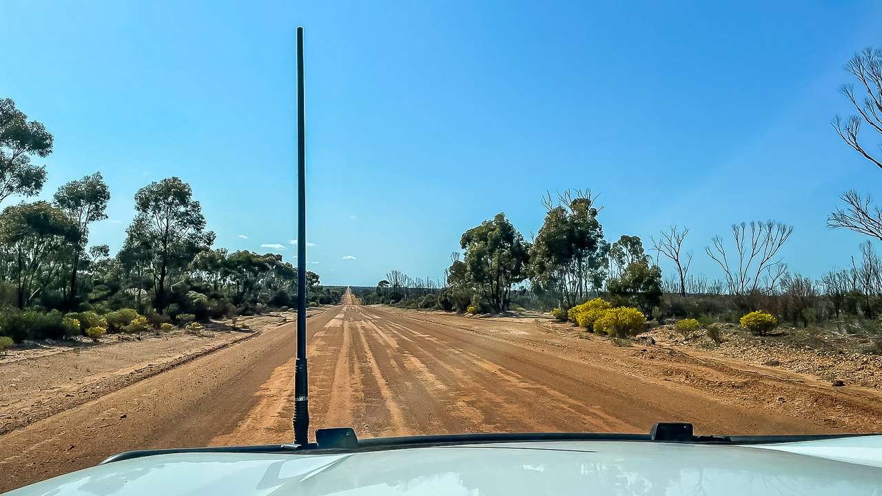
We visited Koonalda Homestead and experienced the remains of an abandoned Nullarbor roadhouse. We camped and explored including nearby Koonalda Cave. Amanda and I recently camped for two nights at Koonalda Homestead just off the Eyre Highway on the Nullarbor. This leg of our roadtrip journey started after we’d camped near Eucla at the Old Telegraph Station Campground. The drive to Koonalda Homestead after leaving the Eyre Highway was a bit rough but easily doable.
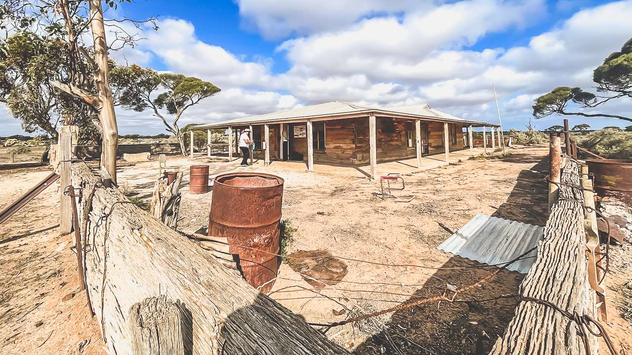
Koonalda Homestead

Koonalda Homestead

The Drive to Koonalda Homestead

Leaving our campsite near Eucla we hit the Eyre Highway after breakfast at the Border Village Roadhouse. The road was long and straight as the Nullarbor tends to be with the occasional bit of roadkill to break the monotony. About 40km past Border Village, we reached the turnoff to Koonalda Homestead – marked by a small, easy to miss sign. From there it’s a 14km dirt road to the homestead itself.

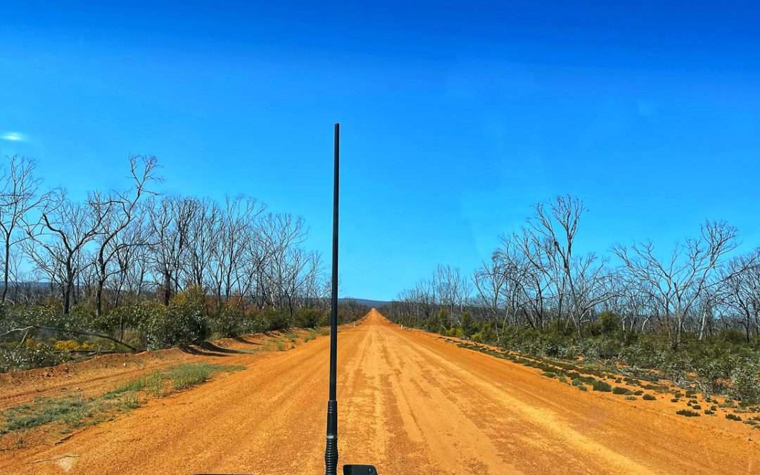
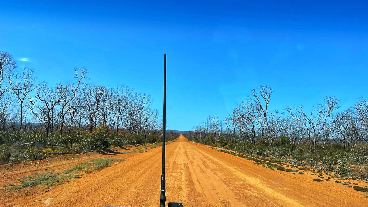
The gravel road in is typical National Parks style that hasn’t seen any maintenance for a long time. It was as rough as guts, with corrugated sections that shook the bejeesus out of everything. We took it slow and steady, sticking to about 40-50 km/h to avoid shaking the car and caravan to bits. We’ve done thousands and thousands of kilometres on this kind of road over the years and have learned that a cautious approach can save you a lot of trouble. I know some people will advocate driving at 90 km/h and “getting up on top of the corrugations” but the slow and steady approach has always worked for us.
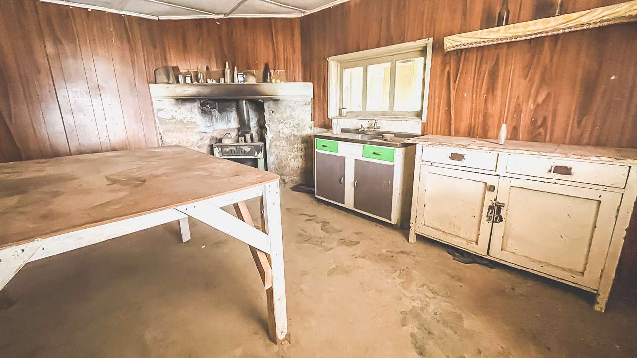
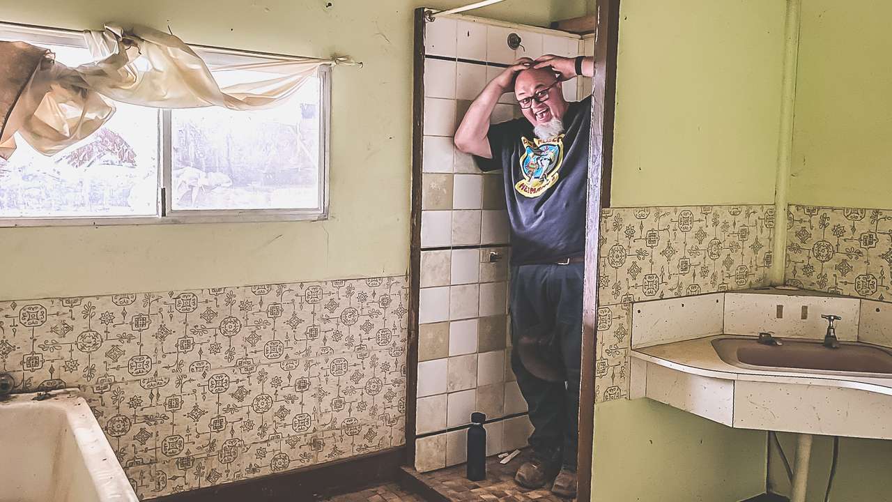
Kitchen At Koonalda Station

Kitchen At Koonalda Station

Koonalda Homestead: A Step Back in Time

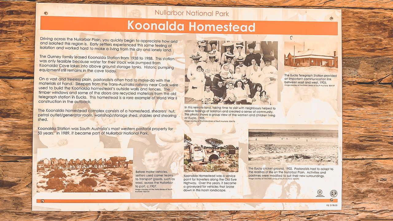
When we finally rolled into Koonalda Homestead the landscape opened up to reveal the remains of the Koonalda Homestead and the wrecked car graveyard at this historic site. Built in the 1930s Koonalda was originally a sheep station before becoming a roadhouse on the old Eyre Highway. From the 1950s to the 1970s it was a lifeline for travellers crossing the Nullarbor, offering fuel, food and a bit of human connection in the middle of nowhere.

But when the new Eyre Highway was built further south in the late 1970s Koonalda’s days as a roadhouse came to an end. What’s left today is an almost fully intact homestead surrounded by endless plains and steeped in stories of resilience and isolation.

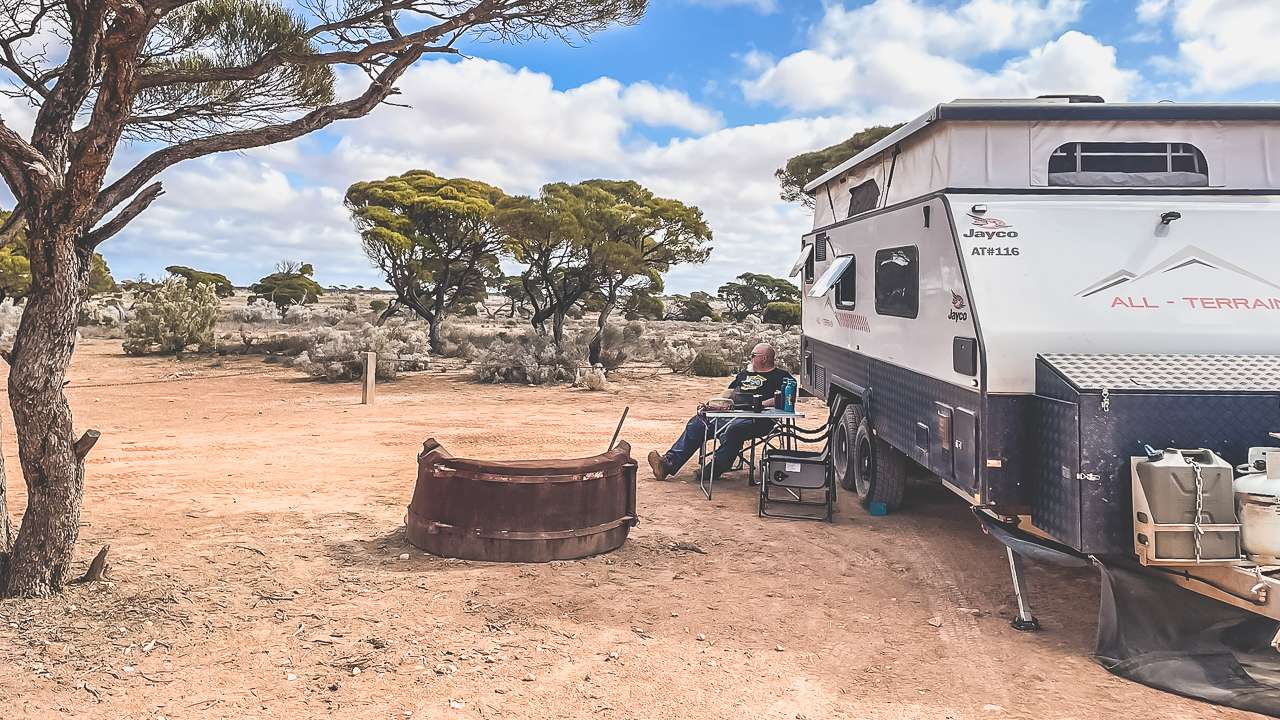
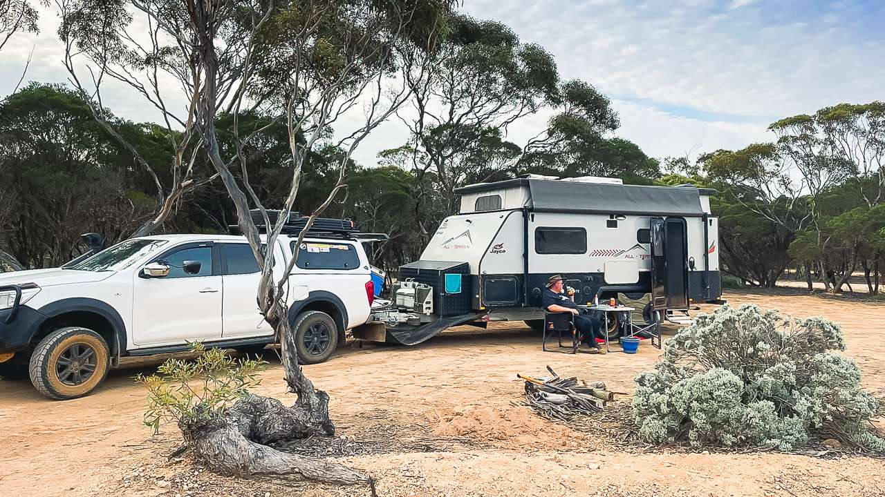
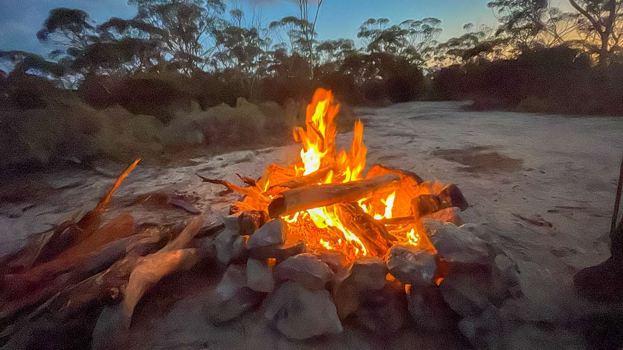
The first thing Amanda and I did was set up camp at the national park campground just a short walk from the homestead ruins. At $13 per night it’s a bargain and booking online was straightforward – although we suspect not everyone bothers. Make sure to book before you get to the Koonalda Homestead camping area as unless you have Starlink you won’t have an internet connection. The campsite is basic but well maintained with flat areas for tents and caravans and a few fire pits.
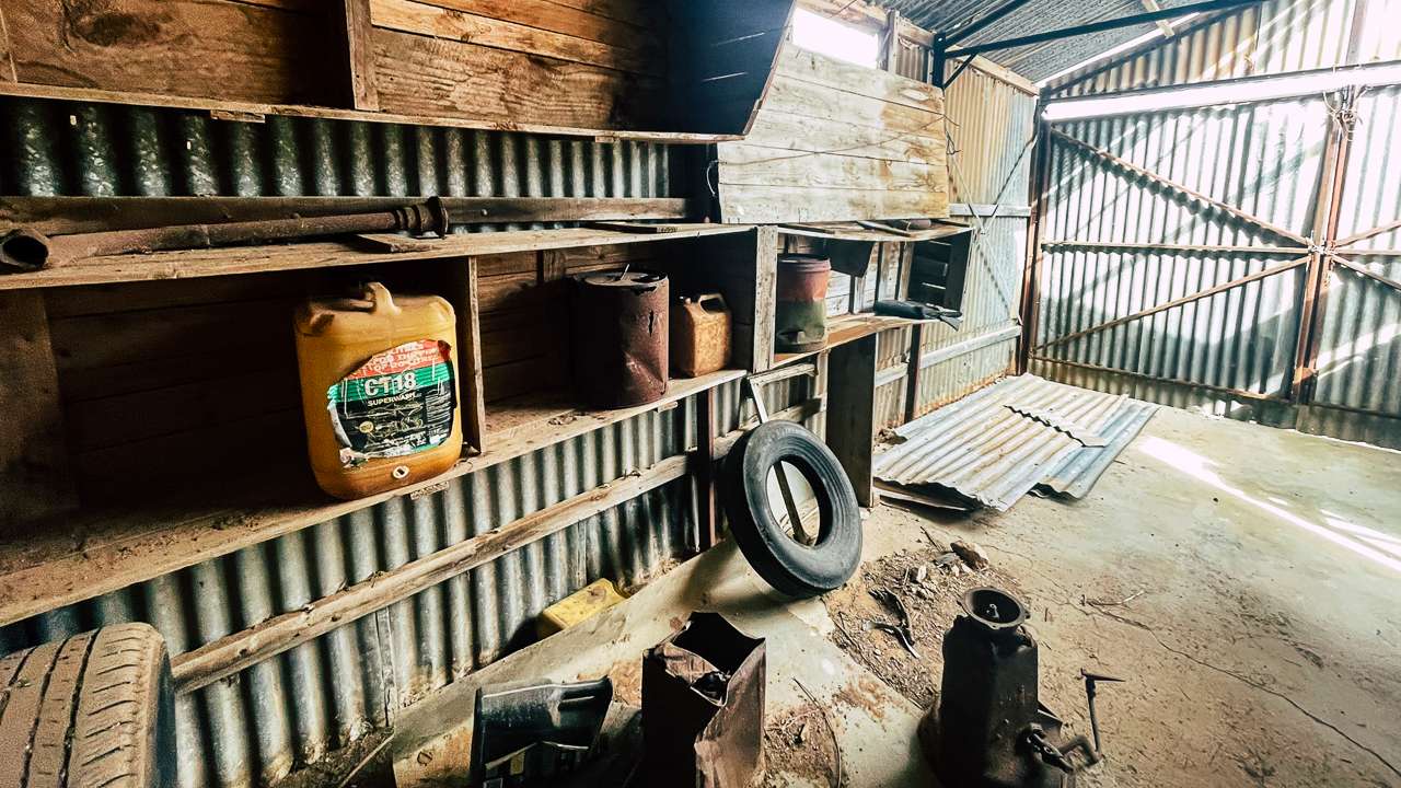
Inside The Abandoned Station Servo At Koonalda Homestead

Inside The Abandoned Station Servo At Koonalda Homestead

Exploring the Old Homestead

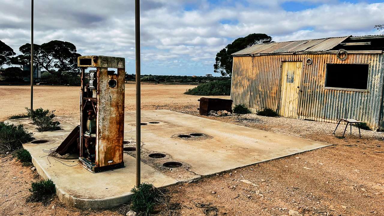
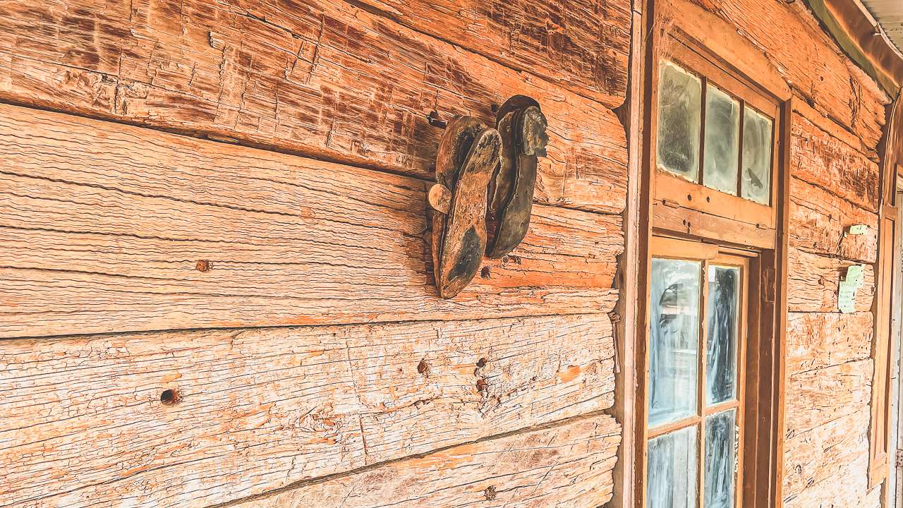
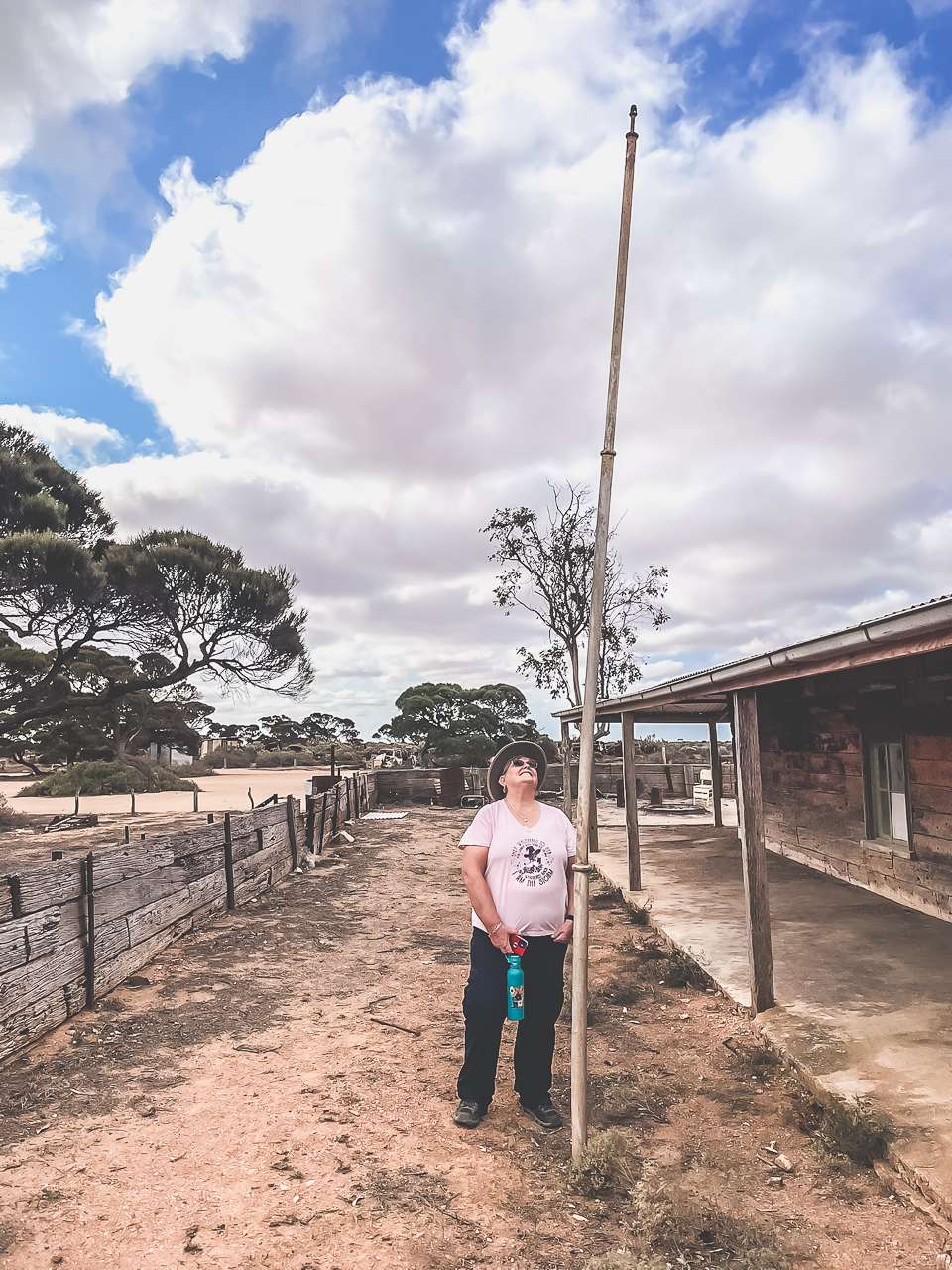
After setting up we spent hours exploring the old Koonalda Station buildings. The main roadhouse structure is still standing. The servo with its old abandoned pumps makes for some awesome photos. Its weathered timbers, rusting tin roofs and old walls tell a story of survival in one of Australia’s harshest environments.

I found myself imagining the bustling days of the 1960s when travellers and truckies would have gathered here swapping stories over cups of billy tea. Amanda on the other hand was fascinated by the little details – old bottles, rusting machinery and remnants of old gardens scattered around.

The Car Graveyard And A Geocache

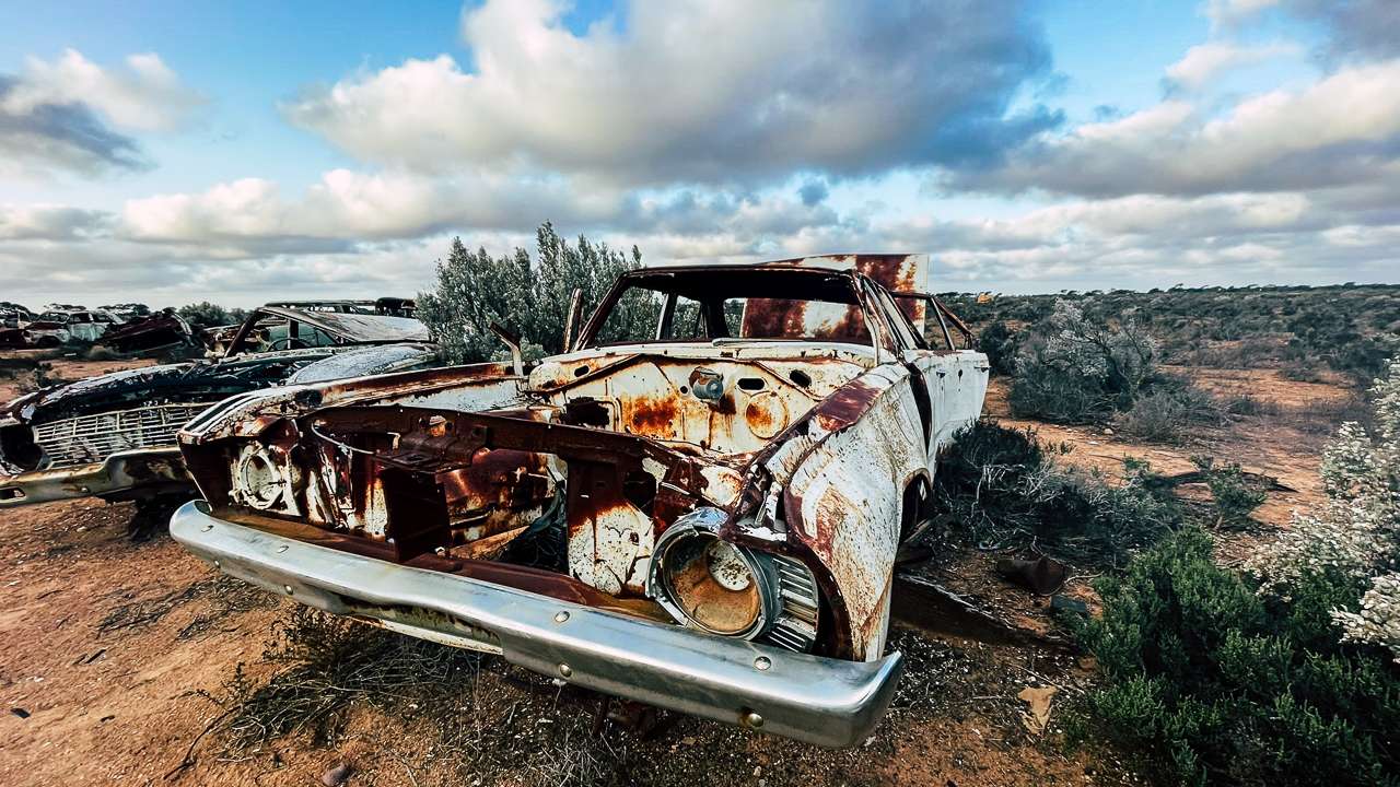
Not far from the homestead lies one of Koonalda’s best and most interesting attractions – the car graveyard. This sprawling collection of abandoned vehicles is a testament to the challenges of crossing the Nullarbor back in the day. Rusting sedans, utes and even quite a few trucks sit scattered like forgotten relics of the past.

While Amanda snapped photos of nature reclaiming these wrecks I set off on a geocaching mission. Somewhere in this mechanical graveyard, I knew there was a hidden cache. It took a bit of searching – and a lot of muttering when I walked through the car graveyard – but I finally found it tucked away under one of hundreds of sheets of corrugated iron. There’s something oddly satisfying about finding a geocache in such a remote and spooky spot.

Long Abandoned Vehicle At Koonalda Roadhouse

Long Abandoned Vehicle At Koonalda Roadhouse

Koonalda Cave: A Cultural and Geological Marvel

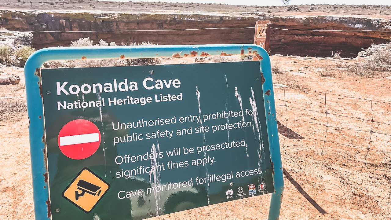
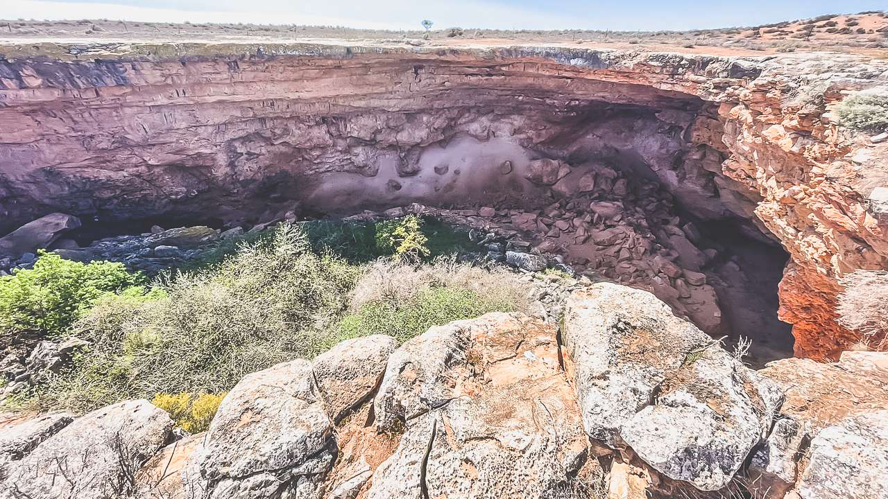
Day two took us to Koonalda Cave, a must-see for anyone visiting the area. This enormous sinkhole has deep cultural significance for the Mirning people and is one of the oldest archaeological sites in Australia. Artefacts found here date back tens of thousands of years, offering a glimpse into the lives of the Nullarbor’s earliest inhabitants.

The cave’s entrance is fenced off to protect it, but just standing near the edge and peering into the darkness was enough for me. I asked Amanda if the fence hadn’t been there if she’d fancied climbing in for a closer look. Her response? Yeah I won’t repeat it but I will say it contained a few references to “idiot”.
Koonalda Cave

Koonalda Cave

The Hunt For The Koonalda Homestead Blowhole

Next on our list was the Koonalda Blowhole. Blowholes are natural vents in the limestone plains where air from underground caves escapes to the surface. Finding this one was a bit of an adventure in itself.

With little in the way of signage or directions we relied on a dodgy map and a lot of trial and error. After what felt like hours of walking around in circles searching we figured out we’d been standing next to it for an hour. It wasn’t what we were expecting!

While the Koonalda Blowhole wasn’t particularly active that day it was still a fascinating thing. Standing over a hidden cave system with air gushing up from below is pretty cool.

Driving The Old Eyre Highway

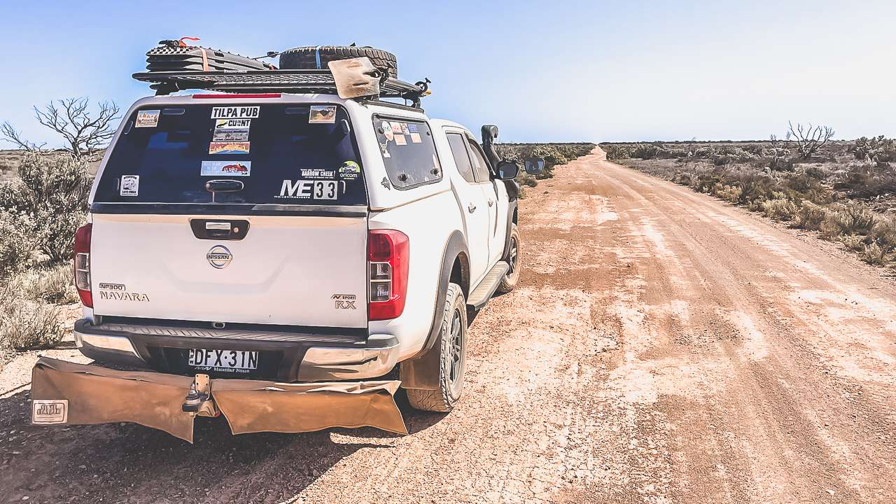
To round out our trip we decided to go for a drive along a section of the old Eyre Highway. This dirt track was once the main route across the Nullarbor and driving it is like stepping back in time.

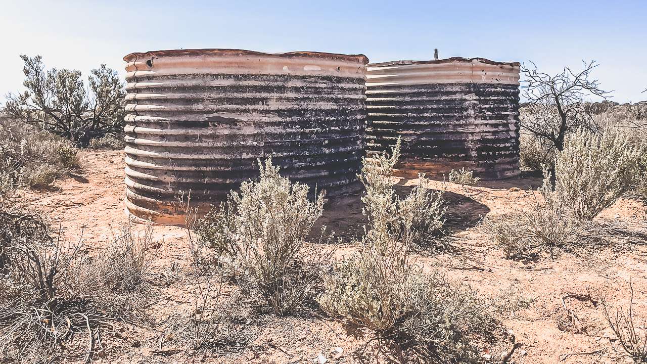
The road was rough and rugged, but it had a charm all its own. We managed about 30 km before turning back. We’d have liked to go further however it was getting late in the day. There were a surprising number of relics to be found including the remains of a substantial set of tanks. There were also a couple more sinkholes / caves.
Driving The Old Eyre Highway Near Koonalda

Driving The Old Eyre Highway Near Koonalda

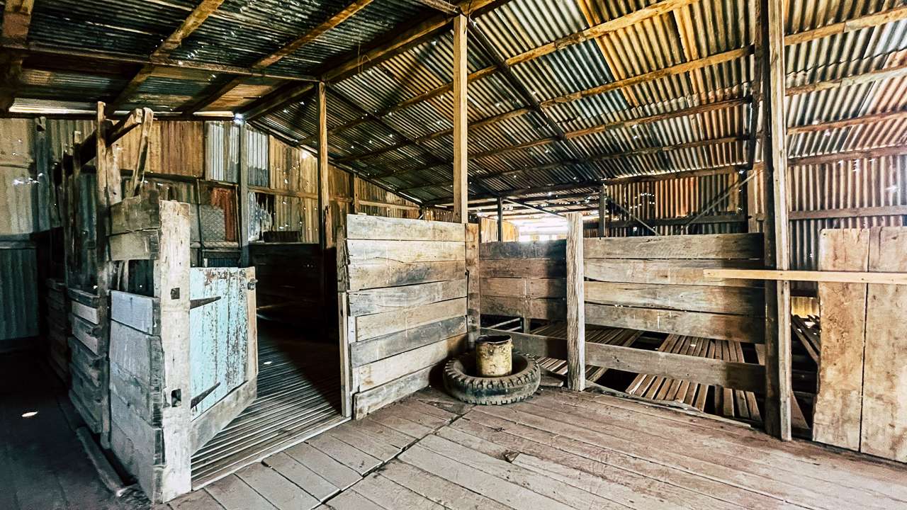
The Koonalda Homestead Shearing Shed

The Koonalda Homestead shearing shed is a testament to the rugged ingenuity of early Australian pastoral life. Constructed with timber and corrugated iron this weathered and beaten up structure echoes the days when wool production sustained remote communities.

Once the lifeblood of the station the shed housed shearers who laboured tirelessly in harsh conditions, helping to shape the economic heartbeat of the Nullarbor Plain. Today the shearing shed offers visitors a look back to a bygone era, with its rustic charm and utilitarian design. Its proximity to the decaying Koonalda Homestead further enhances the site’s historical significance, capturing the resilience of outback life.

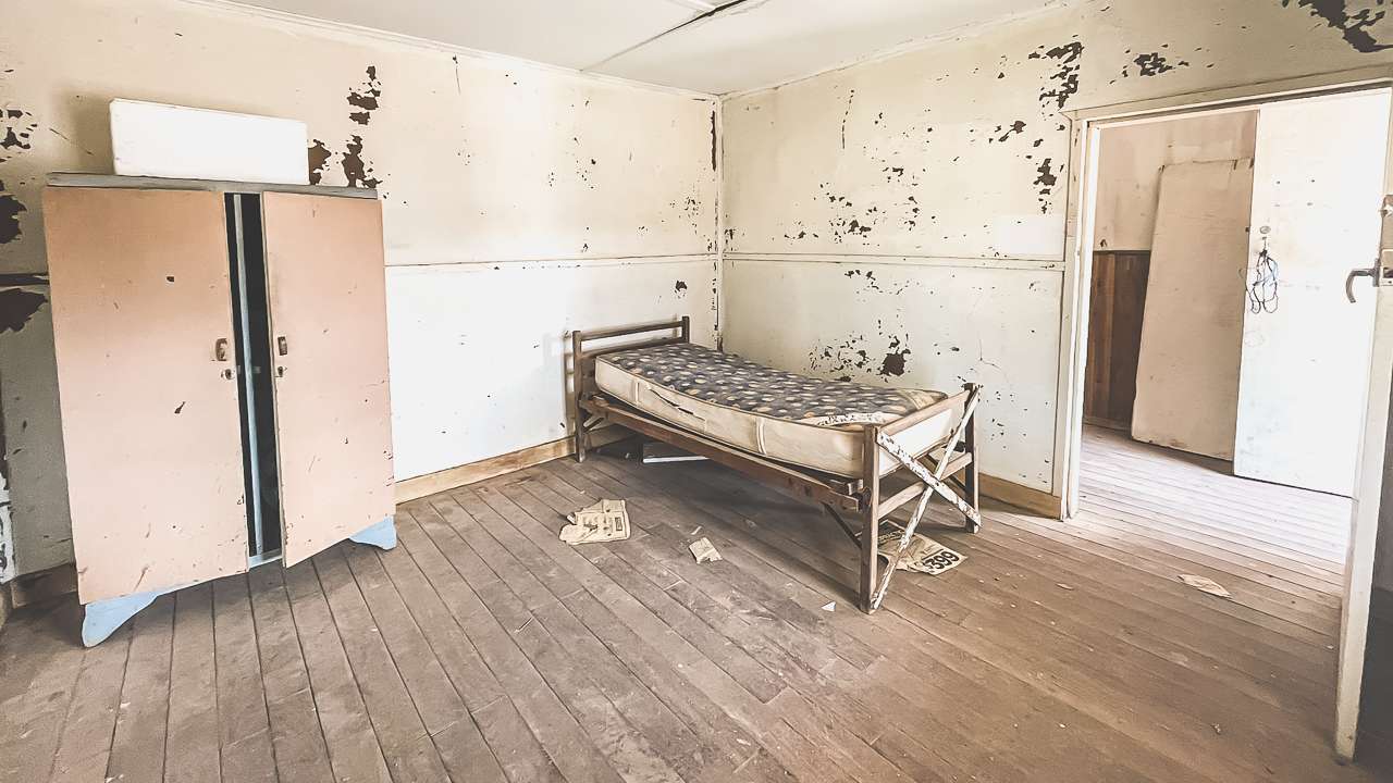
The Koonalda Homestead Sleeper Hut

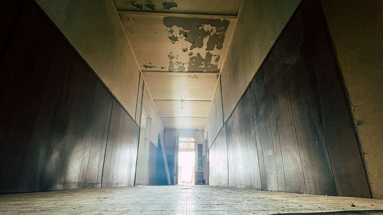
The Koonalda Homestead sleeper hut is a stark reminder of the resourceful practices that defined life on the Nullarbor. Constructed from railway sleepers, the hut exhibits a pragmatic design tailored to the harsh, arid environment. These heavy wooden beams, once intended for rail infrastructure, were repurposed to create sturdy, insulated walls capable of withstanding extreme weather. The sleeper hut, located near the iconic Koonalda Homestead, offers a tangible link to the past, showcasing the ingenuity and adaptability of those who lived and worked in isolation. This modest structure embodies the resilience required to thrive in one of Australia’s most unforgiving landscapes.
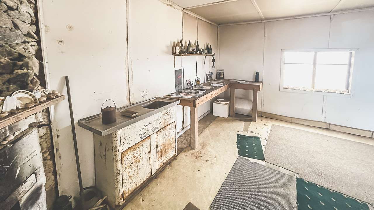
Inside The Sleeper Hut At Koonalda Homestead

Inside The Sleeper Hut At Koonalda Homestead

Weather and Camping Tips

In September, the Nullarbor weather was just about perfect. Days were sunny and mild, sitting around 20°C, while nights were cool enough for a campfire without being too chilly. But the Nullarbor is a place of extremes, so if you’re planning a visit at another time of year, be prepared for scorching summers or biting winter winds.

If you’re thinking of camping at Koonalda Homestead, here are a few tips:

  1. Book Ahead: Reserve your spot online for per night.
  2. Take It Slow: The road in is rough, so drive carefully and avoid rushing.
  3. Bring Supplies: There are no facilities, so pack plenty of water, food and fuel.
  4. Respect the Site: The homestead is fragile – look, but don’t touch.
  5. Check the Weather: Plan for hot days, cold nights and potential storms.

Final Thoughts

Koonalda Homestead is more than just a camping spot – it’s a step back in time, a slice of Aussie history and a reminder of how resilient people can be. Amanda and I left feeling inspired, a little dusty and with plenty of stories to share. If you’re looking for an outback adventure with a healthy dose of Aussie history then Koonalda Station is a place to go.

Just remember: take it slow, book ahead and don’t be the bloke who loses a wheel on the track in. Safe travels and happy camping!

-David & Amanda
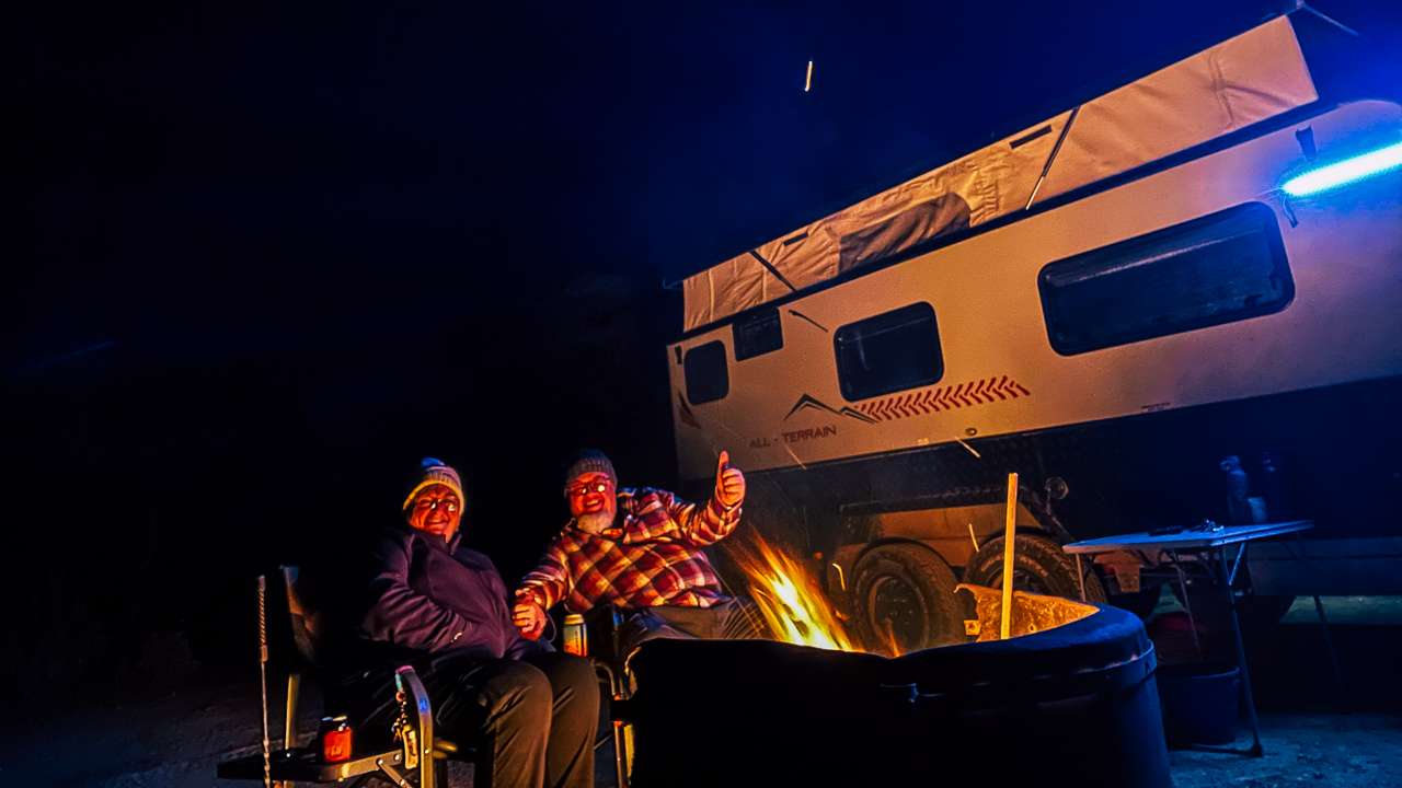
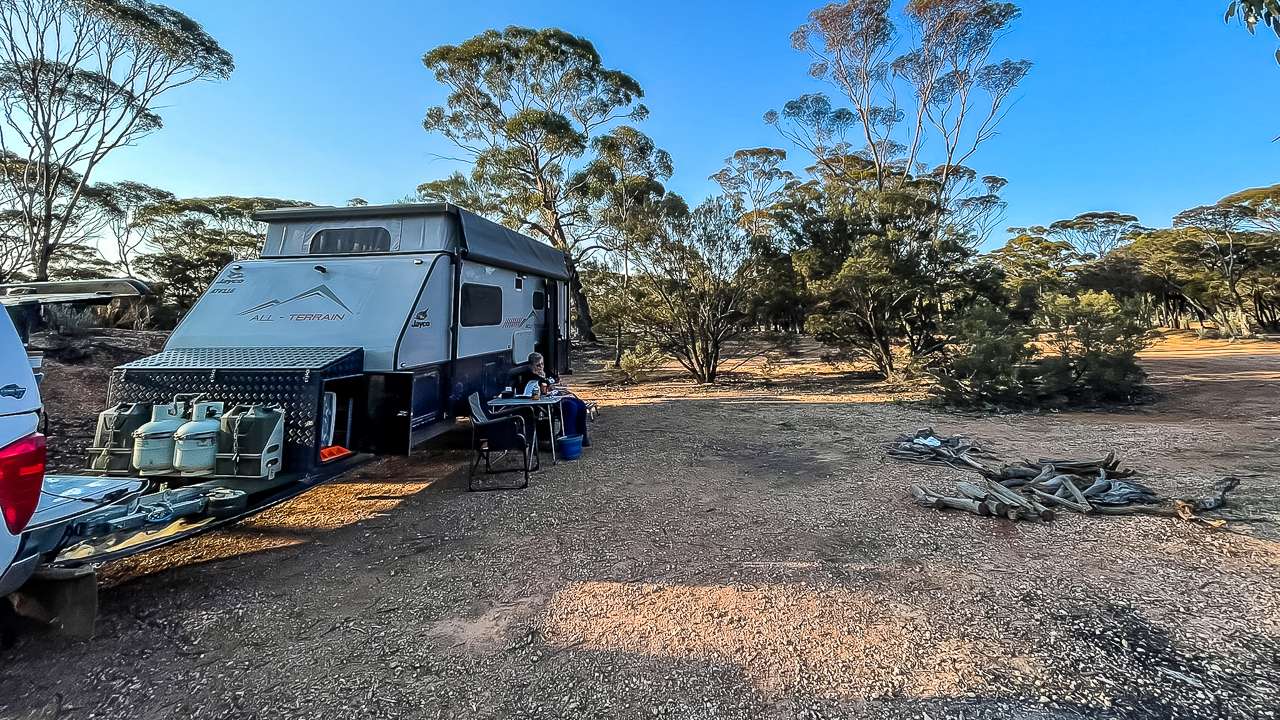
Camping With A Fire At Koonalda Homestead
Camping With A Fire At Koonalda Homestead

Koonalda Homestead Photos

FAQs About Koonalda Homestead Camping And Exploring

What is Koonalda Homestead and why is it significant?

Koonalda Homestead is a historic site on the Nullarbor Plain that once served as a sheep station and later as a roadhouse on the old Eyre Highway. It is significant for its connection to Australia’s outback history and the resilience of those who lived and worked in this isolated region.

How can I get to Koonalda Homestead?

Koonalda Homestead is located off the Eyre Highway, approximately 40km east of Border Village. A 14km dirt road leads to the site, but the track can be rough with corrugations. Driving carefully and allowing extra time is essential.

Can visitors camp at Koonalda Homestead?

Yes, you can camp at Koonalda Homestead within the national park-managed campground. It costs $13 per night, and bookings should be made online. Facilities are basic, so bring plenty of water, food, and other essentials.

What can I see and do at Koonalda Homestead?

Visitors can explore the ruins of the homestead, visit the nearby car graveyard, and take in the stark beauty of the surrounding Nullarbor Plain. Other attractions include Koonalda Cave, a site of archaeological significance, and the Koonalda Blowhole.

What is the history behind the car graveyard near Koonalda Homestead?

The car graveyard is a collection of abandoned vehicles left by travellers on the old Eyre Highway. It reflects the challenges of crossing the Nullarbor in earlier decades when breakdowns often meant leaving vehicles behind.

Is Koonalda Homestead part of a national park?
Yes, Koonalda Homestead is located within Nullarbor National Park. This status helps preserve the site’s historical and cultural significance while allowing visitors to experience its unique outback setting.

Free Camping Caiguna East Bush Camp On The Nullarbor

Free Camping Caiguna East Bush Camp On The Nullarbor

Free Camping Caiguna East Bush Camp On The Nullarbor

Free Camping Caiguna East Bush Camp on the Nullarbor: Easy access, campfires allowed, lots of space and star filled night skies for free. Amanda and I camped there during our September 2024 road trip and it turned out to be one of the highlights of our journey across the Nullarbor.

✔ Free camp
✔ WA Nullarbor location
✔ Lots of room

Caiguna East Bush Camp At A Glance

Caiguna East Bush Camp is a well known free camping area on the Nullarbor located 1,020 km east of Norseman along the Eyre Highway. Set in a remote location the camp offers basic facilities such as shaded seating and picnic areas. While the amenities are limited the camp’s peace and quiet and proximity to the Nullarbor Plain provide a great experience for those on long road trips. With free camping it offers a simple yet enjoyable stopover for pet friendly travelers.

Type: Nullarbor Free Camping
Amenities: None
Location: Eyre Highway, Cocklebiddy, Western Australia
Cost: Free
GPS: -32.249542°, 125.542926°
Phone: N/A
Website: N/A
Pets: Yes
Distance From Norseman: 377 km
Distance From Ceduna: 824 km

Caiguna East Bush Camp – A Great Free Camp On The Nullarbor

The Caiguna East Bush Camp is one of those places you could easily miss if you weren’t looking for it. Just 5 kilometres east of Caiguna and marked by a rusted 44-gallon drum on the edge of the Eyre Highway, this unassuming entrance hides an expansive bush retreat.

Free Camping On The Nullarbor

Free Camping On The Nullarbor

Finding Your Way In

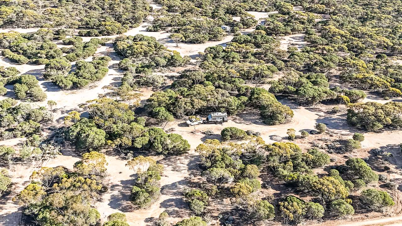
Turning off the highway, we were greeted by a network of tracks weaving through the bush. It felt a bit like entering a natural maze, but instead of dead ends, we stumbled upon private camping spots dotted throughout the landscape. The process of choosing a spot became part of the adventure. After ten minutes of leisurely exploration, we found the perfect nook—flat, quiet and far enough from the highway to drown out any residual traffic noise.

Caiguna East Bush Camp Is Spacious And Quiet

The camp itself is vast, offering plenty of room for vehicles of all shapes and sizes. Whether you’re in a compact campervan or towing a large caravan, you’ll find a spot that suits you. The beauty of this place lies in its tranquillity. We felt like we had the entire bush to ourselves, with only a few other campers tucked away in distant corners. It’s rare to find such a serene setting that’s still so accessible.

Free Camping On The Nullarbor At Caiguna Bush Camp

Free Camping On The Nullarbor At Caiguna Bush Camp

A Starry Night And A Campfire

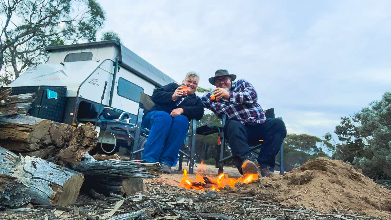
We came prepared with firewood knowing that local supplies have usually been picked clean in well used free camps. As the sun dipped below the horizon we lit a modest fire and sat next to it well into the evening. The flames crackled and above us the sky put on a display of millions of stars. Amanda spotted a satellite streaking across the heavens but whether it was that or just a particularly determined shooting star who knows. The view was fantastic.

Free Camping On The Nullarbor At Caiguna East Bush Camp

Free Camping On The Nullarbor At Caiguna East Bush Camp

Quirks – The Good And The Bad

Like any bush camp Caiguna East isn’t without its quirks. The flies during the day were relentless turning simple tasks into exercises in patience and endurance. Thankfully they retreated with the setting sun leaving us to enjoy the evening in peace. The other challenge was the rubbish. It’s disheartening to see rubbish left behind in such a pristine environment. Amanda and I took the opportunity to tidy up around our area but it’s clear that more campers need to take responsibility for their waste.

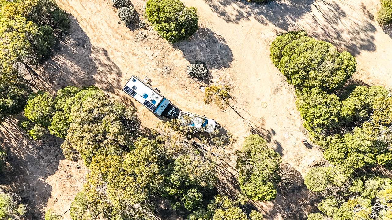
Free Camping On The Nullarbor At Caiguna East Bush Camp From Above

Free Camping On The Nullarbor At Caiguna East Bush Camp From Above

A Must Visit On The Nullarbor

The Caiguna East Bush Camp is more than just a convenient stopover; it’s a great free camp. Whether you’re travelling solo, as a couple or with a group, it’s the perfect spot to take a breather and enjoy the beauty of the Nullarbor.

Just remember to bring your firewood and a commitment to leaving no trace. The rusted drum at the entrance might not look like much but beyond it lies a bloody awesome camping experience.

And if you’re looking for even more great camps including many free camps on the Nullarbor check out this article – 91 EPIC Nullarbor Camping Sites To Add To Your List.

-David & Amanda

FAQs About Free Camping Caiguna East Bush Camp

Where is Caiguna East Bush Camp located?
Caiguna East Bush Camp is located 5 kilometres east of Caiguna along the Eyre Highway. The entrance is marked by a rusted 44-gallon drum, making it an easy landmark for travellers.

What makes Free Camping Caiguna East Bush Camp unique?

This hidden gem offers an expansive bush retreat with secluded camping spots. Its tranquillity, vast open spaces, and starry night skies make it an unforgettable stop on the Nullarbor.

What facilities or features can I expect at Free Camping Caiguna?

While there are no formal facilities, the campsite provides plenty of flat, spacious areas for all types of vehicles. Campfires are a highlight, but visitors should bring their own firewood.

Are there any challenges when staying at Caiguna East Bush Camp?

The main challenges include flies during the day and litter left by previous visitors. Bringing insect repellent and taking responsibility for waste can greatly improve your experience.

Is Free Camping Caiguna suitable for all types of travellers?

Yes, the camp is ideal for solo travellers, couples, and groups. Its secluded spots and peaceful atmosphere cater to those seeking a quiet retreat in nature.

What should I bring when visiting Free Camping Caiguna?

Be sure to bring firewood, as local supplies are scarce. Pack essentials like insect repellent, rubbish bags to carry out your waste, and a sense of adventure to explore this natural bush retreat.

Birdsville Australia – Does It Really Live Up To The Hype?

Birdsville Australia – Does It Really Live Up To The Hype?

Birdsville Australia – Does It Really Live Up To The Hype?

Does Birdsville live up to the hype? Find out if it really is Australia’s ultimate Outback escape for adventure, action and tradition.

Birdsville is a settlement located on the fringe of Australia’s Simpson Desert. It exists as an iconic representation of the Outback. Known for rugged beauty, a challenging climate and rich history this remote Queensland town captures the essence of Australia’s outback. Its strategic location as a gateway to the Outback draws adventurers, historians and culture enthusiasts alike, eager to experience a unique blend of nature, heritage and community.

From its early days as a modest outpost to its evolution into an outback adventure mecca. Birdville has watched the struggles and triumphs of settlers and explorers. Read on to find out if Birdsville lives up to all the hype.

History of Birdsville

Origins and Early Settlement
The story begins in the mid-1800s, during Australia’s early settlement period. Initially, the area was known to the local Indigenous populations, with deep cultural connections to the land. European exploration of the region, however, started with the expeditions of major explorers like John McDouall Stuart in the 1860s. The town itself began to be a settlement around the 1880s, driven by the expansion of cattle stations and the need for a supply depot. 

The Role of Birdsville in Outback Exploration
During the late 19th and early 20th centuries Birdsville played a crucial role in Australia’s exploration of the Outback. It became a vital stopping point for drovers, traders and explorers making their way across the harsh desert landscapes. Its location along the Birdsville Track, a famous route linking South Australia to Queensland, cemented its place as a key logistical point in the Outback’s supply chain. The town provided essential provisions, acting as a lifeline for those traversing the unforgiving terrain.

How Birdsville Became an Iconic Outback Destination
The 20th century saw Birdsville’s transition from a utilitarian outpost to a celebrated Outback destination. With the advent of tourism and the growing allure of the Simpson Desert, Birdsville’s historical landmarks, unique climate and annual events began attracting visitors from around the world. Today, it is known not only for its rich heritage but also for its dynamic festivals, outdoor adventures and its standing as one of Australia’s most remote yet beloved destinations.

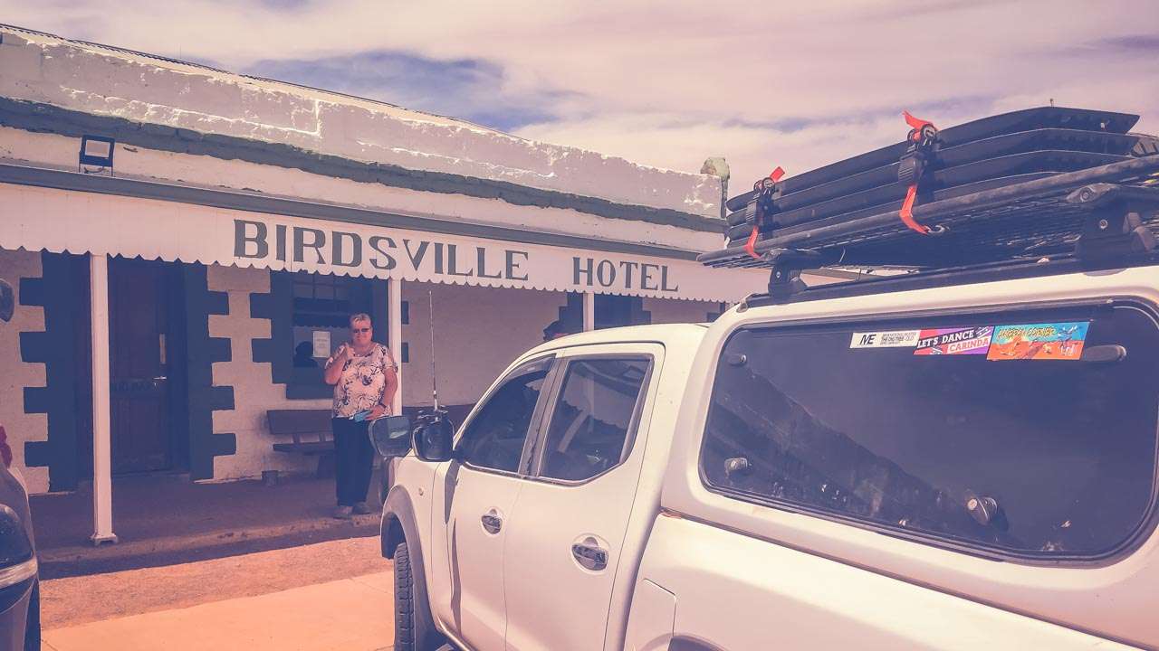
Birdsville Hotel Follow Our Travels

Birdsville Hotel Follow Our Travels

Birdsville Track: The Legendary Route

History of the Birdsville Track and Its Importance
The Birdsville Track is one of Australia’s most iconic and historically significant outback routes. Originally created as a cattle route in the 1860s, it links Birdsville in Queensland to Marree in South Australia, stretching over 500 kilometers of rugged desert terrain. It became an essential link for drovers moving livestock to the markets in South Australia and its historic significance only grew as it became the backbone of outback exploration and transport.

What to Expect When Traversing the Birdsville Track
The Birdsville Track is a challenging and rewarding experience for any adventurer. The route varies from gravel roads to sandy tracks, often requiring 4WD vehicles for safe passage. Driving the track offers stunning views of the desert landscape, with wide, open spaces, unique wildlife and towering sand dunes. Travelers should be prepared for isolation, limited services and sudden changes in weather conditions.

Where to Get the Latest Birdsville Track Conditions Information
Due to its remoteness, the Birdsville Track can be treacherous if not approached with caution. To ensure a safe journey, it is essential to check the latest road conditions and weather reports. Information can be obtained from local authorities, the Birdsville Information Centre, the Birdsville Hotel and online resources dedicated to Outback travel.

10 Facts About The Birdsville Track

  1. An Historic Outback Route
    The Birdsville Track is one of Australia’s most famous and historically significant outback roads. Stretching over 500 kilometers from Marree in South Australia to Birdsville in Queensland, it has been an essential route for settlers, explorers and traders for over a century.
  2. A Rugged Adventure
    Traversing the Birdsville Track is not for the faint of heart. With its dirt roads, remote terrain and challenging conditions, it offers an authentic outback adventure for travelers seeking a true test of endurance and resilience.
  3. A Lifeline to the Outback
    The Birdsville Track has served as a vital link for the transport of livestock and supplies, especially during the early years of settlement. For decades, it provided a crucial connection between remote stations and the rest of Australia.
  4. The Simpson Deserts’ Gateway
    The track runs along the eastern edge of the Simpson Desert, one of the most iconic and expansive desert regions in the world. As such, it offers travelers the chance to experience the vastness of the Outback and witness the raw beauty of the desert landscape.
  5. Challenging Conditions Year-Round
    The Birdsville Track is notorious for its extreme conditions. In the summer, it can be sweltering hot, while winter brings cold nights and occasional flooding during the wet season. You have to be well prepared for the changing challenges posed by the environment.
  6. Wildlife and Scenery Along the Way
    The journey along the Birdsville Track offers a unique opportunity to witness the Outback’s wildlife and dramatic landscapes. From kangaroos and emus to the occasional wild camel, the track provides a front-row seat to some of Australia’s most iconic fauna in their natural habitat.
  7. The Track Was Pioneered by John McDouall Stuart
    In 1862, explorer John McDouall Stuart famously pioneered a route through the harsh terrain of the Birdsville Track as part of his expedition to chart a path to central Australia. His journey paved the way for future exploration and settlement.
  8. A Popular 4WD Route
    Today, the Birdsville Track is one of the most popular 4WD routes in Australia, attracting adventure seekers and off-road enthusiasts who want to explore the remote heart of the Outback. Its rugged beauty, isolation and sense of challenge make it a bucket-list experience for many.
  9. Limited Services Along the Track
    Due to its remoteness, the Birdsville Track offers few services for travelers. There are limited fuel stations, basic accommodations and supplies along the way, so careful planning and self-sufficiency are essential for those attempting the journey.
  10. The Birdsville Track Conditions Change Regularly
    The condition of the Birdsville Track can change rapidly depending on weather conditions, particularly after heavy rains. Travelers are advised to check current road conditions before setting off, as some sections may be impassable during certain times of the year, especially after floods.

Iconic Landmarks

The Birdsville Hotel: A Historic Pub with Stories to Tell
The Birdsville Hotel, built in the 1880s, is one of Australia’s most iconic outback establishments. This historic pub has witnessed the passing of generations and serves as a gathering spot for travelers and locals alike. Its walls are adorned with memorabilia from the town’s colorful past, making it a must-visit for anyone exploring the area. The pub is renowned for its hearty meals, cold drinks and warm hospitality, all in the heart of the desert.

10 Facts About The Birdsville Hotel

  1. A Landmark in the Outback
    Established in 1884, the Birdsville Hotel stands as one of the most iconic and historic establishments in the Australian Outback. Serving as a refuge for travelers and locals alike, it’s a symbol of the resilience and spirit of Birdsville.
  2. The Heart of the Community
    The Birdsville Hotel is more than just a pub—it’s the social hub of the town. For many many years it’s been a gathering place where locals share stories, celebrate milestones and host events, including the legendary Birdsville Races.
  3. A Monument to History
    Stepping into the Birdsville Hotel is like stepping back in time. With its weathered façade and traditional Aussie pub features the hotel preserves the history of the region while offering a warm and welcoming atmosphere for visitors seeking a taste of Outback heritage.
  4. A Haven for Travelers
    As the only major accommodation in the area, the Birdsville Hotel provides a sanctuary for those exploring the harsh desert landscape. Its rooms, pub meals and iconic beer garden offer comfort and respite after long days in the Outback.
  5. The Pub With a Story
    The Birdsville Hotel is known for its unique collection of stories and memorabilia. From autographed photos of past patrons to quirky artifacts the hotel walls tell the tale of those who have ventured to the region over the years. Each leaving behind a piece of Outback history.
  6. The Famous Birdsville Hotel Bar
    The bar at the Birdsville Hotel is a highlight for many visitors. Serving cold drinks in an environment that’s part rustic pub, part Outback museum, it’s a place where weary travelers and adventure seekers can relax and unwind with a drink in hand, often with a bit of friendly banter.
  7. Hosting the Outback’s Biggest Events
    The Birdsville Hotel plays a pivotal role during major events such as the Birdsville Races and the Big Red Bash. As a central gathering point, it provides a space for celebrations, post-race parties and performances, making it an integral part of these iconic Outback occasions.
  8. Culinary Delights in the Desert
    The Birdsville Hotel serves up hearty Australian pub fare, with a focus on locally sourced ingredients and Outback-inspired dishes. From steak sandwiches to traditional Aussie pies, the hotel’s menu satisfies both locals and visitors seeking authentic Outback cuisine.
  9. A Steadfast Outback Icon
    Despite the harsh desert environment and the isolation of Birdsville, the hotel has remained a steadfast fixture. It has withstood floods, droughts and the test of time, maintaining its status as a beloved Outback institution.
  10. A Gateway to the Simpson Desert
    Located just on the edge of the Simpson Desert, the Birdsville Hotel offers a front-row seat to one of Australia’s most remote landscapes. For many, the hotel serves as the starting point for their Outback adventure, providing valuable information, local knowledge and a comfortable base for exploring the surrounding wilderness.

Big Red Sand Dune Birdsville: The Towering Sand Dune of the Simpson Desert
Big Red is one of the most recognisable landmarks. Standing at over 40 meters high, this massive sand dune is the tallest in the Simpson Desert. It gives fantastic panoramic views of the surrounding desert and visitors often challenge themselves to get their vehicle up its steep slopes. Big Red has become a symbol of the awesomely majestic beauty of the desert and is a really mega popular spot for tourists.

The Diamantina River and Its Role in the Region’s Ecosystem
The Diamantina River, though often dry, plays a crucial role in the ecosystem surrounding the area. When it does flow, it brings life to the otherwise barren landscape, supporting a wide range of wildlife and vegetation. The river is a critical water source for both humans and animals and is a reminder of the delicate balance required to sustain life in the desert.

Birdsville Races: The Outback’s Premier Horse Racing Event

Origins and Growth of the Birdsville Races
The Birdsville Races began in 1882 and over time, this event has grown into one of Australia’s premier horse racing festivals. Held annually in September, the races attract thousands of visitors from across the country. It started as a local event for the outback community but has since become a major drawcard for tourism, blending tradition with contemporary celebrations of the Outback.

Why the Races Are a Must-See Spectacle
The Birdsville Races are more than just a sporting event—they are a vibrant celebration of Outback culture. The races bring together horse racing enthusiasts, families and tourists all of whom get stuck into the excitement of the competition, the unique atmosphere and the camaraderie. Attendees are treated to an eclectic mix of fashion, entertainment and Australian deadset authentic Aussie larrikinism.

How the Event Brings the Outback Community Together
The Birdsville Races hold a special place in the hearts of the local community. It is an event that transcends geographic isolation, uniting people from various parts of Australia and even international visitors. For the residents of Birdsville, it is a moment of joy and celebration and it plays a vital role in the town’s economy, as well as its social fabric.

10 Facts About The Birdsville Races

  1. A Storied Tradition
    The Birdsville Races have been held annually since 1882, making it one of the oldest and most iconic horse racing events in Australia. The event has deep roots in Outback culture, symbolizing the resilience and community spirit of the region.
  2. The Ultimate Outback Spectacle
    Known as the “Melbourne Cup of the Outback,” the Birdsville Races attract thousands of attendees each year. It’s a unique opportunity to experience horse racing in one of the more remote and rugged landscapes on the planet.
  3. A Major Social Event
    The Birdsville Races are more than just a sporting event; they are a major social gathering for locals and visitors alike. The races bring together people from across Australia and the world, all eager to celebrate in true Outback fashion.
  4. Held at the Birdsville Racecourse
    Located on the edge of the Simpson Desert, the Birdsville Racecourse is an iconic venue with a unique charm. The track is made from compacted dirt and sand.
  5. A Unique Atmosphere
    Unlike traditional racing events, the Birdsville Races are characterized by their relaxed and festive atmosphere. Visitors dress in Outback-inspired outfits, while the highlight of the event is the chance to mingle with locals, share stories and celebrate under the vast, open skies.
  6. A Thriving Economy for the Region
    The Birdsville Races are a vital part of the local economy. The influx of tourists and participants generates significant revenue for the small town, supporting local businesses such as the Birdsville Hotel, the general store and the caravan park.
  7. A Test of Endurance
    The heat and dust of the Outback provide a challenging environment for both horses and jockeys. The extreme conditions make the Birdsville Races a true test of endurance, adding an element of adventure and excitement to the competition.
  8. A Celebration of Australian Horse Racing
    The races feature a mix of flat races, including the prestigious Birdsville Cup. The event attracts some of the best horses and jockeys from across Australia, making it an exciting event for racing enthusiasts.
  9. A Focus on Community and Tradition
    The Birdsville Races are deeply rooted in the traditions of the Outback. The event is a celebration of local culture, with many Indigenous communities participating and contributing to the festivities, adding a rich cultural layer to the event.
  10. A Once-in-a-Lifetime Experience
    For many, attending the Birdsville Races is a once-in-a-lifetime experience. The combination of the desert landscape, the adrenaline of horse racing and the unique sense of community makes it an unforgettable event that draws visitors from all walks of life.

Birdsville Big Red Bash: A Festival Like No Other in the Heart of the Desert

What Makes the Big Red Bash an Unmissable Event
The Big Red Bash is a unique festival that combines music, adventure and the beauty of the desert. Held annually at the base of Big Red Sand Dune, this event attracts top Australian musical acts and festival-goers who embrace the thrill of outdoor living. It’s more than just a concert; it’s a celebration of the desert landscape and a deep connection to nature.

How Music and Nature Converge at Big Red
The festival’s location at Big Red creates a mesmerizing atmosphere where music and nature seamlessly blend. With the stunning desert backdrop and the sounds of live performances echoing across the dunes, it offers an unparalleled sensory experience. The event attracts a massive crowd. The crowd is united by a love of music and a desire to experience the Outback.

10 Facts About The Birdsville Big Red Bash

  1. The Ultimate Desert Festival
    The Birdsville Big Red Bash is an extraordinary festival set against the dramatic backdrop of the Simpson Desert. Held annually near the iconic Big Red sand dune, it is Australia’s biggest and most unique music festival, combining live music with the raw beauty of the Outback.
  2. A Celebration of Music and Nature
    The event brings together a lineup of world-class artists, including major Australian acts, for an unforgettable music experience. The fusion of music with the vast, open desert landscape creates an unparalleled atmosphere that draws visitors from across the globe.
  3. Held at the Foot of Big Red
    The festival takes its name from the towering Big Red sand dune, the largest of its kind in the Simpson Desert. This iconic dune serves as the festival’s focal point, providing both a natural spectacle and a stunning stage for the performances.
  4. An Eco-Friendly Festival
    Emphasizing sustainability, the Birdsville Big Red Bash is committed to reducing its environmental footprint. From waste management to energy-efficient practices, the festival works hard to ensure that it celebrates the Outback without compromising its fragile ecosystem.
  5. A Festival Like No Other
    Unlike other music festivals, the Birdsville Big Red Bash offers attendees the opportunity to camp under the stars, enjoy the raw beauty of the desert and immerse themselves in the true spirit of the Australian Outback. It’s an experience that combines adventure with live entertainment.
  6. Accessible to All
    Despite its remote location, the festival attracts thousands of attendees each year. With accessible camping options and organized transport from nearby towns, the Big Red Bash offers a way for everyone to experience the magic of the Outback, whether they’re seasoned travelers or first-time adventurers.
  7. A Focus on Community and Fun
    Beyond the music, the Birdsville Big Red Bash fosters a strong sense of community. Visitors gather to celebrate, share stories and enjoy the camaraderie that defines life in the Outback. It’s an event that’s as much about connection as it is about entertainment.
  8. Unique Activities and Experiences
    The festival offers more than just music. Attendees can enjoy activities such as camel rides, sandboarding, 4WD adventures and stargazing, taking full advantage of the surrounding desert landscape. These unique experiences enhance the festival, making it a multifaceted event.
  9. A Family-Friendly Atmosphere
    While the Birdsville Big Red Bash is known for its vibrant music scene, it is also a family-friendly event. With plenty of activities for children and a laid-back vibe, it’s a festival that people of all ages can enjoy, making it an ideal event for families looking to explore the Outback together.
  10. A Gateway to the Simpson Desert
    The Birdsville Big Red Bash is the perfect opportunity to explore the Simpson Desert, one of the most rugged and remote regions in Australia. For those with a sense of adventure, the festival serves as a launching point for deeper exploration into the desert’s vast landscapes, offering a true Outback experience.

Outdoor Adventures

Four-Wheel Driving Across Rugged Terrain
The surrounding area offers a range of outdoor adventures, with four-wheel driving across rugged terrain being one of the most popular activities. The surrounding desert landscapes, with their vast, open spaces and challenging tracks, provide the perfect backdrop for 4WD enthusiasts. It’s an adrenaline-filled way to explore the region while encountering the raw beauty of the Australian Outback.

Sandboarding and Hiking on Big Red
For those seeking adventure beyond the wheel, sandboarding and hiking on Big Red offer a thrilling way to engage with the desert. Hiking to the top of the towering dune rewards visitors with breathtaking views, while sandboarding down its slopes provides a rush of excitement. Both activities are a way to intimately connect with the desert landscape.

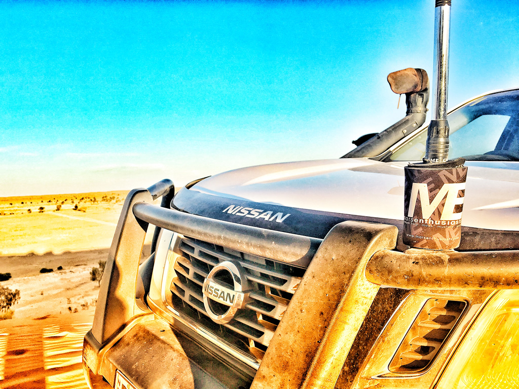
Nissan Navara NP300 Up On Top Of Big Red Birdsville

Nissan Navara NP300 Up On Top Of Big Red Birdsville

Exploring the Remote Beauty of the Simpson Desert
The Simpson Desert is a vast, arid expanse that offers unparalleled opportunities for exploration. Its ever changing sand dunes, salt lakes and rugged terrain provide a natural playground for those with an adventurous spirit. Travelers can embark on guided expeditions or go it alone, but in all cases, the desert’s remoteness and beauty are sure to leave a lasting impression.

Flora and Fauna of Birdsville

Unique Wildlife Found in the Outback
The Outback, including the Birdsville region, is home to a remarkable array of wildlife that has adapted to its harsh conditions. Kangaroos, dingoes and emus roam the landscape, while smaller creatures like reptiles and birds thrive in the arid environment. The region’s wildlife has learned to survive through ingenious adaptations to the desert’s extreme temperatures and limited water sources.

How Native Plants Thrive in Arid Conditions
In addition to its fauna, the flora of Birdsville also displays an impressive resilience to the harsh desert conditions. Native plants, including spinifex grass and saltbush, have evolved to endure long periods of drought. These hardy plants play an essential role in maintaining the region’s fragile ecosystem, providing sustenance for both wildlife and livestock.

Conservation Efforts to Preserve Birdsville’s Ecosystem
The unique flora and fauna of Birdsville are a vital part of the region’s ecological heritage. Conservation efforts are happening to preserve these species and their habitats. Local and national initiatives focus on sustainable land management practices, aimed at protecting the desert environment from overuse and degradation caused by human activities and climate change.

Cultural Heritage and Indigenous Connections

Aboriginal History and Connection to the Land
Birdsville’s history is deeply intertwined with the traditional lands of Indigenous peoples. The area has been inhabited by the Wangkangurru people for thousands of years and their connection to the land is evident in their stories, songs and art. This rich cultural heritage is an integral part of Birdsville’s identity and visitors are encouraged to learn about and respect the traditions of the region’s original custodians.

Indigenous Art and Storytelling in Birdsville
Indigenous art is a powerful form of expression that tells the stories of the land and its people. In Birdsville, local Indigenous artists and communities continue to share their culture through paintings, sculptures and oral traditions. These artworks provide valuable insight into the spiritual and cultural connections that Indigenous Australians have with the Outback.

Respecting and Learning from Local Traditions
For those visiting Birdsville, it is essential to approach the area with respect for its Indigenous heritage. Engaging with local communities, learning about the region’s history and participating in cultural experiences are meaningful ways to gain a deeper understanding of the Outback’s significance to its original custodians.

Planning Your Visit to Birdsville

Best Times of Year to Explore the Region
The best time to visit Birdsville is during the cooler months, from May to September. This period offers more comfortable temperatures for outdoor activities, such as hiking, 4WD adventures and attending the Birdsville Races. While the summer heat can be unbearable, the cooler months provide the ideal conditions for exploring the Outback.

Travel Options: By Air, Road, or 4WD Adventures
Birdsville is accessible by various means of travel. The most popular option is to drive, either by car or 4WD, along the Birdsville Track. There is also a small airstrip in Birdsville, with flights available from larger towns like Longreach and Brisbane. For those seeking adventure, a 4WD journey across the rugged Outback terrain can be an unforgettable experience.

What to Pack for an Outback Journey
When heading to Birdsville, it is essential to pack appropriately for the harsh desert environment. Items such as sunscreen, wide-brimmed hats, sturdy footwear and plenty of water are must-haves. You should bring a detailed map, a first-aid kit and reliable communication equipment to ensure a safe and enjoyable experience.

Birdsville Accommodation

Camping in Birdsville: A True Outback Experience
For those seeking an authentic Outback experience, camping in Birdsville is an ideal option. Whether pitching a tent by the Diamantina River or setting up near Big Red, camping allows visitors to fully immerse themselves in the vast desert landscape.

The Birdsville Caravan Park: Comfort in the Wilderness
The Birdsville Caravan Park offers a more comfortable option for those wishing to stay in the region. With powered and unpowered sites, as well as cabin accommodations, it provides a good balance of convenience and ruggedness for travelers. The caravan park is a great base for exploring the area.

Other Lodging Options for Different Budgets
Birdsville offers a variety of accommodations catering to different budgets. From basic to more luxurious (well for Birdsville), visitors can find suitable options that provide comfort and convenience during their stay in the desert.

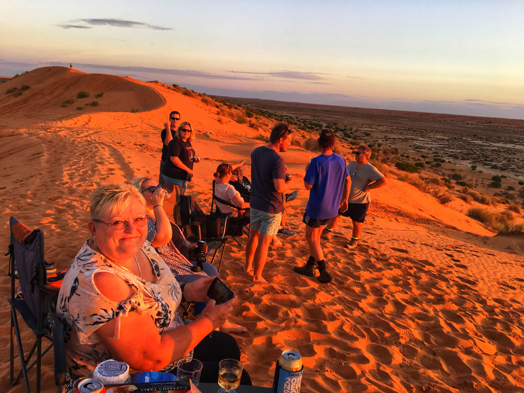
Amanda Sloane On Top Of Big Red Near Birdsville At Sunset

Amanda Sloane On Top Of Big Red Near Birdsville At Sunset

Local Food and Dining

Basically you have the Birdsville Hotel and the Birdsville Bakery. We’ve eaten at both locations and they are bloody great.

The Famous Birdsville Bakery: A Culinary Must-Visit
No trip to Birdsville would be complete without a visit to the Birdsville Bakery. Known for its delicious camel pies and freshly baked bread the bakery is a staple for both locals and travelers. It’s a perfect stop to refuel during an Outback journey and sample some of the region’s most beloved dishes.

Birdsville Hotel
The Birdsville Hotel offers more than just a place to stay; it also serves up traditional Australian pub fare. Known for its relaxed atmosphere and friendly service, it’s a great spot to unwind after a day of exploring, enjoying a cold drink and a hearty meal while swapping stories with fellow adventurers.

Where to Get Mechanical Repairs in Birdsville

The Birdsville Roadhouse
The roadhouse provides repair services for cars, caravans and 4WD vehicles, ensuring that travelers can continue their adventures without delay.

  • RACQ Roadside and Tow Operator
  • Tyres, batteries and oil
  • Fully equipped mechanical workshop
  • Phone: 07 4656 3226

Where to Buy Spare Parts for Your Vehicle and Caravan in Birdsville

Not Just Hardware

A range of basic spares can be found at the local hardware store aptly named “Not Just Hardware”.

Phone: 07 4656 4873
Opening Hours: Mon-Fri 08.30am to 05.00pm. Sat 08.30am to 12.00pm
Items Stocked: Fuel and water jerry cans, shackles, sealants, nuts and bolts, gaffer tape, electrical tape, cable ties, electrical cable, automotive fuses, anderson plugs, trailer plugs, 12v switches, wide range of camping gear, fly nets, insect repellant, uhf radios and antennas and a whole heap of other stuff.

The Roadhouse

The roadhouse also carries some basic spares as well as a limited range of tyres, batteries and oil.
Phone: 07 4656 3226

Travelers are advised to carry essential spares with them if embarking on long journeys in remote areas.

Where to Buy Tyres in Birdsville

The roadhouse also carries some basic spares as well as a limited range of tyres, batteries and oil.
Phone: 07 4656 3226.

Birdsville Supplies

Where to Buy Grocery Items in Birdsville
The Birdsville General Store provides essential grocery items for travelers. This small yet well-stocked store is a vital stop for those stocking up before heading into the desert or for locals needing everyday supplies.

Where to Buy Alcohol in Birdsville
Alcohol can be purchased at the Birdsville Hotel. As with many remote Australian towns, alcohol is regulated and licenses are required to sell it.

Birdsville Amenities

Birdsville Dump Point
Birdsville provides two dump points for caravans.

  1. Name: Birdsville Dump Point
    Location: Big Red Track, Birdsville, Queensland
    GPS: -25.903993°, 139.344741°
  2. Name: Birdsville Dump Point Near Racecouse
    Location: Birdsville Developmental Road, Birdsville, Queensland
    GPS: -25.907821°, 139.377591°

Potable Water
Clean, potable water is available in Birdsville, but visitors are encouraged to carry extra supplies when venturing out into the desert, as access to water can be scarce in remote areas. It’s available from the following locations.

  1. Name: Bronco Yards Fresh Water Taps
    Location: Birdsville Simpson Desert National Park Road, Birdsville, Queensland
    GPS: -25.910793°, 139.336735°
  2. Name: Birdsville Water Tap In Town
    Location: Birdsville Developmental Road, Birdsville, Queensland
    GPS: -25.897940°, 139.354323°
  3. Name: Water Tap
    Location: Birdsville Developmental Road, Birdsville, Queensland
    GPS: -25.900739°, 139.362184°
  4. Name: Water Tap
    Location: Birdsville Developmental Road, Birdsville, Queensland
    GPS: -25.905919°, 139.374067°

Weather in Birdsville

Birdsville’s Strategic Location in the Simpson Desert
Located on the edge of the Simpson Desert, Birdsville is subject to some of the harshest and most extreme weather conditions in Australia. The region experiences a typical desert climate—scorching hot summers and cold winters with little to no rainfall. This location provides a perfect snapshot of the unforgiving nature of Australia’s vast interior.

Understanding the Unique Climate and Seasonal Variations
Birdsville’s climate is characterized by stark seasonal contrasts. Summers, from December to February, can reach temperatures well over 40°C (104°F), while winters, from June to August, are much cooler, with daytime highs of around 20°C (68°F) and chilly nights. Rainfall is extremely rare, with the town averaging less than 150mm annually. However, when it does rain, it can be torrential, causing flash flooding and transforming the landscape dramatically.

How the Harsh Environment Shapes Life in Birdsville
Life in Birdsville is intimately tied to its extreme environment. The intense heat during summer often means that most activities take place in the early mornings or late afternoons. The sparse rainfall, while rare, is eagerly anticipated and can temporarily transform the desert into an ephemeral sea of wildflowers. The local community, accustomed to the unforgiving landscape, has developed resilient practices that help them thrive despite the challenging conditions.

10 Weather Facts About Birdsville

  1. Summer temperatures often exceed 40°C (104°F).
  2. Winters can see temperatures drop below freezing overnight.
  3. The area receives less than 150mm of rain annually.
  4. Birdsville experiences high winds during the summer months.
  5. The region is known for severe dust storms.
  6. Rainfall is highly erratic, with periods of severe drought.
  7. Birdsville is one of the hottest towns in Australia during summer.
  8. The climate is categorized as arid and semi-desert.
  9. Snow is virtually unheard of in the area.
  10. The lack of cloud cover results in extremely clear skies, ideal for stargazing.

Community Life in Birdsville

How Locals Adapt to Life in a Remote Town
The residents of Birdsville are a resilient and resourceful community. Life in such a remote location requires a unique set of skills and a strong sense of independence. Locals adapt to the challenges of isolation, relying on each other for support and maintaining a close-knit, welcoming environment.

The Strong Sense of Community in Birdsville
Despite its small size, Birdsville boasts a robust sense of community. Festivals, local events and daily interactions all contribute to the town’s strong communal spirit, making it feel like a home away from home for visitors and residents alike.

Festivals and Events That Bring Residents Together
Birdsville’s festivals, including the Birdsville Races and Big Red Bash, serve as important social events for the town. These celebrations bring together locals and visitors, fostering a sense of unity and joy that transcends the challenges of life in the Outback.

Challenges of Living in Birdsville
The isolation presents unique challenges for its residents. With the nearest major town over 600 kilometers away access to goods and services can be difficult. However, the local community has developed a culture of self-sufficiency and cooperation, ensuring that they can thrive despite their remoteness.

Nearby Attractions and Things To Do

Exploring the Diamantina National Park
Just a short distance from Birdsville, the Diamantina National Park is a stunning destination for nature lovers. With its diverse wildlife, scenic gorges and ancient river systems, the park offers a serene escape from the desert’s harshness.

Adventuring Further into the Simpson Desert
For those seeking an even deeper Outback experience, venturing further into the Simpson Desert offers endless possibilities for adventure. Whether on foot or by 4WD, the desert’s rugged beauty is sure to leave an indelible mark on anyone who dares to explore its vast expanse.

Hidden Gems Beyond Birdsville
While Birdsville is a gateway to the Outback, it is just the beginning of an extraordinary journey. From the remote corners of the Simpson Desert to nearby natural wonders, travelers can discover hidden gems that offer an authentic and untouched experience of Australia’s wilderness.

Conclusion

Why Birdsville Is a Must Visit Place
Birdsville offers a unique and enriching experience for those seeking to explore the raw beauty of the Australian Outback. With its rich history, iconic landmarks and exciting events, Birdsville is a destination that captures the essence of adventure and community.

Final Tips for Making the Most of Your Birdsville Adventure
To make the most of a visit to Birdsville, plan ahead, pack appropriately and embrace the challenges and beauty of the Outback. Whether you’re attending the Birdsville Races, exploring the Simpson Desert, or simply enjoying the company of locals, Birdsville is a place that promises an unforgettable adventure.

Norseman Free RV Site – Everything You Need To Know

Norseman Free RV Site – Everything You Need To Know

Norseman Free RV Site – Everything You Need To Know

Stay at the Norseman Free RV Site and enjoy easy access to local attractions, dump point, potable water, shops and essential services.

Recently we spent some time in Norseman, Western Australia. A small town rich in history and a popular stopover for travellers on the Eyre Highway. With its convenient Norseman free RV site and other camping options, the town is well suited for those journeying across the Nullarbor or exploring the Goldfields region. In this blog, I’ll share details about camping in Norseman, the town’s facilities, its history and the attractions it offers.

Norseman Free RV Site

The Norseman free RV site is a valuable resource for budget conscious travellers. It’s conveniently located within walking distance of Norseman’s town centre making it easy to access shops, services and local attractions.

Features and Facilities

  1. Free Overnight Stays: The site allows short term camping, providing an excellent base for travellers passing through or spending a couple of days in the area.
  2. Accessible Location: Its central position makes it easy to stock up on supplies or explore the town without needing to drive.
  3. Basic Amenities: While there are no powered sites the area is clean and well-maintained, with ample space for caravans and motorhomes.

This site caters to self-sufficient travellers. If you require additional facilities such as showers, power, or laundry, the nearby caravan park is a good alternative.

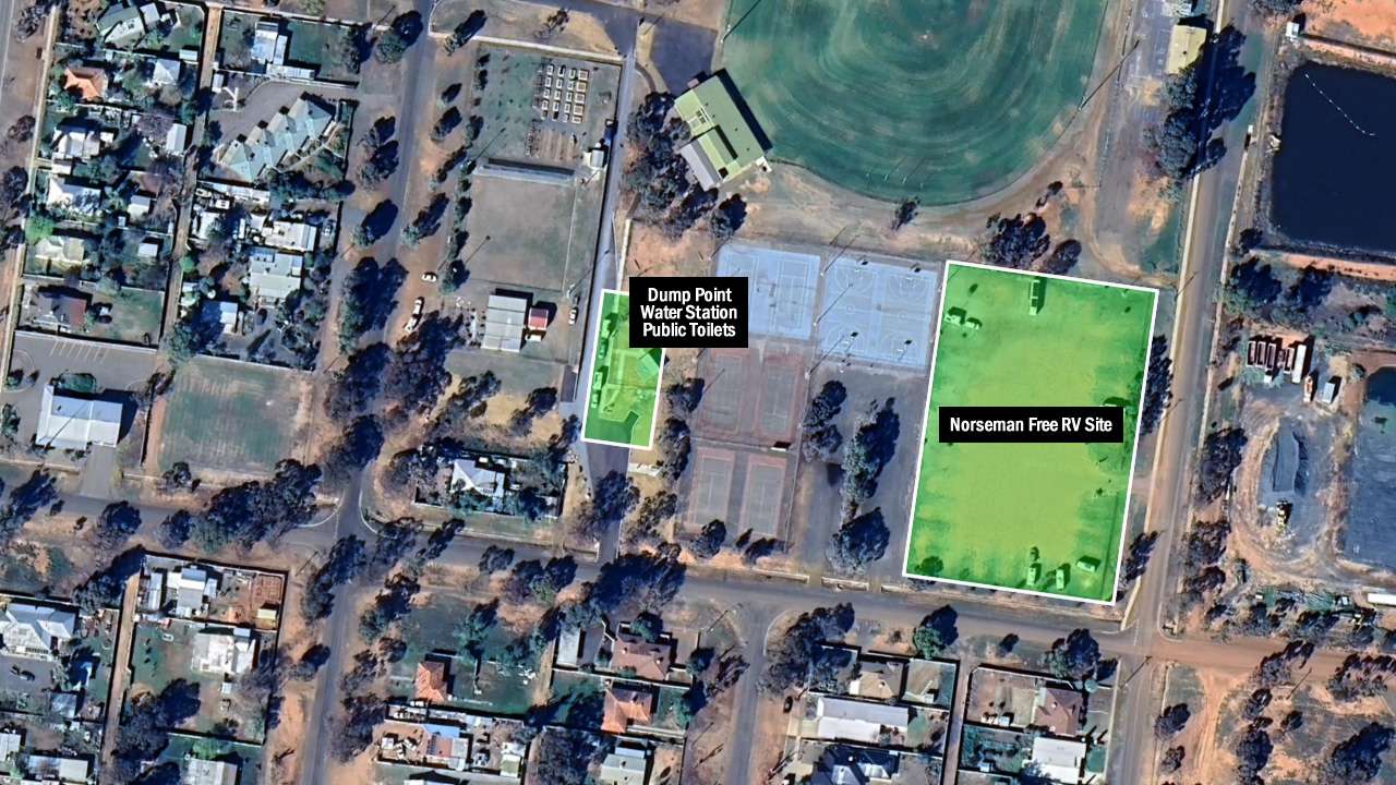
Norseman Free RV Site Map

Norseman Free RV Site Map

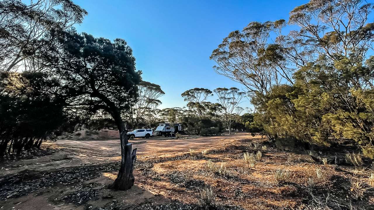
Offroad Camping Spot East Of Norseman

In addition to the Norseman free RV site you have another free camping site near Norseman. We chose to stay at the Offroad Camp Spot east of town on the Eyre Highway. We found this location using WikiCamps. One of the WikiCamp reviews said that the entrance to the free camping spot out of Norseman has a unique marker. “Turn left at the old fridge” and yep as soon as you see the fridge there’s the entrance!

  • Plenty of firewood for an evening fire.
  • A peaceful setting far enough from the highway to feel immersed in nature.

It’s an excellent location for travellers looking for an off-grid experience away from crowds.

Plenty Of Room At The Offroad Camping Spot East Of Norseman

Plenty Of Room At The Offroad Camping Spot East Of Norseman

Camping Options in Norseman

Apart from the Norseman free RV site, there are several other camping options around town, each catering to different needs and preferences:

Norseman Caravan Park

  • Offers powered and unpowered sites.
  • Facilities include showers, toilets, a laundry and BBQ areas.
  • A good choice for those who prefer more amenities.

Fraser Range Station (100 km east of Norseman)

  • A historic sheep station offering a unique Outback experience.
  • Includes powered sites, cabins and access to walking trails.

Lake Cowan Rest Area

  • A scenic location overlooking a salt lake.
  • Suitable for self-contained vehicles, offering peace and quiet for overnight stays.

Offroad Camping Spot East of Norseman

  • Only 5 kilometres from Norseman
  • Quiet, we were the only people there
  • Plenty of firewood

These options along with the free RV site make Norseman camping accessible for all types of travellers.

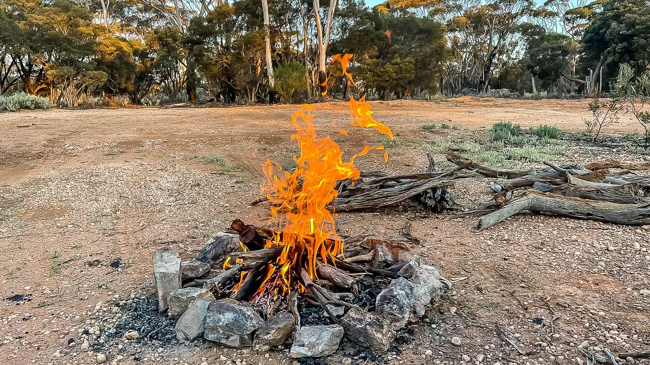
Nice Campfire Freecamping At Norseman

Nice Campfire Freecamping At Norseman

Norseman Weather

Understanding the local weather is essential for planning your visit. Norseman experiences a semi-arid climate with distinct seasonal variations.

  • Summer (December to February): Hot and dry, with daytime temperatures often exceeding 35°C. Nights are cooler but still warm.
  • Autumn (March to May): Mild and pleasant, with temperatures ranging from 15–25°C.
  • Winter (June to August): Cooler during the day (10–20°C) and cold at night, often dropping close to 0°C.
  • Spring (September to November): Comfortable temperatures with occasional windy conditions.

Rainfall is sparse year round, so prepare for dry conditions especially in summer. Travellers should also secure outdoor items as sudden winds can occur at any time.

Shops And Services In Norseman

Norseman offers essential shops and services, making it a practical stop for travellers.

Norseman IGA – Grocery Store

  • Offers groceries, caravan water tokens and everyday essentials.
  • Opening Hours: 8 am – 6 pm daily.
  • Contact: (08) 9039 1001.

Fuel Stations

  • BP Norseman and Shell Norseman are conveniently located along the main highway, providing fuel, snacks and basic supplies.

Medical Services

  • Pharmacy: Open from 9 am to 5:30 pm (Monday–Friday) and Saturday mornings. Stock up on any medications or first aid supplies.

Postal Services

  • Norseman Post Office: Open 9 am – 5 pm (Monday to Friday) for mail and banking needs.

Dump Point And Water Station

  • Dump Point: Located on the main road near the Norseman Visitor Information Centre.
  • Water Filling Station: You need tokens to use the filling station. Tokens are available at the IGA and the Norseman Visitor Centre.

Norseman Hotel

  • Nice cold beer
  • Pub meals
  • Accommodation

These facilities are essential for caravanners providing a convenient way to restock and maintain your vehicle.

Couple Of Pints At The Norseman Hotel

Couple Of Pints At The Norseman Hotel

Norseman Visitor Centre

The Norseman Visitor Centre is considered to be the gateway to Western Australia and the Nullarbor. It is located in Welcome Park on Roberts Street not far from the town centre. The centre carries a wide range of information to cover all surrounding regions plus souvenirs.

Opening Hours

  • Monday to Friday: 8.30am to 4.30pm
  • Saturday: 8.30am to 12:30pm.
  • Sunday: Closed.
  • Public Holidays: 9:00am to 1:00pm.
  • Closed Christmas Day and Good Friday.

For more information contact (08) 9039 0040.

Attractions In Norseman

Norseman is more than just a convenient stop; it’s a destination with its own attractions.

  1. Beacon Hill Lookout
    A short drive from town, this lookout offers panoramic views of the salt lakes and surrounding bushland. It’s particularly stunning at sunset.
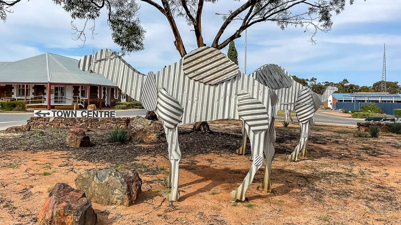
  2. Tin Camel Sculptures
    Located in the centre of town, these sculptures commemorate Norseman’s history with Afghan cameleers and their camel trains.
  3. Heritage Trail
    A walking trail through town highlights historical buildings and sites, including the old courthouse and post office.
  4. Geocaching
    Several geocaches are hidden around Norseman, providing a fun activity for those who enjoy exploring.
  5. Woodlands Walk Trail
    This trail offers an introduction to the unique flora and fauna of the region, ideal for nature enthusiasts.

Camel Statues Norseman WA

Camel Statues Norseman WA

Historical Overview Of Norseman

Norseman’s history dates back to 1894 when Laurie Sinclair discovered gold in the area. The story goes that Sinclair’s horse, Norseman, pawed the ground, uncovering a gold nugget. The gold discovery led to the establishment of a thriving mining town.

During its early years, Norseman relied heavily on camel trains to transport goods across the vast and harsh terrain. Afghan cameleers played a crucial role in this process. This history has been commemorated by the town’s tin camel sculptures. These days gold mining remains an important industry, contributing to the town’s economy.

Having A Beer At The Norseman Hotel

The Norseman Hotel is a staple for travellers crossing the Eyre Highway, offering a genuine and straightforward experience. Located in the centre of town, it’s a spot where locals and visitors come together to relax, refuel and enjoy a cold drink.

Inside the bar has a timeless, no-frills appeal. The staff are friendly and efficient, serving a solid selection of beers on tap. From familiar favourites to the occasional craft brew there’s something to suit every preference. The pub menu is dependable with meals like a well cooked steak or a classic chicken parmi. It’s satisfying fare that hits the mark after a long drive.

Outside, the beer garden provides a comfortable space to kick back, especially on mild evenings. With tables spread out to catch the breeze, it’s ideal for unwinding while you watch the day fade. On some weekends, the Norseman Hotel livens up with live music or other casual events, adding energy to the laid back atmosphere.

For travellers looking to stay overnight, the hotel also offers basic, clean accommodations. It’s a convenient option for recharging before continuing your journey.

The Norseman Hotel isn’t about pretence—it’s a reliable and welcoming stop for anyone exploring the Outback.

Found A Geocache In Front Of The Norseman Free RV Site Sign

Found A Geocache In Front Of The Norseman Free RV Site Sign

Practical Travel Tips

  1. Plan for Supplies: While Norseman has basic shops and services, stock up on groceries and fuel before venturing further into remote areas.
  2. Be Self-Sufficient: Facilities at the Norseman free RV site are limited, so ensure your caravan or motorhome is equipped for off-grid living.
  3. Stay Informed: Check road and weather conditions, particularly if you’re travelling during extreme summer heat or winter cold.
  4. Respect Local Rules: Follow signage and guidelines at campgrounds and public areas.

Conclusion

Norseman is a practical and welcoming stop for travellers on the Eyre Highway. With its free RV site, historical attractions and essential services, the town caters well to the needs of caravanners and campers. Whether you’re looking to explore the area or simply recharge before continuing your journey, Norseman is worth including in your travel plans.

Safe travels,
David and Amanda

Norseman Photo Gallery

Frequently Asked Questions About The Norseman Free Rv Site

Is the Norseman Free RV Site really free to stay at?

Yes, it’s absolutely free for short-term stays! It’s a great option for self-contained travellers looking to save money while exploring the area.

What facilities are available at the site?

The site is basic but spacious. It’s designed for self-contained vehicles, so you’ll need your own amenities. There are no powered sites, but the location is convenient for accessing town services.

How long can I stay at the Norseman Free RV Site?

It’s intended for short stays, usually up to 24 or 48 hours. This gives travellers a chance to rest, stock up on supplies, and continue their journey.

Is the site suitable for larger caravans or motorhomes?

Definitely! The area has plenty of space to accommodate big rigs, so you won’t have to worry about squeezing in.

Can I bring my pets to the Norseman Free RV Site?

Yes, it’s pet-friendly. Just make sure to keep your furry friends on a lead and clean up after them to respect other campers.

Is it safe to camp at the Norseman Free RV Site?

Absolutely. The site is in a central location and is frequently used by other travellers, making it a safe and practical option for an overnight stop.

Hyden Norseman Road – What To See And Do Plus More

Hyden Norseman Road – What To See And Do Plus More

Hyden Norseman Road – What To See And Do Plus More

We drove the Hyden Norseman Road in Sept 2024 and visited some of WA’s lesser known places – from salt lakes to ancient rock formations.

Amanda and I did a trip along the Hyden Norseman Road towing our caravan in early September 2024. We travelled this outback road that stretches from Hyden – home of the famous Wave Rock to Norseman – a town full of gold rush history. In this blog post I’ll go over what we experienced, what you can expect and some tips to make the most of this great road.

Changing Roadside Scenery Between Norseman And Hyden

Changing Roadside Scenery Between Norseman And Hyden

Road Conditions On The Hyden Norseman Road

Road conditions on the Hyden Norseman Road can vary with the seasons. Whilst most of the road is unsealed it is usually well graded and accessible to 4WD vehicles. Caravans and even some 2WD vehicles will have no worries most of the time depending upon weather. After heavy rain the road can get slippery with soft patches and occasional washouts.

When we did it in September 2024 the road was in good condition. There were some rough stretches around the mine site entry points. We made sure to drive cautiously and check conditions beforehand. For the latest updates contact,

History Of The Hyden Norseman Road

There’s a lot of history behind the Hyden to Norseman Road. It was initially established as a stock route. Later on it was used as a pathway for miners and settlers heading out to the goldfields. Today it’s a well maintained gravel road used to connect the agricultural town of Hyden with Norseman in the Eastern Goldfields. At nearly 300 kilometres long the road crosses different terrains including the Great Western Woodlands and expansive salt lakes.

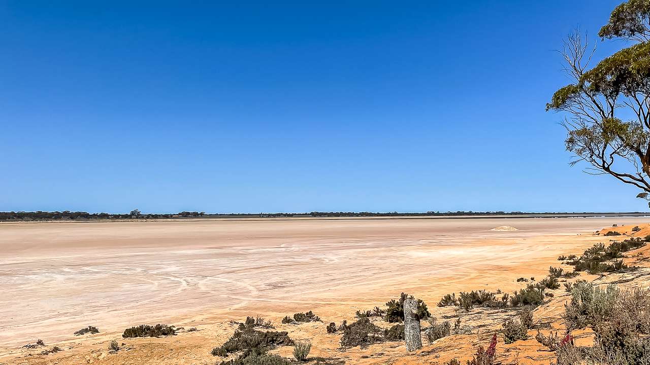
Lake Johnston Seen From The Camping Area

Lake Johnston Seen From The Camping Area

Highlights Of The Trip

The Hyden to Norseman Road is full of unique stops and stunning scenery. Here are some of the highlights we experienced along the way.

  1. Wave Rock (Hyden)
    We started our trip in Hyden, home to the iconic Wave Rock. This rock formation is shaped like a giant wave. It’s considered one of Australia’s natural wonders and a must-see before beginning your journey.
  2. The Breakaways
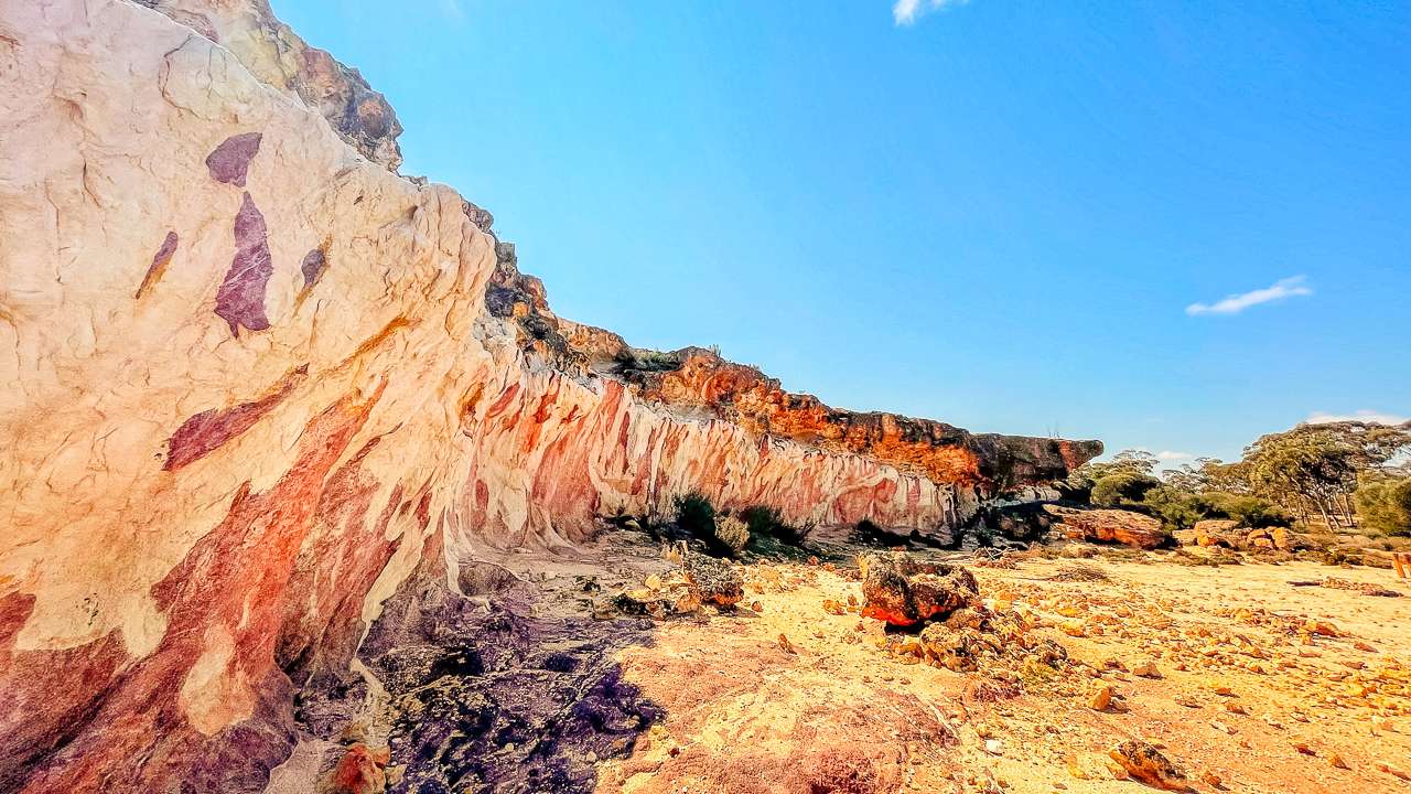
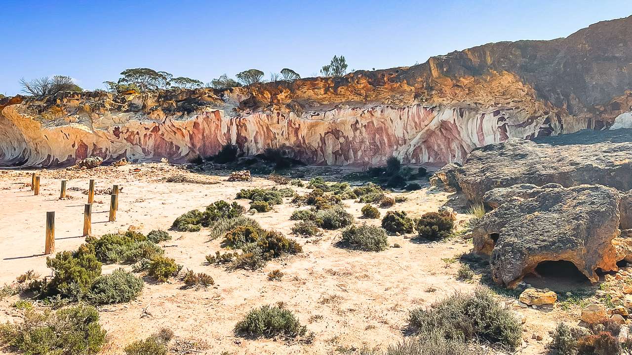
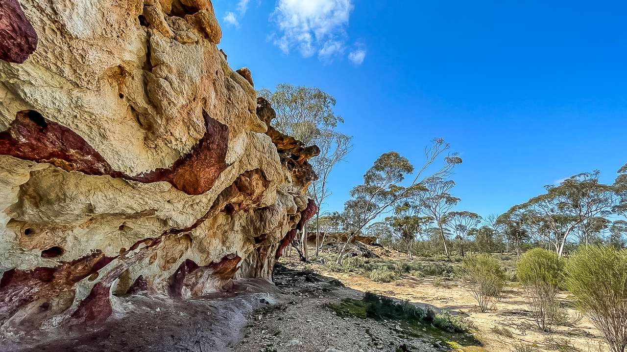
    About 80 kilometres along the road we pulled in at the Breakaways. The Breakaways are a series of ancient rock formations. These colourful cliffs offer incredible photo opportunities. While exploring we found a geocache adding a fun and unexpected element to our stop.
  3. Lake Johnston
    Further down the road, we stopped at Lake Johnston, a vast salt lake. The shimmering white surface of the lake against the blue sky was stunning. Here, we discovered another geocache, which added to our sense of adventure.
  4. Holts Rock
    We camped overnight at Holts Rock, a quiet and scenic spot surrounded by woodlands. The area features a short walking trail around the rock with lovely views of the surrounding landscape. It was a great free camp and nice and quiet. We only had one other camper sharing the whole area with us.
  5. Norseman
    The journey ended in Norseman. Norseman is an historic town that served as a gateway to the goldfields. The town features several attractions, including a striking display of corrugated iron camels that reflect its connection to camel transport during the gold rush era.

Camping Along The Hyden Norseman Road

There are several excellent camping options along the Hyden Norseman Road, ranging from formal caravan parks to informal bush camping spots. Here are some of the places we considered and experienced:

  1. Wave Rock Caravan Park (Hyden): A well equipped starting point with powered sites, hot showers and other amenities.
  2. Holt Rock: This is where we chose to camp. It’s a free camping area with plenty of space for caravans and tents. Be sure to bring your own water and supplies. Holt Rock camping area is about 34 kilometres south off the main road. It’s accessed by a good dirt road. Turn off towards Bushfire Rock and follow your GPS. GPS coordinates for Holt Rock are -32.674985°, 119.416316°.
  3. Lake Johnston: Informal camping is available here, offering stunning views of the salt lake.
  4. Newman Rock: Another free camping spot with basic facilities and beautiful surroundings.

When camping along the road, it’s essential to be self-sufficient as facilities are minimal. Always take your rubbish with you to keep these pristine areas clean for future visitors.

Campfire At Holt Rock Free Camping Area

Campfire At Holt Rock Free Camping Area

Weather On The Hyden Norseman Road

The weather along the road between Hyden and Norseman can significantly influence your travel experience. Summers are very hot, with daytime temperatures often exceeding 40°C, while winters are cooler but can bring cold nights. Rainfall is infrequent, but even a small amount of rain can make the unsealed road challenging to navigate.

Spring and autumn are the best times to travel, with milder temperatures and, in spring, a spectacular display of wildflowers.

Wildflowers At Wave Rock WA

Wildflowers At Wave Rock WA

Fuel Stops On The Hyden To Norseman Road

Planning your journey along the Hyden to Norseman Road requires careful preparation, especially when it comes to fuel. This remote stretch of road offers no fuel stops between Hyden and Norseman, making it essential to top up your tank before departure. In Hyden, the local service station is your first and most reliable spot to refuel. Stock up on essentials here, as the next chance to refuel will be 300 kilometres away in Norseman. Both towns are well equipped with facilities.

Lots Of Colours In The Breakways On Hyden Norseman Road

Lots Of Colours In The Breakways On Hyden Norseman Road

Potable Water On The Hyden Norseman Road

Securing a reliable supply of potable water is essential when traversing the Hyden Norseman Road as this remote stretch offers few opportunities to refill. With no dedicated water stations between Hyden and Norseman, travellers must be fully self-sufficient to avoid unnecessary risks.

Before setting off, ensure you fill all water containers in Hyden. The town provides access to potable water, making it the best place to prepare for the journey. Norseman, at the other end of the route, is another opportunity to refill, but the 300-kilometre expanse between these points requires careful planning.

The dry and often unforgiving terrain along the road means water is not just for drinking. Cooking, washing, and even vehicle emergencies can deplete your supply faster than anticipated. We recommend carrying ample reserves in portable containers or a water tank fitted to your vehicle.

Be careful and conserve water whenever possible. Simple steps like using biodegradable wipes instead of water for cleaning or cooking with minimal water can make a significant difference. Adequate preparation for Hyden Norseman Road water needs will ensure a safe and comfortable journey across Western Australia’s rugged outback.

Norseman Hotel They Have Nice Cold Beer!

Norseman Hotel They Have Nice Cold Beer!

Final Thoughts

Driving the Hyden Norseman Road was an unforgettable journey for Amanda and I. It’s a road that offers a perfect mix of history, natural beauty and adventure. From the fascinating breakaways to the serene salt lakes, every stop along the way added something special to our trip.

If you’re looking to explore a unique and less travelled part of Western Australia the Hyden to Norseman Road is a fantastic choice. Be prepared, take your time and enjoy the remarkable landscapes and experiences this route has to offer.

Safe travels!

Photo Gallery

FAQs Frequently Asked Questions About The Hyden Norseman Road

Is the Hyden Norseman Road suitable for caravans?

Yes but it depends on your setup. If you’ve got an off-road caravan you should be fine as long as the road conditions are good. For standard caravans it’s best to check local advice before setting off. As always when travelling on gravel roads tyre pressure and driving to the conditions are keys to a good trip.

Do I need a 4WD to drive the Hyden Norseman Road?

A 4WD is recommended especially if there’s been rain as the road can get slippery and uneven. In dry conditions, a 2WD may manage, but it’s always safer to travel in a vehicle built for gravel roads.

Are there places to camp along the Hyden Norseman Road?

Yes, there are several great camping spots, like Holts Rock and Lake Johnston. These are bush camps, so you’ll need to bring all your supplies, including water.

Where can I get fuel for the Hyden Norseman Road?

There are no fuel stops along the road itself. Fill up in Hyden or Norseman before you begin the trip, and consider carrying extra fuel if needed.

Is the Hyden Norseman Road open year-round?

Generally, yes, but it’s always wise to check road conditions beforehand. Heavy rain can make sections impassable, so local updates are essential.

What can I expect to see along the Hyden Norseman Road?

You’ll pass stunning salt lakes, granite outcrops, and unique bushland. Highlights include the Breakaways and the ever-changing outback scenery that makes the journey unforgettable.

Great Ocean Road Free Camping – 55 Sites Listed

Great Ocean Road Free Camping – 55 Sites Listed

Great Ocean Road Free Camping – 55 Sites Listed

List of 55 free & low cost camps near the Great Ocean Road. Stunning views & perfect spots for tents, camper trailers, caravans & motorhomes. If you’re wanting an adventure on a budget, Free Camping Sites near the Great Ocean Road offer a perfect way to experience the beauty of this stunning coastline without breaking the bank. This list of free campsites near the Great Ocean Road provide a unique and cost effective way to experience this bloody awesome Australian drive.

We’ve picked 55 free and low cost camps near the Great Ocean Road. A remarkable journey along the wild and rugged Victorian coastline. From quiet campsites to the rich Indigenous culture and stunning landscapes. This adventure is a unique and unforgettable experience.

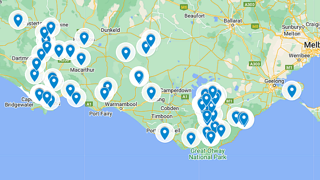
Great Ocean Road Free Camping Map

Note: We’ve tried to be as accurate as possible with compiling this list but mistakes and changes do happen. If you see anything that needs updating, is incorrect or we’ve missed please let us know. You can add a comment at the bottom of this page or alternatively contact us by email.

55 Best Great Ocean Road Free Camps & Donation Camps (Some Include Booking Fees)

We have selected 55 free and low cost camps along The Great Ocean Road. Ranging from free camping to low cost National Park and State Parks there is something here for all budgets and camping styles.

1. Aire Crossing

Address: 300 Wait-A-While Rd, Wyelangta, Victoria
GPS Coordinates: -38.3135, 143.6539
Amenities: Pit toilets, picnic tables, fire pits.
Accessibility: Camper trailers and tents. Not ideal for large caravans or big rigs due to the narrow access.
Cost: Free
Phone: (03) 5236 7777

2. Aire River East Campground

Address: Unnamed Rd, Hordern Vale, Victoria
GPS Coordinates: -38.6705, 143.5261
Amenities: Pit toilets, picnic tables, fire pits.
Accessibility: Better suited for tents and camper trailers. Not ideal for large caravans or big rigs.
Cost: Free
Phone: (03) 8427 2000 (Parks Victoria)
Email: info@parks.vic.gov.au
Website: https://www.parks.vic.gov.au/places-to-see/parks/great-otway-national-park/where-to-stay/aire-river-east-campground

3. Aire River West Camping Ground

Address: 310 Sand Road, Glenaire, Victoria
GPS Coordinates: -38.6180, 143.6217
Amenities: Pit toilets, picnic tables, fire pits.
Accessibility: Camper trailers and tents. Not ideal for big rigs or large caravans.
Cost: Free
Phone: (03) 8427 2000 (Parks Victoria)
Email: info@parks.vic.gov.au
Website: https://www.parks.vic.gov.au/places-to-see/parks/great-otway-national-park/where-to-stay/aire-river-west-campground

4. Allenvale Mill (Tents Only)

Address: Allenvale Rd, Lorne, Victoria
GPS Coordinates: -38.5479, 143.9842
Amenities: Pit toilets, picnic tables, fire pits.
Accessibility: Suitable for small camper trailers and tents. Not ideal for caravans or big rigs.
Cost: Free
Phone: (03) 5237 7400 (Parks Office)
Website: http://parkweb.vic.gov.au/explore/parks/great-otway-national-park/things-to-do/allenvale

5. Annya Camp

Address: Annya Rd, Hotspur, Victoria
GPS Coordinates: -38.3093, 143.5107
Amenities: Pit toilets, picnic tables, fire pits.
Accessibility: Camper trailers and tents are suitable. Not ideal for large caravans or big rigs.
Cost: Free
Phone: (03) 5233 9100 (Local council)
Website: Annya Road, Milltown, Victoria

6. Beauchamp Falls Reserve

Address: Beauchamp Falls Walking Track, Beech Forest, Victoria
GPS Coordinates: -38.5345, 143.5326
Amenities: Pit toilets, picnic tables, walking tracks.
Accessibility: Ideal for tents and camper trailers. Not suitable for large caravans or big rigs.
Cost: Free
Website: [Parks Victoria](https://www.parks.vic.gov.au)

7. Big Hill Track Campground

Address: 1265 Deans Marsh-Lorne Rd, Benwerrin, Victoria
GPS Coordinates: -38.5215, 143.8902
Amenities: Pit toilets, picnic tables, fire pits.
Accessibility: Suitable for tents and camper trailers. Not ideal for large caravans or big rigs.
Cost: Free
Website: https://www.parks.vic.gov.au/places-to-see/parks/great-otway-national-park/where-to-stay/big-hill-campground

8. Blanket Bay Campground

Address: Blanket Bay Road, Victoria
GPS Coordinates: -38.7225, 143.3307
Amenities: Pit toilets, picnic tables, fire pits.
Accessibility: Suitable for tents, camper trailers and caravans. Limited space for big rigs.
Cost: Free
Phone: (03) 5237 9263 (Great Otway National Park)
Email: info@parks.vic.gov.au
Website: https://www.parks.vic.gov.au/places-to-see/parks/great-otway-national-park/where-to-stay/blanket-bay-campground

Great Ocean Road Camping

Great Ocean Road Camping

9. Bowd Campground

Address: River Fire Lane, Mumbannar, Victoria
GPS Coordinates: -38.1145, 141.4116
Amenities: Pit toilets, picnic tables.
Accessibility: Suitable for tents and camper trailers. Not ideal for large caravans or big rigs.
Cost: Free
Phone: 13 19 63
Email: info@parks.vic.gov.au
Website: https://www.parks.vic.gov.au

10. Camp On Crawford River

Address: Bronze Wing Track, Hotspur, Victoria
GPS Coordinates: -38.2341, 142.3083
Amenities: Pit toilets, picnic tables.
Accessibility: Suitable for tents, camper trailers and small caravans. Not ideal for large rigs.
Cost: Free

11. Caramut Western Hotel

Address: 16 Brown St, Caramut, Victoria
GPS Coordinates: -37.8447, 142.7789
Amenities: Toilets, picnic tables and pub access.
Cost: Free
Phone: (03) 5589 7072

12. Carlisle River Reserve

Address: 59 Gellibrand River Rd, Carlisle River, Victoria
GPS Coordinates: -38.3665, 143.4911
Amenities: Pit toilets, picnic tables, fire pits.
Cost: Free
Phone: (03) 5232 9400
Email: inq@colacotway.vic.gov.au
Website: https://www.colacotway.vic.gov.au

13. Cobden Free Camp Park

Address: Bond Street, Cobden, Victoria
GPS Coordinates: -38.2860, 142.8459
Amenities: Toilets, picnic tables.
Cost: Free
Phone: 0456 150 899

14. Crawford River

Address: Portland-Casterton Rd, Hotspur, Victoria
GPS Coordinates: -38.2893, 142.2669
Amenities: Pit toilets, picnic tables.
Cost: Free

15. Dando’s Campground

Address: Lardners Track, Gellibrand, Victoria
GPS Coordinates: -38.4992, 143.6010
Amenities: Pit toilets, picnic tables, fire pits.
Cost: Free

16. Elephant Bridge

Address: 2810 Hamilton Hwy, Darlington, Victoria
GPS Coordinates: -37.9571, 141.9842
Amenities: Pit toilets, picnic tables.
Cost: Free
Contact: Elephant Bridge Hotel
Phone: (03) 5236 3232

17. Ess Lagoon

Address: Ess Lagoon Rd, Casterton, Victoria
GPS Coordinates: -37.7827, 141.5478
Amenities: Pit toilets, picnic tables.
Cost: Free
Contact: Glenelg Shire Council
Phone: (03) 5522 2200
Email: enquiry@glenelg.vic.gov.au
Website: https://www.glenelg.vic.gov.au

18. Ferguson Recreation Ground

Address: 3815 Colac-Lavers Hill Rd, Ferguson 3237, Victoria
GPS Coordinates: -38.4172, 143.5807
Amenities: Toilets, picnic tables, sports grounds.
Cost: Free

19. Fitzroy River Camping

Address: Thompsons Road, Victoria
GPS Coordinates: -38.2580, 141.8484
Amenities: Pit toilets, picnic tables.
Cost: Free
Phone: 0412 832 910
Website: https://www.visitportland.com.au/camping-national-state-parks

20. Fort O’Hare

Address: Greenham St, Dartmoor, Victoria
GPS Coordinates: -37.8772, 141.8506
Amenities: Pit toilets, picnic tables.
Cost: Free
Contact: Glenelg Shire Council
Phone: (03) 5522 2200
Email: enquiry@glenelg.vic.gov.au
Website: https://www.glenelg.vic.gov.au

21. Goat Track

Address: 255 Mahers Rd, Barwon Downs, Victoria
GPS Coordinates: -38.4506, 143.4914
Amenities: Pit toilets, picnic tables, fire pits.
Accessibility: Suitable for tents and camper trailers. Not ideal for large caravans or big rigs.
Cost: Free
Phone: 136 186
Website: https://www.delwp.vic.gov.au

22. Greenhills Hotel

Address: 5191 Henty Hwy, Condah, Victoria
GPS Coordinates: -37.8802, 141.7073
Amenities: Toilets, pub access, picnic tables.
Cost: Free
Contact: Greenhills Hotel
Phone: (03) 5578 7222
Email: greenhillshotel@bigpond.com
Website: https://www.greenhillshotel.com.au)

23. Hammond Road Campground

Address: Hammond Rd, Wensleydale, Victoria
GPS Coordinates: -38.3435, 143.6250
Amenities: Pit toilets, picnic tables, fire pits.
Cost: Free
Phone: 13 1963
Email: info@parks.vic.gov.au
Website: https://www.parks.vic.gov.au/places-to-see/parks/great-otway-national-park/where-to-stay/hammonds-campground

24. Hammond Road North

Address: Hammonds Rd, Wensleydale VIC 3241, Victoria
GPS Coordinates: -38.3384, 143.6317
Amenities: Pit toilets, picnic tables.
Cost: Free
Website: https://www.exploreoutdoors.vic.gov.au/activities/camping/hammonds-road-north-campground

25. Hawkesdale Apex Campsite

Address: 2621 Penshurst-Warrnambool Rd, Hawkesdale, Victoria
GPS Coordinates: -38.1384, 142.6941
Amenities: Toilets, picnic tables, BBQ facilities.
Cost: Donation
Phone: (03) 5561 1112

26. Hawkesdale Racecourse & Rec Reserve

Address: Irving St, Hawkesdale, Victoria
GPS Coordinates: -38.1321, 142.6925
Amenities: Toilets, picnic tables.
Cost: Free
Phone: N/A
Email: N/A
Website: N/A

27. Henty Park

Address: Henty Park, Hamilton, Victoria
GPS Coordinates: -37.7556, 142.0213
Amenities: Toilets, picnic tables, playground.
Cost: Free
Contact: Glenelg Shire Council
Phone: (03) 5522 2200
Email: enquiry@glenelg.vic.gov.au
Website: https://www.glenelg.vic.gov.au

28. Heywood Apex Park

Address: 10 Cameron St, Heywood, Victoria
GPS Coordinates: -38.1461, 141.6296
Amenities: Toilets, picnic tables, BBQ facilities, playground.
Cost: Free
Contact: Glenelg Shire Council
Phone: (03) 5522 2200
Email: enquiry@glenelg.vic.gov.au
Website: https://www.glenelg.vic.gov.au

Port Campbell National Park Twelve Apostles

Port Campbell National Park Twelve Apostles

29. Hiscocks Camp

Address: The Boulevard, Winnap, Victoria
GPS Coordinates: -37.9128, 141.4931
Amenities: Pit toilets, picnic tables.
Cost: Free

30. Jackass Fern Gully Camp (Cobboboonee NP)

Address: Jackass Fern Gully Walk, Drumborg, Victoria
GPS Coordinates: -38.0089, 141.4306
Amenities: Pit toilets, picnic tables, walking tracks.
Cost: Free
Website: https://www.visitportland.com.au/cobboboonee-national-park

31. Jamieson Creek Campground

Address: Jamieson Track, Victoria
GPS Coordinates: -38.6460, 143.7020
Amenities: Pit toilets, picnic tables.
Cost: Free
Website: https://www.parks.vic.gov.au/places-to-see/parks/great-otway-national-park/where-to-stay/jamieson-creek-campground

32. Johanna Beach

Address: Great Otway National Park – Johanna, Victoria
GPS Coordinates: -38.7057, 143.5741
Amenities: Pit toilets, picnic tables, fire pits.
Cost: $14.70pn
Phone: 13 19 63
Email: info@parks.vic.gov.au
Website: https://www.parks.vic.gov.au/places-to-see/parks/great-otway-national-park/where-to-stay/johanna-beach-campground

33. Lake Elingamite

Address: 107 Oates Rd, Elingamite North, Victoria
GPS Coordinates: -38.3372, 141.9197
Amenities: Pit toilets, picnic tables.
Cost: Donation

34. Lake Elizabeth Campground – Tents Only

Address: Kents Rd, Barwon Downs, Victoria
GPS Coordinates: -38.5094, 143.5266
Amenities: Toilets, picnic tables, walking tracks.
Cost: $16pn
Website: https://www.parks.vic.gov.au/places-to-see/parks/great-otway-national-park/where-to-stay/lake-elizabeth-campground?utm_source=google&utm_medium=maps&utm_campaign=GMB-2020

35. Long Lead Bush Camp

Address: Victoria
GPS Coordinates: N/A
Amenities: None.
Accessibility: 4WD only, suitable for tents.
Cost: Free

36. Lookout

Address: 5800-5854 B160, Casterton, Victoria
GPS Coordinates: -37.7064, 141.5323
Amenities: None.
Accessibility: Suitable for tents and small caravans.
Cost: Free

37. Meredith Park Camping Ground

Address: Meredith Park Rd, Ondit (Colac), Victoria
GPS Coordinates: -38.2750, 143.5969
Amenities: Toilets, picnic tables, BBQ facilities.
Cost: Free
Contact: Colac Otway Shire
Phone: (03) 5232 9400
Email: inq@colacotway.vic.gov.au
Website: https://www.colacotway.vic.gov.au

38. Mt Emu Creek

Address: Castle Carey Rd, Gleormiston Nth, Victoria
GPS Coordinates: -37.8992, 142.5316
Amenities: Pit toilets, picnic tables.
Cost: Free

39. Panmure Campground

Address: 8830 Princes Hwy, Panmure, Victoria
GPS Coordinates: -38.3043, 141.4684
Amenities: Picnic tables, BBQ facilities, toilets.
Cost: Free

40. Panmure Free Camp

Address: 8830 Princes Hwy, Panmure, Victoria
GPS Coordinates: -38.3039, 141.4703
Amenities: Picnic tables, BBQ facilities.
Cost: Free

41. Panmure Hotel

Address: 8809 Princes Hwy, Panmure, Victoria
GPS Coordinates: -38.3034, 141.4708
Amenities: Toilets, BBQ facilities, nearby food and drinks.
Cost: Free (but it is encouraged to support the hotel with food or drinks)
Contact: Panmure Hotel
Phone: (03) 5576 5544
Email: info@panmurehotel.com.au
Website: https://www.panmurehotel.com.au

42. Parker Hill Campground

Address: Parker Hill Track, Otway National Park, Victoria
GPS Coordinates: -38.7104, 143.5763
Amenities: Pit toilets, picnic tables.
Cost: $15pn
Website: https://www.parks.vic.gov.au/places-to-see/parks/great-otway-national-park/where-to-stay/parker-hill-campground

43. Princetown Recreation Reserve

Address: 93 Old Coach Rd, Princetown, Victoria
GPS Coordinates: -38.6706, 143.0078
Amenities: Toilets, picnic tables, BBQ facilities, playground.
Cost: $35pn
Phone: 0457 198 662
Email: princetown@greatoceanroadauthority.vic.gov.au
Website: https://greatoceanroadparks.com.au/princetown

44. Queens Park Campground

Address: Armytage Street, Lorne, Victoria
GPS Coordinates: -38.5323, 143.9606
Amenities: Toilets, BBQ facilities, picnic tables, showers.
Pets: $50pn
Cost: Free
Website: https://greatoceanroadparks.com.au/find-a-park/lorne/queens-park-powered-sites?dateFrom=2024-10-05&dateTo=2024-10-06&adults=2&children=0&rvType=6&rvLength=3

45. Rennick State Forest

Address: Princess Margaret Rd, Mumbannar, Victoria
GPS Coordinates: -37.8439, 141.5610
Amenities: Pit toilets, picnic tables.
Cost: Free

46. Riverside – Seasonal Bush Camping

Address: Barwon Heads-Ocean Grove Rd, Ocean Grove, Victoria
GPS Coordinates: -38.2691, 144.5673
Amenities: Pit toilets, picnic tables.
Cost: $40pn
Phone: (03) 5256-1600
Email: riverview@barwoncoast.com.au
Website: https://riverviewfamilycaravanpark.com.au/riverside-camping-seasonal

47. Sawpit Campground

Address: Mount Clay MTB Trail, Off Boyers Rd, Narrawong, Victoria
GPS Coordinates: -38.1821, 141.6494
Amenities: Picnic tables, pit toilets.
Cost: Free

48. Sharps Camping

Address: Garvey Track, Lorne, Victoria
GPS Coordinates: -38.5344, 143.9804
Amenities: Pit toilets, picnic tables.
Cost: $20pn
Contact: Parks Victoria
Phone: 13 19 63
Email: info@parks.vic.gov.au
Website: https://www.parks.vic.gov.au

Looking Out The Car window On The Great Ocean Road

Looking Out The Car window On The Great Ocean Road

49. Stevensons Falls

Address: Colac Water Pipeline Track, Barramunga, Victoria
GPS Coordinates: -38.3995, 143.4658
Amenities: Toilets, picnic tables, BBQ facilities, walking tracks.
Cost: Free
Contact: Parks Victoria
Phone: 13 19 63
Email: info@parks.vic.gov.au
Website: https://www.parks.vic.gov.au

50. Stevensons Falls Campsite

Address: Colac Water Pipeline Track, Barramunga, Victoria
GPS Coordinates: -38.3990, 143.4665
Amenities: Toilets, picnic tables, BBQ facilities.
Cost: Free
Phone: 0491 302 712
Email: geoff70@hotmail.com

51. Surry Ridge Camp Ground

Address: Cut Out Dam Rd, Heywood, Victoria
GPS Coordinates: -38.3644, 141.6040
Amenities: Picnic tables, pit toilets.
Cost: Free
Contact: Parks Victoria
Phone: 13 19 63
Email: info@parks.vic.gov.au
Website: https://www.parks.vic.gov.au

52. Tanner’s Rd Bend

Address: Tanners Rd, Gherang, Victoria
GPS Coordinates: -38.3499, 143.5215
Amenities: Picnic tables, pit toilets.
Cost: Free

53. Trewalla Hike-in Camping Area

Address: Trewalla, Victoria
GPS Coordinates: -37.7733, 142.8399
Amenities: Picnic tables, basic facilities.
Cost: Free

54. Wattle Glen

Address: Casterton-Penola Rd, Casterton, Victoria
GPS Coordinates: -37.6598, 141.6070
Amenities: Picnic tables, pit toilets.
Cost: Free
Phone: N/A
Email: N/A
Website: N/A

55. Wright Horse Camp

Address: Wrights Swamp Rd, Greenwald, Victoria
GPS Coordinates: -38.3273, 141.5569
Amenities: Picnic tables, pit toilets.
Cost: Free
Contact: Parks Victoria
Phone: 13 19 63
Email: info@parks.vic.gov.au
Website: https://www.parks.vic.gov.au

Great Ocean Road Photo Gallery

Frequently Asked Questions About Free Camping On The Great Ocean Road

Is free camping allowed along the Great Ocean Road?

Yes, there are a few designated spots where you can camp for free. Just make sure you're not setting up in a "no camping" zone or on private property. Check for signs and stick to designated areas.

Do I need a 4WD for free camping on the Great Ocean Road?

Nah, most of the free camps are accessible by 2WD, but a 4WD might be handy if you’re keen on exploring some off-the-beaten-track spots.

Can I bring my dog to free camps along the Great Ocean Road?

You bet! Many free camps are pet-friendly, but make sure your furry mate is kept on a leash, especially in national parks and wildlife areas.

What amenities are at free campsites on the Great Ocean Road?

Free camps usually have the basics—think pit toilets, picnic tables, and maybe a fire pit. Don’t expect showers or powered sites, so come prepared with water and supplies.

Can I camp anywhere along the Great Ocean Road if it’s free camping?

Not exactly. Free camping doesn’t mean you can pitch your tent wherever you fancy. Stick to marked free camping spots to avoid fines and keep the area pristine.

Do I need to book a spot for free camping along the Great Ocean Road?

Nah, most of the free campsites operate on a first-come, first-served basis. It’s a good idea to get there early, especially during weekends and holidays!

Pin It on Pinterest