Oodnadatta Track Guide 2026: Road Conditions, Camping & Tips

Oodnadatta Track Guide 2026: Road Conditions, Camping & Tips

Oodnadatta Track Guide 2026: Road Conditions, Camping & Tips

Updated May 2026 after six separate trips along the Oodnadatta Track between 2016 and 2025.

The Oodnadatta Track is one of Australia’s most iconic outback driving routes, stretching approximately 620 kilometres between Marree and Marla in remote northern South Australia. It follows the path of the historic Old Ghan railway and passes through some of the most isolated and visually striking desert landscapes in the country.

This is a complete travel guide to the Oodnadatta Track, designed to help you plan, prepare and confidently drive the route. It covers road conditions, distances, fuel stops, camping, attractions, safety considerations and seasonal travel advice based on real-world experience.

We have driven the Oodnadatta Track six times between 2016 and 2025, in varying conditions including freshly graded roads, heavily corrugated sections, and during peak travel periods such as the 2025 Lake Eyre filling event. This repeated experience provides a practical, on-the-ground understanding of how the track changes over time and what travellers should realistically expect.

While often described as an outback “adventure drive”, the Oodnadatta Track is accessible to most well-prepared travellers in dry conditions. However, conditions can vary significantly between seasons, and proper planning is essential due to long distances between fuel, limited services, and rapidly changing road surfaces.

In this guide, you’ll find everything needed to plan the journey properly — including segment-by-segment driving breakdowns, fuel strategy, road condition insights, camping options, and key attractions along the route.


Oodnadatta Track Quick Facts

Topic Information
Distance Approx. 620km
Starts Marree, South Australia
Ends Marla, South Australia
Road Type Unsealed outback track
Best Time To Visit May to September
Fuel Stops Marree, William Creek, Oodnadatta, Marla
2WD Suitable Usually in dry conditions
Caravan Friendly Yes, ideally off-road or semi off-road
Mobile Reception Extremely limited
Time Required 3–7 days recommended

What Is The Oodnadatta Track?

The Oodnadatta Track is a remote outback route running through South Australia’s far north, roughly following the route of the original Central Australian Railway, commonly known as the old Ghan line.

Today the track attracts travellers looking for:

  • Remote outback scenery
  • Free camping
  • Historic railway ruins
  • Access to Lake Eyre
  • Desert landscapes
  • Outback towns like William Creek and Oodnadatta

Despite its reputation, the track is not an extreme four-wheel-drive route in dry conditions. However, conditions can change rapidly depending on rainfall, grading and traffic levels.
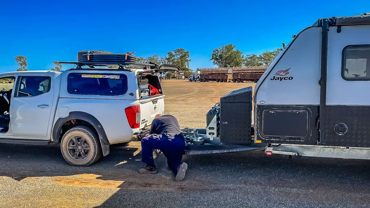
Airing Our Tyres Back Up At Marla After Completing The Oodnadatta Track

Airing Our Tyres Back Up At Marla After Completing The Oodnadatta Track


Our Experience Driving The Oodnadatta Track

We’ve travelled the Oodnadatta Track six times over nearly a decade, and one of the biggest lessons we’ve learned is how dramatically conditions can change between trips.

During our earlier trips in 2016 and 2018, sections of the track were rough and heavily corrugated, particularly north of William Creek. In contrast, some parts were freshly graded during our 2024 trip and significantly smoother.

The 2025 Lake Eyre filling event created an entirely different atmosphere again, with noticeably larger crowds, busier campgrounds and far more caravans travelling through William Creek, Halligan Bay and Oodnadatta.

Repeated travel has also shown us how important preparation is out here. Lower tyre pressures make a huge difference on corrugations, fuel planning matters due to long distances between services, and carrying extra water is essential.


How to Drive the Oodnadatta Track (Segment System Map)

To properly understand and plan the Oodnadatta Track, it helps to break the route into logical driving segments rather than viewing it as one long remote road. This approach makes it easier to plan fuel stops, manage fatigue, and anticipate changes in road conditions along the way.

Below is a practical segment-by-segment breakdown based on our six trips along the track between 2016 and 2025.
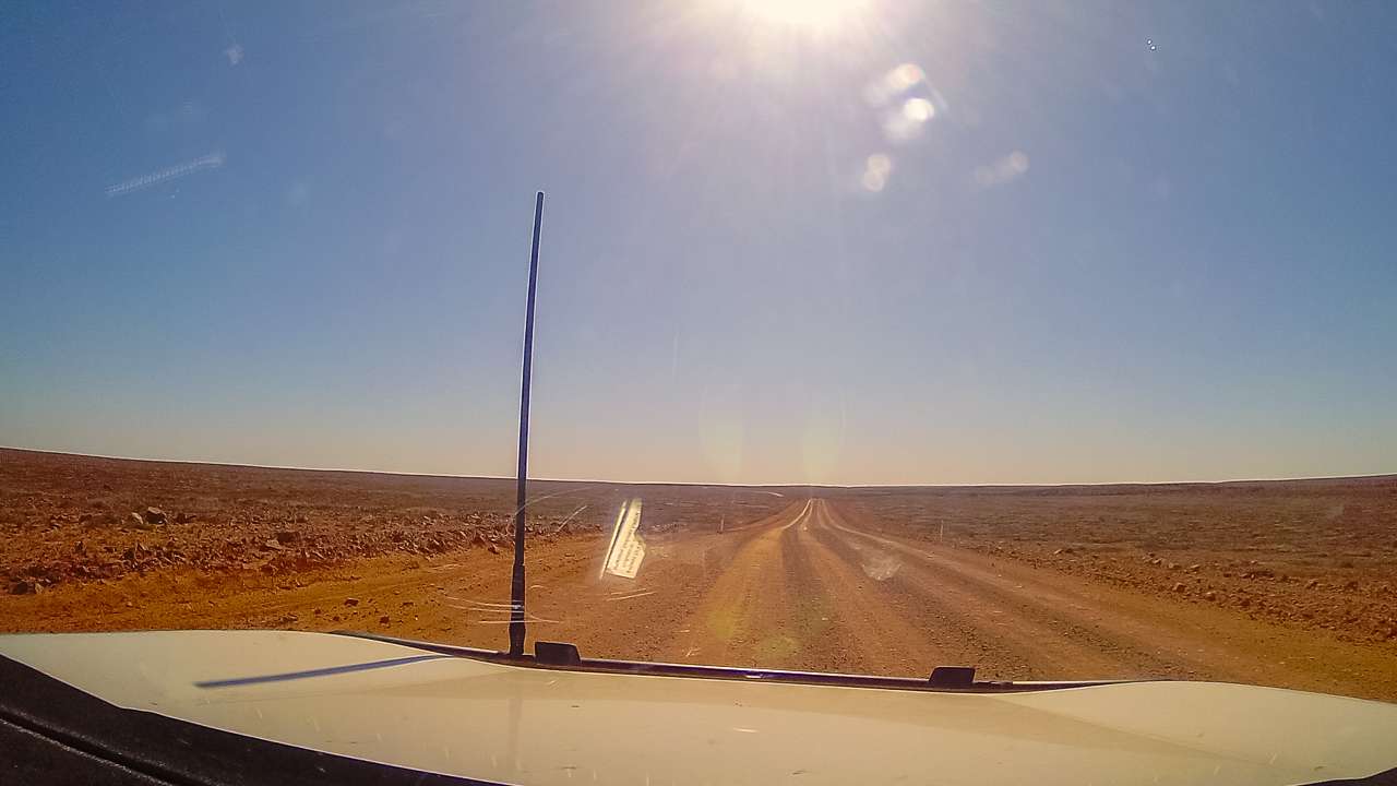
Us Driving Along The Oodnadatta Track in 2020

Us Driving Along The Oodnadatta Track in 2020


Segment 1: Marree to Coward Springs

  • Distance: ~120 km
  • Driving time: 1.5–2.5 hours
  • Road conditions: Generally the smoothest section of the track

This section is often well-maintained and provides an easier introduction to outback driving. The road is typically compacted gravel with occasional corrugations depending on recent grading and traffic.

This is a good adjustment period for tyre pressures, vehicle setup and dust management before entering more remote sections.


Segment 2: Coward Springs to William Creek

  • Distance: ~110 km
  • Driving time: 2–3 hours
  • Road conditions: Variable, increasing corrugations

This section begins to feel more remote, with wider open desert landscapes and less consistent road maintenance. Corrugations become more noticeable depending on traffic levels and season.

Conditions here can vary significantly between trips, with some years being relatively smooth and others heavily corrugated.


Segment 3: William Creek to Oodnadatta

  • Distance: ~200 km
  • Driving time: 3–5 hours
  • Road conditions: Typically the roughest section of the track

This is usually the most challenging part of the Oodnadatta Track. Corrugations can be severe, and speeds often drop significantly to maintain vehicle control and comfort.

Fuel and services are available at William Creek and Oodnadatta, making this a key planning segment for stops and rest breaks.


Segment 4: Oodnadatta to Marla

  • Distance: ~200 km
  • Driving time: 3–4.5 hours
  • Road conditions: Generally improving toward Marla

The final section of the track gradually becomes smoother as you approach the Stuart Highway. While still unsealed, it is often less heavily corrugated than the central sections.

This section provides a gradual transition back to sealed roads and marks the end of the Oodnadatta Track journey.


Why This Segment Approach Matters

Breaking the Oodnadatta Track into segments helps with:

  • Planning realistic daily driving distances
  • Managing fuel consumption between stops
  • Understanding where road conditions change
  • Reducing fatigue on long remote driving days
  • Improving overall trip safety and enjoyment

This structured approach is particularly useful for first-time travellers who may underestimate how different each section of the track can feel in practice.


Seasonal Driving Conditions + Segment Risk Map

The Oodnadatta Track changes significantly depending on the time of year, recent weather events, and traffic levels. Understanding these seasonal variations is essential for planning a safe and comfortable trip.

While the track is generally accessible in dry conditions, each section behaves differently depending on the season. Below is a practical breakdown of what to expect across the four main segments of the route.


Season Overview (When to Travel)

  • May to September (Best Season): Cooler temperatures, generally stable road conditions, highest travel volume.
  • October to April (Hot Season): Extreme heat, increased breakdown risk, soft road surfaces after storms.
  • After Rain Events: Potential closures, boggy sections, and rapidly deteriorating gravel surfaces.

Based on our six trips between 2016 and 2025, winter and early spring consistently provide the safest and most enjoyable driving conditions.


Segment Risk Map Overview

The risk level of the Oodnadatta Track is not uniform. Some sections remain relatively stable year-round, while others deteriorate quickly depending on traffic and weather conditions.

Segment Risk Level (Dry Season) Risk Level (Wet / Post-Rain) Main Issues
Marree → Coward Springs Low Medium Minor corrugations, soft patches after rain
Coward Springs → William Creek Medium High Corrugations, variable grading, loose gravel
William Creek → Oodnadatta High Very High Severe corrugations, washouts, dust conditions
Oodnadatta → Marla Medium High Soft gravel, occasional rough patches after rain

Seasonal Impact by Segment

Marree → Coward Springs

This section remains relatively stable year-round. In wet conditions, minor soft patches may form but it is usually one of the safer sections of the track.

Coward Springs → William Creek

This section begins to show more variation between seasons. In peak travel months, corrugations can develop quickly due to higher traffic volumes.

William Creek → Oodnadatta

This is the most sensitive section of the track. In hotter months, surface degradation accelerates, and after rain it can become unpredictable with washouts and soft shoulders.

Oodnadatta → Marla

Generally more forgiving than the central section, but can still deteriorate after rain events. Conditions usually improve closer to the Stuart Highway.


Key Seasonal Driving Risks

  • Heat exposure: High summer temperatures increase vehicle and driver fatigue risk.
  • Corrugation fatigue: Prolonged rough sections can affect vehicles and towing setups.
  • Dust conditions: Reduced visibility in convoy traffic during dry peak season.
  • Post-rain damage: Rapid track deterioration after storms or flooding events.

Why This Matters for Trip Planning

Understanding seasonal and segment-based risk is critical when planning the Oodnadatta Track. It allows travellers to:

  • Choose safer travel windows
  • Plan realistic daily distances
  • Prepare for variable road conditions
  • Reduce mechanical stress on vehicles and caravans

This seasonal breakdown also helps first-time travellers set realistic expectations and improve overall safety on the journey.

Oodnadatta Track Route System Map + Itinerary Planning Layer

To fully understand the Oodnadatta Track as a travel route, it helps to view it as a complete driving system rather than just a single road. This section brings together the full route structure, key stop sequencing, and practical itinerary planning based on real-world travel experience.

We have driven the Oodnadatta Track six times between 2016 and 2025, and one of the most important lessons is that successful trips are not just about distance — they are about pacing, fuel strategy, and understanding how each section flows into the next.


Oodnadatta Track Full Route Flow

The Oodnadatta Track runs in a clear north–south corridor between Marree and Marla, with natural stopping points that divide the journey into manageable travel segments.

Core Route Sequence
  • Marree (Start Point – fuel, supplies, final preparation)
  • Coward Springs (First major stop – camping, artesian spa)
  • William Creek (Mid-route hub – fuel, accommodation, flights)
  • Oodnadatta (Northern service point – fuel, supplies)
  • Marla (End point – return to Stuart Highway)

This natural flow forms the backbone of all realistic itinerary planning on the Oodnadatta Track.


Recommended Itinerary Options

🚗 3-Day Transit Itinerary (Minimum Practical Drive)
  • Day 1: Marree → Coward Springs → William Creek
  • Day 2: William Creek → Oodnadatta
  • Day 3: Oodnadatta → Marla

This option is suitable for experienced outback travellers who are primarily transiting the route rather than exploring in depth.


🌄 5-Day Balanced Exploration Itinerary
  • Day 1: Marree → Coward Springs (overnight camping)
  • Day 2: Coward Springs → William Creek
  • Day 3: William Creek → Lake Eyre viewpoints / exploration day
  • Day 4: William Creek → Oodnadatta
  • Day 5: Oodnadatta → Marla

This is the most commonly recommended balance between travel time and experience quality.


🏕 7-Day Full Experience Itinerary (Recommended)
  • Day 1: Marree → Strangways Springs → Coward Springs
  • Day 2: Coward Springs exploration day
  • Day 3: Coward Springs → William Creek (slow travel with stops)
  • Day 4: William Creek (Lake Eyre scenic flights / rest day)
  • Day 5: William Creek → Oodnadatta (via key sidings and ruins)
  • Day 6: Oodnadatta exploration day
  • Day 7: Oodnadatta → Marla

This itinerary allows proper time to experience the route without rushing and is the closest to how we personally prefer to travel the track.


How the Route System Affects Your Trip Planning

Breaking the Oodnadatta Track into a structured system helps travellers:

  • Plan realistic daily driving distances
  • Match fuel stops with natural overnight locations
  • Reduce fatigue by avoiding long continuous driving days
  • Time travel around weather and road conditions
  • Build flexibility into remote travel planning

This system-based approach is particularly important on the Oodnadatta Track due to the long distances between services and the variability of road conditions throughout the year.


Why This Section Improves Travel Planning Clarity

Understanding the Oodnadatta Track as a connected route system rather than isolated towns or attractions is key to safe and enjoyable travel. Each stop naturally supports the next, and successful trips are built around pacing rather than distance alone.

This structured approach improves both trip safety and overall experience quality, especially for first-time travellers in the South Australian outback.

Oodnadatta Track Road Conditions

Road conditions on the Oodnadatta Track vary enormously throughout the year.

In dry weather, much of the route is generally suitable for:

  • High-clearance SUVs
  • 4WD vehicles
  • Camper trailers
  • Caravans
  • Some 2WD vehicles

However, after rain the track can deteriorate quickly and closures are common. Corrugations are one of the biggest challenges on the track and can become severe in busy periods.

Always check current South Australian outback road reports before travelling.

We have a comprehensive guide on where to get Oodnadatta Track road condition information from


Best Time To Drive The Oodnadatta Track

The best time to drive the Oodnadatta Track is generally between May and September.

These cooler months provide:

  • More comfortable camping temperatures
  • Safer travel conditions
  • Reduced heat stress
  • Better sightseeing opportunities

Summer temperatures regularly exceed 45°C and can become dangerous if you experience vehicle problems in remote areas.


Is The Oodnadatta Track Suitable For Caravans?

Yes — many travellers tow caravans along the Oodnadatta Track every year.

Across our trips we’ve seen:

  • Compact camper trailers
  • Hybrid caravans
  • Full off-road caravans
  • Larger touring vans
  • Motorhomes
  • Ute toppers

Conditions can become rough enough to damage poorly prepared caravans, especially during heavy corrugations.


Fuel Stops Along The Oodnadatta Track

Fuel availability is limited, so planning ahead is important.

Fuel is available at:

  • Marree
  • William Creek
  • Oodnadatta
  • Marla

Fuel prices are considerably higher than larger regional towns. For more information on Oodnadatta Track Fuel Stops and planning fuel strategies for the Oodnadatta Track check out our Oodnadatta Track Fuel stop in 2026 post.


Attractions Along The Oodnadatta Track

William Creek

William Creek is one of the iconic outback towns in Australia and a popular stop for fuel, camping and scenic flights over Lake Eyre. We have used the dump point at William Creek lots of times to empty our toilet canister.

Coward Springs

Coward Springs is one of our favourite stops anywhere on the route. The artesian spa, date palms and restored railway buildings create a completely different atmosphere compared to the surrounding desert landscapes.

Algebuckina Bridge

The historic Algebuckina Bridge is one of the most photographed locations on the Oodnadatta Track.

Strangways Springs

Strangways Springs is one of the most historically significant locations along the route and well worth allowing extra time to explore.

Lake Eyre Access

The Oodnadatta Track also provides access to Kati Thanda-Lake Eyre via William Creek and Halligan Bay.


Camping On The Oodnadatta Track

Camping is one of the biggest highlights of the journey, ranging from remote bush camps beside old railway sidings through to caravan parks and station stays.

Some of the best-known camping areas include:

  • Coward Springs
  • Algebuckina Bridge
  • William Creek
  • Beresford Railway Siding
  • Oodnadatta
  • Marree

For a full campsite breakdown, see our dedicated guide:

Oodnadatta Track Campsites Guide


Suggested Oodnadatta Track Itinerary

3 Day Itinerary

  • Day 1: Marree to William Creek
  • Day 2: William Creek to Oodnadatta
  • Day 3: Oodnadatta to Marla

5–7 Day Itinerary

Allow extra time for:

  • Lake Eyre flights
  • Remote camping
  • Visiting Strangways
  • Checking out the Mound Springs – we think they’re very interesting and they change each time we visit
  • Exploring railway ruins
  • Photography
  • Side trips
  • Relaxing at Coward Springs

Essential Safety Tips

  • Carry extra water
  • Lower tyre pressures
  • Carry at least one full-size spare tyre
  • Avoid travel immediately after heavy rain
  • Check road reports daily
  • Carry emergency communications if possible
  • Avoid driving at dusk due to wildlife

Mobile reception is extremely limited outside major stops. We have found that the only reliable mobile connection spots are at Marree, William Creek, Oodnadatta and Marla. we now have Starlink and highly recommend it.


Complete Driving Guide to the Oodnadatta Track

The Oodnadatta Track is not just a scenic outback route — it is a long-distance desert drive where planning, fuel management and road awareness are essential. While the track is generally accessible in dry conditions, conditions vary significantly between sections and seasons.

This section breaks down the route into practical driving segments, including distances, estimated drive times, fuel strategy and expected road conditions based on our six trips between 2016 and 2025.


Oodnadatta Track Distances & Drive Segments

The Oodnadatta Track runs between Marree and Marla, with several key stops along the way.

Key Driving Distances

  • Marree → Coward Springs: ~120 km
  • Coward Springs → William Creek: ~110 km
  • William Creek → Oodnadatta: ~200 km
  • Oodnadatta → Marla: ~200 km
  • Full Track (Marree → Marla): ~620 km

These distances can feel longer than expected due to road surface conditions and reduced speeds on corrugations.


Drive Time Breakdown (Realistic Outback Timing)

Typical Travel Times

  • Marree → William Creek: 3–5 hours
  • William Creek → Oodnadatta: 4–6 hours
  • Oodnadatta → Marla: 3–5 hours
  • Full Track (no stops): 10–14 hours driving time

Realistic Travel Plan

  • 3 days minimum (basic transit)
  • 5–7 days recommended (ideal for exploration and camping)

Slower travel improves safety and allows time for key attractions along the route.


Fuel Strategy (Critical Planning Section)

Fuel availability on the Oodnadatta Track is limited, expensive and spread far apart. Careful planning is essential.
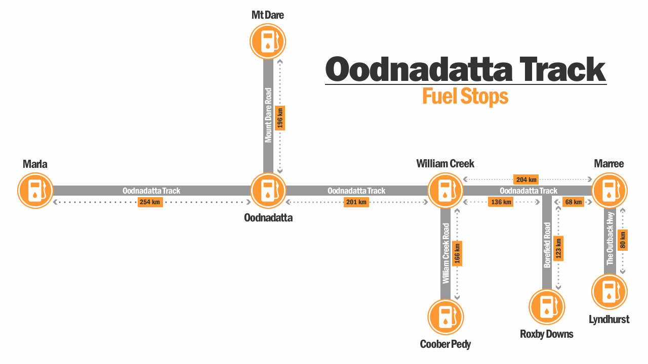
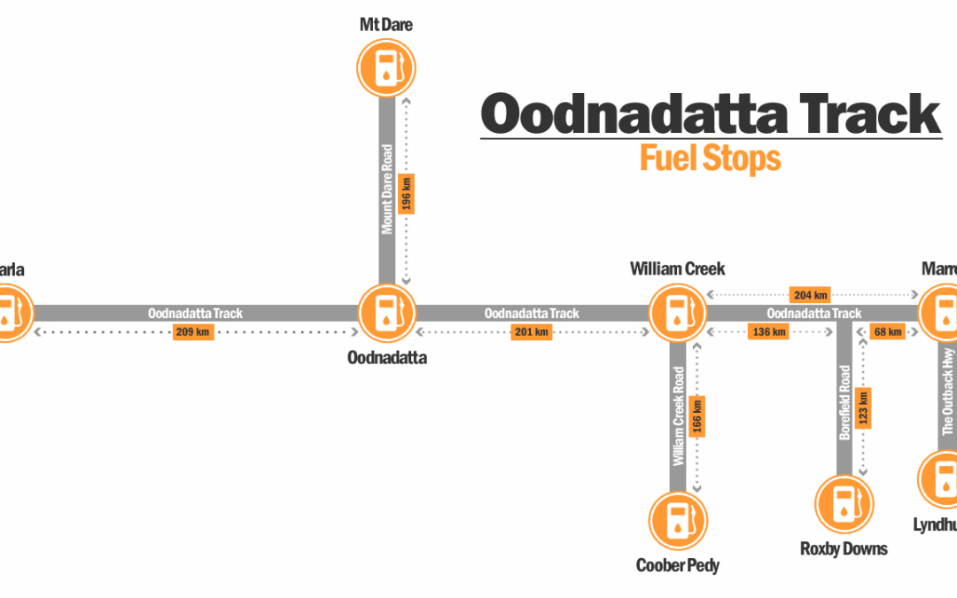
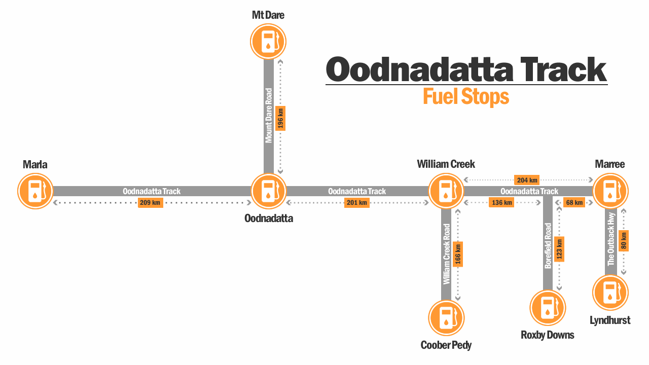
Oodnadatta Track Fuel Stops Map Infographic

Oodnadatta Track Fuel Stops Map (Not To Scale)

Fuel Stops Along the Route

  • Marree (start point)
  • William Creek (mid-route)
  • Oodnadatta (north section)
  • Marla (end point)

Fuel Planning Advice

  • Always start with a full tank
  • Do not rely on topping up later
  • Expect higher fuel prices at remote stops
  • Carry at least 200–300 km fuel buffer
  • Caravans significantly increase fuel use

Fuel consumption can vary significantly depending on road conditions, wind and towing load.


Road Surface Breakdown by Segment
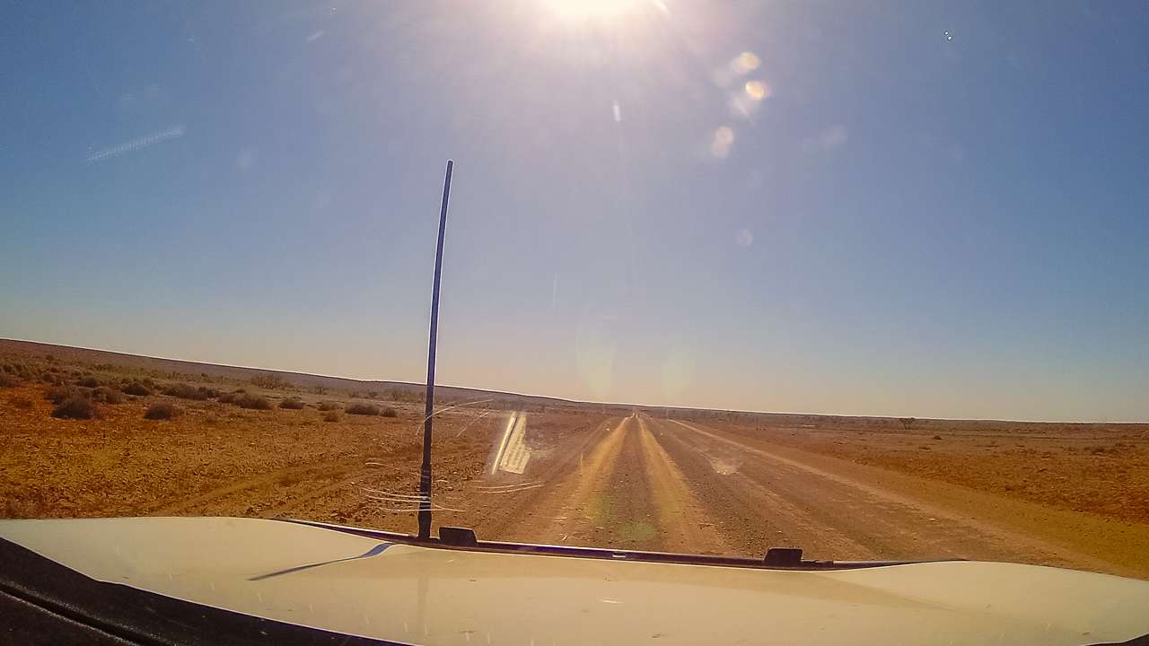
Oodnadatta Track Road Surface From Inside Our Vehicle

Oodnadatta Track Road Surface From Inside Our Vehicle

Marree → Coward Springs

  • Generally well-maintained
  • Mixed gravel and compacted dirt
  • Occasional corrugations

Our experience: Often the smoothest section, especially after grading.

Coward Springs → William Creek

  • Increasing corrugations
  • Wide open desert terrain
  • Soft gravel sections in places

Our experience: Conditions vary significantly between trips.

William Creek → Oodnadatta

  • Typically the roughest section
  • Heavy corrugations common
  • Washboard surfaces in busy periods

Our experience: Consistently the most challenging section.

Oodnadatta → Marla

  • Gradually improves toward Marla
  • Mixed gravel and graded surfaces
  • Less traffic overall

Our experience: Generally smoother than the central sections.


Key Driving Considerations

  • Reduce tyre pressure for corrugations
  • Expect dust and reduced visibility in convoys
  • Avoid driving at dusk due to wildlife
  • Road conditions can change quickly after weather or grading
  • Allow extra time for slower travel on rough sections

Final Thoughts

After six separate trips between 2016 and 2025, the Oodnadatta Track remains one of our favourite outback journeys anywhere in Australia.

What makes the track special is that every trip feels different. Weather, road conditions, traveller numbers and even the desert landscapes can change dramatically from year to year.

Whether you’re visiting for remote camping, Lake Eyre, outback history or simply the experience of crossing one of Australia’s most famous desert tracks, the Oodnadatta Track is an unforgettable adventure when approached with proper preparation and realistic expectations.

FAQs

How long does it take to drive the Oodnadatta Track?

Most travellers allow between 3 and 7 days depending on road conditions and sightseeing.

Do you need a 4WD for the Oodnadatta Track?

Not always in dry conditions, although a high-clearance vehicle is strongly recommended.

Is the Oodnadatta Track difficult?

In dry conditions the track is usually manageable for prepared travellers, although corrugations can be severe.

Can you tow a caravan on the Oodnadatta Track?

Yes, although off-road or semi off-road caravans are best suited.

Is there phone reception on the Oodnadatta Track?

Reception is extremely limited outside towns like Marree, William Creek and Oodnadatta.

What is the best month to drive the Oodnadatta Track?
May through September generally provides the best balance of weather and road conditions.
Oodnadatta Track Campsites Map & Full List (2026 Guide)

Oodnadatta Track Campsites Map & Full List (2026 Guide)

Oodnadatta Track Campsites Map & Full List (2026 Guide)

Updated May 2026 after six separate trips along the Oodnadatta Track between 2016 and 2025.

The Oodnadatta Track stretches more than 600km through remote South Australia between Marree and Marla. This page lists every known campsite along the route, based on multiple real world trips and on the ground experience.

Topic Info
Best Campsite Coward Springs
Best Free Camp Algebuckina Bridge
Best Time To Visit May–September
2WD Suitable Usually in dry conditions
Caravan Friendly Yes (conditions dependent)
Fuel Stops Marree, William Creek, Oodnadatta, Marla


Related guide: Oodnadatta Track South Australia Full Guide

Map Of All Oodnadatta Track Campsites


North Of Marree (Southern Section Campsites)

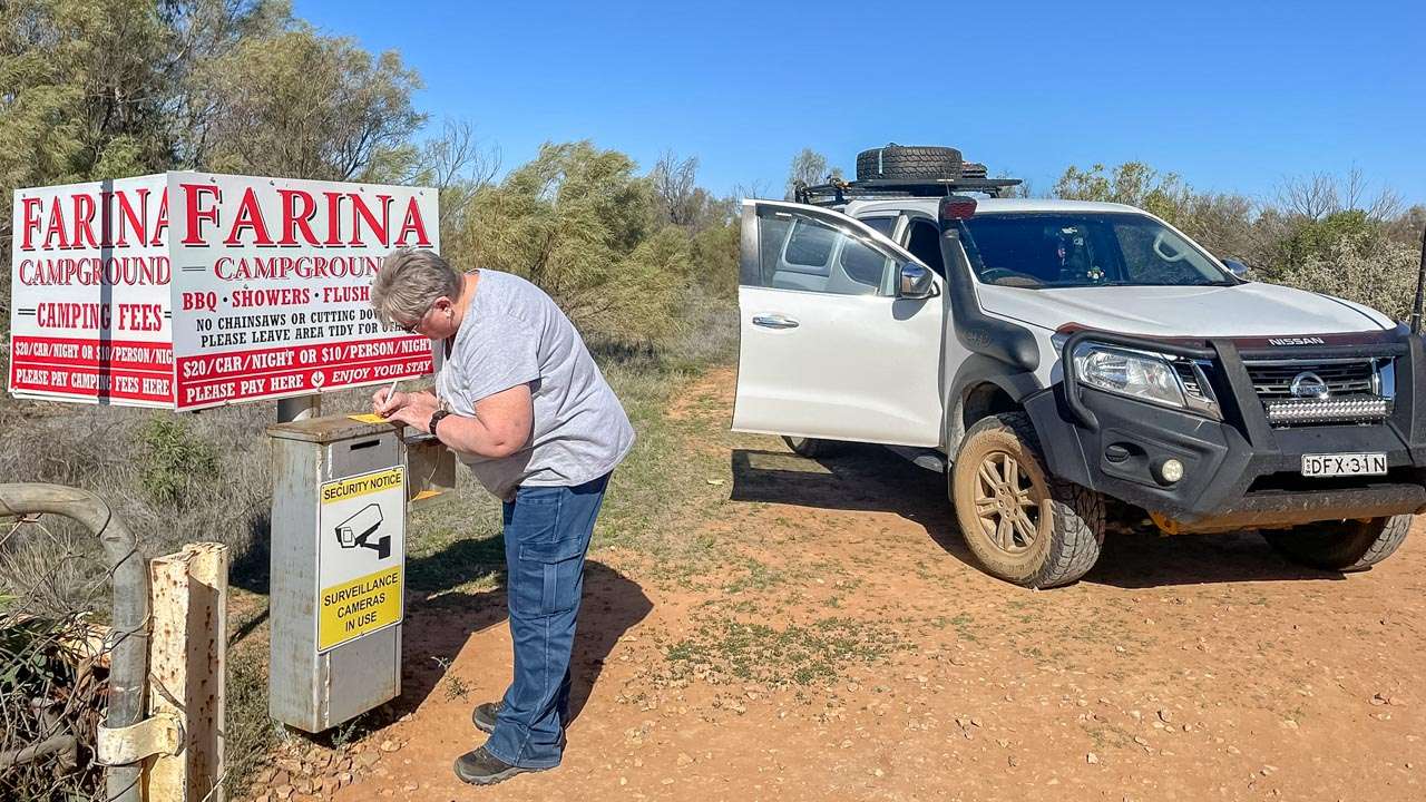
Farina Campground

Restored ghost town campground with hot showers, toilets and seasonal volunteer operations. One of the most popular pre-track stops. The Farina campground is an absolute must visit for us. We stay here whenever we travel the Oodnadatta Track.

Amanda Paying Our Camping Fees At Farina

Amanda Paying Our Camping Fees At Farina

Marree Hotel Campground

Basic outback pub camping behind the iconic Marree Hotel with food, fuel and a strong outback atmosphere. Marree Hotel Campground is a great place to camp up for a day before heading your trip along the track or when you’ve finished.

Marree Oasis Caravan Park

Powered and unpowered sites with full amenities, commonly used as a staging point before entering the track. We’ve never actually stayed at the Oasis Caravan Park however we’ve called in and paid to use their dump point three or four times.

Bridge Ruins Campsite

Simple free camp near historic railway infrastructure. Quiet, and close to the track. The Bridge Ruins Campsite has plenty of room for caravans and rigs of all sizes.

Alberrie Creek Bridge (Near Mutonia Sculpture Park)

Quirky sculpture site with informal bush camping nearby. No facilities but a memorable stop. Alberrie Creek Bridge is one of the typical Oodnadatta Track Campsites.

Gregory Creek Campsite

Wide open bush camping area suitable for caravans with basic roadside access. Gregory Creek Campsite is right alongside the old Ghan Railway as are many of the Oodnadatta Track Campsites.

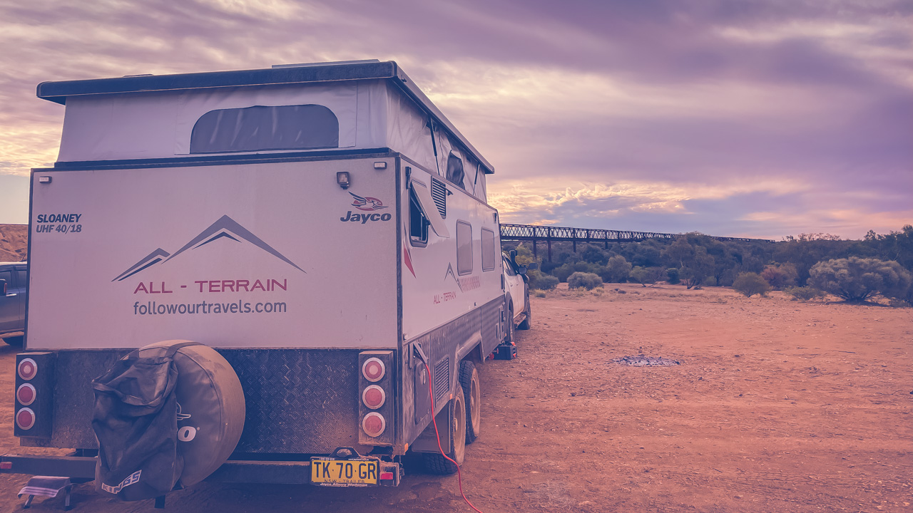
Free Camping At Algebuckina Bridge On The Oodnadatta Track

Free Camping At Algebuckina Bridge On The Oodnadatta Track


Historic Railway & Mid-Track Campsites

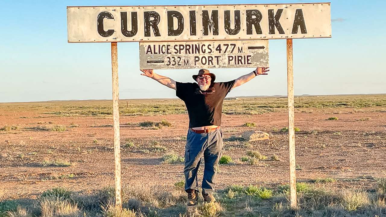
Curdimurka Railway Siding

An almost intact railway siding with flat camping areas beside old Ghan infrastructure and strong photography appeal. Curdimurka Railway Siding has one of the Old Ghan Railway water conditioners still in place which is worth a look. This is one of our preferred Oodnadatta Track Campsites. There’s loads of room here for rigs of all sizes. There’s a geocache hidden here if you can find it! We camped here in 2019 and again in 2024.

Here I Am At The Curdimurka Siding Station Board - I Need To Pull My Pants Up A Bit!

Here I Am At The Curdimurka Siding Station Board – I Need To Pull My Pants Up A Bit!

Stuart Creek Campsite

Large open bush camp with easy access and space for larger rigs and caravans. Stuart Creek Campsite is one of the lesser known Oodnadatta Track Campsites but it’s definitely a good ‘un!

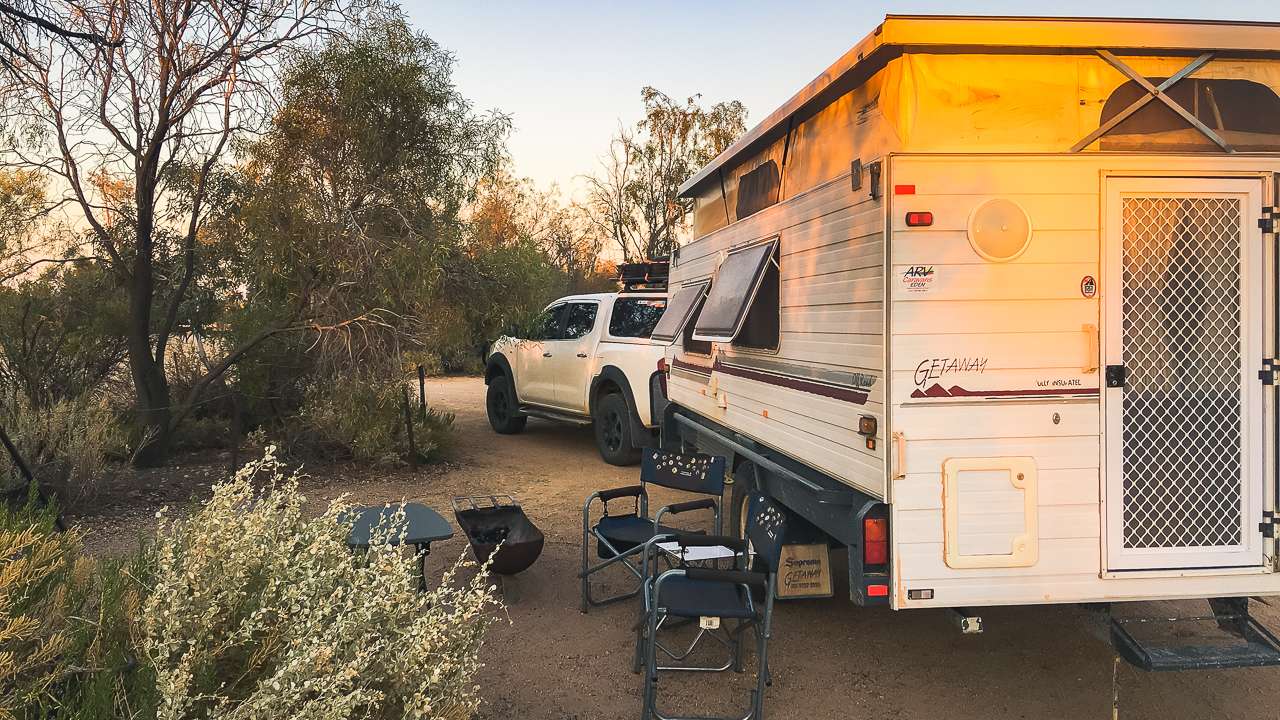
Coward Springs Campground

One of the most established camps on the track. We’ve stayed here multiple times across different trips. Known for the artesian spa, shaded campsites and restored railway buildings. Can be busy during peak travel events. We’ve camped at Coward Springs Campground twice and highly recommend it.

Us Camping At Coward Springs Campground In 2018

Us Camping At Coward Springs Campground In 2018

The Amphitheatre Campsite

Former quarry turned bush camp with wide open space and excellent solitude. Popular with self contained travellers. The Amphitheatre Campsite is well worth a look.

Beresford Bore Railway Siding

Historic siding with basic bush camping near railway ruins. Quiet and atmospheric. We camped here with friends back in 2022 and Beresford Bore Railway Siding was an awesome experience.

Us Camped At Beresford Siding In 2022

Us Camped At Beresford Siding In 2022

Warriner Creek Bridge Camp

Remote bridge crossing camp with no facilities and minimal traffic. Warriner Creek Bridge Camp is a great spot to go for a walk along the Old Ghan Railway from of an afternoon.


William Creek Region Campsites

William Creek Campground

Basic campground in the heart of the track with fuel, food and access to scenic flights over Lake Eyre. William Creek Campground is right across the road from the hotel.

Box Creek Bush Camp

Remote creek crossing camp suitable for self sufficient travellers. The creek that Box Creek Bush Camp is located on has been empty all six times we’ve travelled the Oodnadatta Track.

Quilters Ruins Campsite

Quilters Ruins Campsite is a quiet bush camp with historic railway ruins nearby. One of the more peaceful stops along the track.

Duff Creek Bridge Campsite

Simple roadside camp beside an old railway bridge crossing. Duff Creek Bridge Campsite is easy to get into and has lots of room. It’s usually quiet and you’ll be the only one there on most occasions.

Irrapatana Sand Hills Campsite

Dune backed bush camp with soft sand terrain and no facilities. Be careful getting in and out of Irrapatana Sand Hills Campsite as it’s quite sandy and soft.


Algebuckina & Central Track Campsites

Algebuckina Bridge Campground

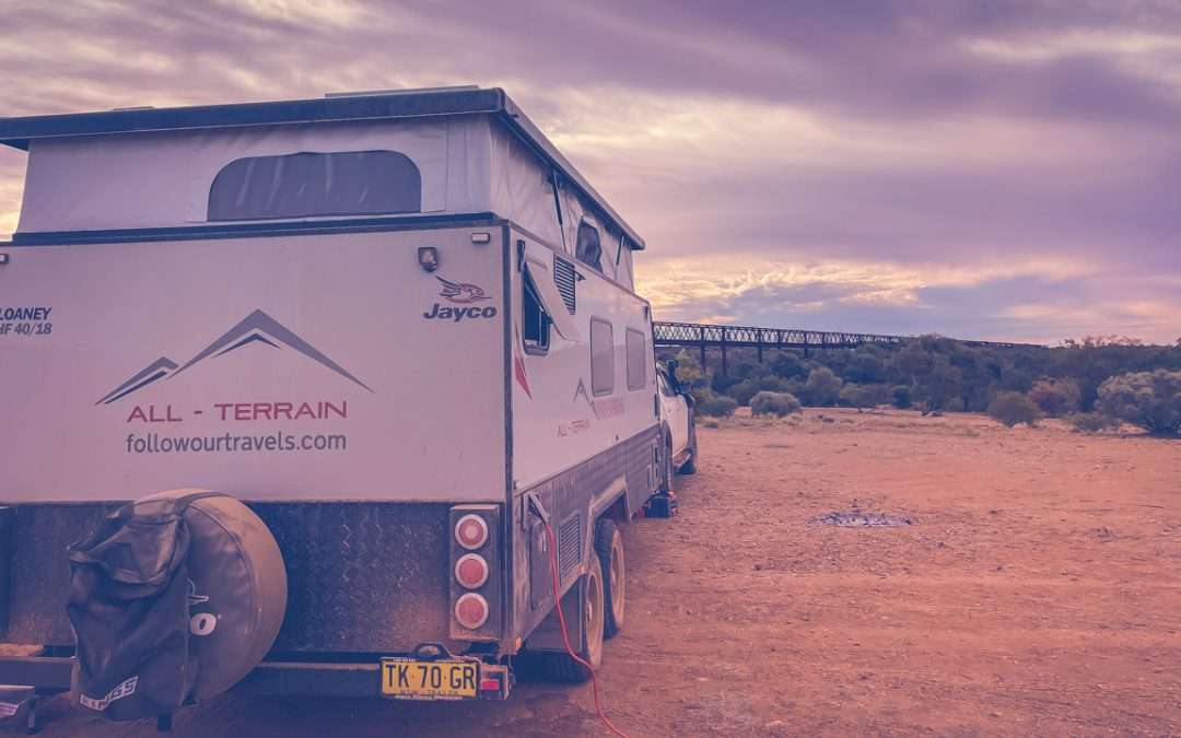
One of the most iconic camps on the Oodnadatta Track. Free camping beside the massive historic railway bridge over the Neales River. We’ve camped here three times and will do so again. There is an absolutely massive amount of room at the Algebuckina Bridge Campground. It doesn’t matter how many campers are in there you’ll always be able to get a spot that feels like you’re on your own.

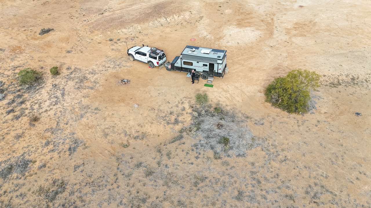
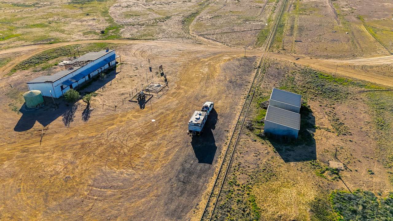
Drone Shot Of Our Campsite On Oodnadatta Track At Algebuckina Bridge

Drone Shot Of Our Campsite On Oodnadatta Track At Algebuckina Bridge

Algebuckina Waterhole (The Peake)

Seasonal waterhole camping area with scenic desert surroundings. Conditions vary depending on rainfall. We got a flat tyre getting into Algebuckina Waterhole in 2024 but it was easily plugged. There’s not a lot of room in here, I’d say half a dozen spots at most.


Oodnadatta Region Campsites

Oodnadatta Free Camp

Oodnadatta Free Camp is a council run free camp with basic facilities near town and walking access to the Pink Roadhouse.

Oodnadatta Pink Roadhouse Campground

Paid campground with toilets, showers and fuel access at the iconic Pink Roadhouse Campground.

Angle Pole Area Bush Camp

Angle Pole Bush Camp is an open desert camping area north of Oodnadatta with minimal facilities.

Kathleen Creek Campsite

Remote roadside bush camp with no facilities. Kathleen Creek is very quiet. It’s ideal.

Oolarinna Creek Campsite

Oolarinna Creek Campsite is a simple creek crossing camp suitable for self contained travellers.

Coongra Creek Campsite

Quiet bush camping area along the track with minimal infrastructure. Coongra Creek Campsite is an absolute ripper of a campsite. WikiCamps will tell you it’s on the left when travelling towards Marla however instead of going left head across the track and head in along the track on the right hand side. There’s an absolute mile of room and plenty of wood well back off the track. We’ve camped in here a few times.


Northern Section (Toward Marla)

Marla Travellers Rest

Full service stop at the northern end of the track with fuel, powered sites and amenities. Marla Travellers Rest is an ideal spot to camp up before or after the Oodnadatta Track.


Oodnadatta Track Campsite Types Explained

Across all our trips, campsites along the track generally fall into four categories:

Free Bush Camps

  • No facilities
  • Remote locations
  • Best for self-sufficient travellers
  • Examples: Algebuckina, Quilters Ruins, Duff Creek

Historic Railway Camps

  • Old Ghan infrastructure
  • Flat open camping areas
  • Strong photography appeal
  • Examples: Curdimurka, Beresford

Station / Paid Camps

  • Toilets and showers
  • Managed sites
  • Examples: Coward Springs, Farina

Pub / Town Camps

  • Fuel + food access
  • Social atmosphere
  • Examples: Marree, William Creek, Oodnadatta

Planning Notes (Based on Six Trips)

From our six trips along the Oodnadatta Track a few consistent patterns stand out:

  • Camps near Coward Springs and William Creek are the busiest in peak season
  • Free camps north of William Creek are generally quieter
  • Weather will strongly influence campsite selection (you may change plans daily)
  • Water availability and flies vary massively year to year
  • Lake Eyre flooding events significantly increase traffic and campsite occupancy

Oodnadatta Track Free Camping At Curdimurka Siding

Oodnadatta Track Free Camping At Curdimurka Siding

FAQs

How many campsites are on the Oodnadatta Track?
There are dozens of formal and informal campsites ranging from station stays to remote bush camps.

Do you need a 4WD for these campsites?

Not always in dry conditions, but a high-clearance vehicle is strongly recommended.

Are free camps available?

Yes, many free bush camps exist along the full length of the track.

Can caravans access these campsites?

Yes, but conditions vary. Off-road caravans are best suited.

Which campsite is the most popular?

Coward Springs and Algebuckina Bridge are among the most visited.

Oodnadatta Pink Roadhouse Camping And Caravan Park

Oodnadatta Pink Roadhouse Camping And Caravan Park

Oodnadatta Pink Roadhouse Camping And Caravan Park

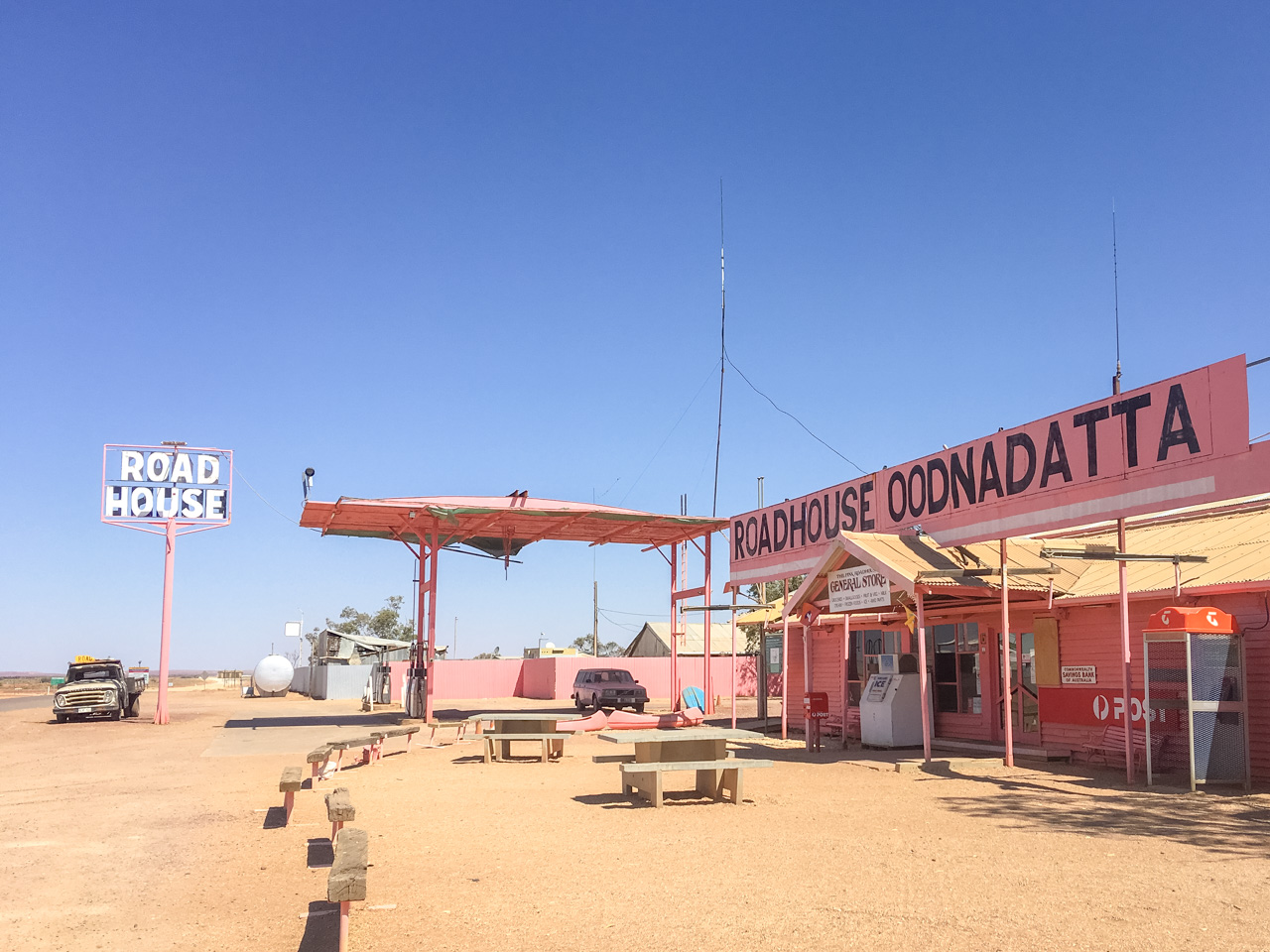
The Pink Roadhouse at Oodnadatta has been serving visitors to the region for decades. It’s a great overnight stop for caravans and campers tackling the Oodnadatta Track. Located behind the pink roadhouse the camping and caravan park has all the basics you need.

Pink Roadhouse Camping & Caravan Park Location And Info At A Glance

Cost: About $35 per night powered and $20 per night unpowered. Varies depending upon season.
Type: Caravan Park / Paid Campground
Location: -27.549235°, 135.447553°
Distance From Marree: 406km
Distance From Oodnadatta: 0km
Distance From Marla: 254km

Accommodation Options At The Pink Roadhouse Camping & Caravan Park

The Pink Roadhouse Camping and Caravan Park has powered and unpowered sites. They also have a limited range of cabins available ranging from basic to not so basic (still a bit basic).

Pink Roadhouse Oodnadatta

Pink Roadhouse Oodnadatta

Facilities

Amenities are a mixed bag – some are new and some show their age. The newer shower and laundry block is excellent, with clean facilities that are a welcome sight after long days on rough roads. Pro tip: use the showers next to the laundry block as they’re the newest and cleanest.

The camp kitchen provides a decent space to prepare meals, though it’s seen better days. Water is available from taps around the site for filling bottles and jerry cans, with desalinated water available out the front. Tank water can be filled at the shared tap on the back fence.

The Roadhouse Experience

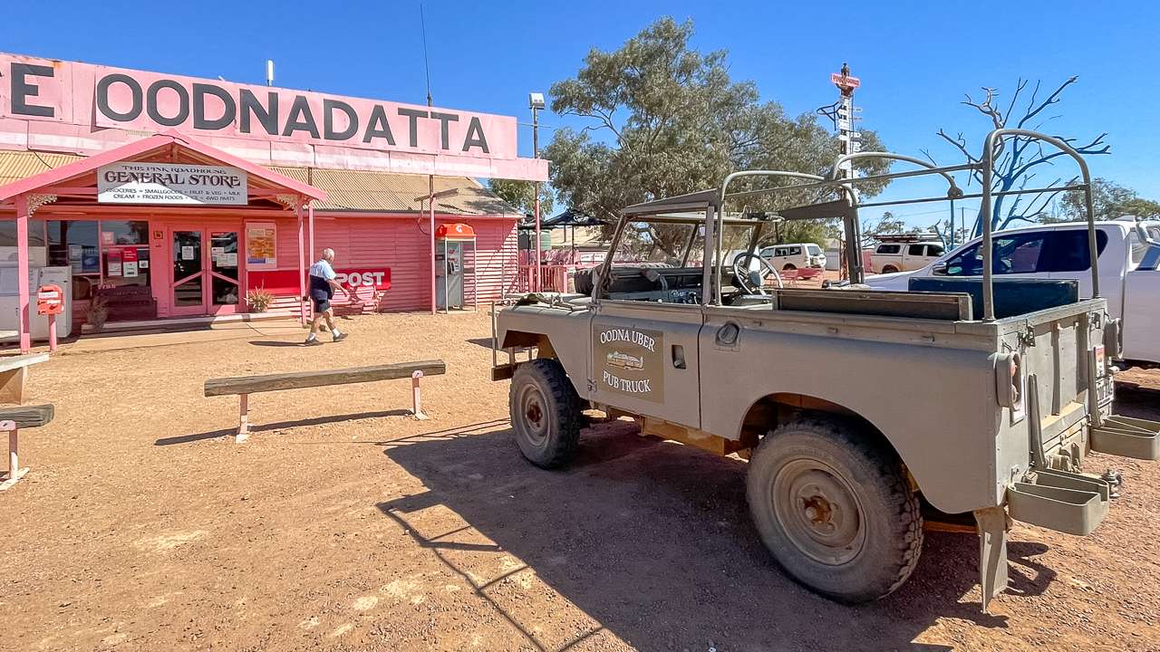
The Pink Roadhouse itself is part of the experience. It’s weathered but functional, stocking fuel, groceries, and a good range of essentials. The general store covers most needs with dry goods, some fresh produce, frozen meat, and the usual tourist souvenirs. Coffee is decent, and the food menu includes solid pub meals like parmas and the local Oodna Burger.

Staff are helpful and knowledgeable about local tracks and conditions – worth having a chat if you’re planning to explore further. Joe in particular is a wealth of information about surrounding tracks and points of interest.

What Works Well

  • Dogs allowed
  • Clean powered and unpowered sites
  • Knowledgeable staff for track advice
  • Well stocked store for restocking basic supplies
  • Good water quality

The Pink Roadhouse At Oodnadatta

The Pink Roadhouse At Oodnadatta

The Reality Check

This isn’t a resort – it’s a working roadhouse in the middle of nowhere. Some facilities are old and functional rather than flash. Prices reflect the remote location on the Oodnadatta Track as you’d expect. The older amenities block shows wear but remains usable.

Summary

The Pink Roadhouse serves is a reliable place to pull up for an overnight stop. It’s clean, it’s functional and has the basics of what you need. It’s an awesome place you don’t want to miss when driving along the Oodnadatta Track.

Whether restocking supplies, refuelling or you need a quick meal and a cold drink the Pink Roadhouse delivers the essentials with genuine outback hospitality.

Marla Travellers Rest: Your Last (Or First) Oodnadatta Track Stop

Marla Travellers Rest: Your Last (Or First) Oodnadatta Track Stop

Marla Travellers Rest: Your Last (Or First) Oodnadatta Track Stop

If you’re driving the Oodnadatta Track chances are you’ll end up at Marla Travellers Rest. This roadhouse is right where the Stuart Highway meets the Oodnadatta Track.

This makes the Marla Travellers Rest an obvious choice for your first or last campsite and supply point before heading into some seriously remote country or taking a rest at the end of it. We’ve stopped here multiple times over the years and it’s one of our regular stops in the region. Here’s what you need to know.

Marla Travellers Rest Caravan Park Location And Info At A Glance

Cost: $45 per night powered – $25 per night unpowered
Type: Caravan Park
Location: Wattle St, Marla, South Australia
GPS: -27.3040320, 133.6244510
Pet Friendly: Yes
Website: https://www.marla.com.au/
Distance From Marree: 603km
Distance From Oodnadatta: 254km
Distance From Marla: 0km

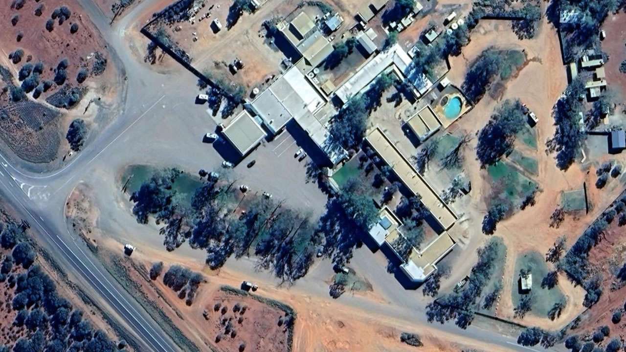
Marla Travellers Rest On Google Earth

Marla Travellers Rest On Google Earth

Why Marla Travellers Rest Caravan Park Works

The amenities here are fantastic. The shower blocks are spotless despite constant use from travellers coming off dusty tracks. Someone’s clearly taking pride in maintaining these facilities properly.

Sites are well thought out too. The powered spots give you gravel to park on but grass to step onto when you open your van door – simple but effective. Unpowered sites follow a more relaxed roundabout setup that works fine, though it’s less structured than in some parks.

What’s Available

Marla Travellers Rest Caravan Park covers pretty much everything you’d expect:

Food And Drink

  • Café doing breakfast, lunch and dinner
  • Decent coffee that actually tastes like coffee
  • Bar with proper happy hour ($5 beers)
  • Good feed available in the restaurant – they don’t skimp on the vegetables

Supplies

  • Supermarket with solid range of basics
  • Cold goods and frozen items
  • Camping gear and mechanical bits
  • Fuel – both diesel and unleaded

Facilities

  • Swimming pool (clean and refreshing)
  • Camp kitchen with sinks and power points
  • Phone coverage works fine
  • Hot showers with good pressure

Pricing And Practicalities

Service Details Notes
Powered Sites $45 a night Book early afternoon for best availability
Unpowered Sites $25 a night Roundabout-style layout
Fuel Diesel and petrol Occasional supply disruptions possible
Supermarket Full range of supplies Cold goods, camping gear, mechanical items
Café/Restaurant Breakfast, lunch, dinner Good portions, fresh vegetables
Bar Happy hour specials $5 beers during happy hour
Swimming Pool Clean and maintained Great for cooling off
Amenities Exceptionally clean Hot showers, good water pressure

Get in by early afternoon if you want a powered site. Place fills up fast, especially when there’s fuel issues elsewhere along the highway. We’ve seen it absolutely packed by nightfall, but it stays surprisingly quiet given the numbers.

Oodnadatta Track Considerations

Whether you’re starting or finishing the Oodnadatta Track, Marla serves a crucial role. Heading out? This is your last reliable chance to grab supplies, top up water and fuel up properly. The next decent services are a long way away. Coming back? Time to celebrate with a cold beer and hot shower after days of rough camping.

The supermarket stocks more than you’d expect for such a remote location. They’ve got the basics covered plus camping accessories and some mechanical gear. Won’t replace proper preparation, but handy for last-minute items or emergency supplies.

What It Is

It’s not fancy. You’re paying for location and reliability rather than luxury. When you’re this far from anywhere location and reliability matter more than fancy landscaping. The pool’s clean, the showers are hot and the bar serves cold beer at good prices. Hard to ask for much more.

Road noise exists but it’s not excessive. Most nights stay pretty quiet despite being right off the highway. The grass areas give you somewhere decent to sit outside your van rather than just dirt or gravel.

End Or Start Of The Oodnadatta Track At Marla

Amanda & I At The End Or Start (End For Us This Trip) Of The Oodnadatta Track At Marla In 2024

Bottom Line

Marla works because it delivers the essentials without fuss. Clean facilities, fair prices, reliable services and everything you need for track preparation or recovery. We keep coming back because it consistently meets expectations rather than promising more than it delivers.

For anyone serious about the Oodnadatta Track this stop makes sense. Just don’t expect to roll in at 5pm and get your pick of powered sites.

Oodnadatta Track Fuel Stops 2026 – Complete Guide

Oodnadatta Track Fuel Stops 2026 – Complete Guide

Oodnadatta Track Fuel Stops 2026 – Complete Guide

Complete list of Oodnadatta Track fuel stops and contacts for your outback adventure along one of Australia’s most iconic tracks.

Fuel planning is absolutely critical for this journey as services are limited and distances between fuel stops can be substantial. We’ve been to and used all of these stops many times. Here’s our complete guide to fuel availability along the track.

Given the current circumstances in 2026 fuel availability along the Oodnadatta Track can change without notice. Some outlets may have limited supplies or altered opening hours due to demand, weather or logistics. Use any details in this guide as a general indication only, not a guarantee. Before you travel you should always phone each service station or roadhouse to confirm current fuel availability, opening hours and what fuel types they have on the day. Phone numbers for all fuel stops mentioned are listed for you in the blog post below so you can check ahead and plan safely.

Oodnadatta Track Fuel Stops Map Infographic

Oodnadatta Track Fuel Stops Map Infographic

Distance Summary & Fuel Planning

Route Section Distance Fuel Strategy
Marree → William Creek 196km Fill at Marree, top up at William Creek
William Creek → Oodnadatta 201km Mandatory fuel stop at William Creek
Oodnadatta → Marla 209km Fill at Oodnadatta for final stretch

List Of Oodnadatta Track Fuel Stops Grouped In Order Of Location

1. Marree General Store & Fuel

Marree is the south eastern beginning of the Oodnadatta Track. The Marree Roadhouse, Oasis Cafe/Bistro is open 7 days a week from 7.30am till 6.30pm for all your general needs, take away meals, coffee, cold drinks, ice, groceries, fresh fruit and vegetables, souvenirs, camping equipment and tools. EFTPOS is available. This is one our favourite Oodnadatta Track fuel stops and we ALWAYS call in here for fuel and to stock up. I’ve been wearing a hat I bought here 10 years ago whenever I go outside!

Address: Oodnadatta Track, Marree, South Australia 5733
GPS Coordinates: -29.6497°S, 138.0413°E
Types Of Fuel Available: Diesel, Unleaded Petrol
Phone: (08) 8675 8352 – (08) 8675 8360
Opening Hours: 7 Days 7:30 AM – 6:30 PM
Fuel Availability Hours: Same as opening hours
Services Available: General store, camping supplies, ice, basic groceries, mechanical services, accommodation bookings
Website: https://marreemotel.com.au

2. William Creek Hotel & Roadhouse

William Creek is just about right on the halfway mark if you’re driving the full length of the track. William Creek is the smallest town in South Australia. This is the only fuel stop between Marree, Coober Pedy and Oodnadatta – making it absolutely essential for track travelers. There is both Unleaded and Diesel at the bowser located outside the William Creek Hotel. Fuel is available 24hrs a day at the self service bowser and there’s always plenty of fuel available all year round.

Address: Oodnadatta Track, William Creek, South Australia, 5710, Australia
GPS Coordinates: -28.9333°S, 136.3500°E
Types Of Fuel Available: Diesel, Unleaded Petrol
Phone: (08) 8670 7880
Opening Hours: Daily 7:00 AM – 8:00 PM
Fuel Availability Hours: 24-hour fuel available (self serve after hours)
Services Available: Hotel accommodation, restaurant, bar, camping ground, general store, mechanical repairs, scenic flights booking
Website: https://www.williamcreekhotel.com/

3. Pink Roadhouse – Oodnadatta

The iconic Pink Roadhouse is a legendary outback stop famous for its Oodnaburgers. This is your last fuel stop before heading northwest to Marla or south back toward civilization.

Address: Oodnadatta, SA 5734
GPS Coordinates: -27.5553°S, 135.4467°E
Types Of Fuel Available: Unleaded petrol, Diesel
Phone: (08) 8670 7822
Opening Hours: 7 Days 8:00 AM – 6:00 PM (extended hours during peak season)
Fuel Availability Hours: Same as opening hours
Services Available: Accommodation (cabins and camping), restaurant (famous Oodnaburgers), general store, mechanical services, camping supplies, ice, tourist information
Website: https://pinkroadhouse.com.au/

4. Marla Travellers Rest

Located on the Stuart Highway Marla serves as the northwestern access point to the Oodnadatta Track. Marla Traveller’s Rest is a sprawling roadhouse, hotel/motel, restaurant, service station, supermarket and more all in one place.

Address: Stuart Highway, Marla, SA 5724
GPS Coordinates: -27.3000°S, 133.0833°E
Types Of Fuel Available: Unleaded Petrol, Premium unleaded, Diesel, LPG
Phone: (08) 8670 7001
Opening Hours: Daily 6:00 AM – 10:00 PM
Fuel Availability Hours: 24-hour fuel available (card payment after hours)
Services Available: Accommodation (motel units), restaurant, takeaway food, general store, camping ground, ATM, mechanical services
Website: https://www.marla.com.au/

5. Lyndhurst Fuel Options

Lyndhurst is at the end of the Strzelecki Track and you will pass through it coming from south to join the OOdnadatta. While not directly on the Oodnadatta Track it’s a great fuel stop for those approaching from the south or connecting to other outback routes.

5a. Perrys Lyndhurst

Address: The Outback Hwy, Lyndhurst, SA, 5731
GPS Coordinates: -30.28719903045753, 138.34923743900703
Types Of Fuel Available: Diesel
Phone: (08) 8636 2274 – Perrys Head Office
Opening Hours: 24 Hours (self serve card only)
Fuel Availability Hours: 24 Hours
Services Available: Fuel
Website: https://perrys.com.au/

5b. IOR Lyndhurst

Address: 3 Short Street, Lyndhurst SA 5731, Australia
GPS Coordinates: -30.287481786739995, 138.35235109667667
Types Of Fuel Available: Diesel
Phone: 1300 457 467 – IOR Head Office
Opening Hours: 24 Hours (payment using Fuel Charge App https://www.fuelcharge.com.au/)
Fuel Availability Hours: 24 Hours
Services Available: Fuel
Website: https://www.ior.com.au/

6. Coober Pedy Fuel Options

Coober Pedy famous for its opal mines and underground houses has multiple fuel options.

6a. Shell Coober Pedy

Address: 454 Hutchison St, Coober Pedy SA 5723
GPS Coordinates: -29.0147°S, 134.7544°E
Types Of Fuel Available: Unleaded petrol, Premium unleaded, Diesel
Phone: (08) 8672 5350
Opening Hours: 7 Days 24 Hours
Fuel Availability Hours: 7 Days 24 Hours
Services Available: Convenience store, food options, ATM
Website: https://find.shell.com/au/fuel/10111493-shell-coober-pedy-roadhouse/en_AUhttps://find.shell.com/au/fuel/10111493-shell-coober-pedy-roadhouse/en_AU

6b. Perrys Coober Pedy

Address: Flat Hill Rd, Coober Pedy SA 5723
GPS Coordinates:
Types Of Fuel Available:
Phone: (08) 8636 2274 – Perrys Head Office
Opening Hours: 24 Hours (self serve card only)
Fuel Availability Hours: Same as opening hours
Services Available: Fuel
Website: https://perrys.com.au/

7. Mount Dare Hotel

Mount Dare is north of Oodnadatta near the border with the Northern Territory. This remote location is a gateway for those continuing north to Alice Springs and for exploring the western MacDonnell Ranges.

Address: Mount Dare, SA 5734
GPS Coordinates: -26.6833°S, 135.1833°E
Types Of Fuel Available: Unleaded Petrol, Diesel
Phone: (08) 8670 7835
Opening Hours: Daily 8:00 AM – 8:00 PM (seasonal variations)
Fuel Availability Hours: Same as opening hours
Services Available: Hotel accommodation, restaurant, bar, camping ground, general store, mechanical services
Website: https://www.mtdare.com.au/

8. Roxby Downs

Borefield Road (Borefield Track) is a popular entry point to the Oodnadatta Track. Borefield Road starts in Roxby Downs and meets the Oodnadatta Track 68km west of Marree, or 136km east of William Creek. Roxby Downs and Olympic Dam just north of Roxby are the last available fuel before either william Creek or Marree when travelling Borefield Road.

8a. BP Roxby Downs

Address: 26 Olympic Way, Roxby Downs SA 5725
GPS Coordinates: -30.553387473299107, 136.89372145435607
Types Of Fuel Available: Diesel, Unleaded Petrol, Premium Unleaded Petrol
Phone: (08) 8419 4683
Opening Hours: 7 Days 4:00 AM – 11:00 PM
Fuel Availability Hours: Same as opening hours
Services Available: Convenience Store, Food, Toilets
Website: https://map.bp.com/en-AU/AU/gas-station/roxby-downs/ampm-roxby-downs/5500

8b. Lavricks Roadhouse

Address: Olympic Way North, Olympic Dam
GPS Coordinates: -30.48424453960465, 136.89301790788122
Types Of Fuel Available: Diesel, Unleaded Petrol, Premium Unleaded Petrol, LPG
Phone: (08) 8671 0554
Opening Hours: 7 Days 6:00 AM – 9:00 PM
Fuel Availability Hours: Same as opening hours
Services Available: Convenience Store, Food, Roadhouse, Toilets
Website: https://www.facebook.com/p/Lavricks-Roadhouse-Olympic-Dam-61556682005282/

Main Track Fuel Stops (South to North)

Location & Facility Address & GPS Distance From Previous
MARREE
Marree Roadhouse & Oasis Cafe
Railway Terrace, Marree SA 5733
29°39’01″S, 138°02’29″E
Starting Point
WILLIAM CREEK
William Creek Hotel
William Creek SA 5710
28°56’00″S, 136°21’00″E
215km from Marree
OODNADATTA
Pink Roadhouse
Main Street, Oodnadatta SA 5734
27°33’19″S, 135°26’48″E
207km from William Creek
MARLA
Marla Traveller’s Rest
Stuart Highway, Marla SA 5724
27°18’00″S, 133°13’00″E
209km from Oodnadatta

Last Updated: September 2026 – Information subject to change. Always verify current details before travel.

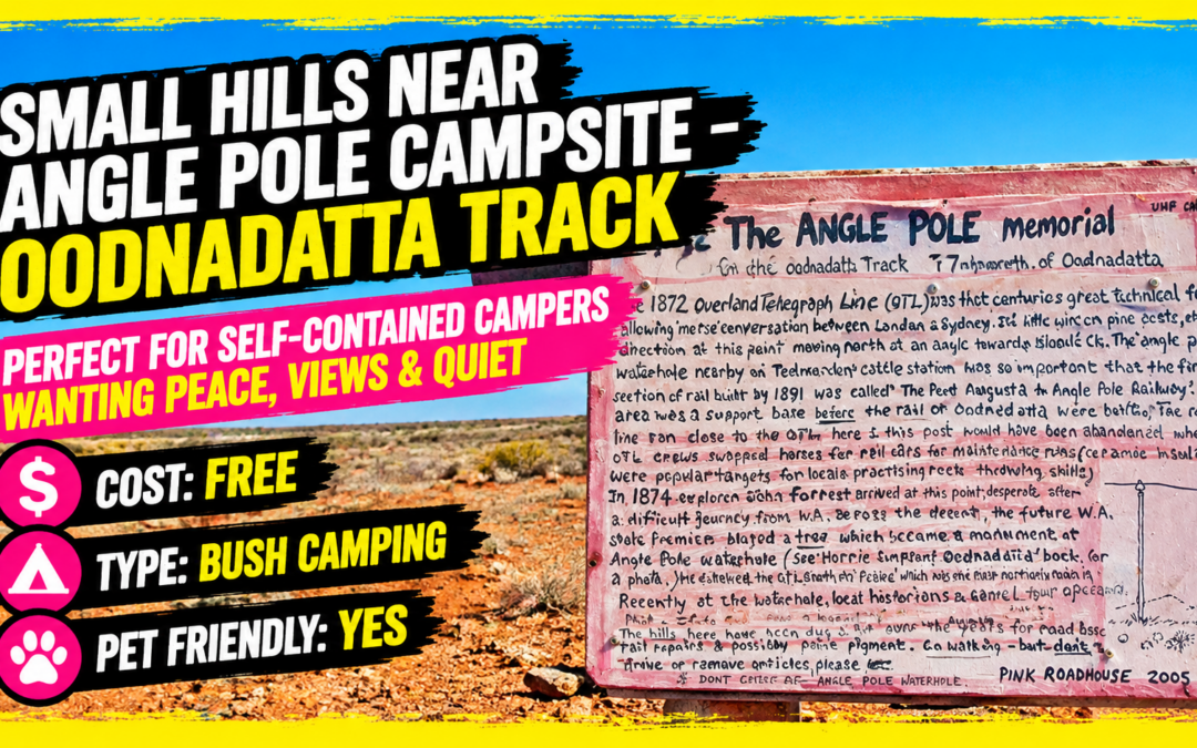
Small Hills Near Angle Pole Campsite – Oodnadatta Track

Small Hills Near Angle Pole Campsite – Oodnadatta Track

Small Hills Near Angle Pole Campsite – Oodnadatta Track

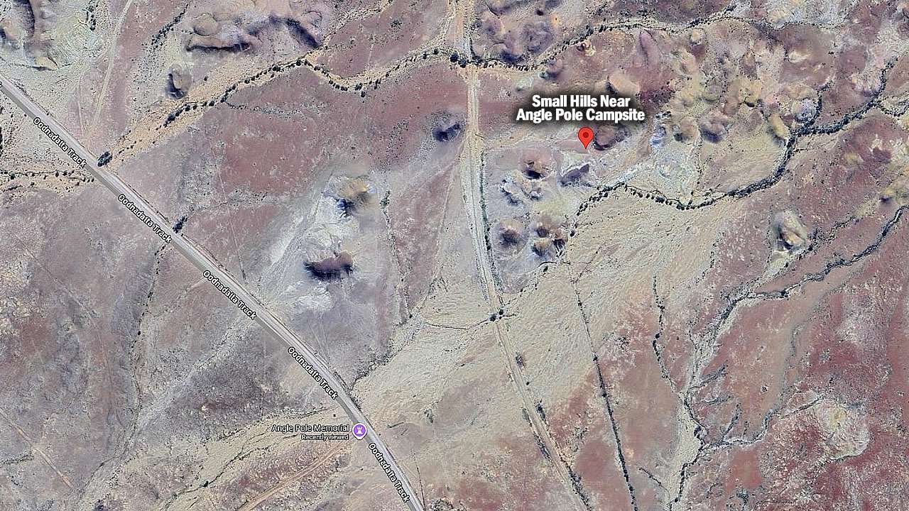
Small Hills Near Angle Pole Campsite offers free camping near Oodnadatta. Perfect for self-contained campers wanting peace, views and quiet. Most people driving the Oodnadatta Track either push through to Marla or stop in town at the Pink Roadhouse. But there’s another option that many campers miss – a small free camping area tucked behind some weathered hills just north of Oodnadatta.

Small Hills Near Angle Pole Campsite Location Map

Small Hills Near Angle Pole Campsite Location And Info At A Glance

Cost: Free
Type: Free Camping / Bush Camping
Location: Small hills near angle pole, South Australia
GPS: -27.490360°, 135.418222°
Pet Friendly: Yes
Distance From Marree: 413km
Distance From Oodnadatta: 7km
Distance From Marla: 247km

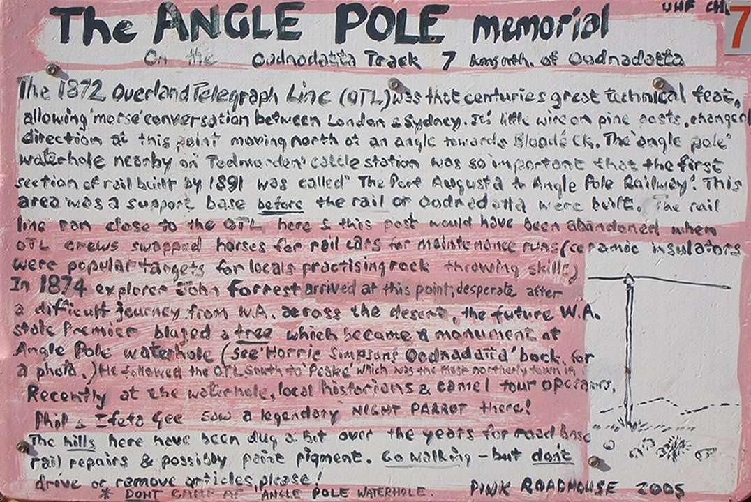
Angle Pole Memorial Sign

Angle Pole Memorial Sign Courtesy Of The Pink Roadhouse

Finding Small Hills Near Angle Pole Campsite

You’ll see vehicle tracks heading towards some low rocky hills. Sometimes someone will have left a branch marking the turn-off, sometimes not. The drive in takes a few minutes following wheel ruts for around 700 metres.

Watch out for one steep dip that can catch low vehicles off guard. Most standard caravans handle it fine, but check your clearance first. Don’t attempt entry after heavy rain – the clay soil turns into the caravan equivalent of a venus flytrap and you could be there for days.

The Camping Area

You’ll find yourself in a sheltered spot between small hills and a dry creek. The ground is mostly gravel and gibber stones, which makes for good drainage. There’s room for three or four rigs without crowding, plus space to turn around even with a big setup.

Old fire pits dot the area from previous campers. The real draw is scrambling up one of the nearby hills for the view. Takes maybe five minutes to reach the top and you can see for kilometers in every direction. Oodnadatta looks tiny from up there.

What To Bring

Everything. Water, food, fuel, toilet paper – the works. No bins either, so pack out your rubbish. The nearest supplies are back in Oodnadatta and the Pink Roadhouse closes early.

Phone signal is patchy at best. Climb a hill and you might get one bar of Telstra coverage if you’re lucky. Forget about streaming anything or video calls.

The Downsides

  • Flies swarm during the day in warmer weather. Bring fly nets or you’ll go mad. When evening comes the flies disappear.
  • Wind can be strong funneling between the hills. Make sure your awning is properly pegged down.

Why Choose Small Hills Near Angle Pole Campsite Over Town?

  • Simple – peace and quiet. Oodnadatta camping can get very busy at times. The only sounds here is the wind and maybe a distant dingo.
  • Plus it costs nothing. Hard to argue with free when you’re on a tight travel budget.

Railway History

Bits of the old Ghan line are scattered around if you look. Sections of rail and wooden sleepers slowly weathering away. Don’t move anything – it’s part of the area’s character.

The railway used to run right through here before they moved it east. These remnants are all that’s left of that era.

Who Should Stay At The Small Hills Near Angle Pole Campsite

Experienced campers who don’t need facilities will love it. First-timers or those wanting hot showers and flushing toilets should stay in town.

If constant flies annoy you, or if dust bothers you, or if you need reliable phone coverage – this isn’t your spot. But if you want genuine outback solitude with great views it’s hard to beat.

Small Hills Near Angle Pole Campsite On Google Earth

Small Hills Near Angle Pole Campsite On Google Earth

Keep It Clean

This place works because people respect it. Take your rubbish with you.

Bottom Line

It’s basic bush camping at its finest. No frills, no facilities, just you and the outback. The hills provide shelter from wind, the views are spectacular.

Most commercial campgrounds along the Track charge upwards of $25 per night. This costs nothing and offers something money can’t buy – complete silence and a genuine connection to one of Australia’s most remote regions.

Pin It on Pinterest