Updated May 2026 after six separate trips along the Oodnadatta Track between 2016 and 2025.
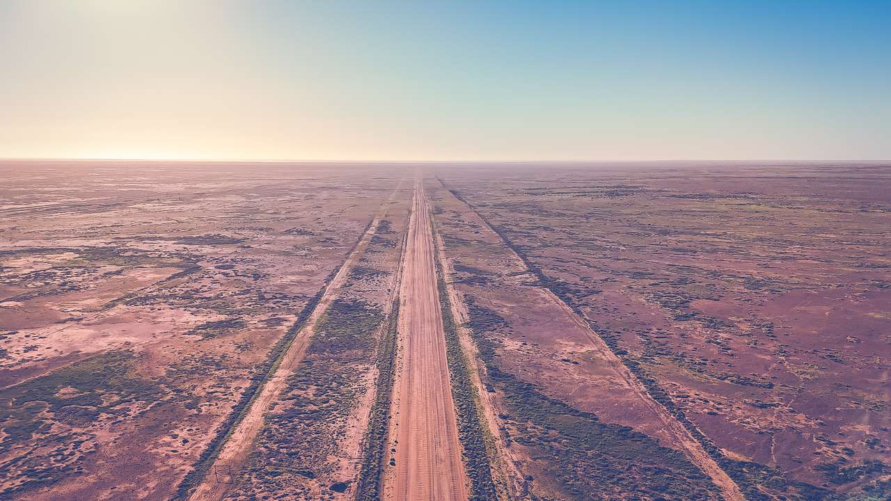
The Oodnadatta Track is one of Australia’s most iconic outback driving routes, stretching approximately 620 kilometres between Marree and Marla in remote northern South Australia. It follows the path of the historic Old Ghan railway and passes through some of the most isolated and visually striking desert landscapes in the country.
This is a complete travel guide to the Oodnadatta Track, designed to help you plan, prepare and confidently drive the route. It covers road conditions, distances, fuel stops, camping, attractions, safety considerations and seasonal travel advice based on real-world experience.
We have driven the Oodnadatta Track six times between 2016 and 2025, in varying conditions including freshly graded roads, heavily corrugated sections, and during peak travel periods such as the 2025 Lake Eyre filling event. This repeated experience provides a practical, on-the-ground understanding of how the track changes over time and what travellers should realistically expect.
While often described as an outback “adventure drive”, the Oodnadatta Track is accessible to most well-prepared travellers in dry conditions. However, conditions can vary significantly between seasons, and proper planning is essential due to long distances between fuel, limited services, and rapidly changing road surfaces.
In this guide, you’ll find everything needed to plan the journey properly — including segment-by-segment driving breakdowns, fuel strategy, road condition insights, camping options, and key attractions along the route.
Oodnadatta Track Quick Facts
| Topic |
Information |
| Distance |
Approx. 620km |
| Starts |
Marree, South Australia |
| Ends |
Marla, South Australia |
| Road Type |
Unsealed outback track |
| Best Time To Visit |
May to September |
| Fuel Stops |
Marree, William Creek, Oodnadatta, Marla |
| 2WD Suitable |
Usually in dry conditions |
| Caravan Friendly |
Yes, ideally off-road or semi off-road |
| Mobile Reception |
Extremely limited |
| Time Required |
3–7 days recommended |
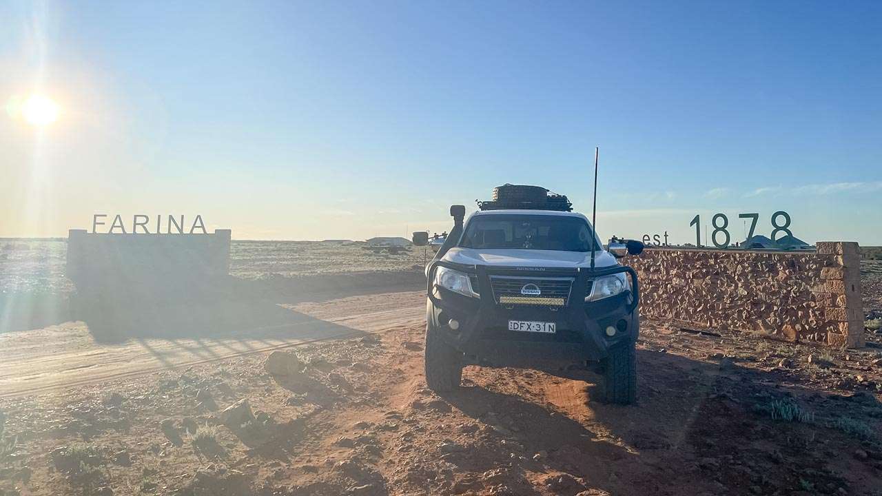
What Is The Oodnadatta Track?
The Oodnadatta Track is a remote outback route running through South Australia’s far north, roughly following the route of the original Central Australian Railway, commonly known as the old Ghan line.
Today the track attracts travellers looking for:
- Remote outback scenery
- Free camping
- Historic railway ruins
- Access to Lake Eyre
- Desert landscapes
- Outback towns like William Creek and Oodnadatta
Despite its reputation, the track is not an extreme four-wheel-drive route in dry conditions. However, conditions can change rapidly depending on rainfall, grading and traffic levels.
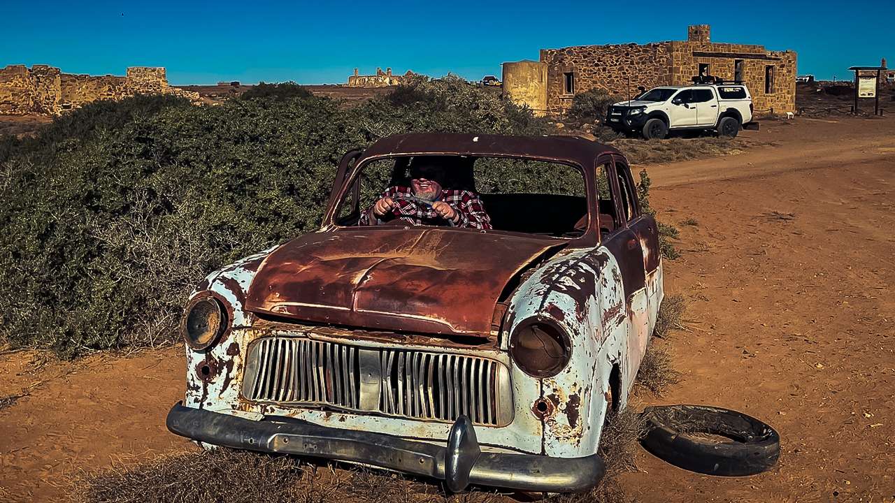
Airing Our Tyres Back Up At Marla After Completing The Oodnadatta Track
Our Experience Driving The Oodnadatta Track
We’ve travelled the Oodnadatta Track six times over nearly a decade, and one of the biggest lessons we’ve learned is how dramatically conditions can change between trips.
During our earlier trips in 2016 and 2018, sections of the track were rough and heavily corrugated, particularly north of William Creek. In contrast, some parts were freshly graded during our 2024 trip and significantly smoother.
The 2025 Lake Eyre filling event created an entirely different atmosphere again, with noticeably larger crowds, busier campgrounds and far more caravans travelling through William Creek, Halligan Bay and Oodnadatta.
Repeated travel has also shown us how important preparation is out here. Lower tyre pressures make a huge difference on corrugations, fuel planning matters due to long distances between services, and carrying extra water is essential.
How to Drive the Oodnadatta Track (Segment System Map)
To properly understand and plan the Oodnadatta Track, it helps to break the route into logical driving segments rather than viewing it as one long remote road. This approach makes it easier to plan fuel stops, manage fatigue, and anticipate changes in road conditions along the way.
Below is a practical segment-by-segment breakdown based on our six trips along the track between 2016 and 2025.
Us Driving Along The Oodnadatta Track in 2020
Segment 1: Marree to Coward Springs
- Distance: ~120 km
- Driving time: 1.5–2.5 hours
- Road conditions: Generally the smoothest section of the track
This section is often well-maintained and provides an easier introduction to outback driving. The road is typically compacted gravel with occasional corrugations depending on recent grading and traffic.
This is a good adjustment period for tyre pressures, vehicle setup and dust management before entering more remote sections.
Segment 2: Coward Springs to William Creek
- Distance: ~110 km
- Driving time: 2–3 hours
- Road conditions: Variable, increasing corrugations
This section begins to feel more remote, with wider open desert landscapes and less consistent road maintenance. Corrugations become more noticeable depending on traffic levels and season.
Conditions here can vary significantly between trips, with some years being relatively smooth and others heavily corrugated.
Segment 3: William Creek to Oodnadatta
- Distance: ~200 km
- Driving time: 3–5 hours
- Road conditions: Typically the roughest section of the track
This is usually the most challenging part of the Oodnadatta Track. Corrugations can be severe, and speeds often drop significantly to maintain vehicle control and comfort.
Fuel and services are available at William Creek and Oodnadatta, making this a key planning segment for stops and rest breaks.
Segment 4: Oodnadatta to Marla
- Distance: ~200 km
- Driving time: 3–4.5 hours
- Road conditions: Generally improving toward Marla
The final section of the track gradually becomes smoother as you approach the Stuart Highway. While still unsealed, it is often less heavily corrugated than the central sections.
This section provides a gradual transition back to sealed roads and marks the end of the Oodnadatta Track journey.
Why This Segment Approach Matters
Breaking the Oodnadatta Track into segments helps with:
- Planning realistic daily driving distances
- Managing fuel consumption between stops
- Understanding where road conditions change
- Reducing fatigue on long remote driving days
- Improving overall trip safety and enjoyment
This structured approach is particularly useful for first-time travellers who may underestimate how different each section of the track can feel in practice.
Seasonal Driving Conditions + Segment Risk Map
The Oodnadatta Track changes significantly depending on the time of year, recent weather events, and traffic levels. Understanding these seasonal variations is essential for planning a safe and comfortable trip.
While the track is generally accessible in dry conditions, each section behaves differently depending on the season. Below is a practical breakdown of what to expect across the four main segments of the route.
Season Overview (When to Travel)
- May to September (Best Season): Cooler temperatures, generally stable road conditions, highest travel volume.
- October to April (Hot Season): Extreme heat, increased breakdown risk, soft road surfaces after storms.
- After Rain Events: Potential closures, boggy sections, and rapidly deteriorating gravel surfaces.
Based on our six trips between 2016 and 2025, winter and early spring consistently provide the safest and most enjoyable driving conditions.
Segment Risk Map Overview
The risk level of the Oodnadatta Track is not uniform. Some sections remain relatively stable year-round, while others deteriorate quickly depending on traffic and weather conditions.
| Segment |
Risk Level (Dry Season) |
Risk Level (Wet / Post-Rain) |
Main Issues |
| Marree → Coward Springs |
Low |
Medium |
Minor corrugations, soft patches after rain |
| Coward Springs → William Creek |
Medium |
High |
Corrugations, variable grading, loose gravel |
| William Creek → Oodnadatta |
High |
Very High |
Severe corrugations, washouts, dust conditions |
| Oodnadatta → Marla |
Medium |
High |
Soft gravel, occasional rough patches after rain |
Seasonal Impact by Segment
Marree → Coward Springs
This section remains relatively stable year-round. In wet conditions, minor soft patches may form but it is usually one of the safer sections of the track.
Coward Springs → William Creek
This section begins to show more variation between seasons. In peak travel months, corrugations can develop quickly due to higher traffic volumes.
William Creek → Oodnadatta
This is the most sensitive section of the track. In hotter months, surface degradation accelerates, and after rain it can become unpredictable with washouts and soft shoulders.
Oodnadatta → Marla
Generally more forgiving than the central section, but can still deteriorate after rain events. Conditions usually improve closer to the Stuart Highway.
Key Seasonal Driving Risks
- Heat exposure: High summer temperatures increase vehicle and driver fatigue risk.
- Corrugation fatigue: Prolonged rough sections can affect vehicles and towing setups.
- Dust conditions: Reduced visibility in convoy traffic during dry peak season.
- Post-rain damage: Rapid track deterioration after storms or flooding events.
Why This Matters for Trip Planning
Understanding seasonal and segment-based risk is critical when planning the Oodnadatta Track. It allows travellers to:
- Choose safer travel windows
- Plan realistic daily distances
- Prepare for variable road conditions
- Reduce mechanical stress on vehicles and caravans
This seasonal breakdown also helps first-time travellers set realistic expectations and improve overall safety on the journey.
Oodnadatta Track Route System Map + Itinerary Planning Layer
To fully understand the Oodnadatta Track as a travel route, it helps to view it as a complete driving system rather than just a single road. This section brings together the full route structure, key stop sequencing, and practical itinerary planning based on real-world travel experience.
We have driven the Oodnadatta Track six times between 2016 and 2025, and one of the most important lessons is that successful trips are not just about distance — they are about pacing, fuel strategy, and understanding how each section flows into the next.
Oodnadatta Track Full Route Flow
The Oodnadatta Track runs in a clear north–south corridor between Marree and Marla, with natural stopping points that divide the journey into manageable travel segments.
Core Route Sequence
- Marree (Start Point – fuel, supplies, final preparation)
- Coward Springs (First major stop – camping, artesian spa)
- William Creek (Mid-route hub – fuel, accommodation, flights)
- Oodnadatta (Northern service point – fuel, supplies)
- Marla (End point – return to Stuart Highway)
This natural flow forms the backbone of all realistic itinerary planning on the Oodnadatta Track.
Recommended Itinerary Options
🚗 3-Day Transit Itinerary (Minimum Practical Drive)
- Day 1: Marree → Coward Springs → William Creek
- Day 2: William Creek → Oodnadatta
- Day 3: Oodnadatta → Marla
This option is suitable for experienced outback travellers who are primarily transiting the route rather than exploring in depth.
🌄 5-Day Balanced Exploration Itinerary
- Day 1: Marree → Coward Springs (overnight camping)
- Day 2: Coward Springs → William Creek
- Day 3: William Creek → Lake Eyre viewpoints / exploration day
- Day 4: William Creek → Oodnadatta
- Day 5: Oodnadatta → Marla
This is the most commonly recommended balance between travel time and experience quality.
🏕 7-Day Full Experience Itinerary (Recommended)
- Day 1: Marree → Strangways Springs → Coward Springs
- Day 2: Coward Springs exploration day
- Day 3: Coward Springs → William Creek (slow travel with stops)
- Day 4: William Creek (Lake Eyre scenic flights / rest day)
- Day 5: William Creek → Oodnadatta (via key sidings and ruins)
- Day 6: Oodnadatta exploration day
- Day 7: Oodnadatta → Marla
This itinerary allows proper time to experience the route without rushing and is the closest to how we personally prefer to travel the track.
How the Route System Affects Your Trip Planning
Breaking the Oodnadatta Track into a structured system helps travellers:
- Plan realistic daily driving distances
- Match fuel stops with natural overnight locations
- Reduce fatigue by avoiding long continuous driving days
- Time travel around weather and road conditions
- Build flexibility into remote travel planning
This system-based approach is particularly important on the Oodnadatta Track due to the long distances between services and the variability of road conditions throughout the year.
Why This Section Improves Travel Planning Clarity
Understanding the Oodnadatta Track as a connected route system rather than isolated towns or attractions is key to safe and enjoyable travel. Each stop naturally supports the next, and successful trips are built around pacing rather than distance alone.
This structured approach improves both trip safety and overall experience quality, especially for first-time travellers in the South Australian outback.
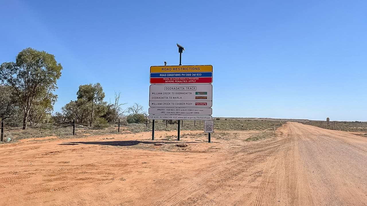
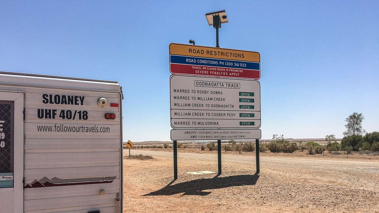
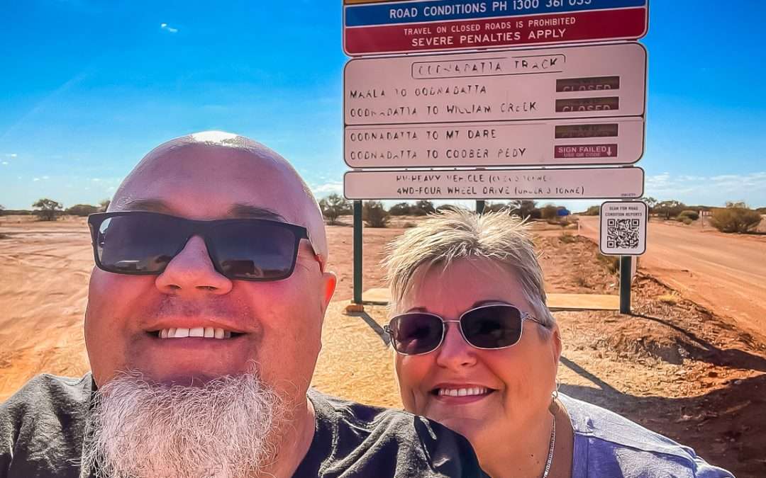
Oodnadatta Track Road Conditions
Road conditions on the Oodnadatta Track vary enormously throughout the year.
In dry weather, much of the route is generally suitable for:
- High-clearance SUVs
- 4WD vehicles
- Camper trailers
- Caravans
- Some 2WD vehicles
However, after rain the track can deteriorate quickly and closures are common. Corrugations are one of the biggest challenges on the track and can become severe in busy periods.
Always check current South Australian outback road reports before travelling.
We have a comprehensive guide on where to get Oodnadatta Track road condition information from
Best Time To Drive The Oodnadatta Track
The best time to drive the Oodnadatta Track is generally between May and September.
These cooler months provide:
- More comfortable camping temperatures
- Safer travel conditions
- Reduced heat stress
- Better sightseeing opportunities
Summer temperatures regularly exceed 45°C and can become dangerous if you experience vehicle problems in remote areas.
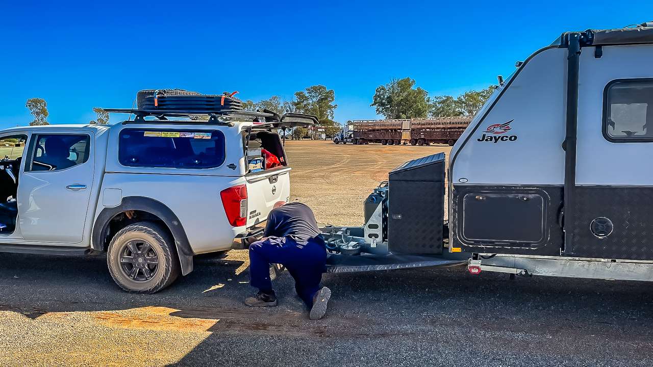
Is The Oodnadatta Track Suitable For Caravans?
Yes — many travellers tow caravans along the Oodnadatta Track every year.
Across our trips we’ve seen:
- Compact camper trailers
- Hybrid caravans
- Full off-road caravans
- Larger touring vans
- Motorhomes
- Ute toppers
Conditions can become rough enough to damage poorly prepared caravans, especially during heavy corrugations.
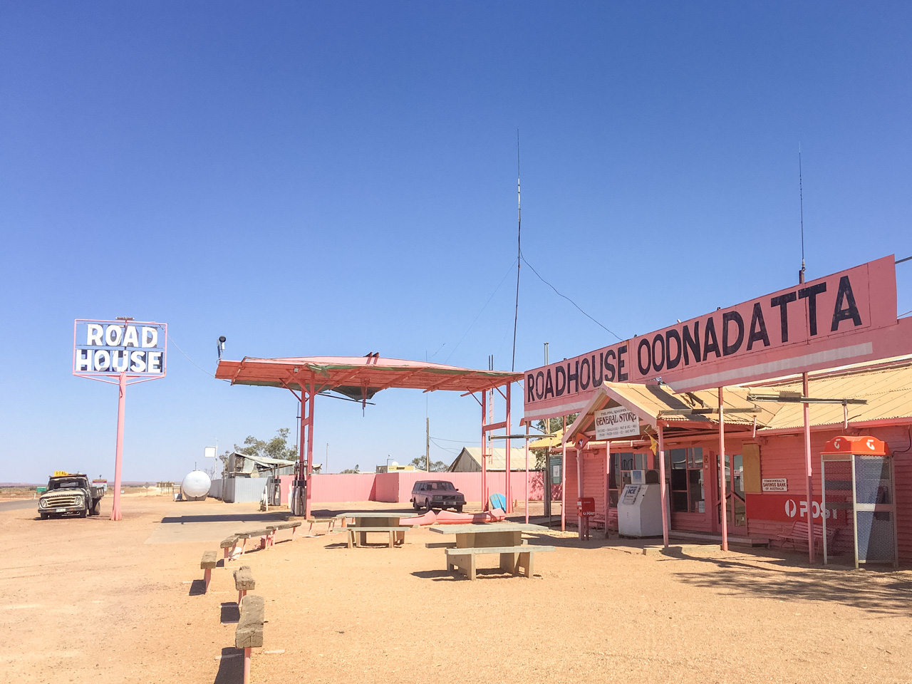
Fuel Stops Along The Oodnadatta Track
Fuel availability is limited, so planning ahead is important.
Fuel is available at:
- Marree
- William Creek
- Oodnadatta
- Marla
Fuel prices are considerably higher than larger regional towns. For more information on Oodnadatta Track Fuel Stops and planning fuel strategies for the Oodnadatta Track check out our Oodnadatta Track Fuel stop in 2026 post.
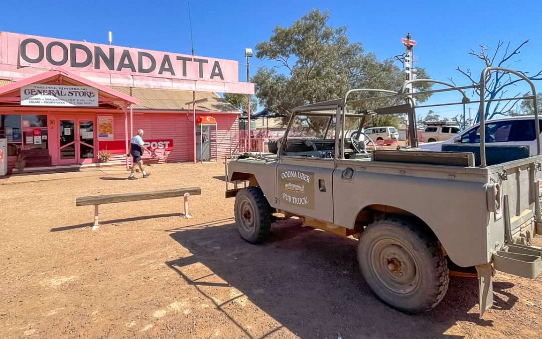
Attractions Along The Oodnadatta Track
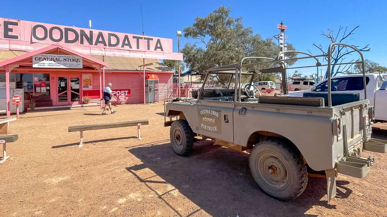
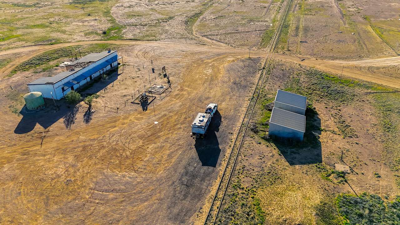
William Creek
William Creek is one of the iconic outback towns in Australia and a popular stop for fuel, camping and scenic flights over Lake Eyre. We have used the dump point at William Creek lots of times to empty our toilet canister.
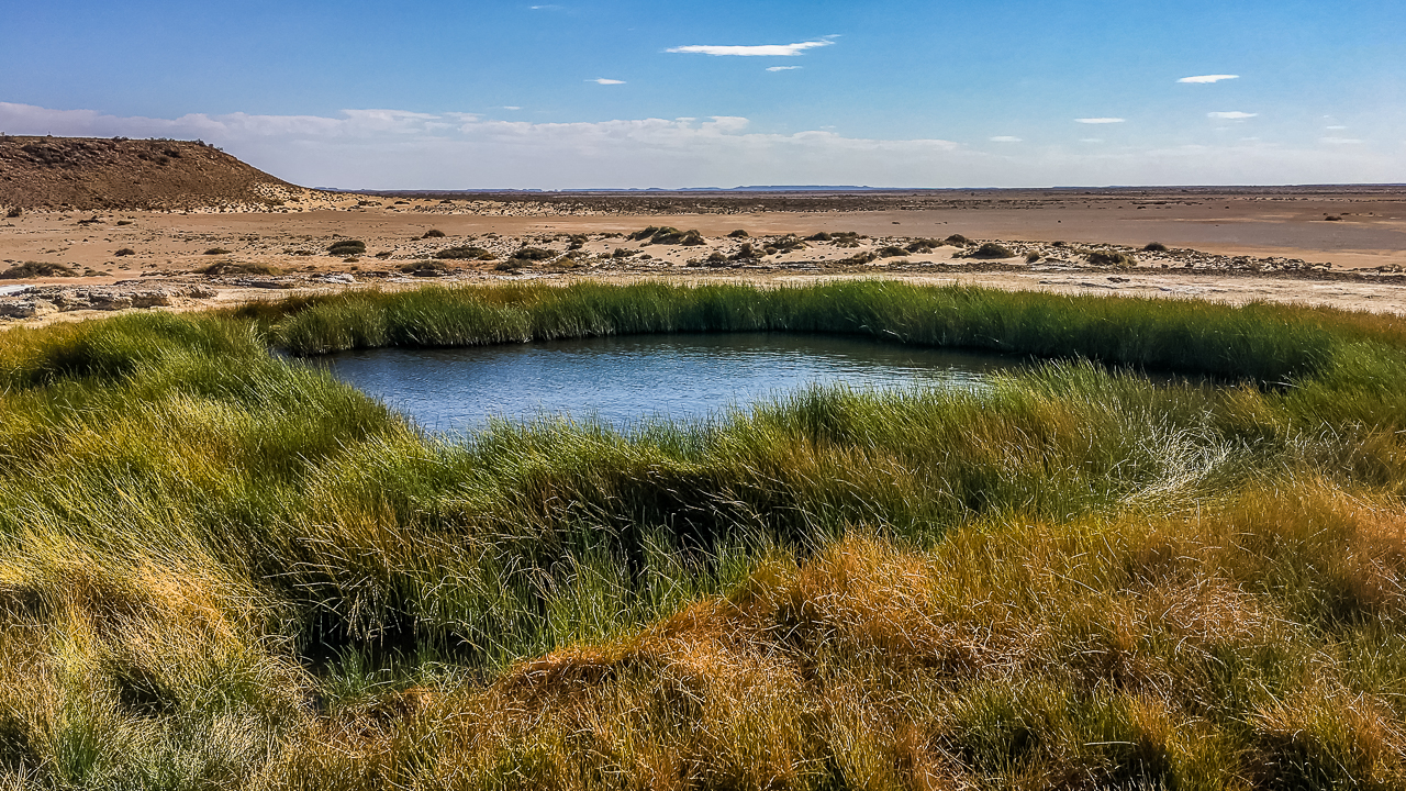
Coward Springs
Coward Springs is one of our favourite stops anywhere on the route. The artesian spa, date palms and restored railway buildings create a completely different atmosphere compared to the surrounding desert landscapes.
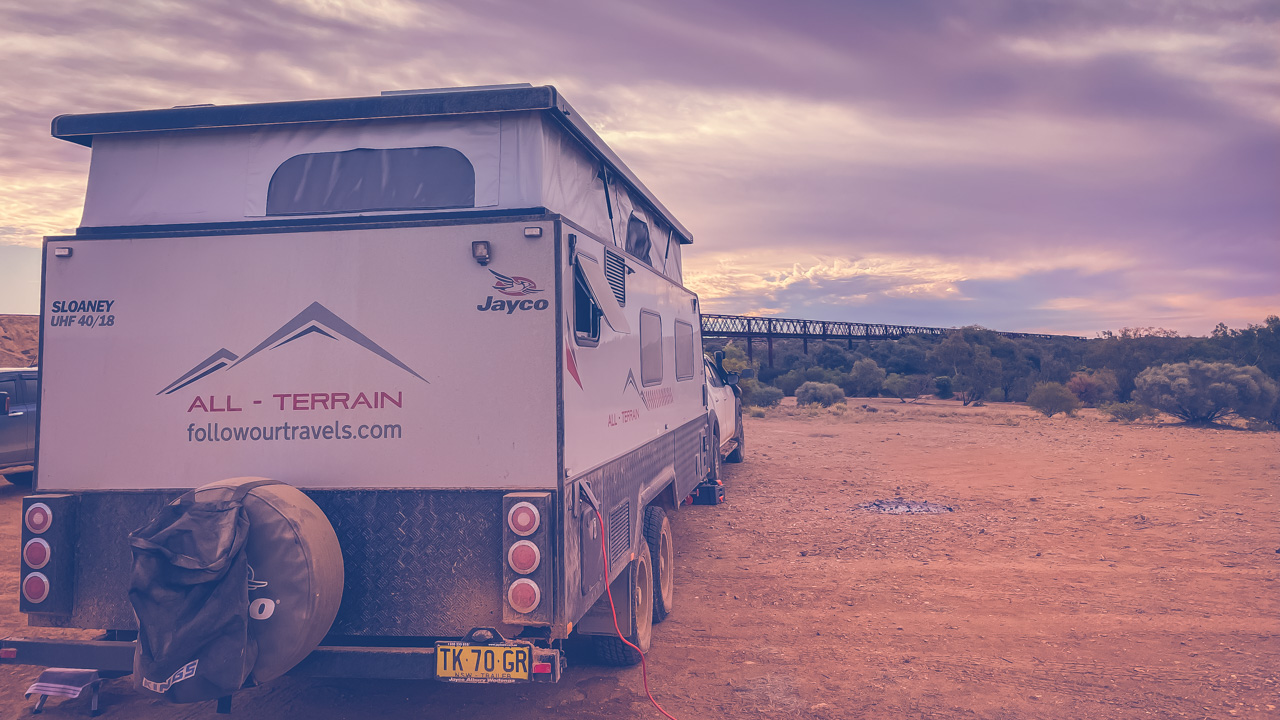
Algebuckina Bridge
The historic Algebuckina Bridge is one of the most photographed locations on the Oodnadatta Track.
Strangways Springs
Strangways Springs is one of the most historically significant locations along the route and well worth allowing extra time to explore.
Lake Eyre Access
The Oodnadatta Track also provides access to Kati Thanda-Lake Eyre via William Creek and Halligan Bay.
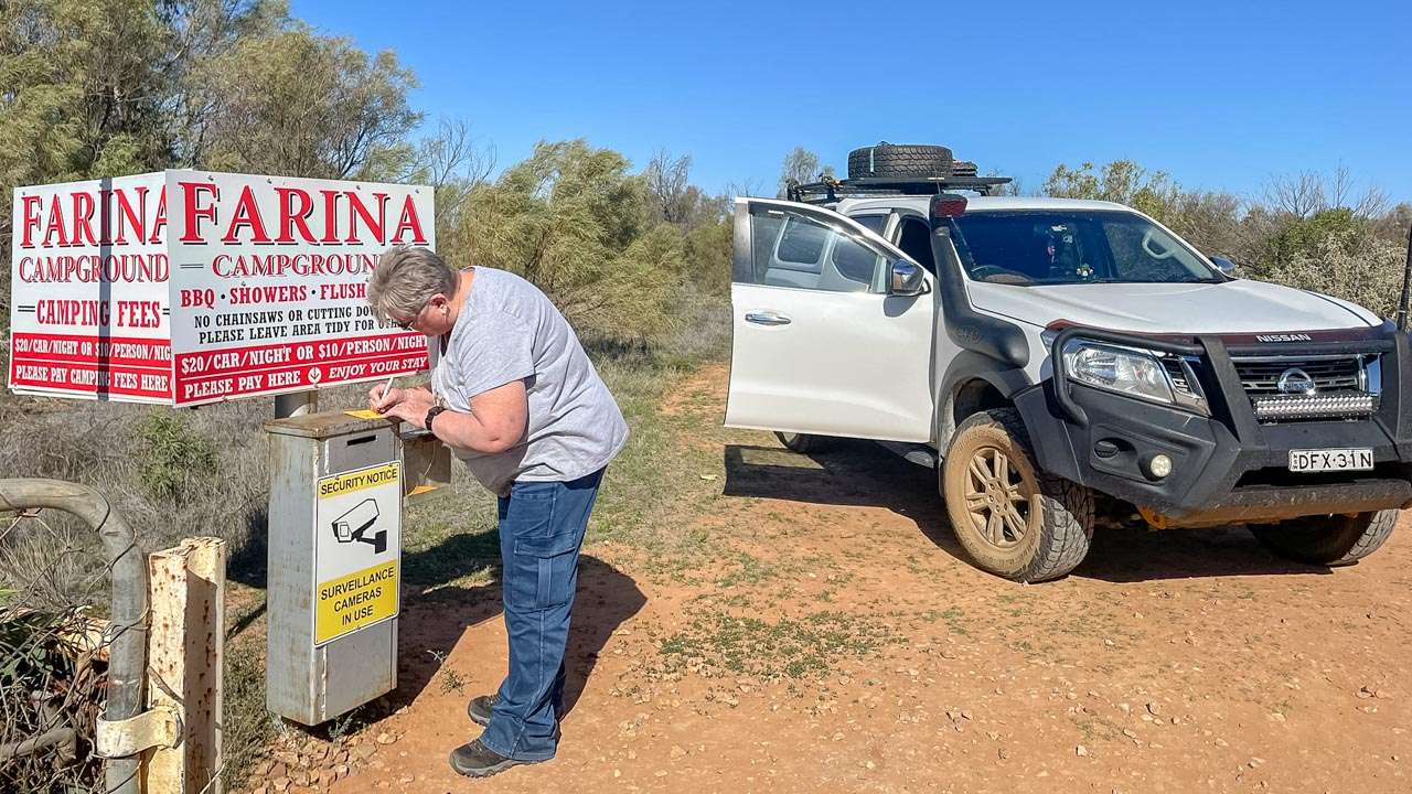
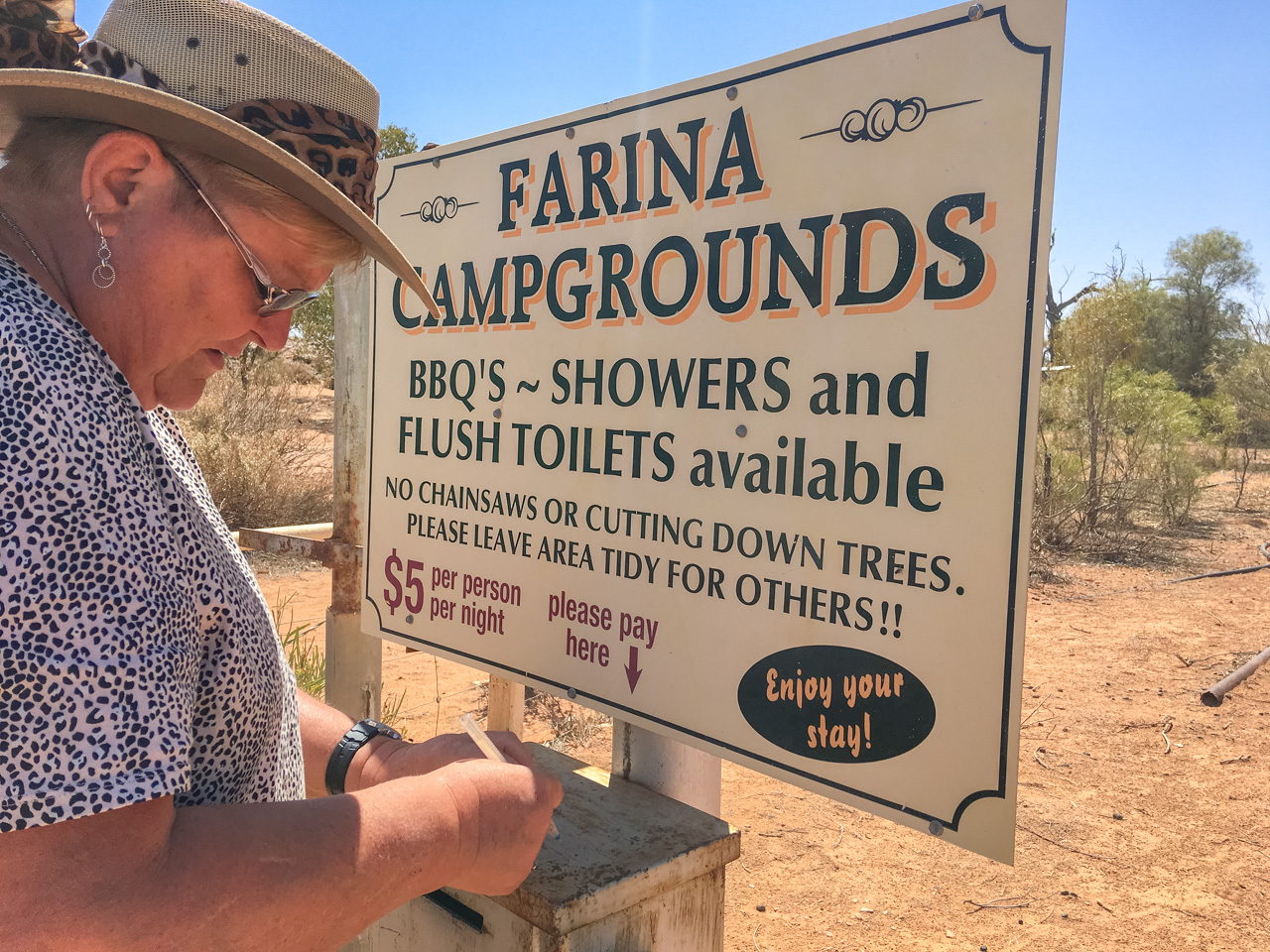
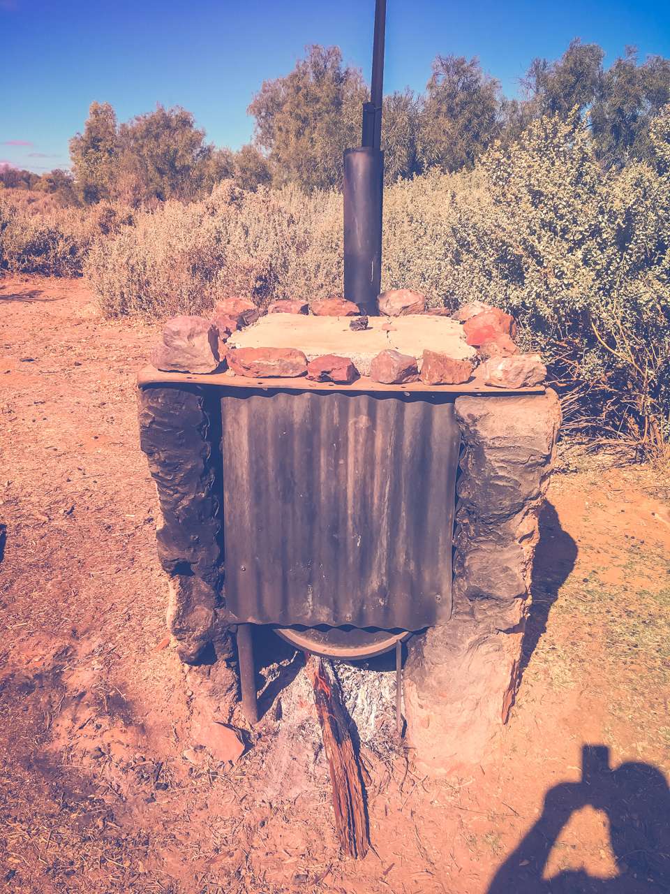
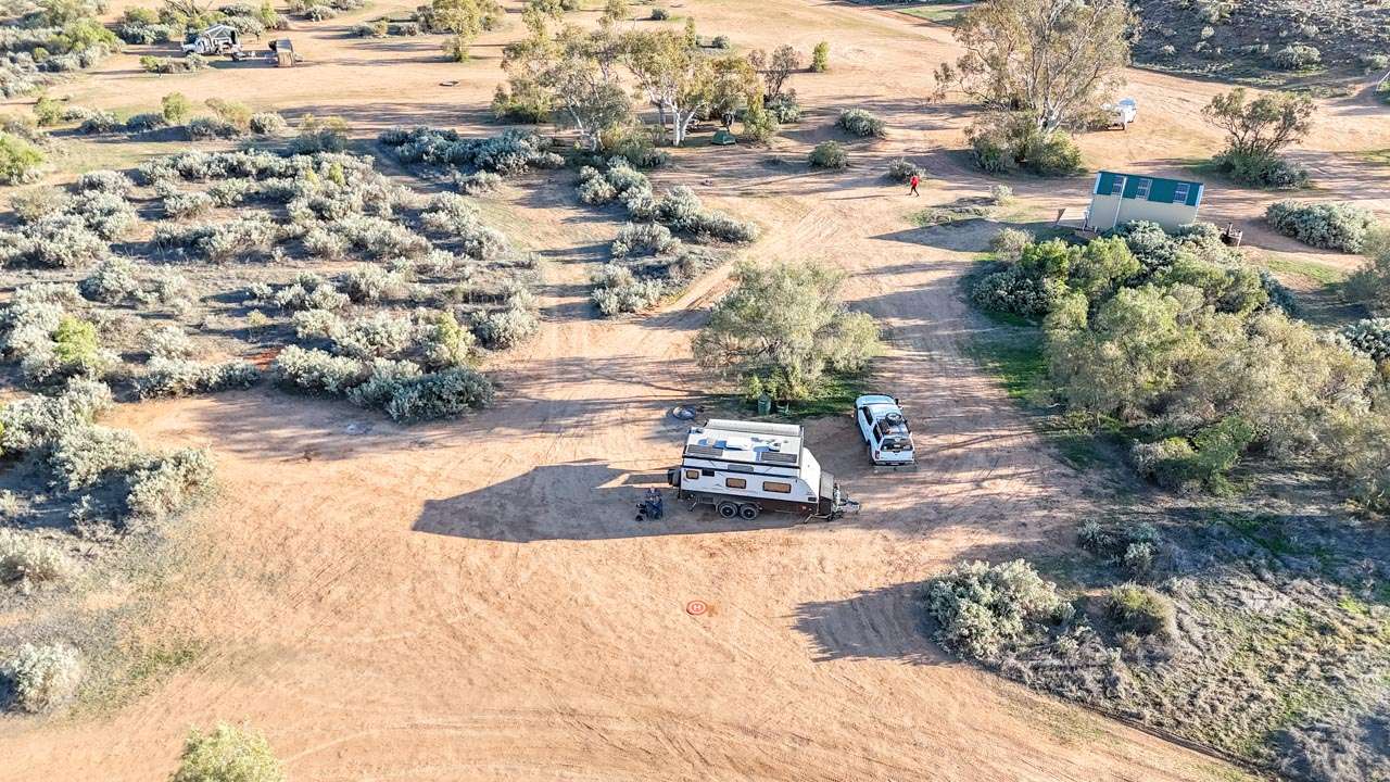
Camping On The Oodnadatta Track
Camping is one of the biggest highlights of the journey, ranging from remote bush camps beside old railway sidings through to caravan parks and station stays.
Some of the best-known camping areas include:
- Coward Springs
- Algebuckina Bridge
- William Creek
- Beresford Railway Siding
- Oodnadatta
- Marree
For a full campsite breakdown, see our dedicated guide:
Oodnadatta Track Campsites Guide
Suggested Oodnadatta Track Itinerary
3 Day Itinerary
- Day 1: Marree to William Creek
- Day 2: William Creek to Oodnadatta
- Day 3: Oodnadatta to Marla
5–7 Day Itinerary
Allow extra time for:
- Lake Eyre flights
- Remote camping
- Visiting Strangways
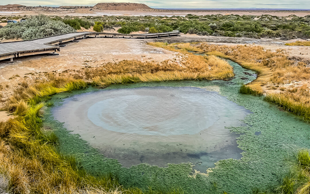
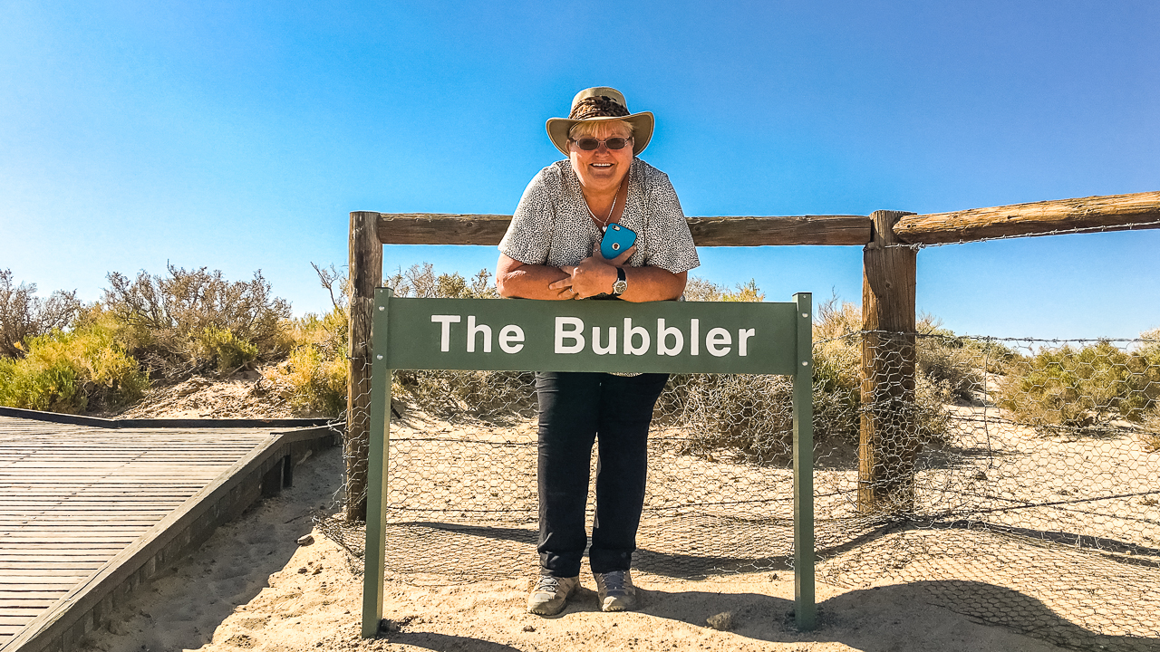
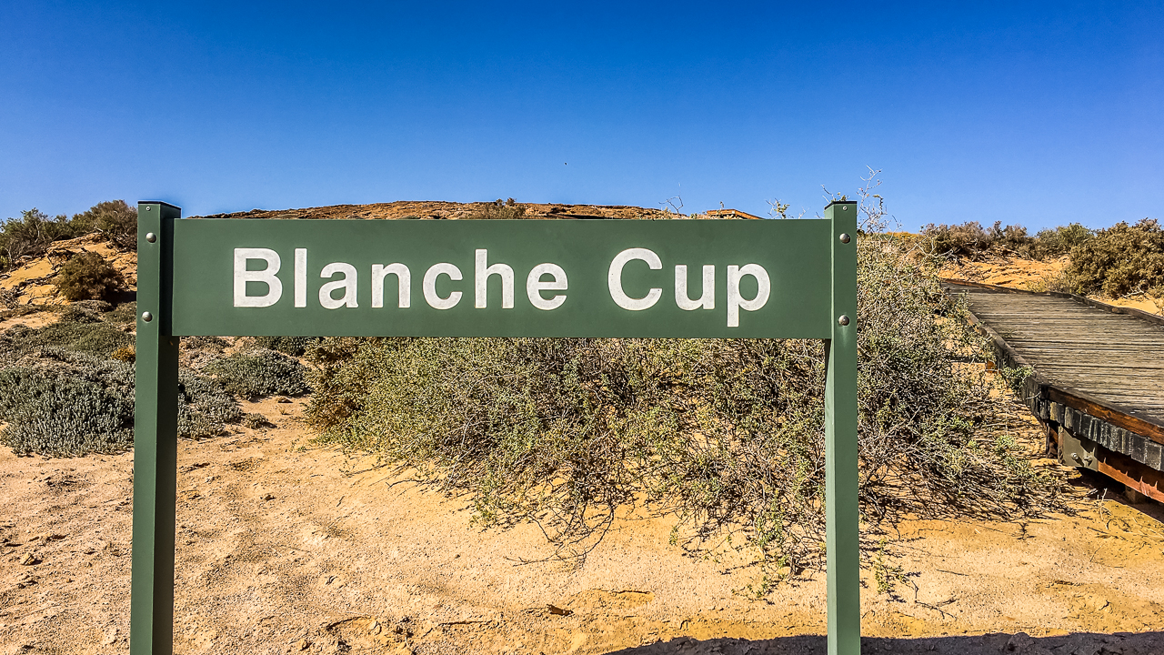
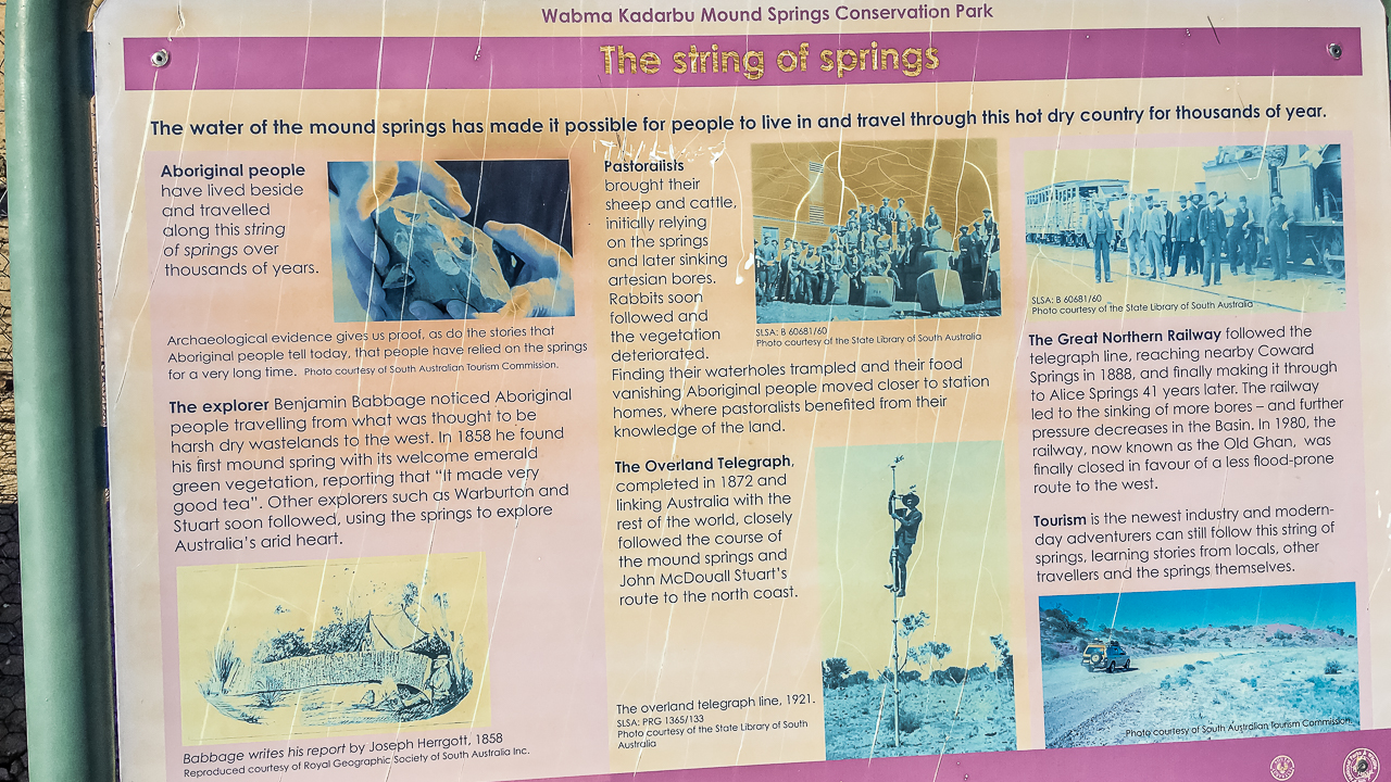
- Checking out the Mound Springs – we think they’re very interesting and they change each time we visit
- Exploring railway ruins
- Photography
- Side trips
- Relaxing at Coward Springs
Essential Safety Tips
- Carry extra water
- Lower tyre pressures
- Carry at least one full-size spare tyre
- Avoid travel immediately after heavy rain
- Check road reports daily
- Carry emergency communications if possible
- Avoid driving at dusk due to wildlife
Mobile reception is extremely limited outside major stops. We have found that the only reliable mobile connection spots are at Marree, William Creek, Oodnadatta and Marla. we now have Starlink and highly recommend it.
Complete Driving Guide to the Oodnadatta Track
The Oodnadatta Track is not just a scenic outback route — it is a long-distance desert drive where planning, fuel management and road awareness are essential. While the track is generally accessible in dry conditions, conditions vary significantly between sections and seasons.
This section breaks down the route into practical driving segments, including distances, estimated drive times, fuel strategy and expected road conditions based on our six trips between 2016 and 2025.
Oodnadatta Track Distances & Drive Segments
The Oodnadatta Track runs between Marree and Marla, with several key stops along the way.
Key Driving Distances
- Marree → Coward Springs: ~120 km
- Coward Springs → William Creek: ~110 km
- William Creek → Oodnadatta: ~200 km
- Oodnadatta → Marla: ~200 km
- Full Track (Marree → Marla): ~620 km
These distances can feel longer than expected due to road surface conditions and reduced speeds on corrugations.
Drive Time Breakdown (Realistic Outback Timing)
Typical Travel Times
- Marree → William Creek: 3–5 hours
- William Creek → Oodnadatta: 4–6 hours
- Oodnadatta → Marla: 3–5 hours
- Full Track (no stops): 10–14 hours driving time
Realistic Travel Plan
- 3 days minimum (basic transit)
- 5–7 days recommended (ideal for exploration and camping)
Slower travel improves safety and allows time for key attractions along the route.
Fuel Strategy (Critical Planning Section)
Fuel availability on the Oodnadatta Track is limited, expensive and spread far apart. Careful planning is essential.
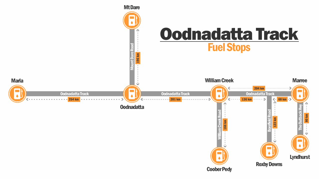
Oodnadatta Track Fuel Stops Map (Not To Scale)
Fuel Stops Along the Route
- Marree (start point)
- William Creek (mid-route)
- Oodnadatta (north section)
- Marla (end point)
Fuel Planning Advice
- Always start with a full tank
- Do not rely on topping up later
- Expect higher fuel prices at remote stops
- Carry at least 200–300 km fuel buffer
- Caravans significantly increase fuel use
Fuel consumption can vary significantly depending on road conditions, wind and towing load.
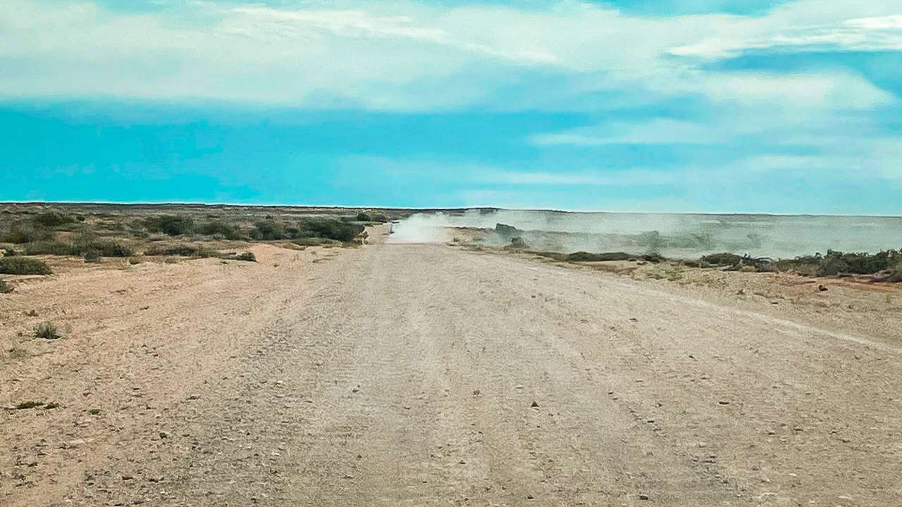
Road Surface Breakdown by Segment

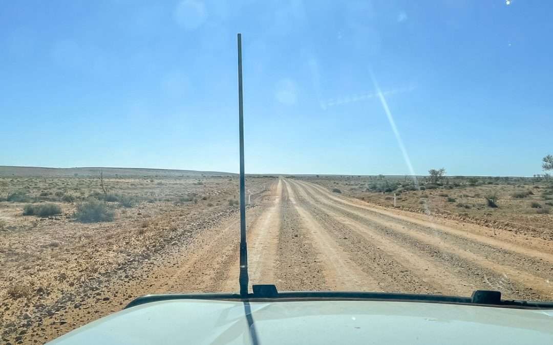
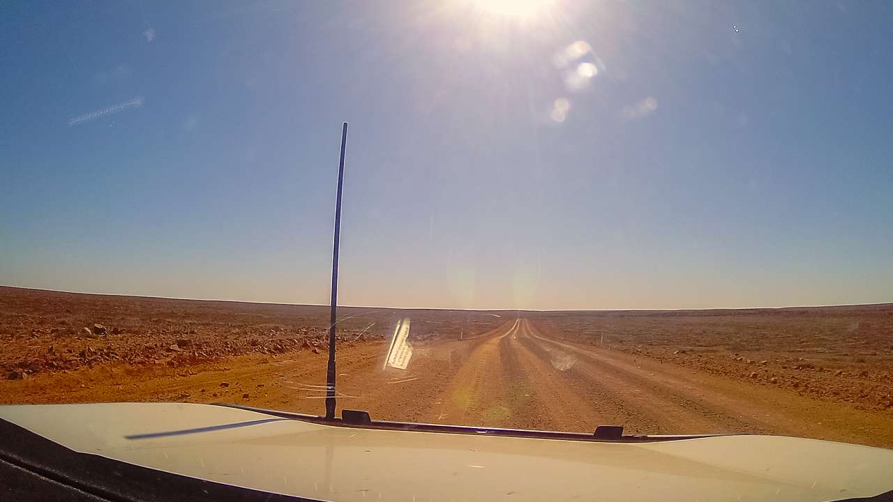
Oodnadatta Track Road Surface From Inside Our Vehicle
Marree → Coward Springs
- Generally well-maintained
- Mixed gravel and compacted dirt
- Occasional corrugations
Our experience: Often the smoothest section, especially after grading.
Coward Springs → William Creek
- Increasing corrugations
- Wide open desert terrain
- Soft gravel sections in places
Our experience: Conditions vary significantly between trips.
William Creek → Oodnadatta
- Typically the roughest section
- Heavy corrugations common
- Washboard surfaces in busy periods
Our experience: Consistently the most challenging section.
Oodnadatta → Marla
- Gradually improves toward Marla
- Mixed gravel and graded surfaces
- Less traffic overall
Our experience: Generally smoother than the central sections.
Key Driving Considerations
- Reduce tyre pressure for corrugations
- Expect dust and reduced visibility in convoys
- Avoid driving at dusk due to wildlife
- Road conditions can change quickly after weather or grading
- Allow extra time for slower travel on rough sections
Final Thoughts
After six separate trips between 2016 and 2025, the Oodnadatta Track remains one of our favourite outback journeys anywhere in Australia.
What makes the track special is that every trip feels different. Weather, road conditions, traveller numbers and even the desert landscapes can change dramatically from year to year.
Whether you’re visiting for remote camping, Lake Eyre, outback history or simply the experience of crossing one of Australia’s most famous desert tracks, the Oodnadatta Track is an unforgettable adventure when approached with proper preparation and realistic expectations.