Dig Tree To Haddon Corner Via Planet Arrabury Road

Dig Tree To Haddon Corner Via Planet Arrabury Road

Dig Tree To Haddon Corner Via Planet Arrabury Road

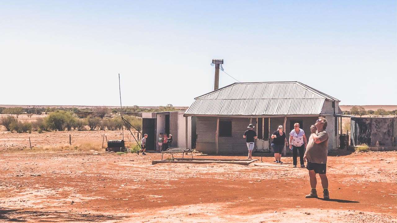
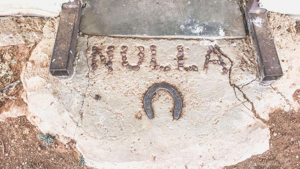
The Dig Tree to Haddon Corner via the Planet Arrabury Road. Another day on the MARS Enthusiasts 2019 National Muster. We called in at Nulla Outstation along the way. We left the dig Tree and headed north on the Planet Arrabury Road. Our final destination for the day was Birdsville however we planned to call in at Haddon Corner for a look.

The Planet Arrabury Road

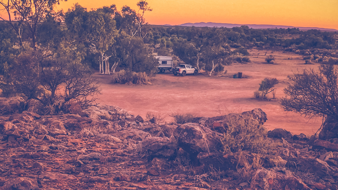
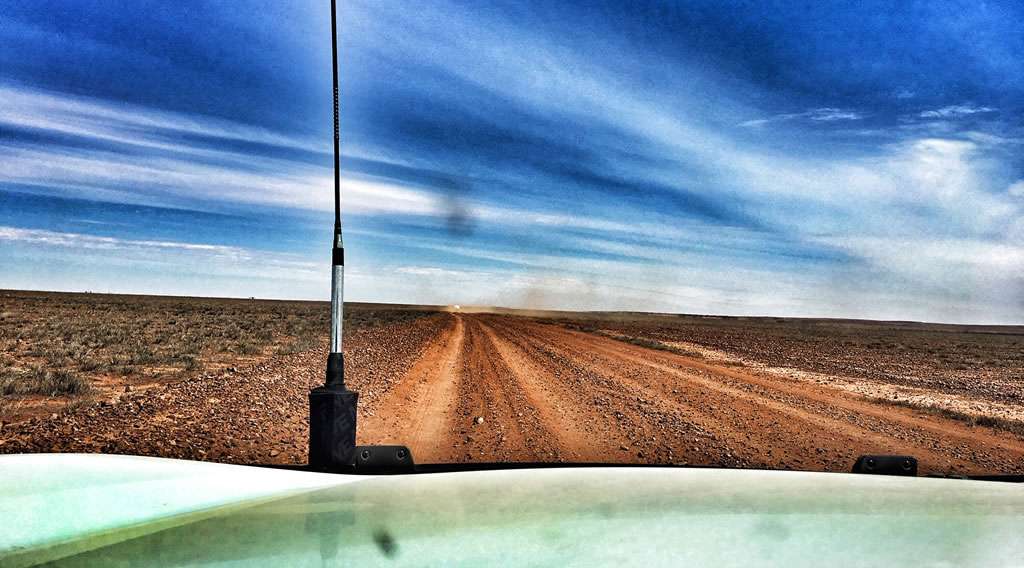
The Planet Arrabury road varies from quite rough with large stones (some big enough to end your day) though to sandy and it eventually becomes a wide gravel highway towards the northern end. The first part of the southern section was awesome. The Cooper Creek basin and northwards is an ancient valley. You are surrounded by eroded flat-topped mesas that let you see the original level of the land as it had been millions of years ago. The planet Arrabury Road follows the valley floor. You are surrounded by fantastic ochre coloured hills – it looks a lot like the painted desert out from Coober Pedy and Oodnadatta. It’d be an awesomely magical sight from the right vantage point at sunset.

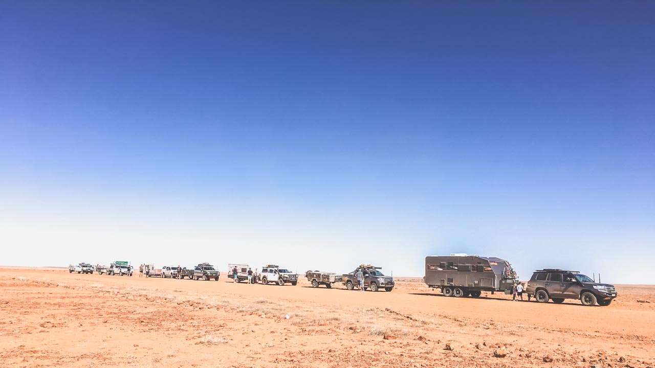
Traffic Jam On The Planet Arrabury Road

Traffic Jam On The Planet Arrabury Road

We called in at Nulla Outstation for a look and to break up the trip. What a nice little detour it was. The old outstation looks just like it must have a hundred years ago. It shows signs of recent use. There are some more modern (albeit dodgy looking dongas) alongside the old building that are probably see more use these days more than the original. On the way back out of Nulla Outstation one of our fellow MARS Enthusiasts Scott White mentioned he’d seen a nice old antique shovel on his way in and he was going to pull over and pick it up. Guess what? Turns out it was his own bloody shovel that must have fallen off his car on the way in. It gave us all one hell of a good laugh!

Nulla Outstation Bunkhouse 2019

Nulla Outstation Bunkhouse 2019

After a few hours the Planet Arrabury Rd rises up onto the tableland. From here to the end the changes are more subtle. As usual out this way there’s a lot of of gibber country and stretches of flood plains and sand country. Eventually you get to Sturt’s Stony Desert. He wasn’t mucking about when he named it either! It’s a never ending view of gibbers covering the landscape. Good old Charles Sturt walked through this country in one direction then walked back through it in the other because he was enthralled by the landscape. The bloke must have been absolutely bloody bonkers.

Entry To Nulla Station Bunkhouse

Entry To Nulla Station Bunkhouse

200km north of the Innamincka/Thargomindah Road you come to the turnoff to Haddon Corner. After we’d all come this far there was no way we weren’t calling in for a look!

Haddon Corner

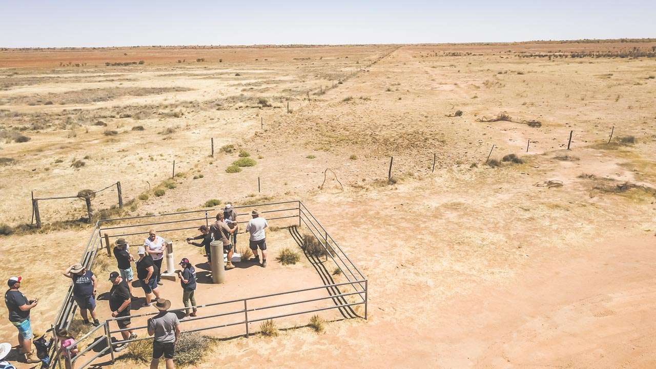
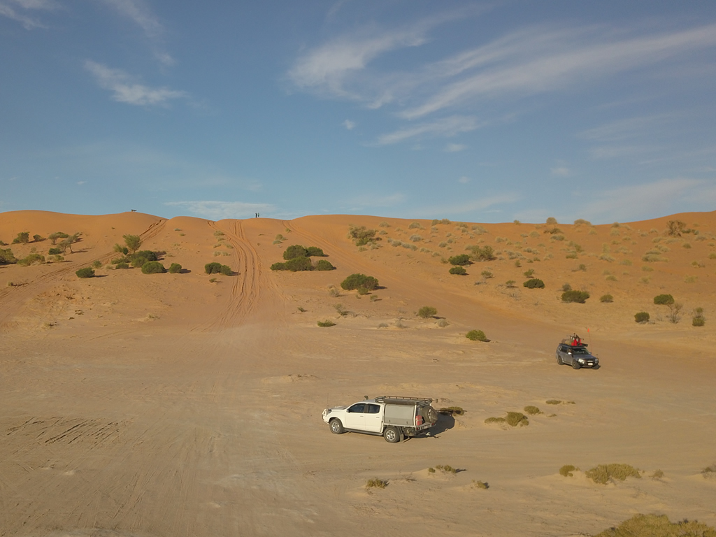
From the Arrabury road, take the Haddon Corner turn off. A green finger sign points to Haddon Corner. The road is gravel, but it’s generally in quite good shape. There will be a difference depending on whether rain has fallen recently. All roads in the region would become impassable if that were the case. A 15-km drive will take you to Haddon Corner. The final two kilometres are across two sand dunes. While these sand dunes aren’t large, dragging a caravan through them wouldn’t be a bright idea. Campers with off-road tyres could get in with reduced tyre pressures. We all unhooked our vans and camper trailers at the base of the first dune, and drove in with just our vehicles. The track across the first dune from the end of the main track is well enough – it’s both easy to find and easy to follow.

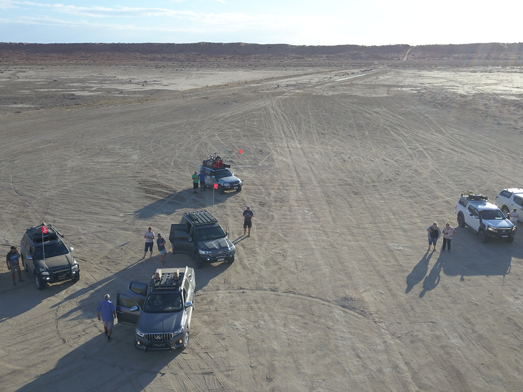
Drone Shot The Crew At Haddon Corner

Drone Shot The Crew At Haddon Corner

We all had our photos taken and signed the visitors book. El Supremo Peter Woolsey put up his drone and took some fantastic videos and photos – thanks Pete you’re a legend! Other than the corner marker there isn’t mush to see – in fact there’s nothing but that isn’t the point. The point is being there. There’s a lot of dust and wide expanses of pretty much nothing except for sand and rocks with the odd shrub having a crack at survival. There are no facilities and this really would be remote camping. There is a picnic shelter if you’re keen on spreading out the rug and munching on some cucumber sangas.

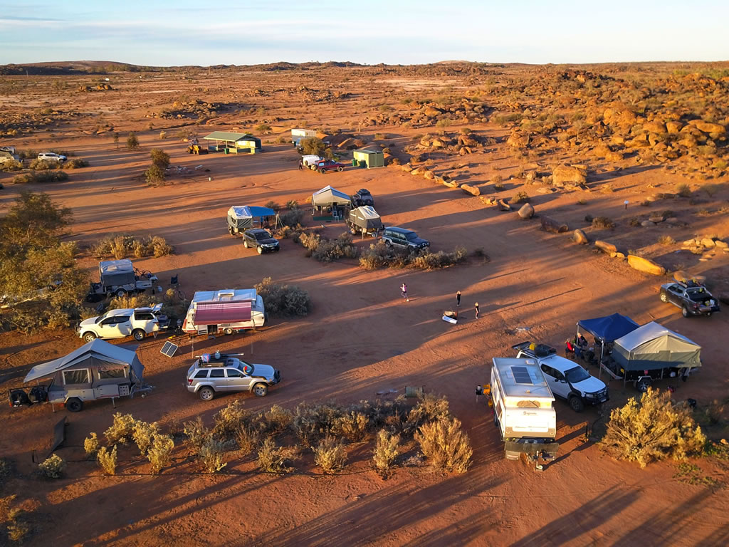
MARS Enthusiasts 2019 National Muster At Haddon Corner

MARS Enthusiasts 2019 National Muster At Haddon Corner

Camping At Haddon Corner

There’s a free camp at Haddon Corner. This free camping area is 4WD only and for tents and camper trailers only. Pets are allowed.

Haddon Corner Location

  • 165.25kms East of Birdsville
  • 178.05kms West of Windorah
  • 195.77kms North of Innamincka
  • 359.13kms South of Boulia

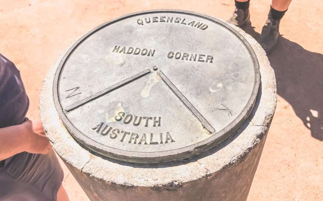
Haddon Corner is the north-eastern corner of the state of South Australia where it meets with Queensland. It was first surveyed by John Carruthers, Lawrence Allen Wells, and Augustus Poeppel around 1883.

27 Best Camp Sites On The Oodnadatta Track South Australia

27 Best Camp Sites On The Oodnadatta Track South Australia

27 Best Camp Sites On The Oodnadatta Track South Australia

We’ve listed 27 of the best free and low cost camp sites on the Oodnadatta Track South Australia. The Oodnadatta Track is one of the most iconic outback tracks in Australia.

The Oodnadatta Track is a 620 km dirt road that connects the towns of Marree and Marla in South Australia. The track is rich in history, culture, and natural wonders, making it a must-visit destination for anyone who loves camping, and outdoor adventure. Please keep in mind that you will need to be self sufficient and well prepared to travel the Oodnadatta Track. And please avoid it during the summer months when temperatures can soar northwards of 40 degrees Celsius for weeks on end. Peak times to experience the track are from May to the end of September.

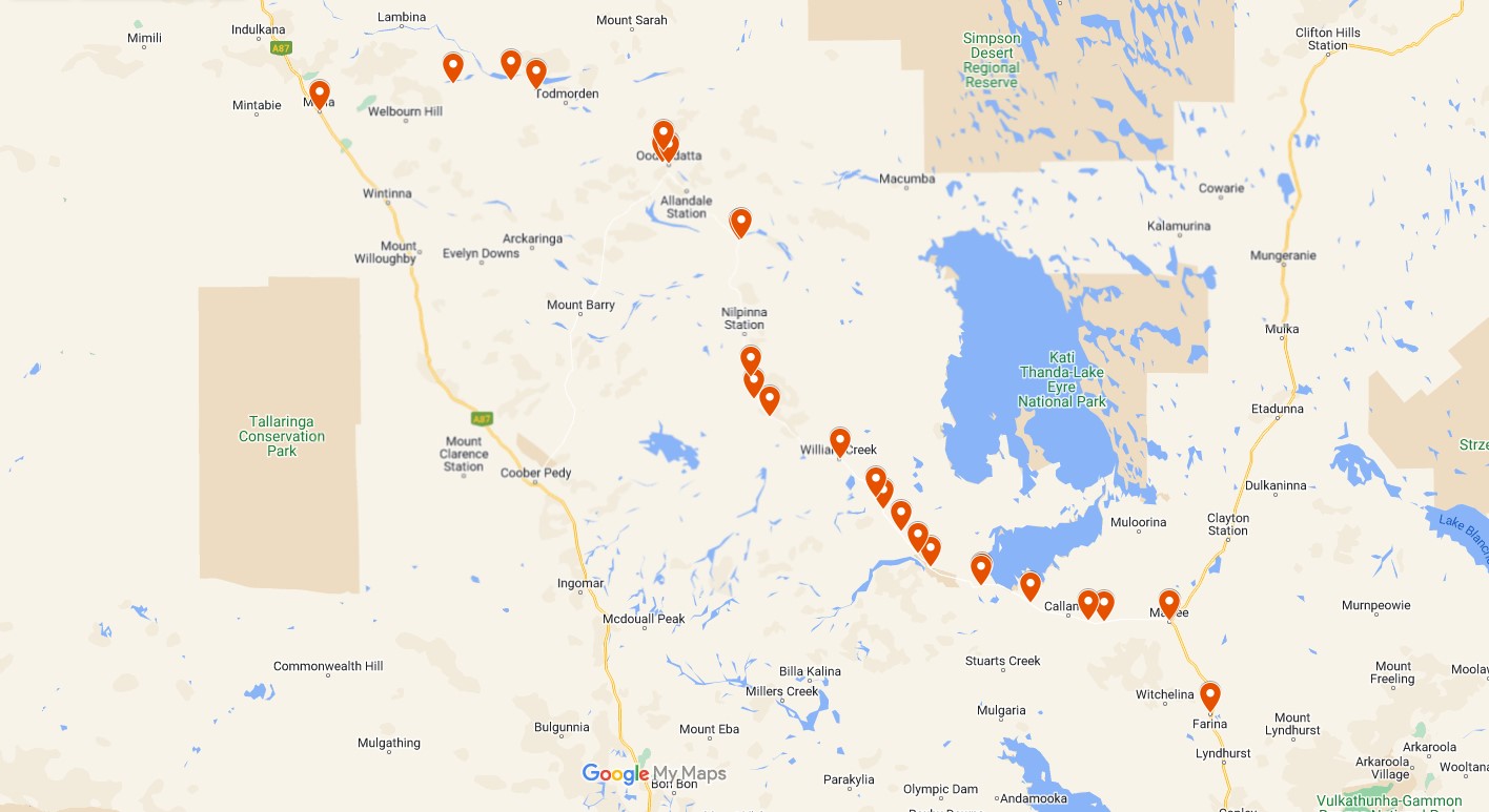
Map Of Camp Sites On The Oodnadatta Track South Australia

Map Of Camp Sites On The Oodnadatta Track South Australia

Camp Sites On The Oodnadatta Track South Australia

1. Farina Camping Grounds

Technically this one isn’t on the Oodnadatta Track South Australia however we have always camped here either before doing the track or after we have finished so we have included it. It’s an absolutely awesome campground in the Ghost Town of Farina. Hot showers and flushing toilets are available.

Cost: $10 per person per night or $20 per car per night
Type: Bush Camping / Campground
Location: -30.062407°, 138.274768°
Distance From Marree: 58km
Distance From Oodnadatta: 462km
Distance From Marla: 774km

Remote Camping At Farina

Remote Camping At Farina

2. Campground Marree Hotel

Camping behind the Marree Hotel. Toilets and showers available and great meals and beer! Very friendly location.

Cost: Free. $2 donation to use toilets and showers. Do the right thing and have a meal in the pub.
Type: Pub Camping
Location: -29.649041°, 138.064652°
Distance From Marree: 0km
Distance From Oodnadatta: 406km
Distance From Marla: 660km

3. Marree Oasis Caravan Park & Cabins

Powered and unpowered sites. Showers and toilets. Laundry facilities.

Cost: Powered $35. Unpowered $30.
Type: Caravan Park
Location: -29.646530°, 138.061902°
Distance From Marree: 0km
Distance From Oodnadatta: 405km
Distance From Marla: 659km

4. Bridge Ruins

This is a free campground with no facilities. Dog friendly. Be responsible and take out what you take in.

Cost: Free
Type: Free Camping / Bush Camping
Location: -29.650705°, 137.716823°
Distance From Marree: 34km
Distance From Oodnadatta: 371km
Distance From Marla: 625km

5. Alberrie Creek Bridge

This is a free campground with no facilities. Dog friendly. Be responsible and take out what you take in.

Cost: Free
Type: Free Camping / Bush Camping
Location: -29.647019°, 137.639436°
Distance From Marree: 42km
Distance From Oodnadatta: 363km
Distance From Marla: 617km

6. Gregory Creek Campsite

This is a free campground with no facilities. Dog friendly. Be responsible and take out what you take in.

Cost: Free
Type: Free Camping / Bush Camping
Location: -29.564041°, 137.334957°
Distance From Marree: 74km
Distance From Oodnadatta: 332km
Distance From Marla: 586km

7. Curdimurka Railway Siding

Curdimurka Siding is an abandoned railway siding on the Oodnadatta Track. This is free camping between the Old Ghan Railway and the Oodnadatta Track with no facilities. Dog friendly. Be responsible and take out what you take in.

Cost: Free
Type: Free Camping / Bush Camping
Location: -29.476580°, 137.084610°
Distance From Marree: 101km
Distance From Oodnadatta: 305km
Distance From Marla: 559km

8. Stuart Creek

This is a free campground with no facilities. Dog friendly. Be responsible and take out what you take in. Turnoff is just before the concrete for when travelling from Marree. Large flat area with plenty of firewood.

Cost: Free
Type: Free Camping / Bush Camping
Location: -29.489504°, 137.076053°
Distance From Marree: 102km
Distance From Oodnadatta: 303km
Distance From Marla: 557km

9. Coward Springs Museum & Campground

This is a paid campground. Showers and toilets. Coward Springs was a railway station of the Central Australia Railway on the Old Ghan Railway. The name refers to a nearby mound spring on the Oodnadatta Track adjacent to the Wabma Kadarbu Mound Springs Conservation Park.

Cost: $15 per person per night
Type: Paid Campground
Location: -29.401325°, 136.813945°
Distance From Marree: 131km
Distance From Oodnadatta: 275km
Distance From Marla: 529km

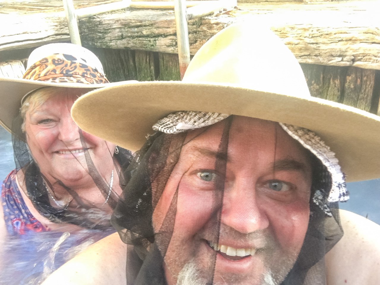
David & Amanda In The Spring At Coward Springs

David & Amanda In The Spring At Coward Springs

10. The Amphitheatre

Large flat abandoned quarry 9km NW of Coward Springs. This is a free campground with no facilities. Dog friendly. Be responsible and take out what you take in.

Cost: Free
Type: Free Camping / Bush Camping
Location: -29.337625°, 136.748336°
Distance From Marree: 141km
Distance From Oodnadatta: 265km
Distance From Marla: 519km

11. Beresford Bore Railway Siding Ruins

Beresford Bore Railway Siding is an abandoned railway siding on the Oodnadatta Track. It’s pretty cool to check out and explore. It has a mostly intact water softener setup used for treating water to go in to the old steam trains that used the old Ghan Railway. This is free camping between the Old Ghan Railway and the Oodnadatta Track with no facilities. Dog friendly. Be responsible and take out what you take in.

Cost: Free
Type: Free Camping / Bush Camping
Location: -29.239932°, 136.656277°
Distance From Marree: 155km
Distance From Oodnadatta: 251km
Distance From Marla: 505km

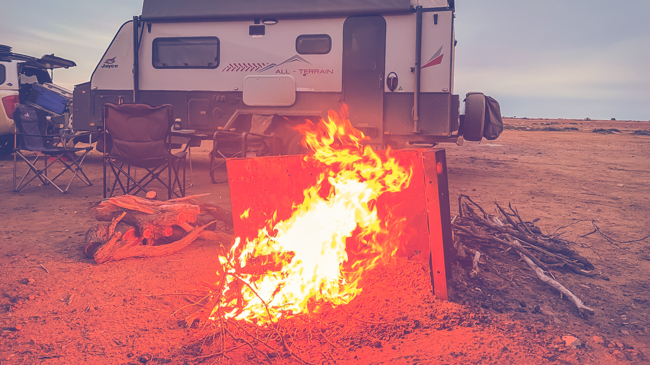
Camped At Beresford Siding On The Oodnadatta Track South Australia

Camped At Beresford Siding

12. Warriner Creek Ghan Rail Bridge Camp

This is a free campground with no facilities. Dog friendly. Be responsible and take out what you take in.

Cost: Free
Type: Free Camping / Bush Camping
Location: -29.139629°, 136.566467°
Distance From Marree: 169km
Distance From Oodnadatta: 236km
Distance From Marla: 490km

13. Near Irrapatana Sand Hills

Dirt track leading to a big flat area behind station. Near a fenced dam. Would be very boggy if wet. Was a lot of old fence posts lying around for firewood when we were there in 2019. This is a free campground with no facilities. Dog friendly. Be responsible and take out what you take in.

Cost: Free
Type: Free Camping / Bush Camping
Location: -29.085839°, 136.529259°
Distance From Marree: 177km
Distance From Oodnadatta: 230km
Distance From Marla: 484km

14. William Creek Hotel Camping Ground

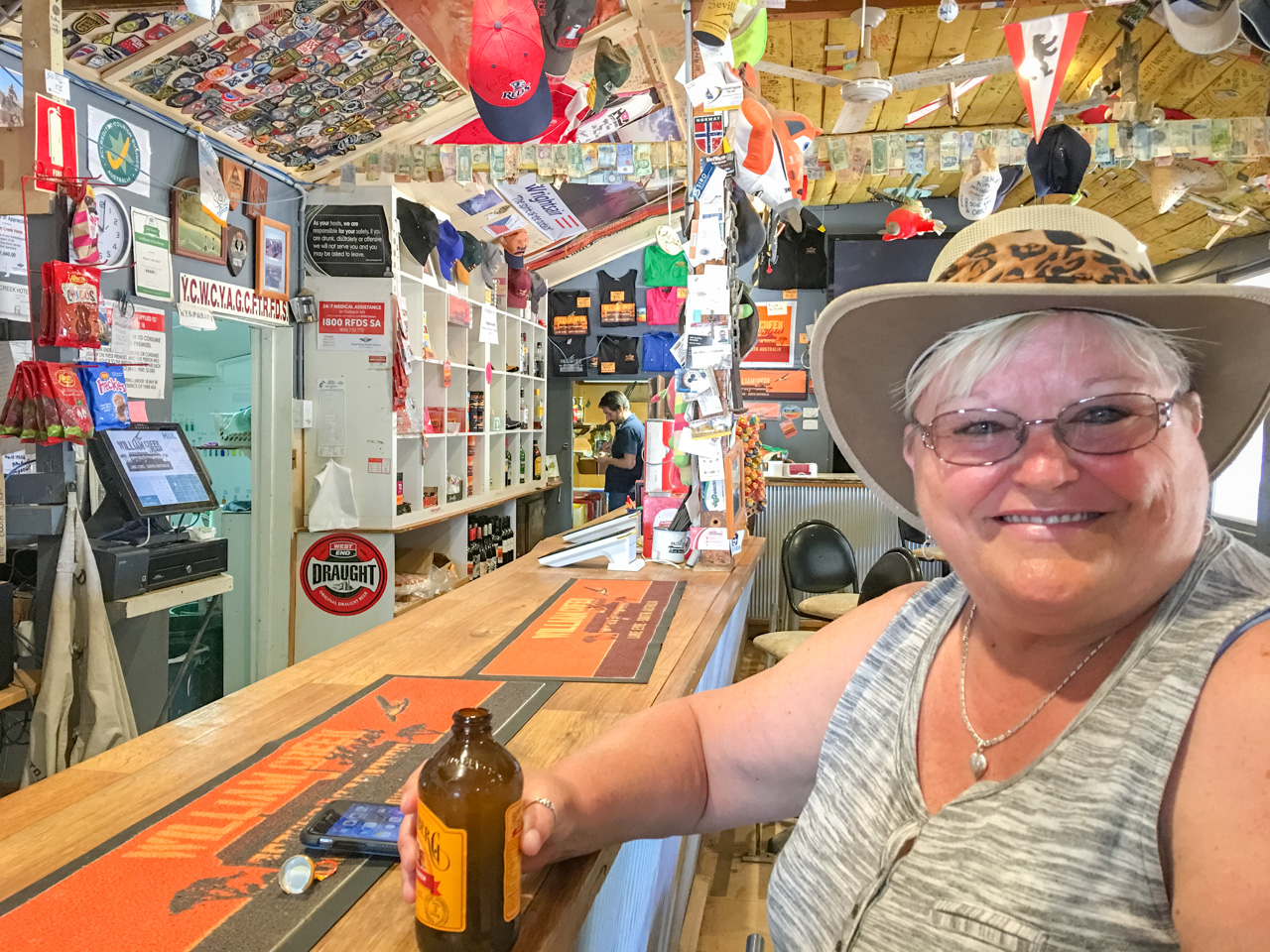
Campground/Caravan Park across the road from the iconic William Creek Hotel. Toilets and showers available and great meals and beer! Laundry facilities. Dog friendly. Fuel available. Awesome meals available at the pub. Very friendly location.

Cost: About $35 per night powered and $30 per night unpowered. Varies depending upon season.
Type: Caravan Park / Paid Campground
Location: -28.909119°, 136.338610°
Distance From Marree: 204km
Distance From Oodnadatta: 202km
Distance From Marla: 456km

Amanda At William Creek Hotel On The Oodnadatta Track South Australia

Amanda At William Creek Hotel

15. Box Creek Bush Camp

If heading north take the first turn left immediately after the sign for Box Creek and drive to the end. This is a free campground with no facilities. Dog friendly. Be responsible and take out what you take in.

Cost: Free
Type: Free Camping / Bush Camping
Location: -28.714409°, 135.970542°
Distance From Marree: 248km
Distance From Oodnadatta: 157km
Distance From Marla: 411km

16. Quilters Ruins

When you see a cattle yard follow the track down to a T intersection. It won’t be very busy so there are no traffic lights or stop signs or anything like that. At the T turn right and drive until you find the ruins. You’ll know them when you see them. This is a free campground with no facilities. Dog friendly. Be responsible and take out what you take in. This is the quintessential Oodnadatta Track camping experience.

Cost: Free
Type: Free Camping / Bush Camping
Location: -28.632512°, 135.891761°
Distance From Marree: 260km
Distance From Oodnadatta: 145km
Distance From Marla: 399km

17. Duff Creek Bridge

This is a free campground with no facilities. Dog friendly. Be responsible and take out what you take in. Nice old Ghan Railway bridge to explore. Road in was a bit corrugated in 2022. Duff Creek was a former railway siding on the old Ghan Railway line.

Cost: Free
Type: Free Camping / Bush Camping
Location: -28.529812°, 135.872557°
Distance From Marree: 272km
Distance From Oodnadatta: 133km
Distance From Marla: 387km

18. Algebuckina Bridge

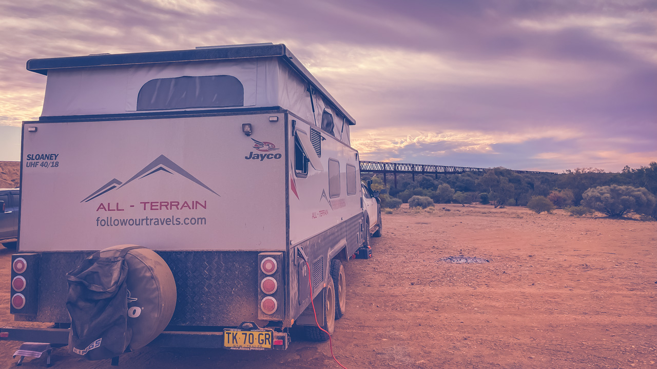
An absolute pearler of a camp site. We’ve stayed here a few times. This is a free campground with no facilities. Dog friendly. Be responsible and take out what you take in. The Algebuckina Bridge camping area is on Peake Creek. Sometimes it has plenty of water in it and other times we’ve seen it completely empty. The bridge is an old railway bridge on the Old Ghan railway. At one time it was the longest railway bridge in South Australia.

Cost: Free
Type: Free Camping / Bush Camping
Location: -27.902157°, 135.812224°
Distance From Marree: 348km
Distance From Oodnadatta: 57km
Distance From Marla: 311km

Free Camping At Algebuckina Bridge On The Oodnadatta Track

Free Camping At Algebuckina Bridge On The Oodnadatta Track

19. Algebuckina Waterhole, The Peake

This is on the opposite side of the Oodnadatta Track to the Algebuckina Bridge. This is a free campground with no facilities. Dog friendly. Be responsible and take out what you take in.

Cost: Free
Type: Free Camping / Bush Camping
Location: -27.897280°, 135.821374°
Distance From Marree: 349km
Distance From Oodnadatta: 58km
Distance From Marla: 312km

20. Oodnadatta Free Camp

Very flat, clean and close to the small town of Oodnadatta. This is a free campground with no facilities. Dog friendly. Be responsible and take out what you take in.

Cost: Free
Type: Free Camping / Bush Camping
Location: -27.544493°, 135.446421°
Distance From Marree: 406km
Distance From Oodnadatta: 700m
Distance From Marla: 254km

21. Oodnadatta West Free Camp

Large open space with a few low trees a long way back off the road. Turn in at the Telegraph Monument. This is a free campground with no facilities. Dog friendly. Be responsible and take out what you take in.

Cost: Free
Type: Free Camping / Bush Camping
Location: -27.540314°, 135.410365°
Distance From Marree: 410km
Distance From Oodnadatta: 4.6km
Distance From Marla: 250km

22. Oodnadatta Pink Roadhouse & Camp

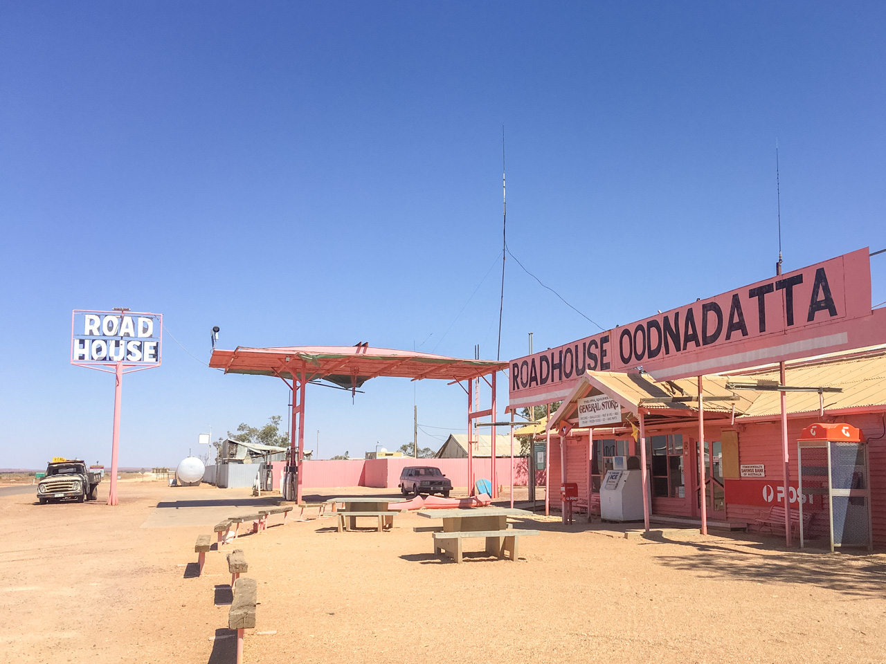
Campground/Caravan Park behind the iconic Pink Roadhouse. Toilets and showers available although there are only a few of each. Laundry facilities. Dog friendly. Fuel available.

Cost: About $35 per night powered and $20 per night unpowered. Varies depending upon season.
Type: Caravan Park / Paid Campground
Location: -27.549235°, 135.447553°
Distance From Marree: 406km
Distance From Oodnadatta: 0km
Distance From Marla: 254km

Pink Roadhouse Oodnadatta

Pink Roadhouse Oodnadatta

23. Small Hills Near Angle Pole

This is a free campground with no facilities. Dog friendly. Be responsible and take out what you take in.

Cost: Free
Type: Free Camping / Bush Camping
Location: -27.490360°, 135.418222°
Distance From Marree: 413km
Distance From Oodnadatta: 7km
Distance From Marla: 247km

24. Kathleen Creek, Oodnadata Track

This is a free campground with no facilities. Dog friendly. Be responsible and take out what you take in.

Cost: Free
Type: Free Camping / Bush Camping
Location: -27.204822°, 134.752916°
Distance From Marree: 489km
Distance From Oodnadatta: 84km
Distance From Marla: 170km

25. Oolarinna Creek

This is a free campground with no facilities. Dog friendly. Be responsible and take out what you take in. Please don’t cut down the trees for firewood. They may look dead however they are only dormant. They will spring to life once it rains however not if they have been cut down.

Cost: Free
Type: Free Camping / Bush Camping
Location: -27.162411°, 134.621032°
Distance From Marree: 503km
Distance From Oodnadatta: 98km
Distance From Marla: 156km

26. Coongra Creek

Fairly flat spot next to the creek with easy access. Travel further along the track if there are people camped up the front. There is plenty of room for everyone. Also don’t cut branches off the trees. There is [lenty of dead wood lying around. This is a free campground with no facilities. Dog friendly. Be responsible and take out what you take in.

Cost: Free
Type: Free Camping / Bush Camping
Location: -27.177435°, 134.320392°
Distance From Marree: 534km
Distance From Oodnadatta: 129km
Distance From Marla: 125km

27. Marla Travellers Rest

This is either the beginning or the very end of the Oodnadatta Track. Toilets and showers availabl. Water. Laundry facilities. Dog friendly. Fuel available.

Cost: About $30 per night powered and $20 per night unpowered. Varies depending upon season.
Type: Caravan Park / Paid Campground
Location: -27.304126°, 133.622447°
Distance From Marree: 603km
Distance From Oodnadatta: 254km
Distance From Marla: 0km

About The Oodnadatta Track South Australia

The Oodnadatta Track is one of the most iconic outback tracks in Australia. It is a 620 km dirt road that connects the towns of Marree and Marla in South Australia. The track is rich in history, culture, and natural wonders, making it a must-visit destination for anyone who loves camping, hiking, and outdoor adventures.

If you’re planning a camping trip on the Oodnadatta Track, there are a few things you need to know to ensure you have a safe and enjoyable experience. In this blog post, we’ll provide you with everything you need to know before you go.

Preparing For Your Trip

Before you embark on your journey, it’s important to do some research and plan your route. The Oodnadatta Track is a remote area, and you won’t have access to basic facilities such as fuel stations, shops, and medical services. Therefore, you need to be self-sufficient and prepared for any situation.

Make sure you have enough fuel, food, water, and camping equipment to last the duration of your trip. You should also check the weather forecast, road conditions, and any road closures before you leave. The Oodnadatta Track is prone to flooding, especially during the wet season, so it’s important to check the weather and road conditions before you set out.

Camping options

There are several camping options along the Oodnadatta Track, ranging from free campsites to more established campgrounds. Here are some of the most popular camping spots along the track:

Coward Springs Campground: This is a popular camping spot, and for a good reason. It is a well-maintained campground that offers hot showers, flushing toilets, and a communal kitchen. There are also several artesian springs, which provide a perfect spot to relax and rejuvenate after a long day of driving.

William Creek Campground: This is another popular campground, located in the small town of William Creek. It is a good spot to set up camp if you want to explore the surrounding area. The campground offers basic facilities such as toilets and showers, but it’s important to note that the showers are coin-operated.

Algebuckina Bridge Campground: This is a free campground that offers basic facilities such as toilets and fire pits. It is located near the Algebuckina Bridge, which is a historic railway bridge that spans the Neales River.

Level Post Bay: This is a free camping spot that offers stunning views of Lake Eyre. There are no facilities available, so you need to be self-sufficient.

Marree Campground: This is a good spot to set up camp if you’re starting or finishing your journey on the Oodnadatta Track. The campground offers basic facilities such as toilets and showers, and it’s located near the town centre.

Things To See & Do On The Oodnadatta Track

The Oodnadatta Track is a historic route through the Australian Outback, passing through some of the country’s most remote and rugged landscapes. Here are some things to see and do on the Oodnadatta Track:

The Mound Springs: There are two well-known mound springs known as showcase mound springs, Blanche Cup and The Bubbler. They are located about 6 kilometers south-east of Coward Springs on the Oodnadatta Track. Standing and looking at these permanent pools of water, you will realize how important they were to early European explorers. Overland Telegraph and Ghan Railway routes were determined by their presence here.

Lake Eyre: Lake Eyre covers an area of over 8000 square kilometres and is usually dry. A large amount of outback rains in Queensland, which feed the river systems that feed Lake Eyre, have brought water to Lake Eyre for the last three years, an event that happens rarely. Lake Eyre can be seen from,

  1. In the vicinity of Coward Springs, the Oodnadatta Track can have water in it after local rain in Lake Eyre South.
  2. ABC/Halligan Bay, a day trip from Coward Springs, 70 kms up the Oodnadatta Track to William Creek, then 64 kms into the Lake (4WD only).
  3. 94 km from Marree on the Birdsville Track at Muloorina Station (2WD is not recommended).

Explore the ruins of the Old Ghan Railway: The Oodnadatta Track was once a major railway line, and the ruins of the old railway stations and tracks can still be seen along the route. Some of the most impressive ruins can be found at Farina, a ghost town that was once a thriving railway community.

Visit the Pink Roadhouse: The Pink Roadhouse is an iconic Outback pit stop, located in the town of Oodnadatta. The roadhouse serves as a general store, fuel station, and café, and is a great place to stock up on supplies and hear stories from other travellers.

Marvel at the Painted Desert: The Painted Desert is a stunning geological formation, with colourful rock formations that resemble a painted landscape. The desert is located near the northern end of the Oodnadatta Track, and can be accessed via a side road.

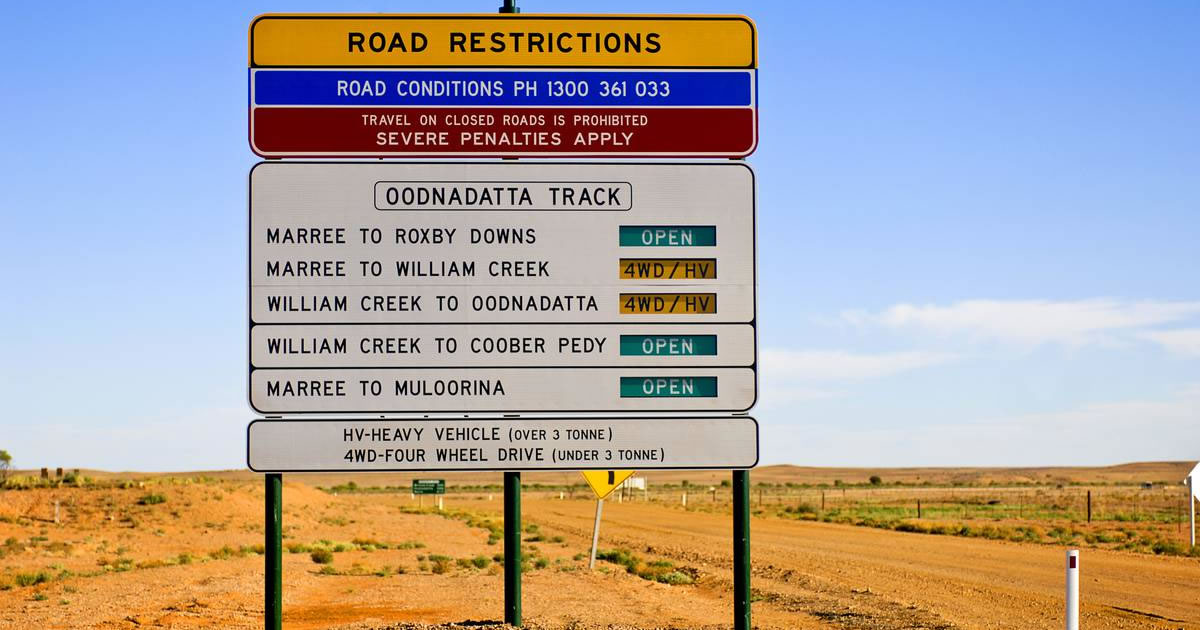
Oodnadatta Track Road Restrictions Sign

Oodnadatta Track Road Restrictions Sign

Visit the Marree Mosque: The town of Marree, located near the southern end of the Oodnadatta Track, is home to one of the oldest mosques in Australia. The mosque was built in 1861 to serve the needs of the Afghan cameleers who helped to open up the Outback.

Experience Aboriginal culture: The Oodnadatta Track passes through the traditional lands of several Aboriginal groups, and there are opportunities to learn about their culture and history along the way. The Aboriginal community at Nepabunna offers guided tours and cultural experiences.

Go Stargazing: The Outback is one of the best places in the world for stargazing, thanks to its clear skies and lack of light pollution. The Oodnadatta Track South Australia is a great place to set up camp and spend an evening marvelling at the stars.

Oodnadatta Track South Australia Road Conditions

Check the official government websites for road conditions and travel advice, such as the South Australian Government’s Department of Planning, Transport and Infrastructure website. You may also want to consider contacting the local authorities, such as the Outback Communities Authority or the local police department, for the latest information on the Oodnadatta Track road conditions.

Oodnadatta Track Fuel Availability

The Oodnadatta Track South Australia is a remote 620-kilometre dirt track that runs through the Australian Outback, connecting Marree in South Australia with Oodnadatta in the Northern Territory. Fuel is essential for any journey along this track as there are limited fuel stops available. Currently, there are four fuel stations on the Oodnadatta Track – one at the beginning at Maree, one at William Creek, one at The Pink Roadhouse at Oodnadatta and one at the other end at Marla. It is recommended that you fill up your tank at these stations as you will not find another fuel stop for several hundred kilometres.

MarreeWilliam CreekOodnadattaMarla
 <- 204km<- 201km<- 254km
Marree RoadhouseWilliam Creek Fuel (24hr)Pink RoadhouseMarla Travellers Rest
0488 444 544(08) 8670 7880(08) 8670 7822(08) 8670 7001

It’s also worth noting that fuel prices can be higher in remote areas, so it’s a good idea to budget accordingly. It’s also important to check the opening hours of these fuel stations in advance, as they may not be open every day or may have limited operating hours. Finally, it’s always a good idea to carry spare fuel with you as a backup, especially if you’re planning on travelling long distances or venturing off the beaten track.

Some Essential Safety Tips For Travelling In The Australian Outback

Here are some essential tips for ensuring your safety while travelling in the Australian Outback.

Choose the Right Vehicle

Your vehicle is one of the most critical components of a safe Outback trip. Choose a four-wheel drive vehicle that is well-suited for off-road driving and can handle rough terrain. Make sure that your vehicle is in good condition and that all essential components, such as brakes, suspension, and tires, are in good working order. It’s also important to carry spare parts, such as extra tires and a spare battery, and to have a basic understanding of how to repair your vehicle in case of a breakdown.

Plan Your Route

Before you embark on your Outback adventure, plan your route carefully. Research the roads and trails you’ll be taking, and make sure you have a detailed map and a GPS device. Know the distance between fuel stops and carry enough fuel to get you to the next station. Consider the time of year and weather conditions and be prepared for sudden changes in weather, particularly if you’re traveling during the summer months when temperatures can soar.

Take Precautions

The Australian Outback can be an unforgiving environment, so it’s important to take necessary precautions to ensure your safety. Always wear a hat, sunscreen, and appropriate clothing to protect yourself from the sun and heat. Carry plenty of water and food, and make sure you have a first aid kit on hand. It’s also a good idea to carry a satellite phone or emergency beacon, in case of an emergency.

Drive Safely

Driving in the Outback requires a different set of skills than driving on a highway. Reduce your speed and take it slow on dirt roads, particularly if you’re driving on unfamiliar terrain. Be aware of wildlife on the roads, particularly at dawn and dusk when animals are most active. Keep a safe distance from other vehicles and always wear your seatbelt.

Avoid Driving at Night

Driving at night in the Outback can be hazardous, particularly if you’re driving on dirt roads or unlit highways. Wildlife is more active at night, and the risk of a collision is higher. Additionally, it can be difficult to judge distances and navigate unfamiliar terrain in the dark. Plan your travel so that you’re off the road before sunset.

Be Prepared for Emergencies

Even with careful planning and precautions, emergencies can still happen. If you’re involved in an accident or experience a breakdown, stay with your vehicle and make yourself visible to passing traffic. Use your emergency beacon or satellite phone to call for help. If you’re stranded, conserve your resources and stay in the shade during the day and wrap up warm at night.

Conclusion

The Oodnadatta Track South Australia is a truly awesome outback adventure. Travelling in the Australian Outback can be a rewarding and unforgettable experience, but it’s important to prioritise safety, particularly when it comes to road and vehicle safety. Choosing the right vehicle, planning your route, taking necessary precautions, driving safely, avoiding driving at night, and being prepared for emergencies are all essential steps in ensuring a safe and enjoyable Outback adventure. By following these tips, you’ll be well-prepared to explore the stunning landscapes and unique culture of the Australian Outback while keeping yourself and your travelling companions safe.
4 Week Uluru Itinerary – Oodnadatta – Coober Pedy

4 Week Uluru Itinerary – Oodnadatta – Coober Pedy

4 Week Uluru Itinerary – Oodnadatta – Coober Pedy

Our Uluru itinerary. Four weeks through outback Australia is going to be our next trip. We are leaving from home in Cootamundra and travelling the Oodnadatta Track with some good friends then Coober Pedy then north to Uluru and Alice Springs then through outback Queensland.

MarreeFarinaWilliam CreekCoward SpringsAlgebuckina BridgeThe Pink Roadhouse At OodnadattaCoober PedyUluruAlice SpringsTennant CreekLongreachWintonUluru Itinerary

We will visit many iconic locations on this epic 4 week road trip. Marree, Farina, William Creek, Coward Springs, Algebuckina Bridge, The Pink Roadhouse at Oodnadatta, Coober Pedy, Uluru, Alice Springs, Tennant Creek, Longreach and Winton are just some of the bucket list locations we’ll be visiting as part of this Uluru itinerary. All up we plan on about 7,000kms and many of them will be on red dirt. We love red dirt. It’s going to be an awesome trip. Please follow us along!

Marree

We’ve been to Marree quite a few times now and it’s a favourite outback destination of ours. We can’t wait to have another burger in the pub and have a look around. Marree really is the intersection of some of our most iconic outback tracks.

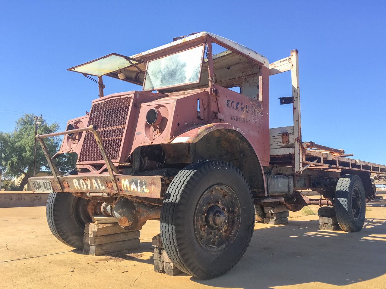
Tom Kruse Mail Truck At Marree

Tom Kruse Mail Truck At Marree

Farina

We love Farina and keep going back. It’s a great old Aussie ghost town and a fantastic place to camp. I think this trip will see us chalk up our tenth night of camping at Farina. If you haven’t been to Farina before then you should add it to your list.

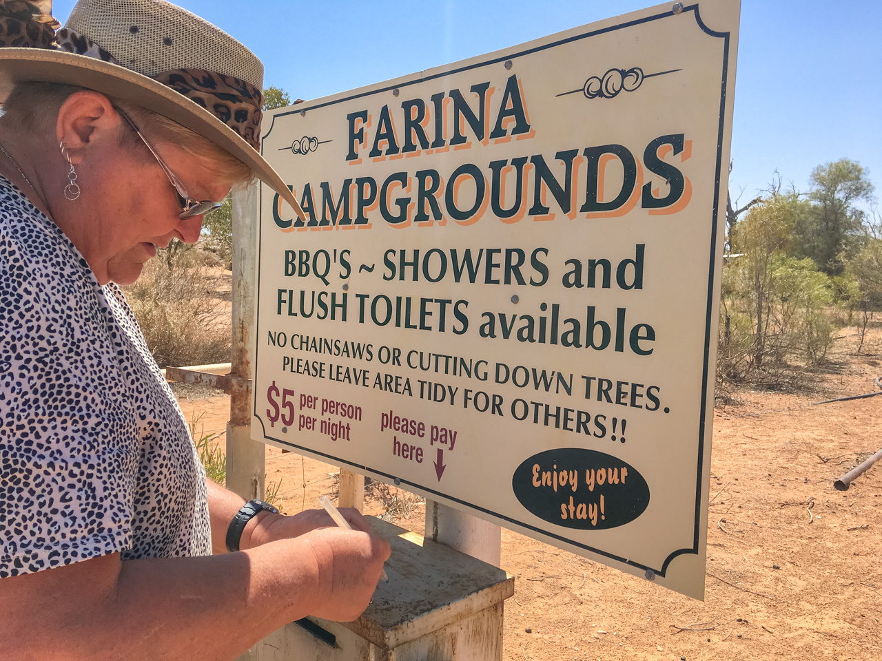
Farina Campgrounds Camp Honesty Box

Farina Campgrounds Camp Honesty Box

William Creek

The pub at William creek is a favourite of ours and we’ve had quite a few beers there. Looking forward to camping across the road from the pub at William Creek and having a few more.

Amanda At William Creek Hotel

Amanda At William Creek Hotel

Coward Springs

Coward Springs is an oasis in the middle of the desert. We’ve camped there before and really enjoyed it. The little pool at Coward Springs is a great way to cool off after a hard days travelling – but don’t forget the fly nets!

David & Amanda In The Spring At Coward Springs

David & Amanda In The Spring At Coward Springs

Algebuckina Bridge

On the route of the now-closed Central Australia Railway lies the Algebuckina Bridge. The Algebuckina Bridge is an Australian Victorian era railway bridge in the state of South Australia about 55 kilometres south of the town of Oodnadatta. January 1892 marked its opening. We have stopped in here before and had a look and taken some photos but this time we plan on camping there.

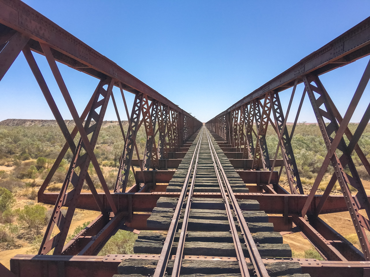
Algebuckina Bridge On The Oodnadatta Track

Algebuckina Bridge On The Oodnadatta Track

The Pink Roadhouse At Oodnadatta

No trip along the Oodnadatta Track would be complete without calling in at the iconic Pink Roadhouse at Oodnadatta. I’m going to have one of their famous “Oodnaburgers” again – Amanda probably won’t as she didn’t like hers last time. What’s wrong with her – they’re bloody awesome! Hopefully this time we have a bit better luck and don’t get a flat tyre (Tek Screw) at the fuel bowser.

Pink Roadhouse Oodnadatta

Pink Roadhouse Oodnadatta

Coober Pedy

This time in Coober Pedy we’re hoping to be able to explore the town. On our last visit we had an issue with the car’s battery and it was a long weekend so nothing was open. We were limited to having a look at places we get to on foot. On our last day there after getting a replacement battery we had an explore and loved what we saw. I’m really looking forward to going out to the Breakaways and watching the sunset. We’ve been up Big Red at Birdsville to watch the sunset before and I’m hoping this is just as spectacular. We’re also planning on going to the drive in movies!

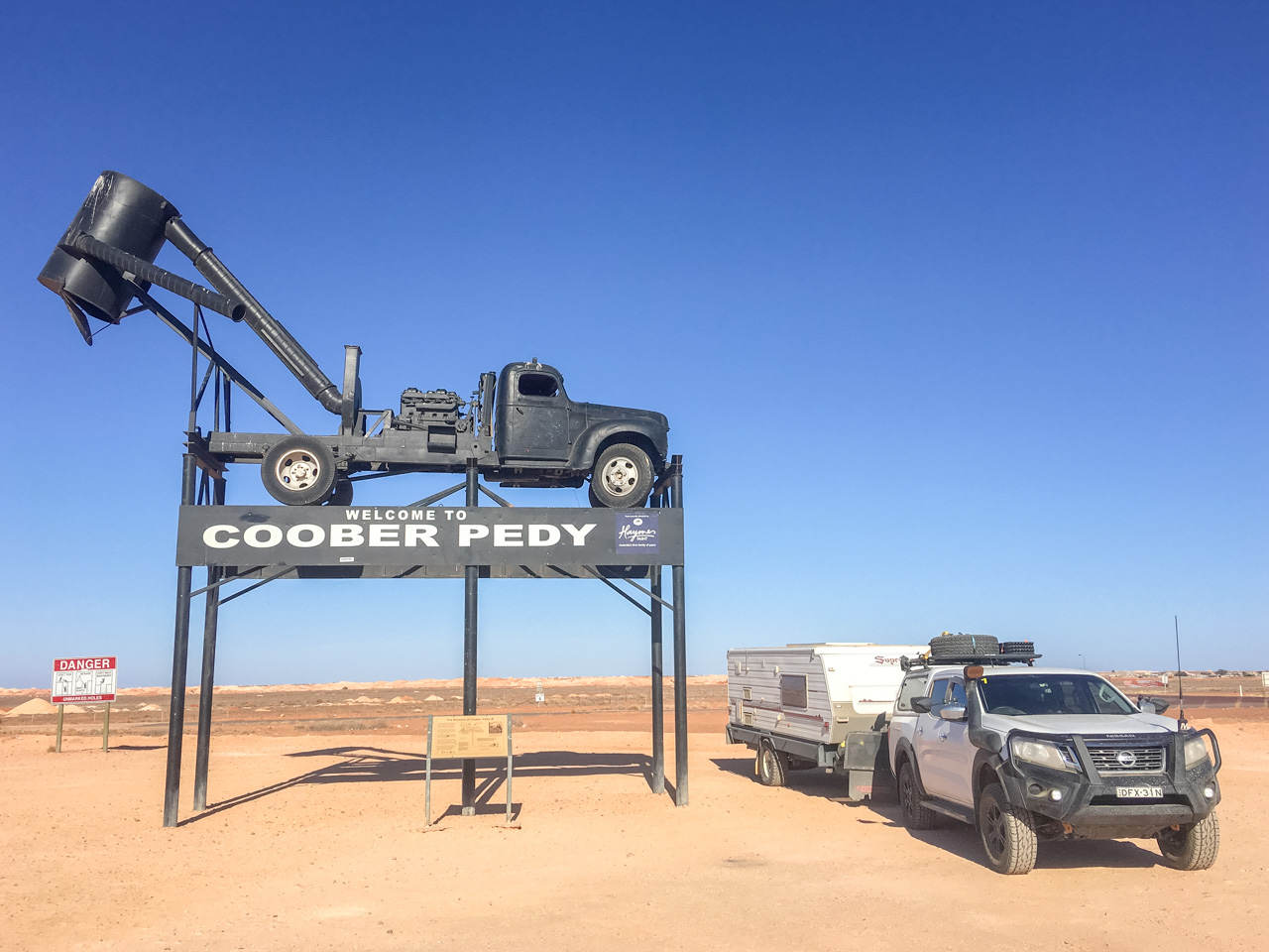
Welcome To Coober Pedy

Welcome To Coober Pedy

Uluru

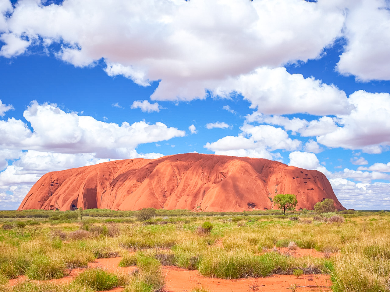
How have we never been to Uluru? We’ve been saving it for years, now it’s finally time to check it out. I really want it to be as spiritual an experience as I have been told it is. It’s been right towards the top of my bucket list since I was a little kid. Uluru is a massive sandstone monolith in the heart of the Red Centre, an arid region of the Northern Territory. It is roughly 450km from the closest large city Alice Springs. In Indigenous Australian culture, Uluru holds great spiritual significance. Around 550 million years ago, Uluru was thought to be beginning to form. The natural formation is part of Uluru-Kata Tjuta National Park, which also features 36 red-rock domes called “The Olgas”. This part of the trip is the focus of our Uluru itinerary.

Uluru

Uluru

Alice Springs

We’ve never been to Alice Springs before and it’s been on our bucket list ever since we started travelling Australia. The Northern Territory town of Alice Springs lies halfway between Darwin and Adelaide, each 1,500 km away. Visitors travel there to explore the Red Centre, the country’s interior desert region. I’m looking forward to seeing the historic buildings and equipment at the Alice Springs Telegraph Station Historic Reserve. The vintage equipment and buildings date from 1872 and were part of the Overland Telegraph Line (linking Darwin and Adelaide).

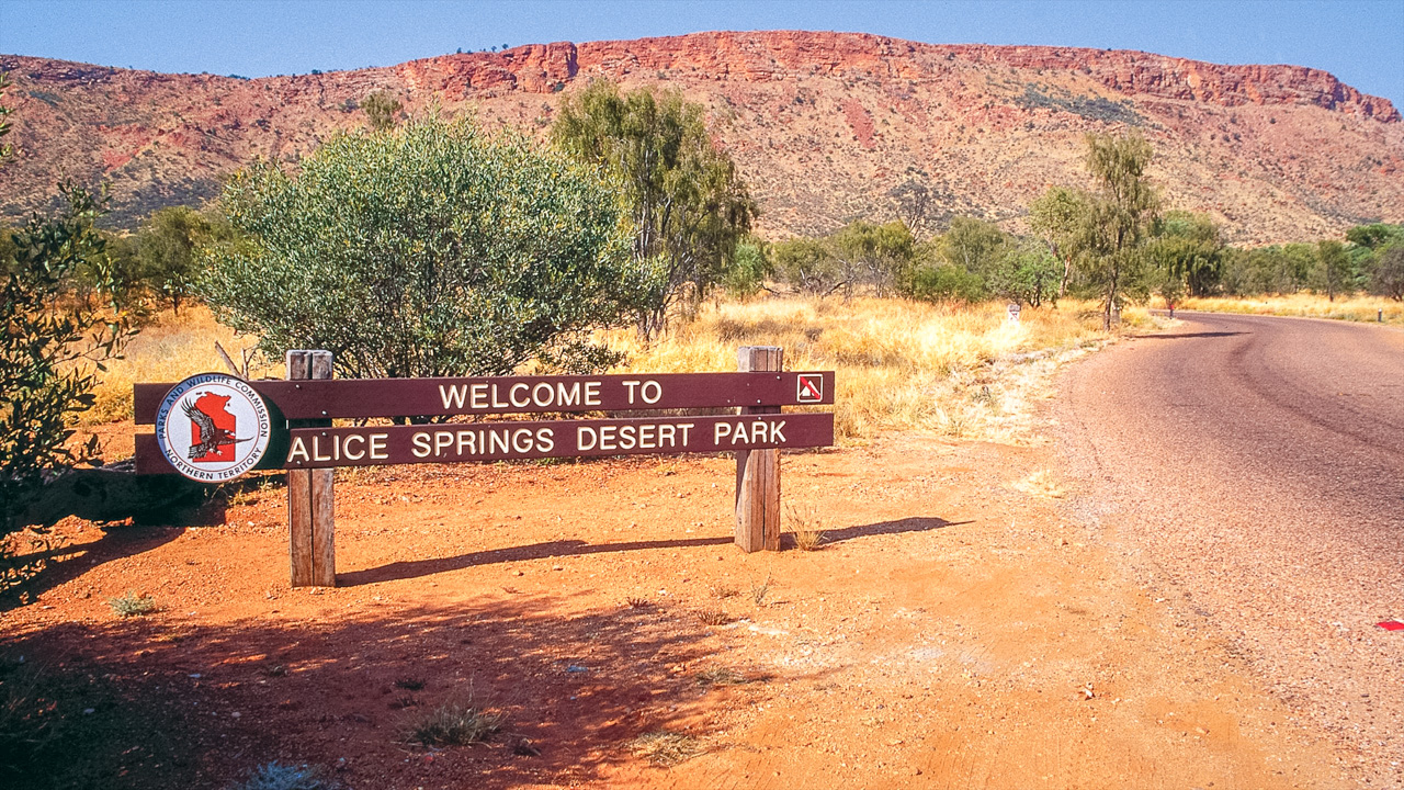
Alice Springs Desert Park

Alice Springs Desert Park

Tennant Creek

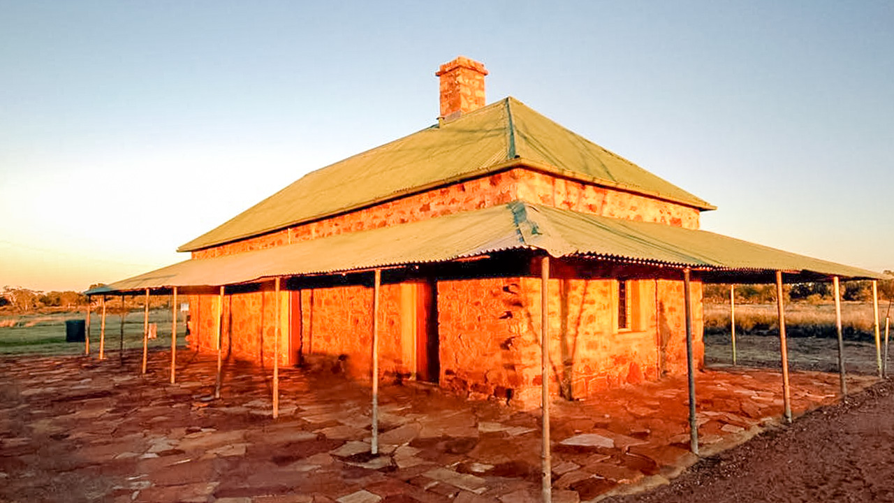
Warumungu Aboriginal people occupied the Tennant Creek region for thousands of years. Located close to the telegraph station is a very significant sacred site called “Jurnkurakurr”, where a black-nosed python called “Jalawala” resides. Tennant Creek Telegraph Station was constructed in 1872. By 1875, it had been rebuilt from locally quarried stone after first being constructed out of bush timber.

It served as a repeater station on the Overland Telegraph Line, which connected Darwin with Adelaide. In addition, it was used as a depot for government supplies. A 19th century blacksmith shop was found there, as well as a cart shed, ration store, meat house, smokehouse, and cellar. Cattlemen and slaughtermen were employed by the Warumungu at the station. In the 1890s well over 100 indigineous Australians were living at the station.

Tennant Creek Telegraph Station

Tennant Creek Telegraph Station

Longreach

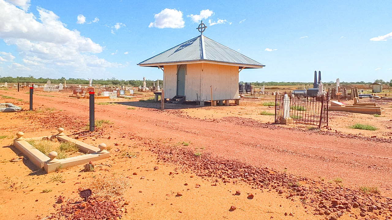
Longreach is the heart of Outback Queensland. It’s home to attractions including the Australian Stockman’s Hall of Fame and Qantas Founders Museum. We’ve never been to Longreach before and I think it will be awesome. Call us weirdos but we want to have a good walk through the cemetery. If you haven’t noticed it on our blog before visiting cemeteries is something we do a lot of. You can learn a lot about a towns history by visiting it’s cemetery.

Longreach Cemetery

Longreach Cemetery

Winton

Looking forward to visiting the pubs in Winton. I’ve heard a bit about them and want to find out for myself. Amanda wants to hit the dinosaur trail, that will be good too.

Winton Queensland We Want To Check Out The Pubs

Winton Queensland We Want To Check Out The Pubs

Uluru Itinerary

We are really looking forward to this trip. Our Uluru itinerary is outlined below with driving distances and approximate times.

DayTownStateDistanceTime
SaturdayCootamundraNSW624KM06:48
SaturdayMerbein (Mildura)VIC  
SundayOrrorooSA464KM05:02
MondayFarinaSA327KM03:21
Tuesday    
WednesdayCoward SpringsSA187KM02:11
ThursdayAlgebuckina BridgeSA218KM02:45
FridayCoober PedySA240KM03:38
Saturday    
Sunday    
MondayAyers Range SouthSA349KM03:33
TuesdayUluruNT420KM04:28
Wednesday    
Thursday    
FridayAlice SpringsNT468KM04:58
Saturday    
Sunday    
MondayBarrow CreekNT284KM02:52
TuesdayTennant CreekNT152KM01:32
Wednesday    
ThursdayCamoowealQLD471KM04:53
FridayMcKinlayQLD417KM04:37
SaturdayWintonQLD340KM02:34
Sunday    
MondayLongreachQLD179KM01:51
Tuesday    
WednesdayYandarloQLD360KM03:49
ThursdayCunnamullaQLD355KM03:49
FridayNynganNSW459KM04:48
SaturdayCootamundra 411KM04:36
SundayUnpack & Clean   
   6725KM 
2021 MARS Enthusiasts National Muster Preparations

2021 MARS Enthusiasts National Muster Preparations

2021 MARS Enthusiasts National Muster Preparations

For those of us who are confirmed for this years MARS Enthusiasts 2021 National Muster it won’t be that long before we are heading off and the time will go quickly. The meet up at the Burke & Wills Camp at Lake Pamammaroo (Menindee) is on 18/09/2021 and that’s only 147 days away but who’s counting eh!

The Van

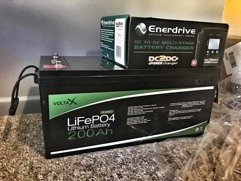
I am installing a lithium battery system and an upright 12v fridge in the caravan and I have ordered a couple of new and slightly larger water tanks for it. We’ve already had the gas fitter over to blank off the old 3way fridge we removed and he’s fitted a new gas regulator and a bayonet fitting so we can plug the BBQ in directly – he also did us a new gas compliance plate to keep it all legal. The van will be going to the mechanic in about a months time to get some new shocks fitted as well as having the suspension and brakes looked at and wheel bearings given a going over. The shocks on it have only done about 20,000ks since they were fitted but a LOT of that has been on the kind of tracks and roads we’ll be doing on this years National. On bitumen they’d probably be good for 100,000 plus!

VoltaX LiFePO4 200Ah Enerdrive DC2DC

VoltaX LiFePO4 200Ah Enerdrive DC2DC

The Ute

The ute is in pretty good nick. We’ve had it since new and it’s always been serviced at shorter intervals than recommended. It needs a new set of tyres so we’ll put some on before we go. The tyres probably have at least 20 or 30,000ks left on them but considering where we are going a new fresh set is cheap insurance. About 6 weeks before we go we’ll get our mechanic to give it a good service and we’ll get him to replace top and bottom radiator hoses as well as the turbo hose and all belts. They’re all coming up on 5 years old and the ute has 120k on it now so again I reckon it’s cheap insurance. We’ll get it done 6 weeks out to give the mechanic time to get in and fit any parts needed. We’ve already ordered some new snorkel head filters and a spare diesel prefilter elements.

A good recommendation is to join a Facebook group for your specific vehicle and read back through posts and see if it has any common issues. Most vehicles will have something that crops up regularly – better to get it looked at before you head off than to be stuck on the side of the Strzelecki Track.

Food & Meal Planning Etc

Amanda Sloane is pretty good when it comes to making sure we are always well fed and looked after. Have a go at the size of my guts, they don’t get like that by going hungry! We’ll be doing a lot of pub meals this trip so we won’t need to take as much with us as we sometimes do. Things such as powdered milk, coffee, sandwich wraps and dried and pre-packaged meals will be sorted in the weeks before we leave.

Conclusion

The National Muster Trip is coming up sooner than you think. Amanda Sloane and I have done plenty of these kind of offgrid semi remote trips so we know the mad rush that can happen in the last few weeks if you leave your preparation too long. I reckon the best way to go is to make yourself a list, whack it on the fridge with due dates then tick them off. We’re really looking forward to this!

2019 MARS Enthusiasts National Muster Tibooburra Aboriginal Land Council Camp Site

2021 MARS Enthusiasts National Muster Tibooburra Aboriginal Land Council Camp Site

Going Up Big Red At Birdsville To Watch The Sunset

Going Up Big Red At Birdsville To Watch The Sunset

Going Up Big Red At Birdsville To Watch The Sunset

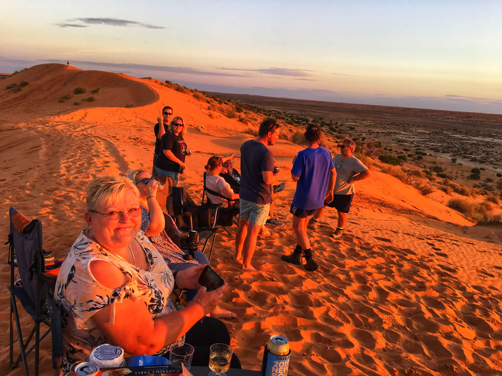
We drove up to the top of Big Red at Birdsville to watch the sunset.  Part of the  2019 MARS Enthusiasts National Muster groups adventure to the Dig Tree and Birdsville. What a drive! The view from the top of the sand dune aptly named Big Red is nothing short of incredible. And to experience it as part of a group just made it better. We even witnessed a wedding proposal between a couple of group members!

Getting Out To Big Red From Birdsville

You’ll find Big Red about 40km out of Birdsville right on the edge of the Simpson desert. The road is bitumen in a couple of short sections but mostly dirt. After about 35km you get to Little Red, a slightly smaller sand dune that you need to navigate to enter the Simpson desert. Before heading up over Little Red it’s a good idea to pull over and drop your tyre pressure to something more suitable to sandy desert driving. We went down to 18psi front and rear and it worked well. Once over Little Red you turn right. Then you drive a few more kilometres until you get to the base of Big Red.

Getting Ready To Climb Big Red At Birdsville

Getting Ready To Climb Big Red At Birdsville

Going Up Big Red The Hard Way

Most of the group members decided to have a crack at getting up Big Red head on. They all made it eventually after more than one attempt in a few cases! The techniques varied. A steady run up and climb to a launching a few kilometres back. Hitting the base of Big Red at warp speed!

Head On Climb Big Red At Birdsville

Head On Climb Big Red At Birdsville

The Chicken Track

There is an easier way to get up Big Red although it’s still not easy by any stretch of the imagination. Off to the right of the main tracks there is a track that sweeps around through a reverse curve that increases the distance you travel up the dune hence decreasing the steepness of the track. Any decent 4wd with good clearance and tyres (tyres with reduced pressure) will have no problem getting to the top in 4wd high range. Make sure you have some recovery gear, a shovel and a mate in another vehicle to lend you a hand just in case.

The View From The Top

The view from the top as the sun sets is amazing. Big Red is supposedly only 40m high but when you are up on top it feels like it’s a lot higher than that. The view back towards Birdsville in one direction and the Simpson Desert in the other is something you have to experience. All of us in the group agreed it was one of the most amazing things we’d ever done.

Amanda Sloane On Top Of Big Red Near Birdsville At Sunset

Amanda Sloane On Top Of Big Red Near Birdsville At Sunset

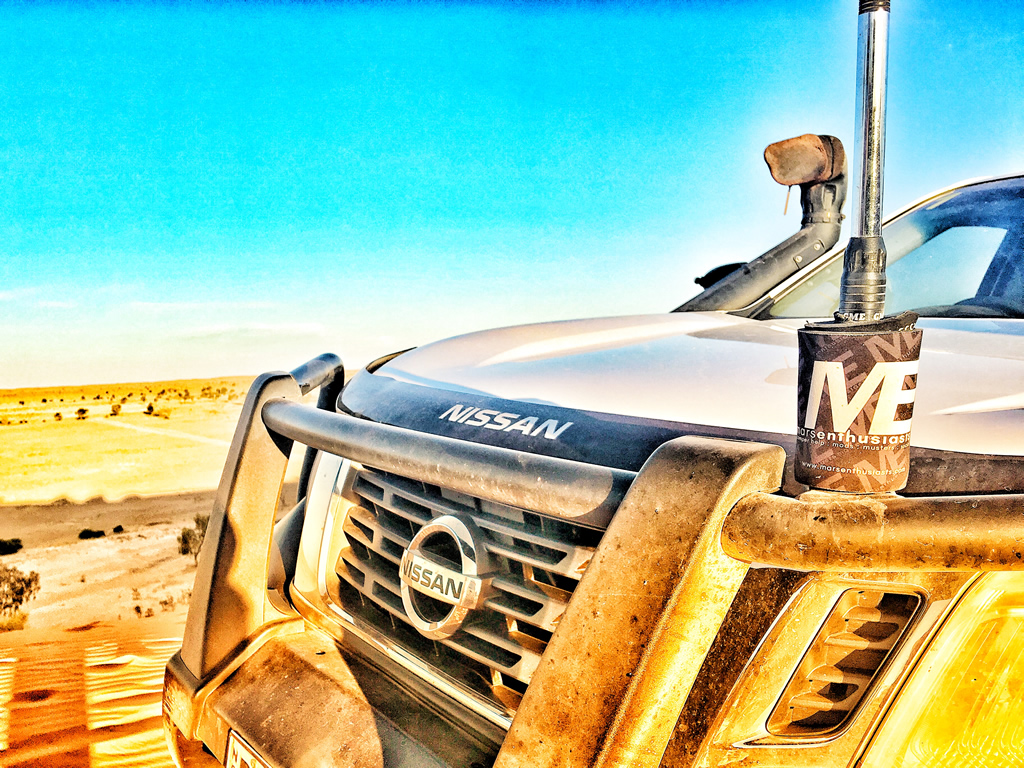
Nissan Navara NP300 Up On Top Of Big Red Birdsville

Nissan Navara NP300 Up On Top Of Big Red Birdsville

Conclusion

What an awesome place. If you ever get a chance to get up to Birdsville then go that little bit further and check out Big Red. It’s something you will never forget.

Save Travels!


Tibooburra to Cameron Corner via Jump Up Loop Road

Tibooburra to Cameron Corner via Jump Up Loop Road

Tibooburra to Cameron Corner via Jump Up Loop Road

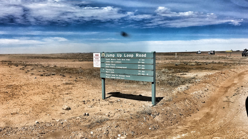
Cameron Corner via Jump Up Hills Loop Road 2019 MARS Enthusiasts National Muster. A day trip via the Jump Up Loop Road out of Tibooburra NSW during our recent 2019 National Muster adventure to the Dig Tree and Birdsville. What a drive! The Jump Up Hills Lookout is spectacular – you have to see it to believe it. The drive heads out north from Tibooburra towards the Warri Gate then 15ks out of town you turn left. You can’t miss the sign.

Tibooburra to Cameron Corner via Jump Up Loop Road with the MARS 2019 National Muster Crew

We originally intended travelling out to Cameron Corner and and back via the Main road from Tibooburra. However when we were fuelling up at TJ’s Roadhouse in Tibooburra the lady behind the counter told us that there a nice touring route via the Jump Up Loop Road and she gave us a mud map. After a discussion outside we all agreed that it was worth a crack so off we went. What a fantastic decision!

We headed out to the north and stopped at the Pioneer Park to drop our tyre pressures. After that we carried on along the Silver City Highway towards the Warri Gate for about 15 kilometres until we reached the well signposted turnoff.

The Jump Up Loop Road Turnoff

The Jump Up Loop Road Turnoff

Jump Ups Lookout

After about an hour or so we came to the lookout. This lookout made the day 100% worthwhile. The views are magnificent. You have to see it to believe it. It’s as dry as a dead dingos’ donger for as far as you can see. And the colours. The colours are spectacular. They range from the whitest of white through to the reddest of red with all shades of brown and purple in between. It’s truly amazing. If you look closely you can see small areas where it looks like some mining has occurred in the past on a small scale. I am guessing it might have been done for the collection of clay to use for some of the road construction.

The Lookout Over The Jump Ups on The Jump Up Loop Road From Tibooburra To Cameron Corner

The Lookout – Very Awesome!

Middle Road

After the lookout we continued on along the Middle Road towards Cameron Corner. We passed a few old falling down homesteads that were pretty cool. I’d love to come back some time and camp near one of the old homesteads and have an explore. Middle Road turned in to a bit of a corrugated goat track in a few places so we just took our time and muddled along. A few vehicles picked up a bit of damage in this section. Nothing major just things rattling loose so as a result made a few short stops for repairs.

Cameron Corner

Eventually we got on to Cameron Corner Road and followed it in to Cameron Corner. The main road is in a bit better condition but it’s still a lot of fun to drive. In sections it traverses flood plains where you can see to the horizon and in other parts it is sand dune country and goes up, down, over and around sand dunes. It keeps you on your toes but it’s well worth the adventure.

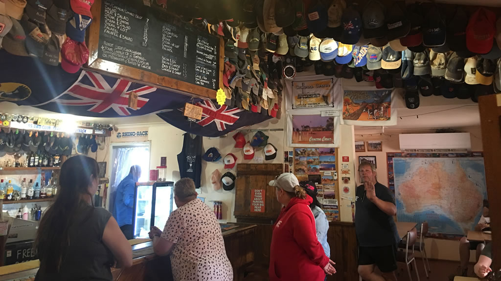
We all arrived safely at Cameron Corner and went in to the store for a look around and to have some late lunch. The store is a great old place and very welcome to arrive at out in the middle of nowhere. They server great food and have a small bar for drinks. The inside is worth stopping and having a good look at. There are probably hundreds of caps and hats stuck to the ceiling, and stickers all over the walls from past adventurers and groups.

Inside the Cameron Corner Store

Inside the Cameron Corner Store

The Corner Store can also sort you out with basic grocery needs and fuel. You can hire some golf clubs and have a round of “Tri-State Golf” at the makeshift 9 hole course. You can also camp at Cameron Corner. They have powered sites, unpowered sites and bush camping available. We’ve camped here before and the views are spectacular and the showers are nice and hot and the toilets are clean. Not much more you need is there?

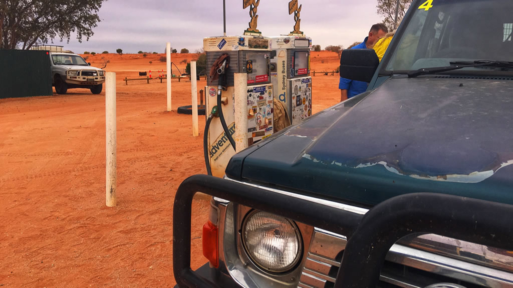
Fuel Pumps at Cameron Corner

Fuel Pumps at Cameron Corner – Are They The Most Iconic Fuel Pumps In Australia?

The Famous Cameron Corner Corner Marker

All of us headed across to have a look at the corner marker and to check out the dingo fence. The corner marker really is a special thing. I first remember seeing it on a Leyland Brothers episode about 40 years ago. That very episode is one of the things that made me want to get out and travel the bush so the marker is even more significant to me in particular!

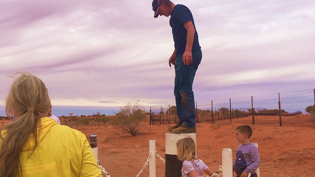
On top Of The Corner Marker at Cameron Corner

One Of The Crew On Top Of The Corner Marker

After a bit of time at the marker we all piled back in to our vehicles and headed back to Tibooburra along the main road. It was a fun drive back, we saw plenty of kangaroos along the side of the road and a few crossed the road in front of us so that kept us on the lookout.

The MARS Enthusiasts Crew Back At Tibooburra In Front Of The Tibooburra Sign

The MARS Enthusiasts Crew Back At Tibooburra In Front Of The Tibooburra Sign

The roads were of varying quality, all dirt and gravel. Some of them were a bit sandy, some were pretty corrugated and some had some fairly large rocks on them that had to be avoided. All up though the roads were pretty good.

All up it was a great day out with a great bunch of people. I really wish we could do it all again tomorrow. If you ever get the chance to do this drive, make sure your vehicle is prepared for the corrugated parts and have a crack. You won’t regret doing it. It’s been one of the most fun and memorable things I have done in a long time.

The Jump Up Loop Road and Middle Roads

The Jump Up Loop Road and Middle Roads are a bit on the rough side in parts and we all copped a few small damages here and there but we made it through safely. If you’re up for a bit of adventure and some incredible scenery it’s definitely worth the effort.

The Jump-up Loop Road takes you through some impressive and harsh country. Types of terrain include desert areas, gibber rock plains and red dune country. The loop is dotted with the occasional tree and small rocky gorge. In some places landscape looks like the surface of the moon. Not that we’ve been to the moon but you know what I mean!

Be warned that this is a remote and harsh area and you will need to be well-prepared with food, water and communication just in case. There is no phone reception here. It’s best to advise someone of your travels and for safety travel with at least one other vehicle. It’s inadvisable to travel this road during the hotter months of the year as temperatures can skyrocket north of 45 degrees for days on end.

The Jump-up Loop Road heads towards the Queensland border and the Silver City Highway. 55km north of Tibooburra you’ll find the Olive Downs campground. You can camp at the Olive Downs camp ground. While camped you can explore the ruins of the derelict Olive Downs station.

Directions

Before leaving Tibooburra make sure you have fuelled up your vehicle as there is no fuel available until you reach Cameron Corner about 150km away. Also air down your vehicles tyres as the roads are corrugated in parts.

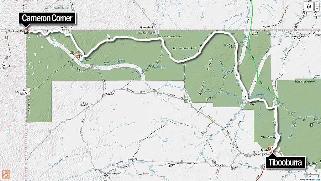
Tibooburra To Cameron Corner Ump Up Loop Road Map

Tibooburra To Cameron Corner Jump Up Loop Road Map

  • Head north out of Tibooburra past the Pioneer Park towards the Warri Gate.
  • About 15 kilometres out of town you will see a sign for the turnoff to the jump Up Loop Road on your left.
  • Follow this road for about 45 minutes and you will see the turnoff to the lookout on your left. Go up to the lookout. It is beyond spectacular.
  • After the lookout continue along the Jump Up Loop Road until you come to the Olive Downs Ruins. Continue until you reach the corner of Middle Road and Jump Up Loop Road. Turn left. This is where you need to hang on to your hat as the road gets a quite corrugated in parts from here on.
  • Keep going until you reach Binerah Well where the is a T intersection. Turn right and keep driving and you will get to Binerah Downs ruins.
  • At the Binerah Downs ruins take a left to continue along Middle Road towards Fort Grey.
  • Turn right at the next junction and follow the signs to Cameron Corner.

All up the drive took our group about four and a half hours from the Pioneer Park in Tibooburra to the Cameron Corner store. This included stopping in at the Jump Up Hills lookout and quite a few short stops to repair minor battle damage to our vehicles.

If You Need a Map

  • If you visit the roadhouse at Tibooburra and go to the counter and ask they will give you a mud map of the route
  • The HEMA Explorer app has very good coverage of this area

Vehicle Preparation

Make sure your vehicle and in particular your tyres are in good condition before attempting this route as it very corrugated and stony in parts. Also go all over everything that is bolted to your car and make 100% certain nuts are done up tight and preferable they have spring washers, Loctite or Nyloc nuts fitted. Examples of the damage we had on the trip are listed below.

  • Battery hold down bracket came adrift on our vehicle and had to be put back on
  • Shock absorber mounting bolt fell out on one vehicle resulting in the shock absorber coming apart from the vehicle on one end
  • A few bullbars came loose
  • A nudge bar came loose
  • A few vehicles had driving light mounting brackets break
  • UHF aerial snapped off on one car
  • A number plate all but fell off
  • A winch rattled loose
  • A fuel pump stopped working. Luckily this vehicle had LPG gas fitted as well so they were able to swap over to LPG to continue back to Tibooburra

Sturt National Park

Sturt National Park encompasses a huge and arid landscape of space and solitude. Starting with the Strezlecki desert rolling red sand dunes to flat topped mesas and 450 million year old granite tors near Tibooburra. A visit to this outback park is genuinely a once in a lifetime experience for anyone who goes there.

A self guided drives or guided tour with one of the tour operators that visit the park is a great way to explore what the park has to offer. For close up views of the landscape go on the short loop walks at Fort Grey or Dead Horse Gully. If you have limited time and can only do one walk check out Mount Wood hills for a walk to the summit. Stunning views of this spectacular landscape make it more than worth your while.

The Dingo Fence

Visit the historic Dingo Fence that runs east to south-west along the eastern third of Australia and along the western and northern boundary of Sturt National Park. The Dingo Fence was originally built in the 1880’s to keep dingoes away from sheep in the southern part of the country. It’s 5,614km long making it the world’s longest fence.

There are four campgrounds in Sturt National Park. They all have sites suitable for caravans and camper trailers as well as the usual barbecue and picnic facilities. Sometimes you can even be lucky enough to have the campground all to yourself although you’ll probably still have share the space with some of the parks’ many kangaroos and birdlife.
About The Jump-Ups

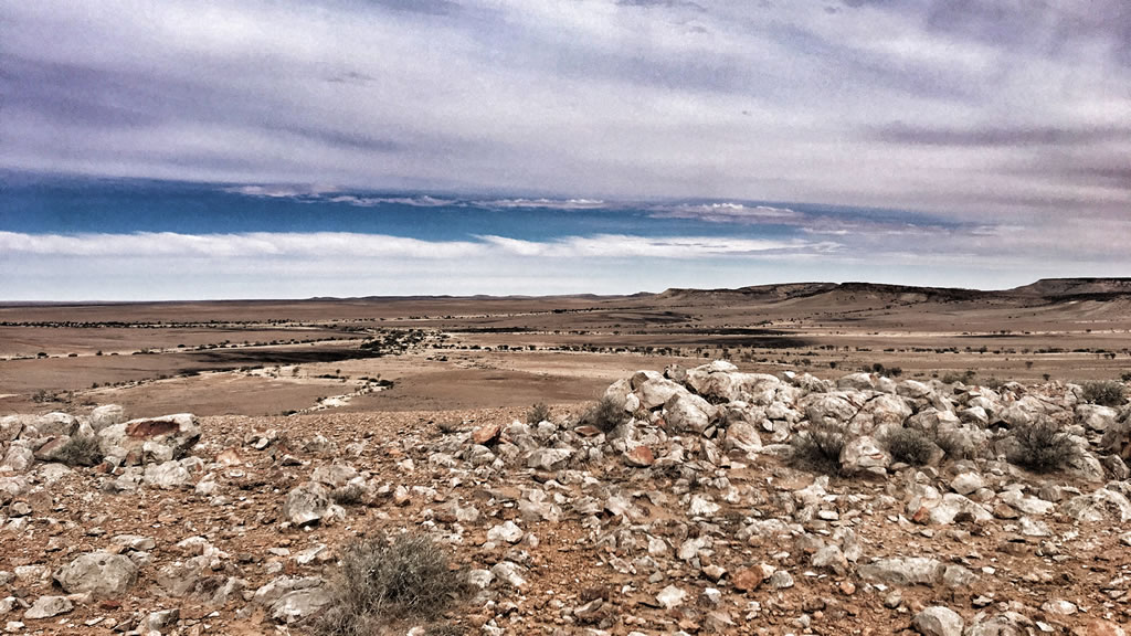
The Jump Ups are ancient landforms. The Jump-Ups are the remains of an ancient mountain range that has been eroded down over millions of years leaving a 150m plateau (Mesa) and the granite strewn plains which form the catchment of Connia Creek. Connia Creek follows south-east into Twelve Mile Creek.

About Cameron Corner

Short History

Charles Sturt on his expedition to find the Australias’ “inland sea” (how’d that go?) was the first European to explore the area now known as “Corner Country”.
About twenty years later the “corner” was named after John Cameron who successfully led a party to survey the NSW and Qld borders between 1879 and 1881. On arrival atthe intersection of the South Australian border in September 1880 put a wooden post in. The poost was marked “LAT 29” and “Cameron”. This post can be viewed at the National Park & Wildlife Office in Tibooburra.

Quick Facts
  • Cameron Corner is located at longitude 141° east and latitude 29°south
  • Elevation is 112m although it’s so flat it doesn’t seem like it!
  • The Corner store is in QLD and is in the Bulloo Shire.
  • The area code for phone calls is 08 (SA)
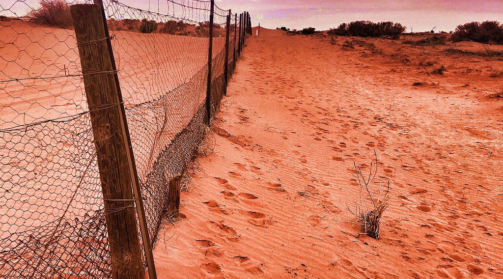
  • The Dog Fence follows the SA/NSW and NSW/Qld borders closely and can be seen right behind the corner marker
  • The best time to visit Cameron Corner is from March to October. Outside of these months it can be unbelievably (dangerously) hot
  • Time Zones! Three different states with two time zones Australian Eastern Standard Time (AEST) and Australian Central Standard Time (ACST). During summer you get a third because Qld doesn’t have daylight saving – apparently it fades the curtains
Location & Facilities
  • Phone: 08 8091 3872
  • Address: Camerons Corner Rd, Cameron Corner QLD 4492
  • Opening Hours: 7days 8am–12am
  • Fuel: Petrol and diesel. Not cheap but hey you’re in the middle of nowhere and if you need it you need it!
  • Food: They do breakfast from 8:00am and then your usual pub style meals at lunch and dinner. Burgers, steaks, schnitzels, chips and that kind of thing.All very nice. They also have a bar area where you can beer and cider. Your typical outback bar but very friendly and with excellent service
  • Groceries: Basic grocery items such as bread, milk and meat. All dependant of course on when they had their last delivery. Items are all sold frozen
  • Camping: powered sites $35 per vehicle. Unpowered sites $25 per vehicle. Bush camping $10 per vehicle (includes a $5 donation to Royal Flying Doctors). Male and female toilets and showers
  • Camp Kitchen: Sink, fire pit with hotplate and a billy post (don’t see them very often these days)
  • Accommodation: Donga style cabins in single, double and family size. Not five star, hell not even two star but they’re clean and comfortable

View Along The Dingo Fence @ Cameron Corner

View Along The Dingo Fence @ Cameron Corner