Eucla Telegraph Station Guide 2026 | Ruins, Jetty & Free Camping

Eucla Telegraph Station Guide 2026 | Ruins, Jetty & Free Camping

Eucla Telegraph Station Guide 2026 | Ruins, Jetty & Free Camping

Planning a Nullarbor trip? Visit the Eucla Telegraph Station ruins, walk to the old jetty, and camp near the coast. Our 2026 guide covers access, history, camping, and what to expect. The Eucla Telegraph Station is one of the most interesting historic stops on the Nullarbor.

Sitting among the sand dunes below the modern township of Eucla the ruins tell the story of how messages once crossed Australia long before mobile phones and the internet.

Amanda and I visited the Eucla Telegraph Station in 2024 while crossing the Nullarbor. During our visit we walked through the ruins, followed the track to the old jetty and spent a night at the nearby free campground. It was one of the highlights of our trip through this part of Western Australia. If you are travelling between South Australia and Western Australia this is a stop that deserves more than a quick photo.

Why Visit Eucla Telegraph Station?

Many travellers know Eucla as the border town on the Eyre Highway. However a short drive south reveals one of the most important communication sites in Australian history.

The station formed part of the East-West Telegraph Line which connected Western Australia with the eastern colonies in 1877. Before the telegraph messages could take weeks or months to arrive. After the line opened communication took minutes.

At its peak Eucla had homes, stores, staff accommodation and a busy jetty that supplied the settlement from the sea. Over time, shifting sand dunes swallowed much of the original town. Today the ruins remain partially buried beneath the sand.
Old Eucla Telegraph Station

Old Eucla Telegraph Station

Quick Visitor Information

Item Details
Location Approximately 4km south of Eucla township
Access Unsealed road suitable for most vehicles in dry conditions
Entry Cost Free
Time Needed 1 to 2 hours
Camping Available Yes
Pet Friendly Generally yes at campground areas. Check current conditions.
Best Combined Attraction Head of Bight

Eucla Telegraph Station

The remaining ruins are easy to reach from Eucla. A short gravel road leads down from the Eyre Highway to the coast.

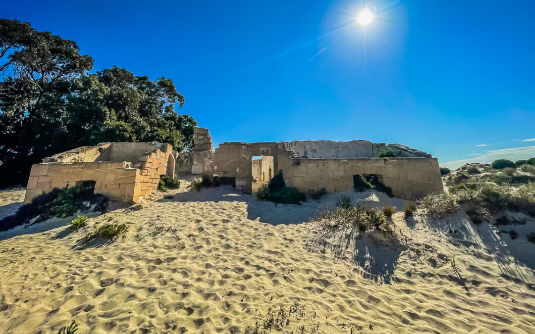
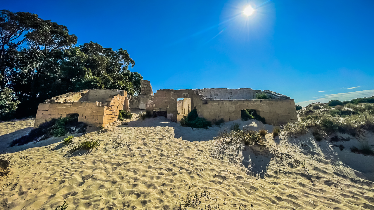
Once you arrive a walking track takes you directly to the main stone building. The structure visible today dates from the late 1890s and replaced the earlier timber station. Much of the building has been damaged by weather and moving sand, yet the remaining walls still give a good sense of its original size.

When we visited in 2024, the station was partly surrounded by sand dunes. The amount of exposed stonework changes over time as the dunes move. In some years more of the building becomes visible. In others, sections disappear beneath the sand.

The walk around the ruins is straightforward and suitable for most visitors.
Remains Of Eucla Telegraph Station

Remains Of Eucla Telegraph Station

Eucla Telegraph Station Ruins

The Eucla Telegraph Station Ruins are among the best preserved telegraph relics on the Nullarbor.

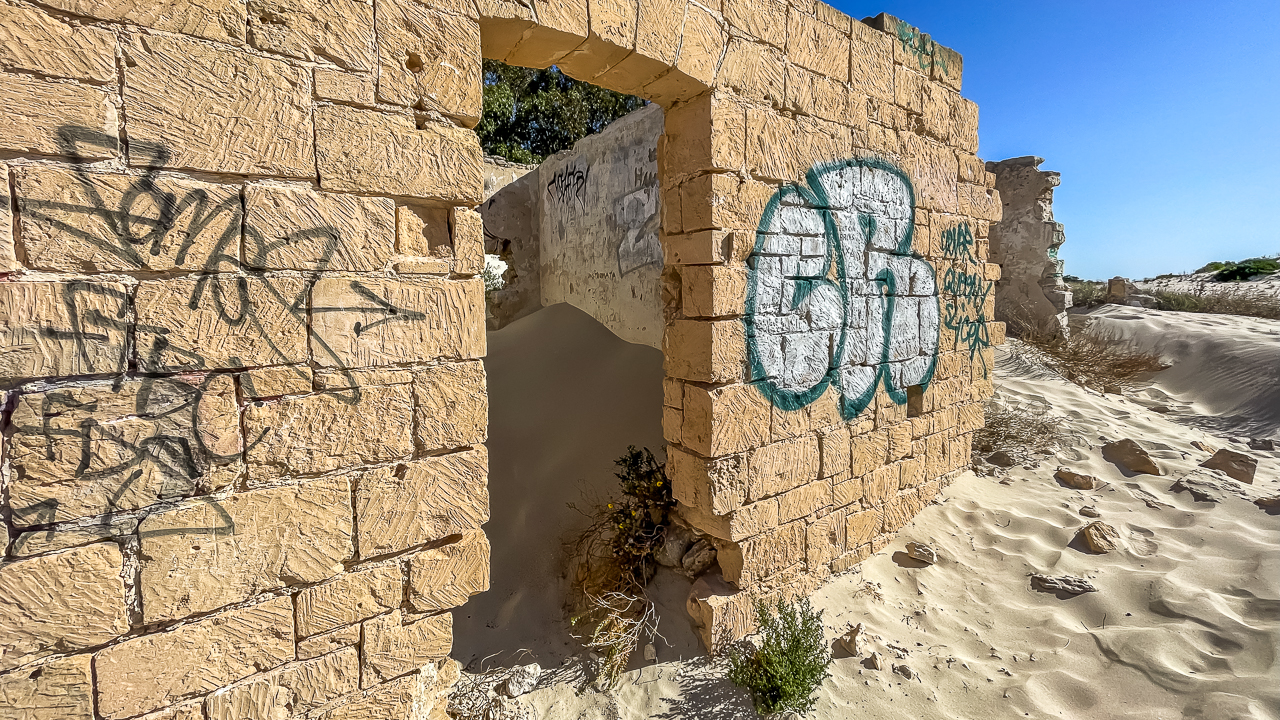
Unlike many historic sites that have been heavily restored, these ruins remain largely untouched. As a result, visitors can see the effects of more than a century of wind, salt air and drifting sand.

One of the interesting aspects of the site is its isolation. Standing among the ruins makes it easier to understand how remote this settlement once was. Staff and their families lived here for decades while handling communications between Western Australia and the eastern colonies.

For photographers, early morning and late afternoon provide the best light. The contrast between the limestone walls and the surrounding dunes creates excellent photo opportunities.

As an interesting side note, some of the windows and doors used at Koonalda Homestead came from the Eucla Telegraph Station. A fantastic example of recycling – it’s been going on forever.
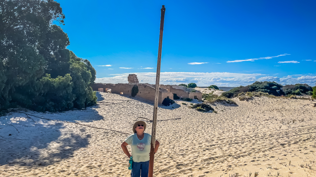
An Old Telegraph Post At Eucla Telegraph Station

An Old Telegraph Post At Eucla Telegraph Station

Eucla Telegraph Station Jetty

After visiting the ruins, continue along the walking track to the remains of the Eucla Telegraph Station Jetty.

The jetty played a critical role in supplying the settlement before reliable road transport existed. Ships delivered food, building materials and equipment directly to the coast below the station. A tramway then carried supplies inland.

Today, only remnants of the jetty remain. Even so, it helps visitors understand how important maritime access once was to this isolated community.

Amanda and I enjoyed the walk from the ruins to the beach. The coastline is quiet and the views across the Great Australian Bight are impressive. It also provides a different perspective of the station ruins sitting among the dunes above.

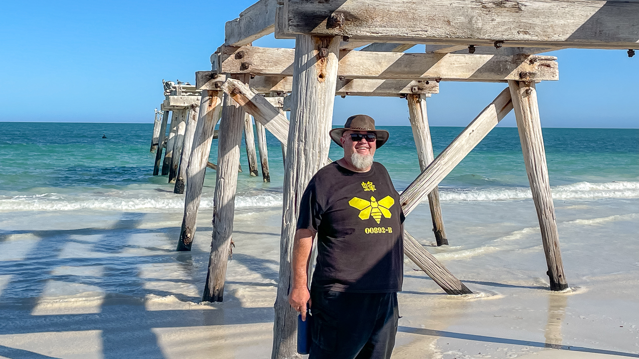
Eucla Jetty Remains Near Telegraph Station

Eucla Jetty Remains Near Telegraph Station

Eucla Telegraph Station Camping

Camping is available near the ruins at the Old Telegraph Station Campground.

This campground is popular with caravanners, camper trailers and motorhome travellers crossing the Nullarbor. Sites are spread out and the location offers easy access to both the ruins and the beach.

During our 2024 visit, we stayed here overnight. The campground provided a peaceful stop after a day on the road. Being able to walk to both the ruins and jetty without driving was a bonus.

Facilities can change over time, so check current conditions before arriving. Travellers should also carry enough water and supplies as services are limited.

Eucla Telegraph Station Free Camp

Many travellers search for Eucla Telegraph Station Free Camp options.

Historically, informal camping has occurred around the area. However, camping arrangements can change due to local management decisions and environmental concerns.

As of July 2026, travellers should confirm current camping rules locally before setting up. The nearby Eucla township remains the best source of up-to-date information. Avoid assuming older online reports are still accurate.

Checking locally helps protect the site and prevents issues with changing regulations.
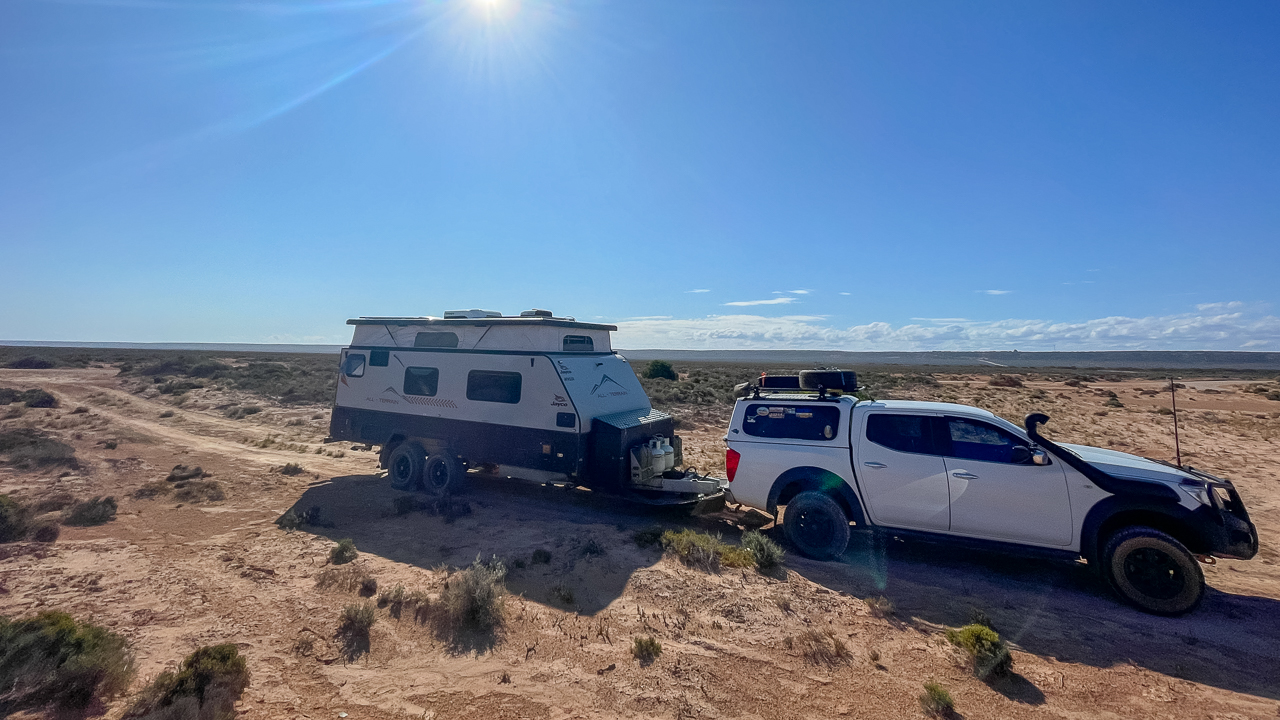
Free Camping Near Eucla Telegraph Station

Free Camping Near Eucla Telegraph Station

Eucla Telegraph Station Or Head Of Bight?

Travellers often ask whether they should visit the Eucla Telegraph Station or Head of Bight.

The answer is simple. Visit both if your schedule allows.

Attraction Best For
Eucla Telegraph Station History, photography, walking and camping
Head of Bight Whale watching, coastal views and visitor facilities

The Eucla Telegraph Station focuses on Australian history and the early communication network. Head of Bight focuses on natural attractions and Southern Right Whale viewing during the whale season.

The two locations complement each other well. Many travellers visit Head of Bight while crossing the Nullarbor and then continue west to Eucla later the same day.
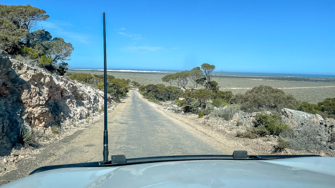
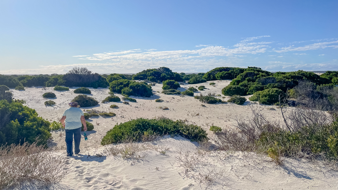
Heading Down To Eucla Telegraph Station Ruins

Heading Down To Eucla Telegraph Station Ruins

Tips For Visiting

  • Wear sturdy footwear for walking on soft sand.
  • Carry drinking water during warmer months.
  • Allow time to walk to the jetty remains.
  • Visit early or late in the day for better photography.
  • Check local road conditions after heavy rain.
  • Respect the historic ruins and avoid climbing on walls.

Is Eucla Telegraph Station Worth Visiting?

Yes. The Eucla Telegraph Station remains one of the most interesting historic stops on the Nullarbor.

It combines Australian history, coastal scenery, camping and easy walking access in one location. The moving sand dunes also make every visit slightly different.

Amanda and I found the site far more interesting than we expected during our 2024 visit. Walking through the ruins and along the beach helped bring the history of the Nullarbor to life.

If you are travelling between Western Australia and South Australia allow a few hours to visit. You will gain a much better understanding of how isolated this region once was and why Eucla played such an important role in connecting Australia.
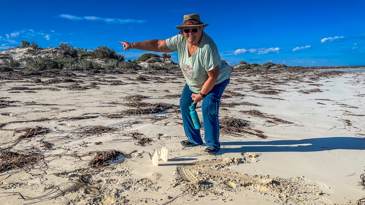
We Left A Mark On The Beach So We Could Find The Track

We Left A Mark On The Beach So We Could Find The Track

Eucla Telegraph Station Guide Photo Gallery

Eucla Telegraph Station FAQs – Things Travellers Ask About Eucla Telegraph Station

Where Is The Eucla Telegraph Station?

The Eucla Telegraph Station is located about 4 kilometres south of the township of Eucla in Western Australia. Access is via an unsealed road that branches off the Eyre Highway and leads down towards the coast.

Is The Eucla Telegraph Station Worth Visiting?

Yes. The ruins are one of the most significant historic sites on the Nullarbor. Visitors can see the remains of the former telegraph station, learn about Australia's early communication network and enjoy coastal views over the Great Australian Bight.

Can You Camp At Eucla Telegraph Station?

Yes. Camping is available at the Old Telegraph Station Campground near the ruins. The campground is popular with caravanners, motorhome travellers and campers crossing the Nullarbor. It also provides easy access to the ruins and beach.

Is There Free Camping At Eucla Telegraph Station?

Camping arrangements can change from time to time. While travellers have traditionally free camped in the area, it is best to check current local advice before arriving. This helps avoid issues with changing regulations or site management requirements.

How Long Does It Take To Visit The Eucla Telegraph Station Ruins?

Most visitors spend between one and two hours at the site. This allows enough time to walk through the Eucla Telegraph Station Ruins, visit the old jetty remains and enjoy the surrounding coastal scenery.

What Is The History Of Eucla Telegraph Station?
The Eucla Telegraph Station opened in 1877 as part of the East-West Telegraph Line linking Western Australia with the eastern colonies. The station played an important role in long distance communication before modern telecommunications existed. Over time, moving sand dunes buried much of the original settlement, leaving the ruins visible today.

Head Of Bight Visitor Guide 2026 |  Nullarbor Whale Watching

Head Of Bight Visitor Guide 2026 | Nullarbor Whale Watching

Head Of Bight Visitor Guide 2026 | Nullarbor Whale Watching

Planning a visit to Head Of Bight in 2026? Learn the best time to see whales, entry fees, opening hours, travel tips, facilities and what to expect from one of Australia’s best whale watching locations.

The Head Of Bight is one of the most popular stops on the Nullarbor Plain. Located on the far western coast of South Australia,it offers some of the best land based whale watching in Australia.

Many whale watching locations require a boat trip. Head Of Bight is different. Visitors can stand on elevated boardwalks and viewing platforms above the ocean and watch whales from the cliffs. At times whales will swim in very close to the viewing areas.

Amanda and I visited the Head Of Bight Visitor Centre in 2024 during a trip across the Nullarbor. The viewing platforms provided excellent views of the coastline. Mine and Amandas knees aren’t what they used to be but luckily the boardwalk made it easy to get around and spend time watching the whales and taking photos.

For caravanners and campers travelling between South Australia and Western Australia, it is one of the easiest wildlife experiences to add to a Nullarbor itinerary.

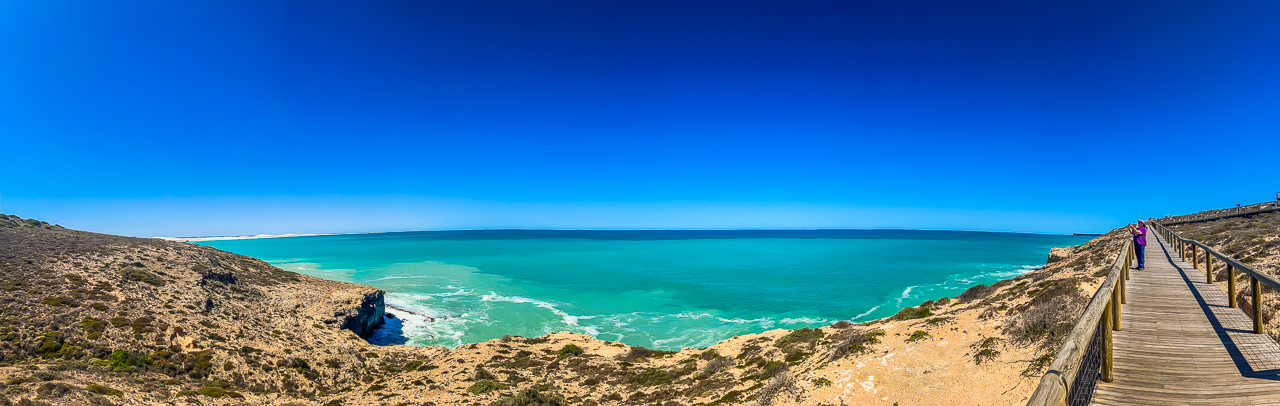
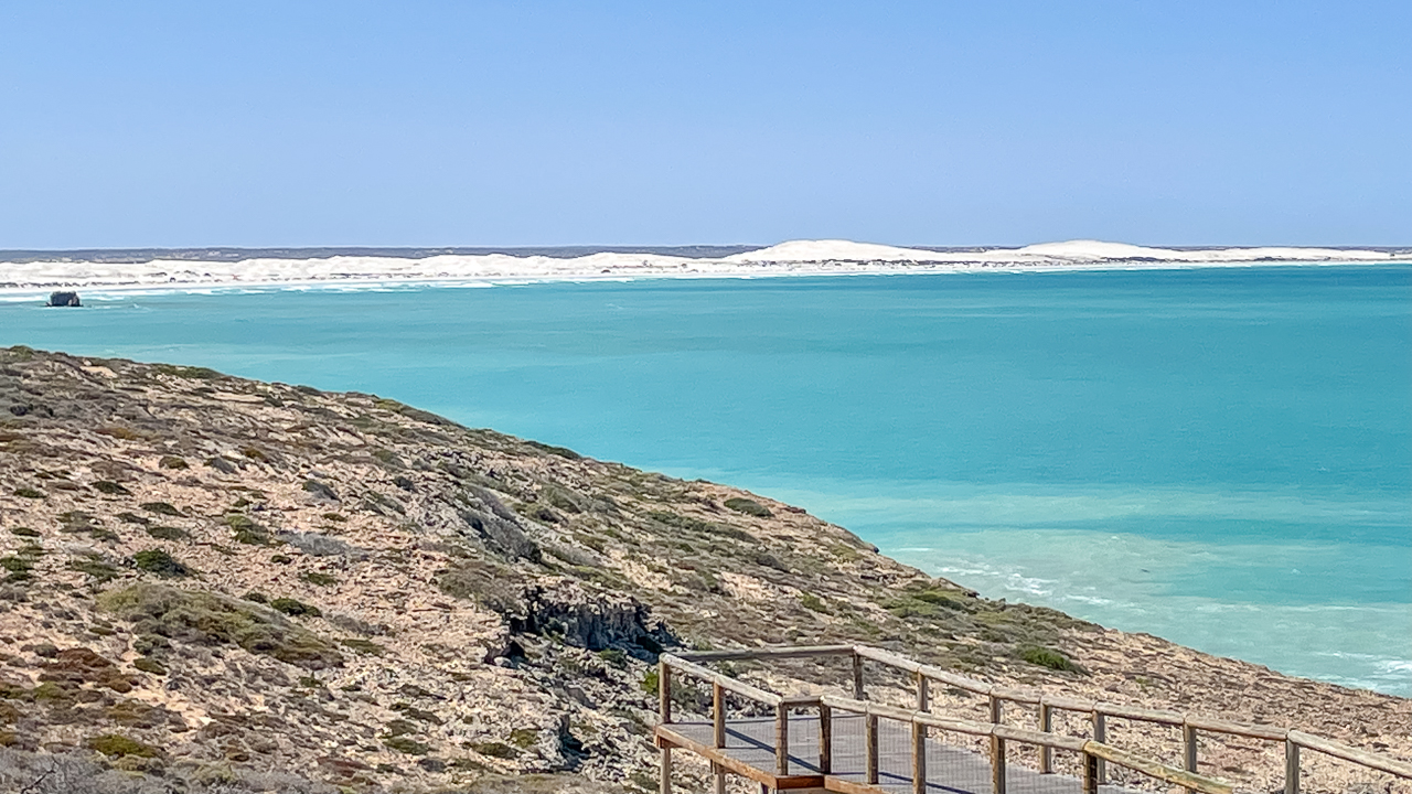
Panorama View From Head Of Bight Boardwalk

Panorama View From Head Of Bight Boardwalk

Head Of Bight

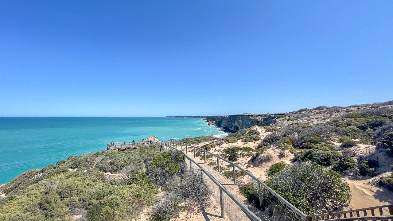
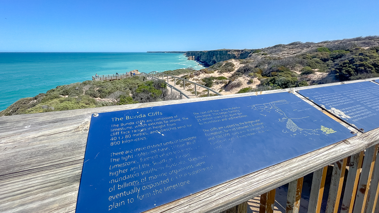
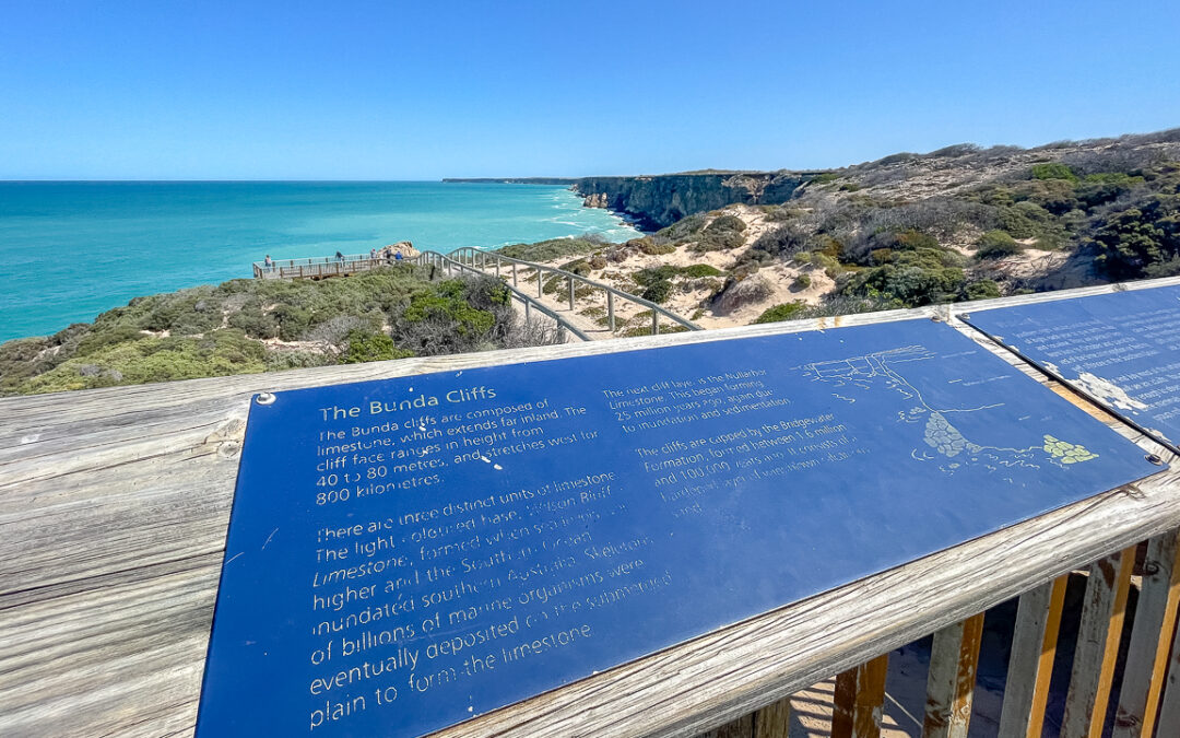
The Head Of Bight sits along the famous Bunda Cliffs on the southern edge of the Nullarbor Plain. The area forms part of the Great Australian Bight and is known as a breeding and nursery area for Southern Right Whales.

Each year, whales migrate into the sheltered waters to mate, give birth and raise calves before heading back into the Southern Ocean. The whale season generally runs from June through to October. During July and August, whale numbers are generally at their highest.

Unlike many whale watching destinations there is no need for a cruise. The boardwalk and viewing platforms allow visitors to watch whales from above.

In recent seasons, visitors have regularly reported seeing multiple whales at the same time, including mothers with calves. During peak periods many dozens of whales may be visible from the viewing platforms.

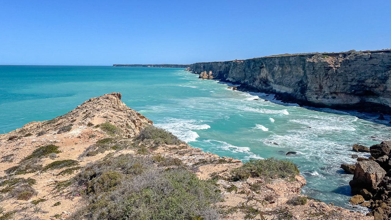
Bunda Cliffs Viewed From Head Of Bight Boardwalk

Bunda Cliffs Viewed From Head Of Bight Boardwalk

Why Head Of Bight Is Different

Australia has many whale watching locations. However, few offer the same combination of accessibility and viewing opportunities.

Feature Head Of Bight Typical Whale Watching Location
Boat required No Often
Viewing platform Yes Sometimes
Whale calves commonly seen Yes Depends on location
Suitable for caravanners Yes Varies
Easy highway access Yes Often limited
Viewing height above ocean High cliff top views Usually beach or boat level

This is one reason why so many travellers crossing the Nullarbor make the stop.

The experience is simple. Park your vehicle, walk the boardwalk and watch the ocean. There is no need to book a cruise or follow a tour schedule.

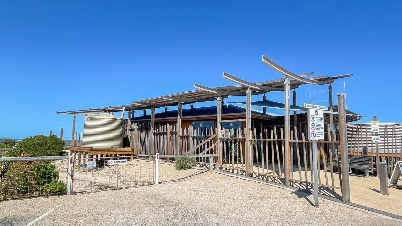
Entry Path To Head Of Bight Visitor Centre

Entry Path To Head Of Bight Visitor Centre

Head Of Bight Whale Watching

If your main goal is whale watching, timing matters.

The official whale season generally operates from 1 June to 30 October, depending on whale movements. During this period the visitor centre opens daily from 8:00am to 5:00pm – last entry is at 4:00pm.

June and July usually feature adult whales arriving in the bay. By late August and September, mothers with calves become more common. At times more than 70 whales can be visible from the platforms.

For the best experience:

  • Allow at least one to two hours.
  • Bring binoculars if you have them.
  • Visit early or late in the day for softer light.
  • Dress for wind, especially during winter.
  • Be patient between whale sightings.

Whales can remain underwater for extended periods before resurfacing.

Head Of Bight Boardwalk

Head Of Bight Boardwalk

Nullarbor Whales

The Nullarbor coastline supports one of Australia’s most important Southern Right Whale nursery areas.

The protected waters around Head Of Bight provide a safe environment for mothers and calves. As a result, the area has become one of the country’s best places to observe natural whale behaviour from land.

Visitors often see:

  • Tail slapping
  • Rolling
  • Spyhopping
  • Breaching
  • Mothers travelling with calves

Sea lions, dolphins and seabirds also appear regularly along the coastline.

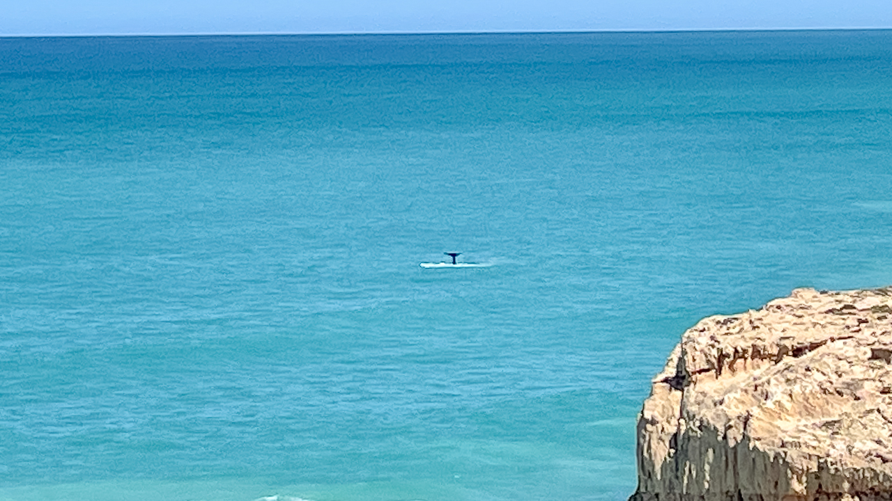
Because the whales come so close to shore, photography opportunities can be excellent. Even basic cameras and smartphones can capture great images. All the photos attached to this article were snapped on an old iPhone 13.

Head Of Bight Views

Head Of Bight Views

Southern Right Whales Nullarbor

Southern Right Whales were heavily hunted during the whaling era and their population declined dramatically.

Fortunately conservation efforts have helped numbers recover. The Head Of Bight has become one of the most reliable places in Australia to see these whales in their natural environment.

Adult Southern Right Whales can reach around 17 metres in length and weigh up to 70 tonnes. They are recognised by the rough white callosities on their heads (a bit like myself).

Watching a mother and calf moving beneath the cliffs provides a clear reminder of why these protected areas remain important.

Opening Times

Whale Season

1 June to 30 October (pending the arrival and departure of Southern Right Whales)

  • Open 8:00am to 5:00pm
  • Monday to Sunday, including Public Holidays
  • Last entry is 4:00pm

Off Season

1 November to 31 May (pending the arrival and departure of Southern Right Whales)

  • Open 8:30am to 4:00pm
  • Monday to Sunday, including Public Holidays
  • Closed on Christmas Day and Proclamation Day
  • Last entry is 3:00pm

To confirm opening hours, contact the Head Of Bight Visitor Centre on (08) 8625 6201.

Ticket Prices*

Ticket Type Whale Season Off Season
Adult $20 $10
Seniors Card Holders $17 $8
Child (5–15 Years) $9 Free
Family (2 Adults / 2 Children) $50 $20

*Prices correct as of July 2026

Visitor Information

As of July 2026 the visitor centre provides a range of facilities for travellers.

Information Details
Address Head Of Bight Visitor Centre, Eyre Highway, Nullarbor SA 5690
Phone (08) 8625 6201
Whale Season Hours 8:00am to 5:00pm
Last Entry 4:00pm
Wheelchair Access Available
Toilets Yes
Caravan Parking Yes
Boardwalk Access Yes
Food And Drinks Limited snacks and drinks available

The road from the Eyre Highway to the visitor centre is sealed, making access straightforward for caravans, motorhomes and camper trailers.

Pets are not permitted on the boardwalk or inside the visitor centre.

View Of The Bunda Cliffs

View Of The Bunda Cliffs

Where To Stay

There is no full service campground at the visitor centre itself. Most travellers stay at nearby Nullarbor Roadhouse, Nundroo, Ceduna or one of the recognised camping areas along the Eyre Highway.

If you are crossing the Nullarbor with a caravan, Head Of Bight works well as a half day stop before continuing west toward Eucla or east toward Ceduna.

Head Of Bight Whale Watching

Head Of Bight Whale Watching

Is Head Of Bight Worth Visiting?

For most travellers, the answer is yes.

The location combines dramatic cliffs, accessible viewing platforms and a strong chance of seeing whales without boarding a boat.

Many attractions along the Nullarbor focus on scenery. Head Of Bight adds wildlife to the experience. As a result, it offers something different from the lookouts, roadhouses and historic sites found elsewhere across the region.

Amanda and I found it to be one of the standout stops on our 2024 Nullarbor crossing. The boardwalk was easy to access, the views were excellent and the opportunity to watch whales from the cliffs made the visit memorable.

If you are travelling the Eyre Highway between South Australia and Western Australia, Head Of Bight deserves a place on your itinerary.

Panorama View From Head Of Bight Boardwalk

Panorama View From Head Of Bight Boardwalk

Head Of Bight FAQs: What You Need To Know

What Is The Best Time To Visit Head Of Bight?

The best time to visit Head Of Bight is during the whale season from June to October. July, August and September are often the most popular months because Southern Right Whales are commonly seen close to the viewing platforms.

Can You See Whales From The Cliffs At Head Of Bight?

Yes. Head Of Bight is one of Australia's best land based whale watching locations. Visitors can watch Southern Right Whales from elevated boardwalks and viewing platforms without needing to join a boat tour.

How Much Does It Cost To Visit Head Of Bight?

As of 2026, adult tickets cost $20 during whale season and $10 during the off season. Discounts are available for Seniors Card holders, and children aged 5 to 15 years receive free entry during the off season.

Is Head Of Bight Suitable For Caravans And Motorhomes?

Yes. The access road from the Eyre Highway is sealed and suitable for caravans, camper trailers and motorhomes. There is also ample parking available for larger vehicles.

How Long Should You Allow For A Visit?

Most travellers spend between one and two hours at Head Of Bight. This allows enough time to walk the boardwalk, visit the viewing platforms, take photos and watch for whale activity.

Are Dogs Allowed At Head Of Bight?

No. Pets are not permitted on the boardwalks or inside the visitor centre. Travellers with pets should plan accordingly before arriving at the attraction.

Oodnadatta Track Road Conditions (2026) – Access Latest Updates

Oodnadatta Track Road Conditions (2026) – Access Latest Updates

Oodnadatta Track Road Conditions (2026) – Access Latest Updates

Updated May 2026: all links and information have been checked and verified.

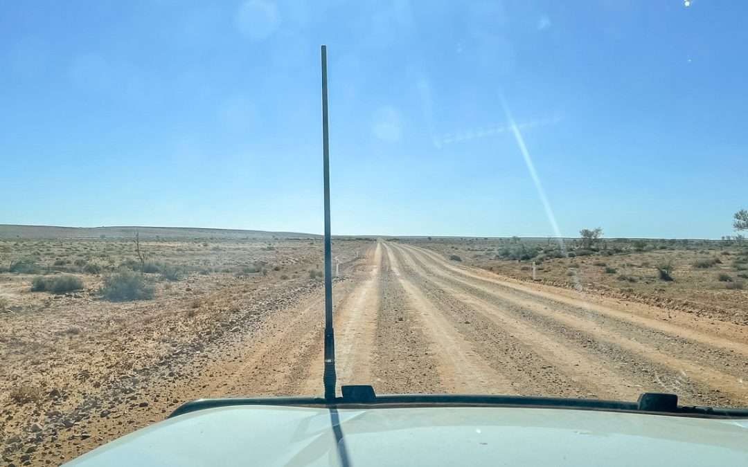
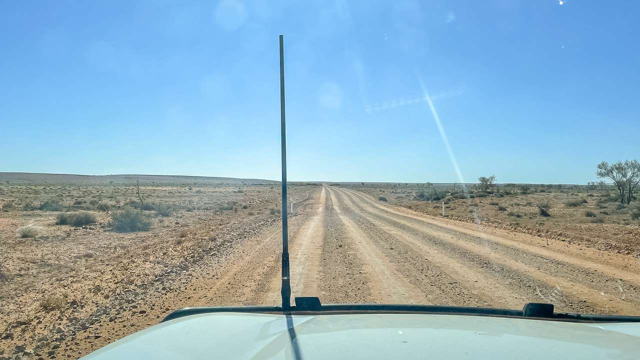
We’ve done six separate trips along the Oodnadatta Track between 2016 and 2025 and the road conditions have been different each time. Oodnadatta Track road conditions can change quickly. The list below outlines the best places to get current track conditions.

Where Can I Find Reliable Oodnadatta Track Road Condition Information?

Oodnadatta Track Road Conditions

Multiple resources provide current Oodnadatta Track road conditions, including the official South Australian Department for Infrastructure and Transport website, automated phone services, local businesses along the route and mobile applications designed for outback travel. These resources offer real-time updates on closures, restrictions and weather related impacts that can change rapidly in outback conditions.

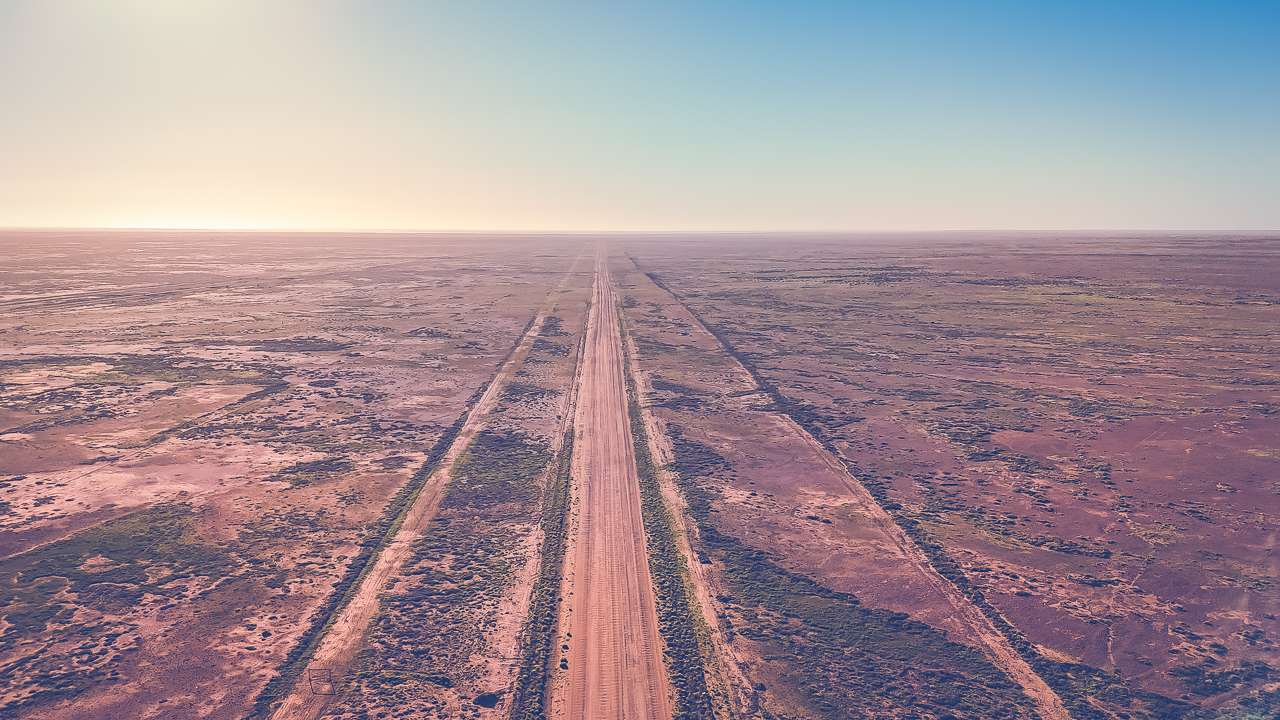
Oodnadatta Track Aerial View Near Curdimurka

Oodnadatta Track Aerial View Near Curdimurka

Official Government Resources For Oodnadatta Track Road Conditions

The South Australian Department for Infrastructure and Transport maintains the most authoritative source for outback road information. Their comprehensive Outback Roads Warnings website provides real time updates on Oodnadatta Track road conditions, road closures, restrictions and warnings across northern South Australia. Additionally, this official platform updates whenever conditions change, ensuring travellers receive the most current information available.

How Much Rain Does It Take To Close The Oodnadatta Track

Even small amounts of rainfall can dramatically impact track accessibility. Historical records show that as little as 5 millimetres of rain has caused temporary closures of sections between major towns. The track’s surface can become extremely hazardous when wet creating conditions that can strand vehicles for days. Driving on the track when wet can cause damage to the road surface that is costly to repair in both time and money.

The Department for Infrastructure and Transport monitors rainfall patterns closely and implements closures proactively to prevent travellers from becoming stranded. Consequently, understanding rainfall thresholds helps travellers appreciate why seemingly minor weather events can have major impacts on accessibility.

Automated Phone Services For Road Updates

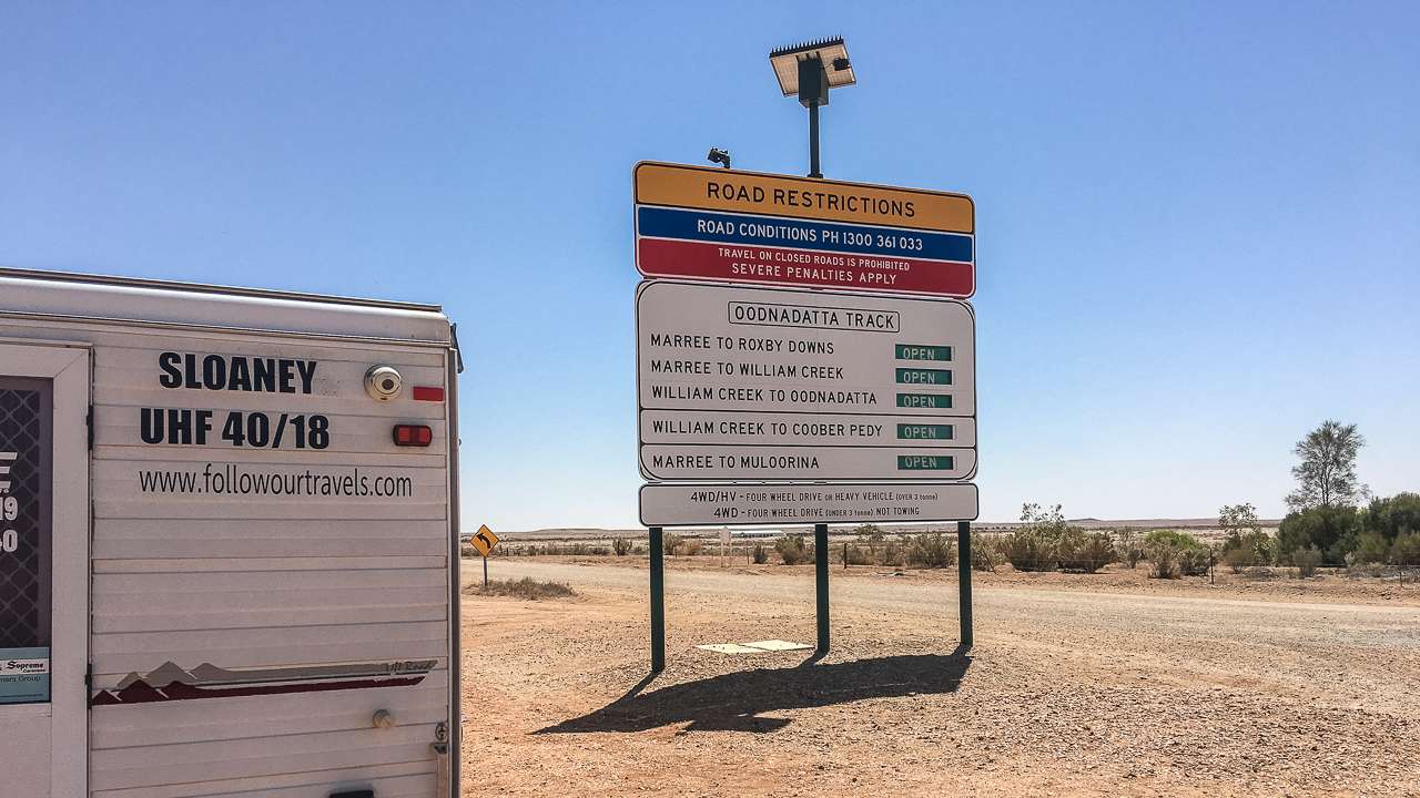
Travellers can access recorded road condition reports by calling 1300 361 033 which provides 24 hour automated updates. This service covers all major outback routes including detailed information about the Oodnadatta Track. The automated system updates regularly to reflect changing conditions across the region.

The phone service proves particularly valuable for travellers without reliable internet access in remote areas. Additionally, many experienced outback travellers recommend calling this number before departing and again at major stops along the route.

Technology Solutions For Tracking Oodnadatta Track Conditions Today

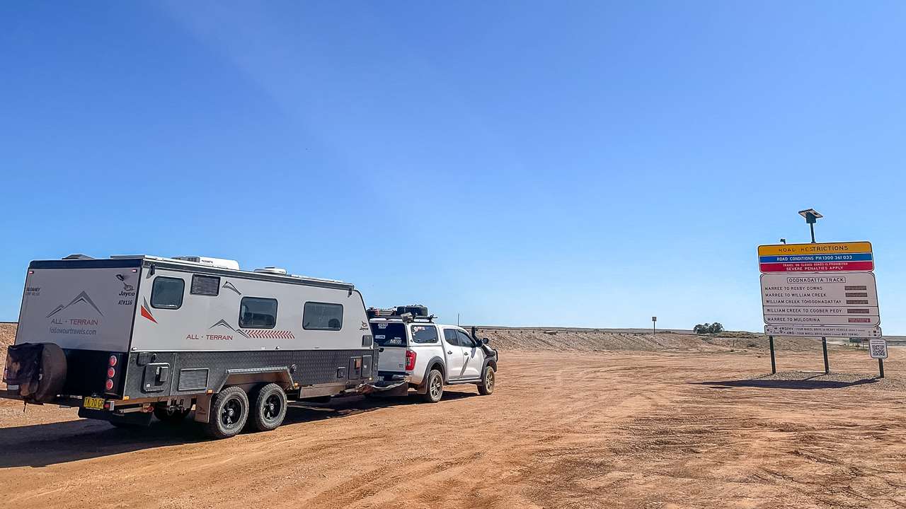
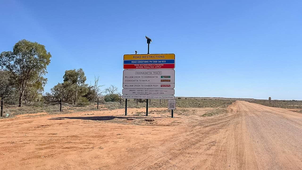
Modern technology has revolutionised how travellers access current road condition information. QR codes installed on roadside signs throughout the outback provide direct links to the latest warnings and closures. These codes work wherever mobile phone coverage exists giving travellers immediate access to updated information.

Mobile Applications And Digital Resources

The ExplorOz Traveller application offers comprehensive offline mapping capabilities specifically designed for Australian outback conditions. This platform includes community contributed road reports and track conditions from recent travellers. Similarly, the application provides valuable insights into current track conditions that official sources might not immediately reflect.

Drive Weather applications help travellers understand weather patterns along their planned route. These specialised tools predict conditions that could affect road accessibility hours or days in advance. Consequently, proactive planning using weather applications can prevent travellers from encountering unexpected closures.

Us At The Oodnadatta Track Sign At Marree In 2024 With QR Code

Us At The Oodnadatta Track Sign At Marree In 2024 With QR Code

Is The Oodnadatta Track Open – Real Time Monitoring

Real time monitoring systems provide continuous updates on track accessibility. The official DIT website features an interactive map showing current road statuses using colour-coded indicators. Green sections indicate open roads, while red areas show complete closures to all vehicle types.

However satellite outages occasionally disrupt automatic updates to roadside signs. During these periods, QR codes on signs provide alternative access to current information. Travellers should always verify conditions through multiple sources before departing.

Local Business Network For Current Road Information

William Creek Hotel

The William Creek Hotel serves as a crucial information hub for track conditions. Staff members receive regular updates from travellers and maintain close contact with maintenance crews. Moreover, the hotel’s strategic location halfway along the track makes it an ideal source for current conditions in both directions.

Travellers can contact the William Creek Hotel at (08) 8670 7880 for detailed local knowledge. The hotel staff understand seasonal variations and can provide advice about vehicle suitability for current conditions. Additionally, they offer insights into fuel availability and accommodation options along the route.

Marree Hotel

The historic Marree Hotel, located at the southern terminus of the track, provides invaluable local intelligence. Staff members regularly discuss road conditions with pastoralists and travellers who use the route daily. Furthermore, their experience with seasonal patterns helps them provide realistic assessments of track conditions.

Hotel representatives can advise on tyre pressures, travel times, and current hazards along specific sections. They also maintain awareness of alternative routes when main sections experience closures. Consequently, calling ahead to Marree Hotel often provides insights unavailable through official channels.

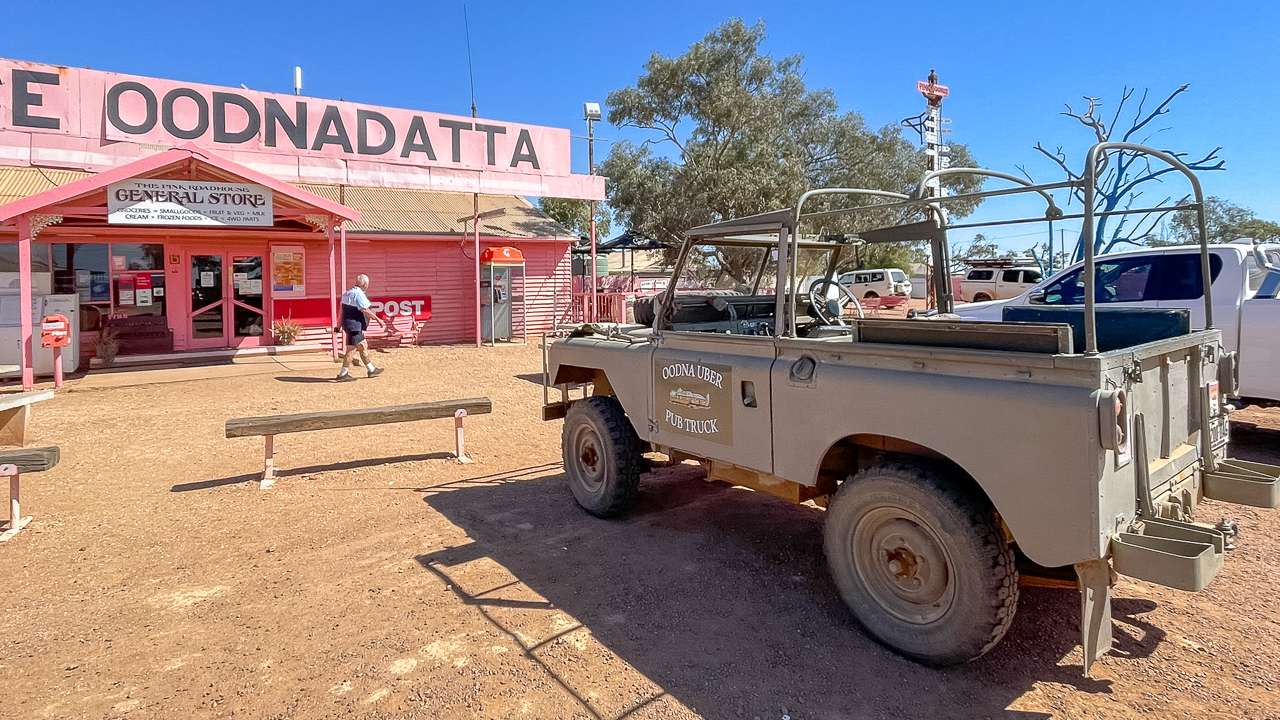
Oodnadatta Pink Roadhouse

The Oodnadatta Pink Roadhouse operates a toll free information service on 1800 802 074 . This service provides current track conditions from the northern perspective. Staff members receive regular reports from freight operators and maintenance crews working on the track.

The Pink Roadhouse At Oodnadatta

The Pink Roadhouse At Oodnadatta

Weather Monitoring For Oodnadatta Track Planning

Bureau Of Meteorology Resources

The Bureau of Meteorology provides essential weather forecasting for outback regions. Their Oodnadatta weather station offers current conditions and forecasts that directly impact track accessibility. Additionally, rainfall warnings help travellers understand when conditions might deteriorate rapidly.

Understanding weather patterns proves crucial for successful track navigation. Even moderate rainfall can transform well-maintained sections into impassable quagmires within hours. Therefore, monitoring weather forecasts should form an integral part of pre-departure planning.

Rainfall Impact Assessment

Different sections of the track respond differently to rainfall events. The stretch between Marla and Oodnadatta includes several major floodways that become impassable during significant rain events. Recent infrastructure improvements have enhanced these sections, but they remain vulnerable to major weather events.

Clay surfaces throughout the middle sections become extremely slippery when wet. These areas can remain hazardous for days after rainfall events cease. Consequently, understanding which sections face the greatest weather-related risks helps travellers plan accordingly.

Resource Type Contact Details Information Provided Update Frequency
DIT Official Website dit.sa.gov.au/outbackroads Real-time closures, restrictions, warnings As conditions change
Automated Phone Service 1300 361 033 Recorded road conditions Multiple daily updates
William Creek Hotel (08) 8670 7880 Local conditions, fuel, accommodation Real-time local knowledge
Marree Hotel (08) 8675 8344 Southern access conditions Daily traveller reports
Pink Roadhouse 1800 802 074 Northern access conditions Regular operator updates
Bureau of Meteorology bom.gov.au Weather forecasts, warnings Hourly weather updates

Social Media And Community Networks

Department For Infrastructure And Transport Social Channels

The Department for Infrastructure and Transport maintains active social media channels providing regular updates. Their Facebook page ( facebook.com/DFITSA ) shares maintenance schedules and emergency closures. Twitter updates ( @DFIT_SA ) offer immediate notifications when conditions change rapidly.

Social media channels often provide faster updates than official websites during emergency situations. Maintenance crews post updates directly from work sites, giving travellers immediate awareness of changing conditions. Therefore, following these channels provides an additional layer of current information.

Facebook Group

There is a currently a very active Oodnadatta Track Facebook group that has a lot of posts and current up to date road conditions. Join the group if you want to see what they have going on.

ExplorOz Community Contributions

The ExplorOz community platform hosts active discussions about current track conditions. Experienced travellers share recent experiences and provide warnings about specific hazards. Moreover, these community reports often include photographs showing current road surfaces and obstacles.

Community contributions supplement official information with practical insights from recent travellers. Members frequently post updates about corrugations, creek crossings, and vehicle suitability for current conditions. Consequently, consulting community forums provides valuable real-world perspectives on track conditions.

Emergency Communication And Safety Resources

Emergency Contact Networks

Emergency communication becomes critical when travelling remote sections of the Oodnadatta Track. The Royal Flying Doctor Service maintains emergency contact numbers for outback regions. Additionally, the Automobile Association emergency service (131 111) provides 24-hour breakdown assistance.

Satellite communication devices offer reliable contact options in areas without mobile coverage. Personal locator beacons provide emergency services with precise location information when assistance becomes necessary. Therefore, carrying appropriate emergency communication equipment forms an essential safety requirement.

Is The Oodnadatta Track Open – Emergency Closures

Emergency closures can occur without warning when conditions deteriorate rapidly. Maintenance crews prioritise safety over convenience, implementing closures proactively when risks increase. Flash flooding events can close multiple sections simultaneously, stranding travellers at intermediate locations.

Understanding emergency procedures helps travellers respond appropriately when unexpected closures occur. Local businesses along the route provide accommodation and supplies during extended closure periods. Furthermore, maintaining flexible travel schedules allows for delays caused by emergency situations.

Us Travelling The Oodnadatta Track In Good Condition In 2022

Us Travelling The Oodnadatta Track In Good Condition In 2022

Seasonal Considerations For Track Conditions

Oodnadatta Track Conditions Today – Seasonal Variations

Track conditions vary dramatically between seasons, affecting accessibility and vehicle requirements. Winter months generally provide the most stable conditions, with minimal rainfall and moderate temperatures. However, overnight frosts can create slippery surfaces during early morning hours.

Summer conditions present extreme heat challenges, with temperatures regularly exceeding 40 degrees Celsius. Additionally, summer storms can produce intense rainfall that quickly transforms track surfaces. Spring and autumn offer transitional conditions that require careful weather monitoring.

Oodnadatta Track Road Conditions Photo Gallery

Lake Eyre (2026): Is It Full, Can You Visit And What to Expect

Lake Eyre (2026): Is It Full, Can You Visit And What to Expect

Lake Eyre (2026): Is It Full, Can You Visit And What to Expect

Last updated: April 2026

Current Conditions (April 2026): Is Lake Eyre Filling Right Now?
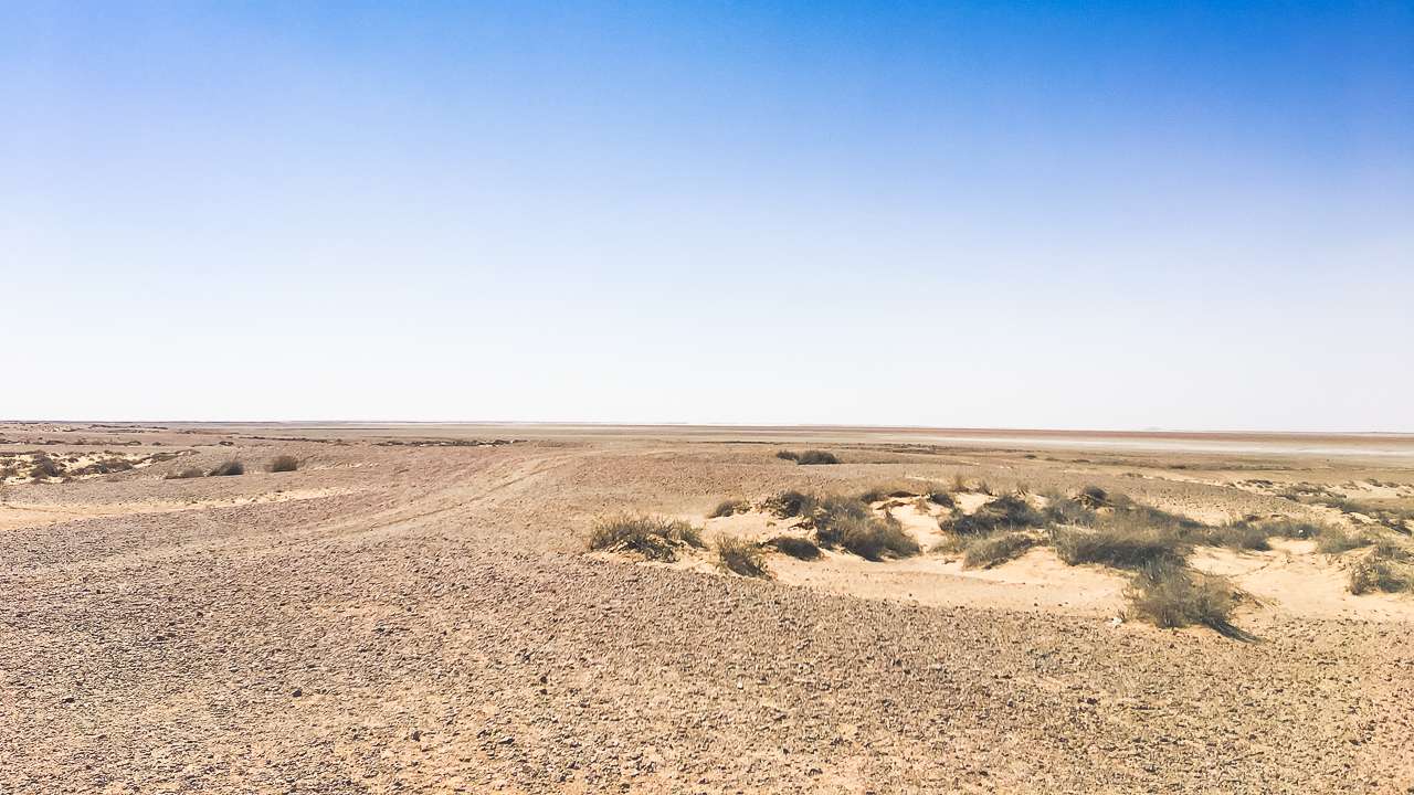
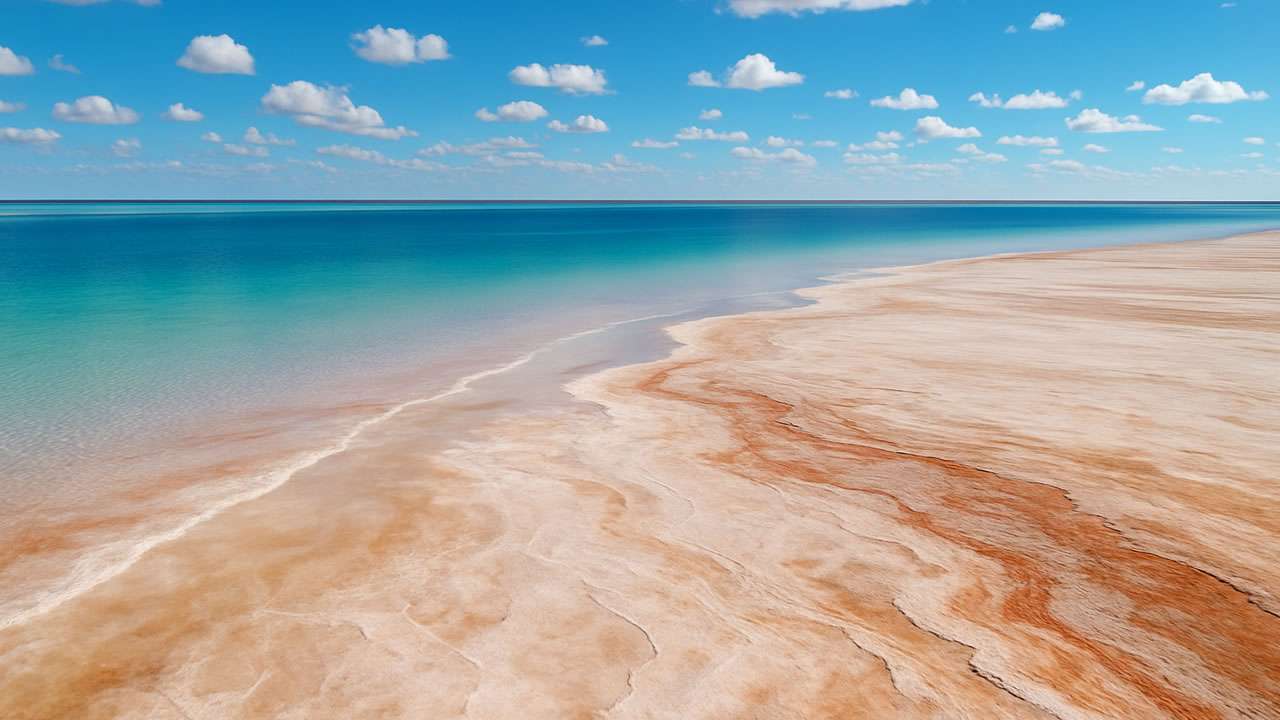
Kati Thanda – Lake Eyre is currently in a rare major filling event, with water covering an estimated 70 – 80% of the lake. Levels have already matched the 2025 peak of around 2.2 metres, and with more inflows expected, conditions are rapidly evolving. Experts suggest the lake could approach full capacity – something not seen since 1974. For travellers, this is one of the best times to consider visiting. Significant water levels bring birdlife, reflections and a completely different landscape – but access, viewing conditions and timing will be critical to getting the most out of the experience.

Bottom line: Lake Eyre is actively filling and conditions are changing fast – this is a rare window, but check latest access updates before planning your trip.

Introduction To Lake Eyre In Australia

Lake Eyre in Australia is the largest salt lake in the country and sits at the lowest natural point on the continent, about 15 metres below sea level. Located in the Far North of South Australia, it is approximately 700 kilometres north of Adelaide. The lake is renowned for its dramatic transformations – from a shimmering salt pan to a vast, shallow inland sea during rare flood events. Its official name, Kati Thanda–Lake Eyre, honours both its European and Aboriginal heritage, with native title held by the Arabana people.

Lake Eyre In Australia: Location And Geography

Where Is Lake Eyre In Australia?

Lake Eyre is situated in the Far North region of South Australia, within the arid heart of the continent. The lake’s coordinates are approximately 28°40′S 137°20′E. It lies about 647 to 718 kilometres north of Adelaide, depending on the access point. The nearest outback towns are Marree (about 134 kilometres south) and William Creek, both popular bases for Lake Eyre camping and scenic flights.

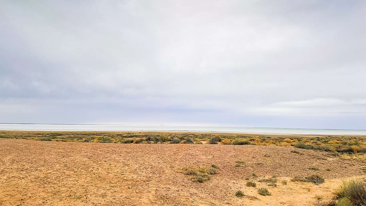
From The Lake Eyre Viewing Area In Aug 2022

From The Lake Eyre Viewing Area In Aug 2022

The Structure Of Lake Eyre

Lake Eyre is made up of two main basins: Lake Eyre North and Lake Eyre South. These are connected by the Goyder Channel, a 15-kilometre-long waterway. When full, the combined lake stretches up to 144 kilometres long and 77 kilometres wide, covering a surface area of up to 9,500 square kilometres. However, the lake is usually dry, with water only present after significant rainfall in its vast catchment area.

Feature Lake Eyre North Lake Eyre South Combined Lake Eyre
Surface Area (km²) 8,430 1,260 9,500
Length (km) ~144 ~144
Width (km) ~77 ~77
Depth When Full (m) Up to 4 Up to 4 Up to 4
Elevation (m below sea) -15 -15 -15

Kati Thanda Lake Eyre National Park

Kati Thanda Lake Eyre National Park: A Protected Icon

Kati Thanda Lake Eyre National Park encompasses the entire lake and much of the surrounding desert landscape. The park is managed for conservation and cultural heritage, reflecting its significance to the Arabana people and its unique ecosystem. The area is home to rare plants, wildlife, and, during flood years, becomes a haven for thousands of waterbirds.

Visiting The National Park

Access to Kati Thanda Lake Eyre National Park is typically via the Oodnadatta Track, with entry points at Halligan Bay and Level Post Bay. Facilities are basic, reflecting the remote and rugged nature of the region. Visitors should be well-prepared for self-sufficient travel, especially when planning Lake Eyre camping adventures.

Lake Eyre Camping: Outback Adventure

Lake Eyre Camping Options

Lake Eyre camping is a unique experience, offering a front-row seat to the stark beauty of the outback. The most popular camping area is at Halligan Bay, within Kati Thanda Lake Eyre National Park. This site provides basic toilets but no showers, water, or other amenities. Campers must bring all supplies, including drinking water, food, and fuel.

Other nearby options include bush camping along the Oodnadatta Track and more developed caravan parks in Marree and William Creek. These towns also serve as hubs for guided tours and scenic flights over Lake Eyre.

Tips For Lake Eyre Camping

  • Be Self-Sufficient: Carry all essentials, including water, food, and fuel.
  • Check Road Conditions: Outback roads can be closed after rain.
  • Respect The Environment: Leave no trace and respect cultural sites.
  • Prepare For Extremes: Temperatures can be extreme, especially in summer.

How To Get To Lake Eyre

How To Get To Lake Eyre: Routes And Travel Tips

Reaching Lake Eyre in Australia is an adventure in itself. Most travellers drive from Adelaide, heading north via Port Augusta and then either the Oodnadatta Track or the Birdsville Track. The roads are mostly unsealed and can be rough, so a high-clearance 4WD is recommended. Always check road conditions before setting out, as rain can make tracks impassable.

From The Lake Eyre Viewing Area In Oct 2019

From The Lake Eyre Viewing Area In Oct 2019

Main Access Routes

  • Oodnadatta Track: The most popular route, with access points at Marree and William Creek.
  • Birdsville Track: Connects from the north-east, joining the Oodnadatta Track near Marree.
  • Scenic Flights: Available from Marree, William Creek, and Coober Pedy, providing a bird’s-eye view of the lake.

Distance Table: How To Get To Lake Eyre

Starting Point Distance to Lake Eyre (km) Typical Route
Adelaide 647–718 Port Augusta, Oodnadatta Track
Marree 134 Oodnadatta Track
William Creek 60 Oodnadatta Track
Coober Pedy 220 William Creek, Oodnadatta Track

The Unique Nature Of Lake Eyre In Australia

An Ephemeral Wonder

Lake Eyre is classified as an endorheic lake, which means water flows in but never out – it only leaves through evaporation. The lake fills only occasionally, usually after heavy rainfall in the Queensland catchment area. When full, it becomes the largest lake in Australia, attracting a surge of birdlife and transforming the landscape into a temporary oasis.

Lake Eyre Flood Events – Lake Eyre To Flood In 2026

Lake Eyre has only filled completely a handful of times in the past century, with major floods recorded in 1950, 1974, 2011 and 2025. Even partial fills are rare and unpredictable, making each event a spectacle for visitors and wildlife alike. As of late April 2026 Lake Eyre looks very likely to flood again in 2026 with experts predicting it may even surpass the 1974 peak.

Aboriginal Heritage And Cultural Significance

The Arabana People And Kati Thanda

The traditional owners of Lake Eyre in Australia are the Arabana people, who know the lake as Kati Thanda. The area holds deep spiritual and cultural importance, featuring in Dreamtime stories and serving as a meeting place for generations. In 2012, native title was formally recognised, and the dual name Kati Thanda – Lake Eyre was adopted.

Wildlife And Birdwatching

Birdlife Bonanza

During flood years, Lake Eyre becomes one of Australia’s most important breeding grounds for waterbirds, including pelicans, banded stilts, and gulls. The transformation from salt pan to inland sea draws thousands of birds from across the continent, providing a rare opportunity for birdwatchers and photographers.

Lake Eyre In Australia: Climate And Best Time To Visit

Outback Weather

Lake Eyre sits in Australia’s driest region, receiving only about 100 millimetres of rain per year. Summers are scorching, with daytime temperatures often exceeding 40°C. The best time to visit is during the cooler months from April to October, when conditions are more comfortable for camping and exploring.

Practical Tips For Caravanners And Campers

Essential Preparation

  • Vehicle: A well-maintained 4WD is recommended for outback tracks.
  • Supplies: Stock up on food, water, and fuel in Marree or William Creek.
  • Permits: Check if park entry or camping permits are required.
  • Safety: Carry a satellite phone or EPIRB for emergencies.
  • Respect: Honour the cultural significance of Kati Thanda and follow park guidelines.

Lake Eyre In Australia: A Must See For Adventurers

Lake Eyre in Australia is a destination like no other. Its remote beauty, cultural heritage, and rare natural phenomena make it a bucket-list stop for caravanners and campers. Whether you’re marvelling at the endless salt flats, camping under the stars, or witnessing a rare flood, Kati Thanda–Lake Eyre promises an unforgettable outback adventure.

Where Is Lake Eyre In Australia

Where Is Lake Eyre In Australia

References

Artesian Bore Baths Lightning Ridge NSW: What Is It Really Like?

Artesian Bore Baths Lightning Ridge NSW: What Is It Really Like?

Artesian Bore Baths Lightning Ridge NSW: What Is It Really Like?

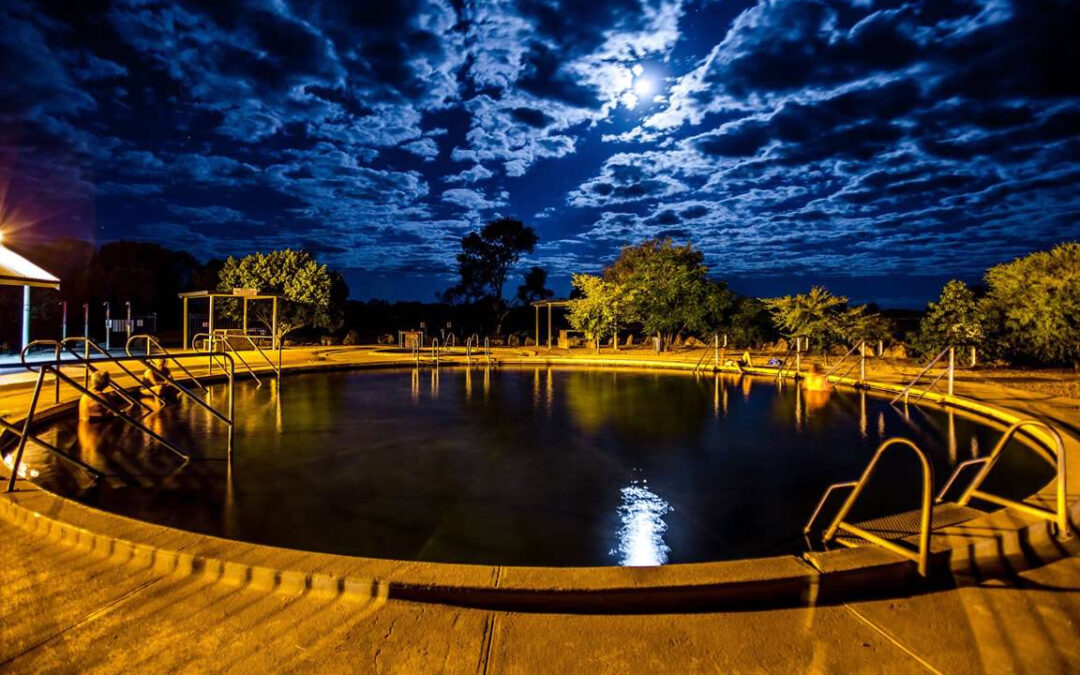
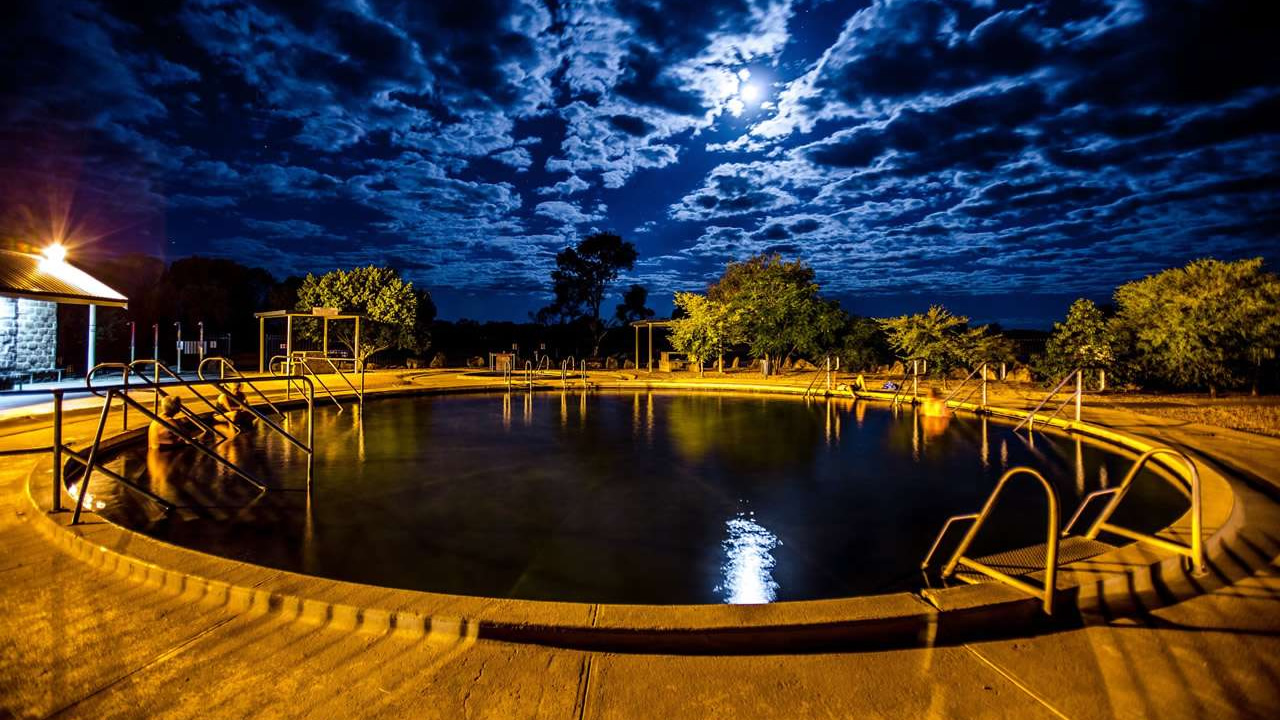
Artesian Bore Baths Lightning Ridge NSW is a free, open air artesian spa sitting on Pandora Street, a short drive from the town of Lightning Ridge in outback New South Wales. The baths are open 24 hours a day, every day, with cleaning breaks on Monday, Wednesday, and Friday from 10:00 am to 12:00 noon. Water flows at about 41.5°C, usually between 40 – 50°C, so it feels properly hot rather than just warm. The site is unattended, with basic showers and a simple change area, and entry is free for all visitors. It suits anyone looking for a quiet soak, a health style dip, or a unique outback experience without a big budget.

What The Artesian Bore Baths In Lightning Ridge NSW Actually Are

The baths are a large open air spa filled with natural artesian water from deep underground. The water comes from the Great Artesian Basin,which lies under a big part of inland Australia. That water is often said to be about two million years old. Once it reaches the surface at Lightning Ridge it flows into the pool and stays warm without needing heaters. Visitors can soak in hot mineral rich water at no charge. The site suits people who want a quiet retreat, a health style soak, or just a different way to spend time in the outback.

Lightning Ridge Artesian Bore Baths NSW

Lightning Ridge Artesian Bore Baths NSW

Artesian Bore Baths Lightning Ridge NSW

The baths are on Pandora Street, roughly a couple of kilometres out from the main town strip. You follow signposts from the town centre, then drive down a sealed road until you see the circular pool in the bush.

The main feature is a big circular spa with steps leading into the water. Around the edge you will find basic seating, some shade, and a couple of showers to rinse off afterwards.

Amenities are simple and match the outback feel. There is no reception, no ticket desk and no fee; you just arrive, have a quick rinse off in the shower block then climb in and use the pool.

Lightning Ridge Bore Baths

The Lightning Ridge Bore Baths are one of the better known free artesian baths in western NSW. Unlike private resorts, they stay open around the clock and welcome everyone including late night visitors.

The biggest draw is the heat and mineral content of the water. After a long drive or a busy day, many people find their shoulders, back, and legs feel looser after 10 to 15 minutes in the water.

There is also a friendly social side. You might see locals, opal fossickers and other visitors sitting on the edge, chatting or just soaking quietly.

How The Water Works

The water comes from the Great Artesian Basin, a huge underground reservoir under much of inland NSW and beyond. Drillers tap into it so that natural pressure pushes the water to the surface without pumps.

The same system feeds bore baths in nearby towns like Walgett and Burren Junction. Efforts now focus on rehabilitating old bores so the water still flows but does not waste groundwater.

The water is slightly mineralised, which gives it a soft, almost silky feel on the skin. Because of the minerals, it is best not to soak for very long; many similar sites suggest about 20 minutes per session.

Water Temperature: What To Expect

The bore head temperature at Lightning Ridge is usually about 41.5°C, with most sources quoting a range of 40–50°C. This means the water feels quite hot, especially compared with nearby Walgett baths at 38–40°C.

The heat can irritate sensitive skin if you stay in too long. If you are not used to hot springs, it helps to sit on the steps first, let your legs warm slowly, then move deeper once you adjust.

On cool nights, steam rising off the pool gives the place a natural outback spa feel. On hot days, the main benefit is easing muscle tension rather than cooling down.

How Amanda And I Use The Artesian Bore Baths Lightning Ridge NSW

Amanda and I have visited Artesian Bore Baths in Lightning Ridge NSW many times and we’ve worked out how to use the baths to best suit us. First up we have a rinse under the shower in the shower block.

When we first get in we sit with on the top step with just our feet in for a few minutes. Then we move down to the next step for a bit then back up to the top. We keep getting in a step lower each time then moving back up. Eventually we end up on one of the lower steps with just our heads above the water. Then we continue the cycle again for as long as we like.

I even like to go for a bit of a swim, diving under for a bit of an underwater swim although I do always keep my eyes closed. Amanda finds the water a bit too hot to go for a swim.

When we’re finished we have a rinse of under the shower.

Opening Times And Practicalities

The Lightning Ridge Bore Baths are officially open 24 hours a day, every day of the year. They close only for cleaning on Monday, Wednesday, and Friday from 10:00 am to 12:00 noon.

This means you can visit whenever you like. If you stay in town or nearby, an early morning or late night dip is easy to fit in.

Artesian Bore Baths Lightning Ridge NSW Compared To Other Nearby Bath Sites

The table below shows how Lightning Ridge compares with two nearby bore bath towns.

Feature Lightning Ridge Bore Baths Walgett Bore Baths Burren Junction Baths
Typical water temperature 40–50°C (around 41.5°C) 38–40°C Similar to Walgett
Age of water (approx.) About 2 million years About 2 million years About 2 million years
Opening hours 24/7, cleaning 10–12 MWF Daytime access Daytime access
Entry cost Free Free Free
Main appeal Very hot soak, open air, social vibe Milder warmth Milder and quieter

Tips For Visitors

Bring your swimmers, a towel and a bottle of water. Sitting in the bore bath can be dehydrating and sipping water will help you avoid this. After a drive or a long day, you can grab a snack or drink from town and sit by the picnic style spots near the baths.

Because the water is very hot, it is wise to keep your first soak short, about 10 to 15 minutes. If you feel dizzy, nauseous, or very flushed, step out, cool yourself off then sit in the shade for a few minutes before deciding whether to go back in.

If you visit with a partner or family, someone can keep an eye on kids or less mobile people in the shallower edges. The stairs into the water are simple and uncovered, so taking your time while entering and exiting is a good idea.

Why The Artesian Bore Baths Are a Must Visit On A Trip To Lightning Ridge

The Artesian Bore Baths Lightning Ridge are more than just a quirky stop. They offer a simple way to relax, unwind, and feel the effects of heat and minerals without booking a spa or paying extra fees.

The steady 41.5°C warmth helps loosen stiff joints and relax tired muscles after hours on the road. At the same time, the low cost and open access make it easy to fit the baths into a relaxed travel itinerary.

Every time we visit, the mix of hot water, simple setup, and outback feel makes it feel like a small luxury that costs nothing. Whether you come once or several times, the baths become a quiet highlight of a trip to Lightning Ridge.

Final Thoughts On Artesian Bore Baths Lightning Ridge NSW

Whether you visit once or plan to come back, the Artesian Bore Baths Lightning Ridge offer a relaxed, free, and memorable outback experience. You do not need special gear, bookings, or a big budget; just your swimmers, common sense about the heat, and an openness to enjoy a relaxing soak. The site fits neatly into a broader outback travel plan, especially one that includes other Great Artesian Drive locations. Next time you pass through Lightning Ridge a quick stop at the bore baths can be the difference between feeling worn out and arriving actually relaxed.

For more information on Australia’s Artesian Bore Baths & Mineral Springs we have a list of all of them including a map.

Frequently Asked Questions About The Artesian Bore Baths Lightning Ridge NSW

Where are the Artesian Bore Baths Lightning Ridge NSW located?

The Artesian Bore Baths Lightning Ridge NSW are located on Pandora Street, a short drive out of the town of Lightning Ridge in outback New South Wales. You can follow the roadside signs from the town centre to reach the site.

Are the artesian bore baths free to use?

Yes, the Artesian Bore Baths Lightning Ridge NSW are free to use. There is no entry fee, and the site is unattended, so you can arrive, change, and use the baths without paying anything.

What are the opening hours for the Lightning Ridge bore baths?

The Lightning Ridge Bore Baths are open 24 hours a day, seven days a week. They close briefly for cleaning on Monday, Wednesday, and Friday from 10:00 am to 12:00 noon, but you can still visit outside those times.

How hot is the water in the artesian bore baths?

The water at the Artesian Bore Baths Lightning Ridge NSW is around 41.5°C, usually between 40–50°C. This makes the water feel properly hot, so it is best to ease in and keep your first soak relatively short.

Do I need to bring anything to use the bore baths?

You should bring a swimsuit, towel, and maybe a small bottle of fresh water to keep you hydrated. There are basic showers and a change area on site, but amenities are simple and not designed for long term stays.

Is it safe for children and older visitors to use the bore baths?

Most people can use the bore baths safely, but the water is hot and mineral rich, so children and older visitors should enter slowly and limit their time in the pool. If anyone feels dizzy, unwell, or overheated, they should step out and cool down immediately.

Disclaimer: This article is provided for general information purposes only and is not intended as professional advice. Visitors to the Artesian Bore Baths Lightning Ridge NSW are responsible for their own safety and wellbeing. You should assess your own health, comfort level with hot water, and any personal circumstances before entering the baths. Always supervise children closely, follow local signage and safety rules, and leave the water immediately if you feel unwell, dizzy, or uncomfortable. Conditions such as opening hours, facilities, and water temperature may change without notice, so it is your responsibility to check the latest information before visiting. The authors and publishers do not accept liability for any injury, loss, or damage arising from reliance on the information in this article or from visiting the Lightning Ridge bore baths.
Barmedman Mineral Pool – Australia’s Bright Blue Inland “Beach”

Barmedman Mineral Pool – Australia’s Bright Blue Inland “Beach”

Barmedman Mineral Pool – Australia’s Bright Blue Inland “Beach”

Quick Summary: Barmedman Mineral Pool is a large, mineral swimming area surrounded by a simple shaded reserve about halfway between Temora and West Wyalong. It operates roughly from October to April and is ideal for tired travellers and families needing a swim and a cheap overnight stop. Camping on site costs $10 per vehicle per night, making it excellent value for caravanners and campers.

What Is Barmedman Mineral Pool?

Well for starters it isn’t a “beach” but it sure as anything is bright blue and inland! I just chucked in the beach bit to see if you were paying attention. Wagga Beach on the other hand…

Anyway, you’ll find Barmedman Mineral Pool on Nobbys Road just off the main strip in the village of Barmedman located in The Bland Shire. It lies about 110 km north of Temora and 100 km south of West Wyalong. It’s about 90km from our home in Cootamundra which is why we call in there for a swim a few times every summer.

Originally it formed after an underground stream flooded old gold mine workings, and locals later turned it into a purpose built public pool.

The water is cool and naturally rich in minerals, often compared to a mild Epsom salt style soak. Many visitors say it eases sore muscles and aches after long dusty drives, which is handy for grey nomads and campers. I personally find that the water feels incredibly soft and smooth. I also find that the water is very easy to float in, I could just lie on my back or on my front and bob around all day if I wanted to.

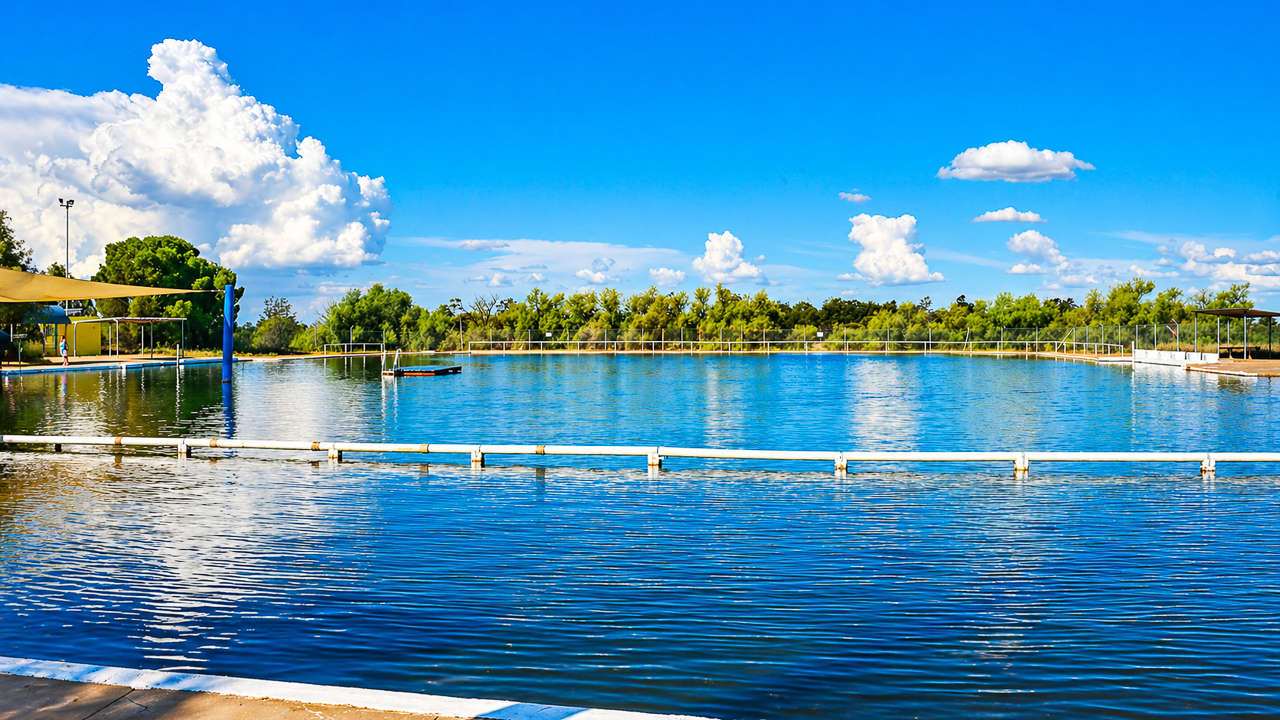
The pool itself is about 100m long and 60m wide making it one of the largest mineral pools in the world. It sits inside a four hectare reserve with grassy lawns, trees and picnic areas so you can rest in the shade while kids run around.

Barmedman Mineral Pool

Barmedman Mineral Pool

Opening Hours And Dates

Barmedman Mineral Pool is not open all year. The usual season runs from around October to April, with the pool filled in October and drained in April.

During this season, opening hours are generally daytime only, often from early morning until late afternoon or early evening. Exact daily hours can change, so it is best to check the local Facebook page or the Barmedman community noticeboard before you drive out.

The pool is closed in winter, roughly from May to October so it suits caravanners planning summer or shoulder trips through the Riverina. If you arrive in the coldest months you can still wander around the reserve but you will not be able to swim.

Pool Entry Costs And Facilities

Swimming entry at Barmedman Mineral Pool is effectively free, with no official ticket booth or fixed fee. Users are encouraged to respect the place and its facilities, but there is no swimming charge. Amanda and I always put $5 each in the donation box when we go for a swim. It’s a great facility and we like to think that our donation contributes to it’s upkeep.

Inside the reserve you will find basic but very functional amenities. Change rooms, toilets and barbecues are available to keep day‑visitors comfortable.

There is also a small kiosk that usually opens in the warmer months, selling drinks and simple supplies. Shade is plentiful, and the grassy banks are popular for picnics and family gatherings.

Barmedman Mineral Pool Camping

Barmedman Mineral Pool Camping sits right next to the reserve, making it easy to walk from your van to the water. The site is run by volunteers from the local community which explains the low price and friendly atmosphere.

Camping is available all year, even while the pool is drained in winter. The typical fee is around $10 per vehicle per night, whether you have a caravan, camper trailer or tent.

Facilities are simple but practical. You can expect toilets, cold showers, and sometimes a hot shower you can pay a small coin for, such as $1.

There are bins and barbecues, which helps keep the site tidy given how many road trip travellers stop over. The whole setup is peaceful, with little more than a low fence and a gate to mark the camping area.

Barmedman Mineral Pool Entry Gates

Barmedman Mineral Pool Entry Gates

Barmedman Mineral Pool Donation Camping

Barmedman Mineral Pool Donation Camping is the same site just described, but highlighting the “donation based” feel of the $10 per night fee. The word “donation” reflects that the money supports volunteers who maintain the toilets, showers and grounds.

Because the site is so affordable attracts younger families and budget conscious campers. Volunteers mention that around $10 per vehicle per night helps cover water, power and basic upkeep.

This donation model is common in small country towns, where locals rely on community goodwill rather than big council budgets. In practical terms, you still pay each night but your money is helping keep a rural facility alive rather than lining corporate pockets.

Comparing Barmedman To Other Riverina Stops

Barmedman Mineral Pool and camp sit in a different league from many newer, powered‑site caravan parks. Below is a simple comparison to help you gauge what you gain and what you give up.

Feature Barmedman Mineral Pool (Camping + Pool) Typical Powered Caravan Park (Riverina)
Nightly camping cost About 10 AUD per vehicle Often 30–60 AUD or more per night
Pool entry cost Free Often included in higher site fee or extra
Power hook‑ups None Usually available
Showers Basic cold, coin‑hot option Multiple hot showers included
Atmosphere Quiet, community‑run, rustic More commercial, busier peak times
Seasonal availability Pool: Oct–Apr; camping: year‑round Generally year‑round

Barmedman suits travellers who want low cost a genuine artesian type pool experience. Caravan parks suit those who need electricity, dump points and more structured facilities.

Why Caravanners Keep Coming Back

The $10 camping donation is an easy decision when you are counting coins. You can sleep close to the water, walk straight to the pool in the morning and still be back on the road early if you need to.

It is also pet friendly, at least for camping so long as animals stay out of the main pool area.

Practical Tips For Your Visit

If you are planning a stop at Barmedman Mineral Pool, check the current status on the local Facebook page or the town noticeboard. Different volunteer groups sometimes tweak days or hours, so a quick check can save you a wasted detour.

Bring sun protection, towels, and your own snacks, even if the kiosk is open. The nearest town with full shops is Temora, about 35 – 40 minutes away by car.

Wrapping Up

Barmedman Mineral Pool is one of those quiet unpretentious places that matter more to some caravanners than flashy brochure style parks. It offers a simple, low cost swim and a cheap, clean overnight campsite.

If you are travelling between Temora and West Wyalong and want to stretch your legs, have a swim in the mineral pool and rest for a night, Barmedman is a great stop.

For more information on Australia’s Artesian Bore Baths & Mineral Springs we have a list of all of them including a map.

Going For A Swim At The Barmedman Pool On A Degree Day January

Going For A Swim At The Barmedman Pool On A 44 Degree January Day

Frequently Asked Questions About Barmedman Mineral Pool

Is the Barmedman Mineral Pool ever open in winter?

The pool is not open in winter, as it usually runs from October to April only. The reserve and camping area are available year round, but the pool is drained during the colder months.

Are there facilities for campers at Barmedman Mineral Pool?

Yes, there is a small camping area next to the reserve with toilets, cold showers and sometimes a coin‑operated hot shower. You can also use nearby barbecues and bins, but there are no powered sites.

Do I have to pay to swim in the mineral pool?

No, there is no fixed entry fee to swim. The pool is free to use, though visitors are encouraged to respect the site and keep it clean.

How much does it cost to camp at Barmedman Mineral Pool?

Camping usually costs around $10 per vehicle per night. This covers a basic, volunteer‑run site with simple facilities and easy access to the pool during the warmer months.

Can dogs camp at Barmedman Mineral Pool?

Yes, pets can usually camp on site as long as they are kept under control. Dogs are generally not allowed in the main pool area, but check the latest local notices before you arrive.

What should I bring for a day trip to Barmedman Mineral Pool?

Bring swimwear, towels, sunscreen, drinking water and snacks. There is often a small kiosk in the warmer months, but it is wise to carry your own supplies since the nearest full shops are in Temora.

Pin It on Pinterest