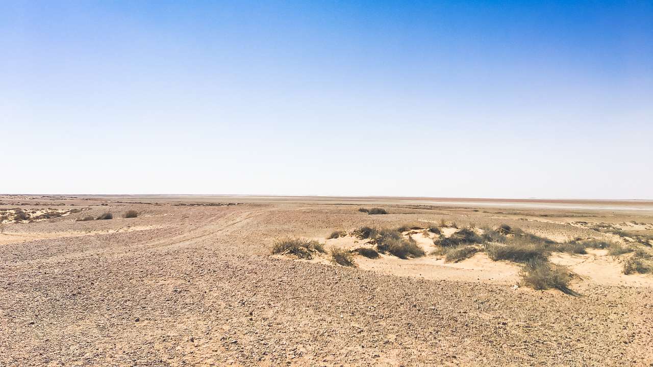
Discover Australias top artesian bore baths and mineral springs complete with handy map – perfect for your next caravan or camping adventure. Australia’s vast outback conceals a remarkable secret beneath its surface – the Great Artesian Basin, home to numerous thermal springs and bores that provide some of the most unique bathing experiences in the world.
Have you ever wondered where you can soak in ancient, mineral rich waters beneath the Australian sky?
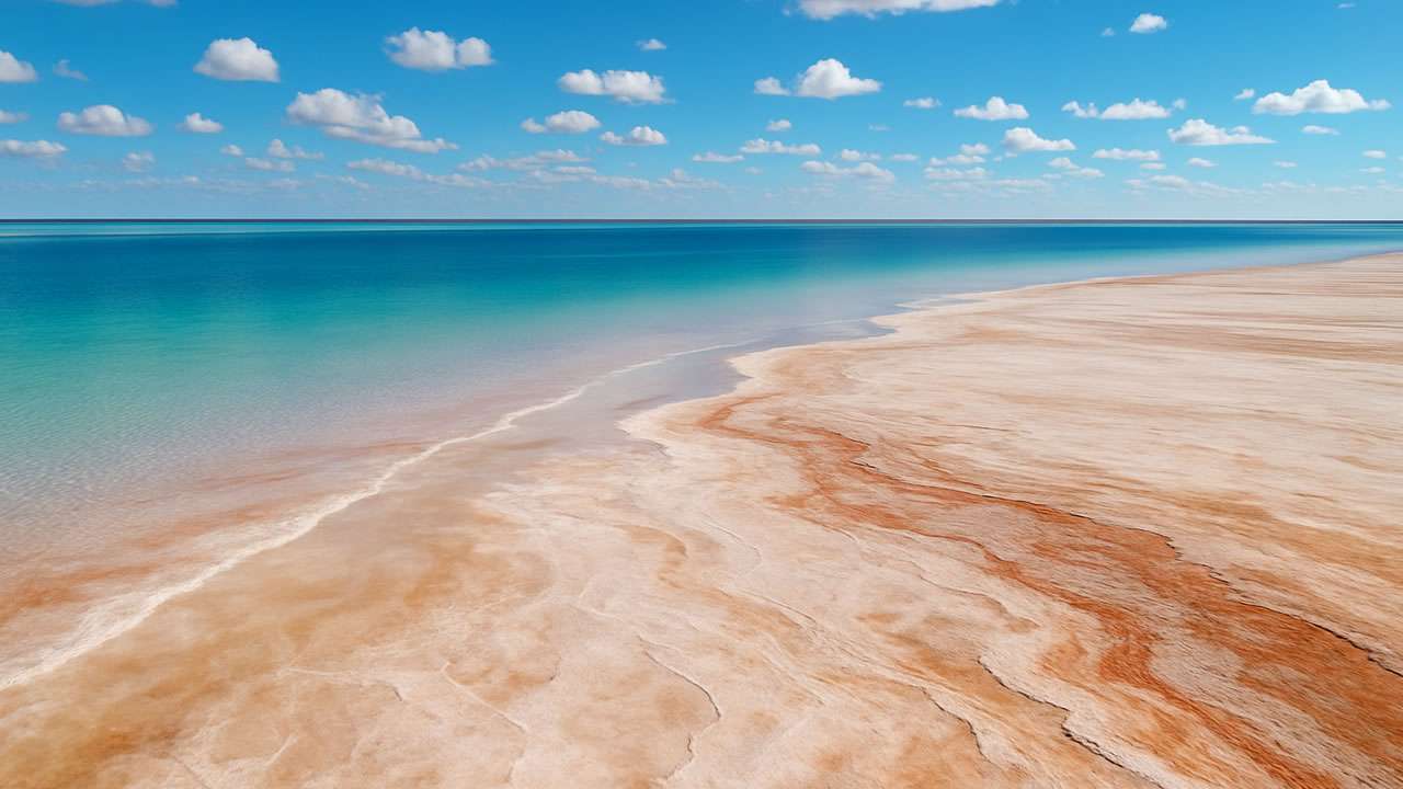
Australia’s artesian bore baths and mineral springs offer a unique chance to relax in naturally heated pools, with water drawn from deep underground aquifers like the Great Artesian Basin – some of it up to two million years old. These soothing spots are renowned for their therapeutic benefits and are popular stops for caravan and camping travellers seeking outback serenity and a memorable soak.
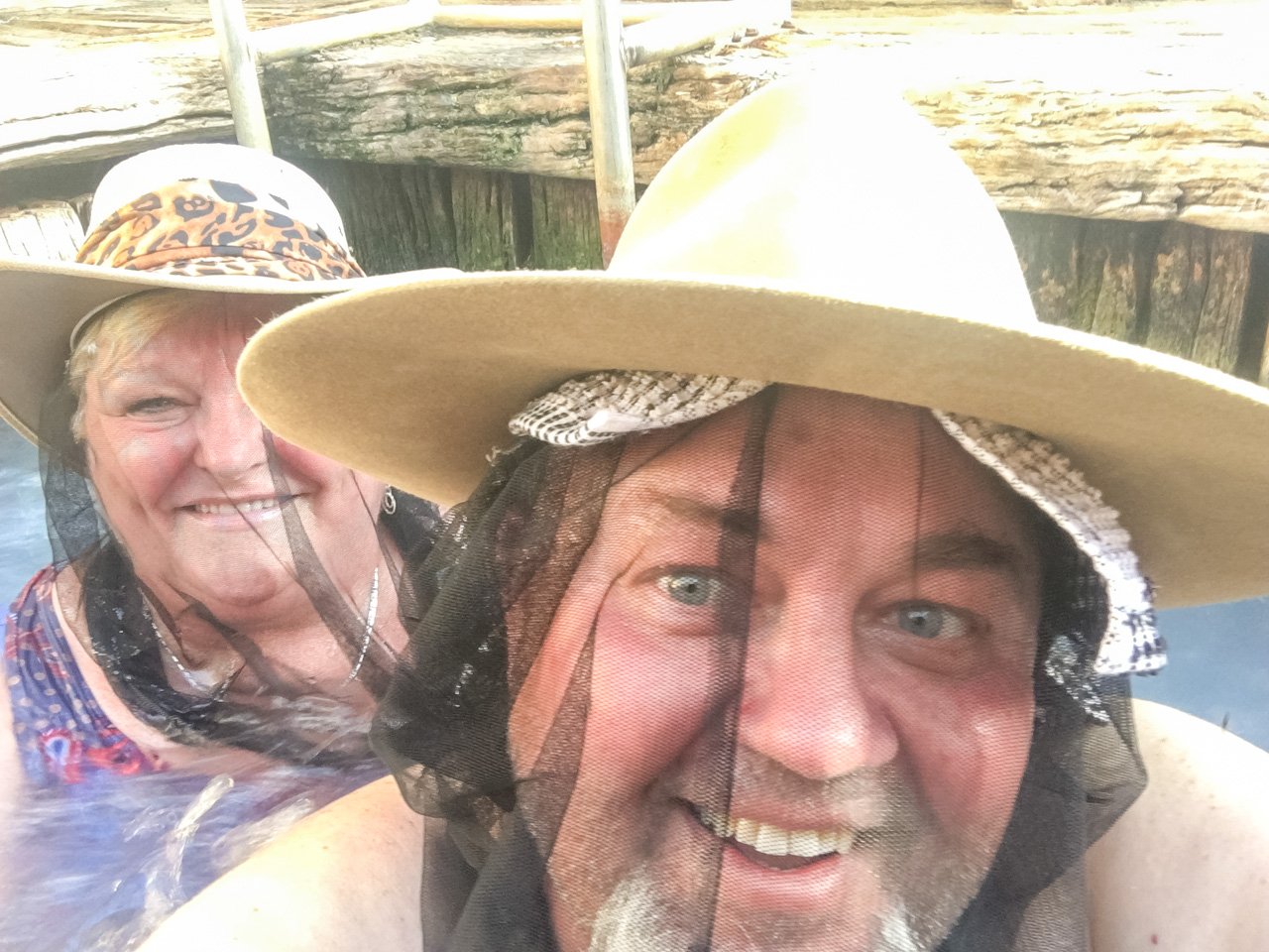
For caravan and camping enthusiasts, Artesian Bore Baths represent an extraordinary attraction, offering relaxation, rejuvenation and relief after long journeys across the country’s expansive landscapes. The healing properties of these natural thermal waters have drawn visitors for generations, creating a tradition of wellness that continues to thrive today.
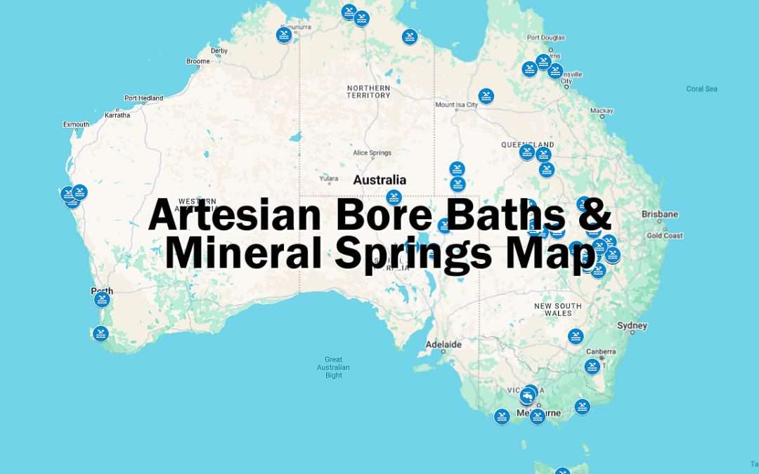
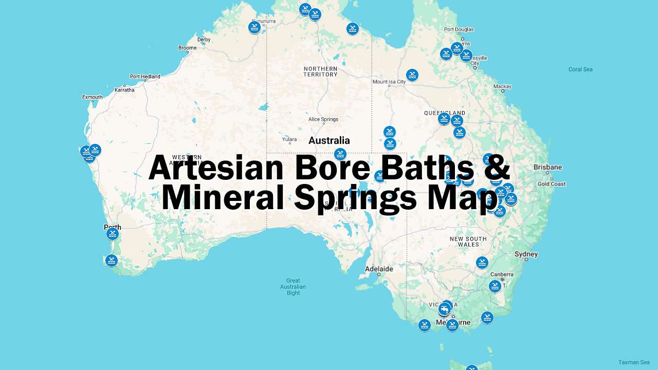
Artesian Bore Baths Location Map – Map Includes Mineral Springs
Artesian Bore Baths And Mineral Springs by State: Your Perfect Caravan Camping Stops
If you’re dreaming of soaking your cares away under wide open skies, Australia’s artesian bore baths and mineral springs offer the perfect escape for caravan and camping travellers. Fed by the ancient waters of the Great Artesian Basin and other natural aquifers, these thermal pools are scattered across the country – each promising a unique blend of relaxation, outback scenery, and a touch of local history. Whether you’re after the therapeutic benefits of mineral rich waters or simply looking for a memorable stop on your next road trip, this state-by-state guide will help you discover some of Australia’s most inviting hot springs and artesian baths – many with campgrounds right next door for the ultimate soak and stay experience.
NSW – New South Wales Artesian Bore Baths And Mineral Springs
1. Artesian Spa Motel
The famous Moree Bore (Bore Baths) was completed in 1895. People from all over the world have enjoyed the healing qualities of the natural hot mineral springs for over one hundred years.
Address: 2 Boggabilla Rd, Moree, NSW 2400
View On Map: Google Maps
GPS: -29.458737574528836, 149.84296653897746
Phone: 02 6752 2466
Website: https://artesianspamotel.com.au/
2. Barmedman Mineral Pool
Barmedman Mineral Pool is a large relaxing cold water pool with a naturally high mineral content.
Address: Nobbys Rd, Barmedman, NSW 2668
View On Map: Google Maps
Email: barmedmanpool@gmail.com
Website: https://www.facebook.com/barmedmanmineralpool/
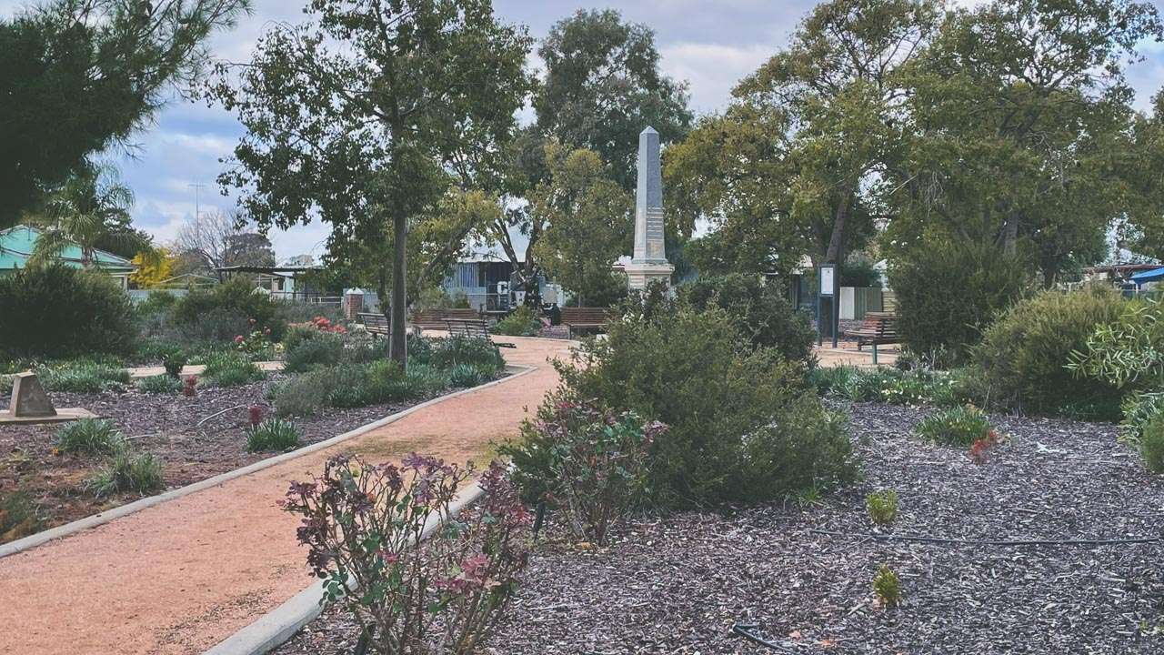
War Memorial Park In Barmedman
3. Boomi Artisian Spa Pools
The Boomi Artesian Pool draws artesian water from a depth of 1,222 metres and has been used to swim in since its construction in 1905. Construction of the present day baths was commenced in 1975 and the latest addition of the spa baths was in 1996.
Address: Boomi St, Boomi, NSW 2405
View On Map: Google Maps
GPS: -28.724929739484086, 149.57828765429144
Phone: 02 6753 5336
Website: https://www.moreetourism.com.au/
4. Burren Junction Bore Baths
The Burren Junction Bore Baths and Camp Ground are located in a rural setting, 100 metres off the Kamilaroi Highway on a sealed road. The baths are open 24 hours a day, seven days a week (may close seasonally) and are a popular meeting place for locals and visitors. The artesian water flowing from the bore maintains a constant temperature of approximately 36 degrees Celsius and contains reputed therapeutic qualities that relieve aching muscles.
Address: Kamilaroi Hwy, Burren Junction, NSW 2386
View On Map: Google Maps
GPS: -30.113182039281906, 148.995878883175
Email: admin@walgett.nsw.gov.au
Phone: 02 68286100
Website: https://www.walgett.nsw.gov.au/Departments/Infrastructure-Compliance/Swimming-pools-bore-baths/Burren-Junction-Bore-Baths
5. Collarenabri Artesian Hot Spring
[CURRENTLY CLOSED] Collarenebri Artesian Bore Bath was funded as part of the Murray Darling Basin Economic Development Program and seen as a significant opportunity for the local community, aiming to revitalise the Collarenebri economy and boost tourism in the town.
Address: 6 Wilson St, Collarenabri, NSW 2833
View On Map: Google Maps
GPS: -30.113154196789747, 148.99586815434012
Phone: 02 6828 6139
Website: https://www.nsw.gov.au/visiting-and-exploring-nsw/locations-and-attractions/collarenebri-bore-bath
6. Dragon Pheonix Resort
The property features open-air artesian thermal pool along with our salt water swimming pool, perfect for relaxation. The outdoor artesian thermal pool, with a temperature of 38 to 40°C and the refreshing swimming pool are both fully open and ready for guests to enjoy.
Address: 361 Frome St, Moree, NSW 2400
View On Map: Google Maps
GPS: -29.47576769240387, 149.8429222831525
Email: info@phoenixresort.com.au
Phone: 0409 981 172
Website: https://www.phoenixresort.com.au/
7. Goodooga Artesian Spa
Goodooga Artesian Springs are a serene oasis that promises relaxation and rejuvenation in the heart of the outback. Nestled in the picturesque landscape of western New South Wales, our artesian springs offer a unique experience for those seeking tranquillity and wellness.
Address: Queensland St, Goodooga, NSW 2838
View On Map: Google Maps
GPS: -29.1099185024653, 147.45826142546997
Email: info@brewarrina.nsw.gov.au
Phone: 02 6830 5100
Website: https://visitbrewarrina.com.au/goodooga-artesian-springs/
8. Gwydir Thermal Pools
The artesian thermal mineral pools are what brings many of their guests from far and wide . They have 5 fully tiled Artesian pools ranging from 39 to 34 degrees Celcius and a 25 metre Artesian lap pool kept at about 29 degrees . All of their pools are for exclusive use of their guests at no extra charge.
Address: 4 Amaroo St, Moree, NSW 2400
View On Map: Google Maps
GPS: -29.4850202970618, 149.8495019831528
Email: enquiries@gwydircarapark.com.au
Phone: 02 6752 2723
Website: https://www.gwydircarapark.com.au/
9. Hot Springs Pools & Units
Hot Springs Pools and Units love seeing their guests smile. There is nothing quite as relaxing and therapeutic as a soak in their Artesian Thermal Pool. As a guest you get to use the pool for free. Their 25 metre fully tiled pool has plenty of seating benches, water jets and water curtains to help maximize your Artesian Thermal Water experience. The pool is filled with pure Artesian water from the Great Artesian Basin and is drawn from 2,400 feet below the ground where it’s naturally warmed by the heat inside the earth. The high mineral content of the Artesian Thermal Water is absorbed from the earth as the water filters down to the lower areas of the basin. This process occurs very slowly which means that the water extracted from the basin to fill their pools may not have seen daylight for millions of years.
Address: Jones Ave, Moree, NSW 2400
View On Map: Google Maps
GPS: -29.480057361375177, 149.84230655431787
Email: enquire@hotspringspoolandunits.com.au
Phone: 02 6752 2723
Website: https://www.hotspringspoolandunits.com.au/
10. Lightning Ridge Bore Baths
The Lightning Ridge open-air Artesian Baths were opened in 1962. The Artesian Baths are free of charge and open 24 hours a day 7 days a week (Closed for cleaning Monday, Wednesday & Friday between 10 am-12noon). The Bore Baths are a popular meeting place for locals and visitors to bathe, relax and socialise.
Address: Pandora St, Lightning Ridge, NSW 2834
View On Map: Google Maps
GPS: -29.422487949453384, 147.99787658315054
Phone: 02 6828 6100
Website: https://www.explorelightningridge.com.au/Things-To-Do/Hot-Artesian-Bore-Baths

Lightning Ridge Artesian Bore Baths
11. Moree Artesian Aquatic Centre
The Moree Artesian Aquatic Centre is nature’s magic at work! The Moree Artesian aquatic centre is the region’s premier health and wellness centre. Home to Artesian water, it attracts both domestic and international travellers that come for the healing properties of the water. Open all year round as a family friendly facility that welcomes all.
Address: 20 Anne St, Moree, NSW 2400
View On Map: Google Maps
GPS: -29.47390114833185, 149.84666182732678
Phone: 02 6752 2272
Website: https://www.moreeartesianaquaticcentre.com.au/
12. Moree Tourist Park
Swimming pool & therapeutic hot pools. Please note: therapeutic hot pools are adults only.
Address: 28 Oak St, Moree, NSW 2400
View On Map: Google Maps
GPS: -29.470823301239157, 149.85056386596858
Email: stay@moreetouristpark.com.au
Phone: 02 6752 7188
Website: https://moreetouristpark.com.au/
13. Mungindi Swimming Pool
Artesian Water – Rest and rejuvenate in an ambience created by nature at the Mungindi Swimming Pool Complex.
Address: Bucknell St, Mungindi, NSW 2406
View On Map: Google Maps
GPS: -28.97984962600047, 148.99271692546546
Email: info@moreetourism.com.au
Phone: 02 6753 2347
Website: https://www.moreetourism.com.au/directory/128601/mungindi-hot-pool
14. Pilliga Artesian Bore Bath
Soak away those aches and pains in the 37-degree mineral-rich water of the Pilliga Artesian Bore Bath. It has become a popular recreational spot for swimming and camping, with the therapeutic value of the water having long been recognised by locals and visitors who make regular pilgrimages to the Bath. Open 24hrs a day, relax in the bath and enjoy the sunsets and serenity that Pilliga is known for.
Address: Narrabri Rd, Pilliga, NSW 2388
View On Map: Google Maps
GPS: -30.355082408515955, 148.90698866968842
Email: tourism@narrabri.nsw.gov.au
Phone: 02 6799 6760
Website: https://explorenarrabriregion.com.au/narrabri-directory/pilliga-hot-artesian-bore-baths/
15. Walgett Bore Baths
The original Walgett Bore Baths were located in Dewhurst Street and officially opened on the 8th of December 1933. The bore baths proved extremely popular from the start, particularly in the evening. Between the 8th and 17th December 1933, 1047 people passed through the turnstile. The current Bore Baths located on the corner of Montkeila and Fox Streets was opened in 1988 and built as part of the Bi Centenary celebrations. The water in Walgett Bore Baths, comes from the Great Artesian Basin and is approximately two million years old. Natural pressure sends the water to the surface through an artesian bore and it maintains a constant temperature of 38-40 degrees Celsius. The warm artesian waters are rich in potassium salts, which are reputedly therapeutic for tired and aching muscles.
Address: Montkeila St/Castlereagh Hwy, Walgett, NSW 2832
View On Map: Google Maps
GPS: -30.016419417421243, 148.11680876783208
Phone: 02 6828 6100
Website: https://www.explorelightningridge.com.au/Things-To-Do/Hot-Artesian-Bore-Baths
16. Yarrangobilly Caves Thermal Pool
Take the short Yarrangobilly Caves thermal pool walk and enjoy a swim in the spring-fed natural pool. It’s easily combined with a picnic, bushwalk or cave tour in the Yarrangobilly area of Kosciuszko National Park.
Address: Thermal Pool Walk, Yarrangobilly, NSW 2720
View On Map: Google Maps
GPS: -35.73105163522771, 148.48599452366827
Email: parks.info@environment.nsw.gov.au
Phone: 1300 072 757
Website: https://www.nationalparks.nsw.gov.au/things-to-do/walking-tracks/yarrangobilly-caves-thermal-pool-walk
NT – Northern Territory Artesian Bore Baths and Mineral Springs
17. Berry Springs Nature Park
Berry Springs is one of the most beautiful parks to cool off and relax in close to Darwin. It has great shaded picnic and barbeque areas close to clear swimming pools surrounded by trees and aquatic life.
Address: Berry Springs Nature Reserve, Berry Springs, NT 0837
View On Map: Google Maps
GPS: -12.702141864920096, 130.99759496736257
Phone: 08 8999 4555
Website: https://nt.gov.au/parks/find-a-park/berry-springs-nature-park
18. Bitter Springs
Bitter Springs is one of two natural thermal pools in Elsey National Park. Spring water rises from underground at a rate of 30.5million litres per day. The water is very warm all year round.
Address: Martin Road, Mataranka, NT 0852
View On Map: Google Maps
GPS: -14.899467756135369, 133.08320449718647
Phone: 08 8973 8888
Website: https://nt.gov.au/parks/find-a-park/elsey-national-park/bitter-springs
19. Tjuwaliyn (Douglas) Hot Springs Park
[CURRENTLY CLOSED] The park is on the traditional lands of the Wagiman people and contains sacred sites. The Wagiman women care for and work with Parks and Wildlife to manage the park and continue to perform ceremonies on the land. They ask that men do not go near the sacred site. Do not enter areas of the park closed for cultural and conservation reasons.
Address: Hot Springs Rd, Hayes Creek, NT 0822
View On Map: Google Maps
GPS: -13.764286809875374, 131.44068371155686
Phone: 08 8999 4555
Website: https://nt.gov.au/parks/find-a-park/tjuwaliyn-douglas-hot-springs-park
20. Katherine Hot Springs
These natural thermal springs are situated on the banks of the Katherine River, within the Katherine township and comprise of a series of clear pools framed by native vegetation.
Address: Riverbank Dr, Katherine, NT 0850
View On Map: Google Maps
GPS: -14.481940663415847, 132.25411130972677
Email: records@ktc.nt.gov.au
Phone: 08 8972 5500
Website: https://northernterritory.com/katherine-and-surrounds/see-and-do/katherine-hot-springs
21. Lorella Springs Wilderness Park
[CURRENTLY CLOSED] Until further notice, Lorella Springs will remain closed to the drive by market. Registered 4×4 guided tour groups are still permitted. Please contact them for details of groups currently booked for if you wish to join in.
Address: Savannah Way, Borroloola, NT 0854
View On Map: Google Maps
GPS: -15.720438341906464, 135.64029692324797
Email: mail@lorellasprings.com
Phone: 08 8975 9917
Website: https://www.lorellasprings.com.au/
22. Mataranka Thermal Pool And Rainbow Springs
Elsey National Park. The park is 8km from Mataranka and home to historical sites and crystal clear thermal pools. Enjoy a swim, scenic walk or fishing.
Address: 642 Homestead Rd, Mataranka, NT 0852
View On Map: Google Maps
GPS: -14.922271911338935, 133.1336325539102
Phone: 08 8973 8888
Website: https://nt.gov.au/parks/find-a-park/elsey-national-park/bitter-springs
QLD – Queensland Artesian Bore Baths and Mineral Springs
23. The Lake – Lake Houdraman
Want to make the most of your outback station visit at The Lake Quilpie with a delicious soak in warm artesian water? Then their new Lakeview bathhouse just might be the ticket. Relax into one of two large clawfoot baths steaming with mineralised artesian water.
Address: 20545 Diamantina Developmental Rd, Quilpie, QLD 4480
View On Map: Google Maps
GPS: -26.588717640116123, 144.31073832354096
Email: thelakequilpie@gmail.com
Phone: 0418 947 955
Website: https://www.thelakequilpie.com/
24. Alroy Camping Grounds
This is an amazing spot, with immaculate amenities and the giant outdoor tubs are magical under the stars. Plenty of space to camp and nice and level. Firewood delivery and a chat every afternoon is great.
Address: Eulo Toompine Rd, Yowah, QLD 4490
View On Map: Google Maps
GPS: -27.802211208417845, 144.70892299659027
Email: alroystation@gmail.com
Phone: 0427 992 889
Website: https://www.facebook.com/AlroyStationEulo/
25. Artesian Mud Baths Eulo
Picture yourself soaking in a clean bath of natural artesian water, filled with the rich minerals of smooth milky clay, sipping on your choice of beverage and some nibblies, all included in your package price…now that’s luxury. Soak in warm artesian water impregnated with clay, pat on milky grey natural mud and let your skin absorb the goodness from the rich minerals. The clays and minerals cleanse, tone and revitalise your body.
Address: 6889 Adventure Way, Eulo, QLD 4491
View On Map: Google Maps
GPS: -28.16284042042208, 145.04429576776752
Email: eulomudbaths@gmail.com
Phone: 0405 030 707
Website: https://www.artesianmudbathseulo.com.au/
26. Bedourie Artesian Spa Complex
Soothe your travel weary muscles in Bedourie’s 22 person therapeutic spa, filled with crystal clear water from the historic Artesian Bore, drilled in 1905. For over a century, visitors have found relief in the spa’s warm waters, maintained at a comforting 38 to 40 degrees Celsius.
Address: Nappa St, Bedourie, QLD 4829
View On Map: Google Maps
GPS: -28.162830961775448, 145.04432795427215
Email: visitors@diamantina.qld.gov.au
Phone: 1300 794 257
Website: https://www.outbackqueensland.com.au/attractions/bedourie-artesian-spa-and-aquatic-centre/
27. Blackall Aquatic Centre
In need of some rest and relaxation? Take a break at the Blackall Aquatic Centre. Unwind in the spa, where warm, bubbling artesian waters – naturally heated to 36-40 degrees – await you. If a swim is more your style, there’s also a 50 metre Olympic sized pool available. With walk in access, everyone can experience the therapeutic benefits of the artesian waters. Facilities include changing rooms, hot showers, toilets and a kiosk offering snacks and drinks. Stop by for a refreshing dip and enjoy this unexpected oasis – it’s bliss after a long day on the road.
Address: 1 Salvia St, Blackall, QLD 4472
View On Map: Google Maps
GPS: -24.42640237623522, 145.47513570997793
Email: binfo@btrc.qld.gov.au
Phone: 07 4657 4975
Website: https://www.outbackqueensland.com.au/attractions/blackall-aquatic-centre/
28. Carcory Bore
The Carcoory Homestead was built in 1877 of local limestone by Hector and Norman Wilson. Listed by the National Trust, this attraction is an example of the rich history of the Diamantina Shire. After years of drought and the loss of 4,000 bullocks, Carcoory was abandoned by Sir Sydney Kidman in 1906. Today, it is part of Roseberth Station and serves as a reminder of early settlement in the area. Located on the road between Bedourie and Birdsville, the closest town to this attraction is Birdsville.
Address: Eyre Development Road, Birdsville, QLD 4482
View On Map: Google Maps
GPS: -25.24392667623726, 139.56011958301244
Email: info@diamantina.qld.gov.au
Phone: 07 4656 2000
Website: https://www.queensland.com/au/en/things-to-do/attractions/p-56b25f64d5f1565045da24fb-carcoory-ruins
29. Cardwell Spa Pool
The Cardwell Spa Pool is a geological wonder, located in the beautiful coastal town of Cardwell in Tropical North Queensland. Although locals have been cooling off here for years, this magical swimming hole remained relatively unknown until a social media post went viral.
Address: Brasenose St, Cardwell, QLD 4849
View On Map: Google Maps
GPS: -18.2639372392526, 145.9697406251497
Email: cardwelltourism@ccrc.qld.gov.au
Phone: 07 4066 2412
Website: https://tropicalnorthqueensland.org.au/articles/cardwell-spa-pool/
30. Channel Country Tourist Park & Spas
Enjoy a relaxing dip in one of the three hot artesian spas. The water in the spas comes from the Great Artesian Basin, emerging from the ground at around 80° celsius. They have to cool the water down. Artesian water is known to have therapeutic qualities, a great way to shake off the day’s driving.
Address: 21 Chipu St, Quilpie, QLD 4480
View On Map: Google Maps
GPS: -26.616746724017926, 144.26444182538629
Email: channelpark@bigpond.com
Phone: 07 4656 2087
Website: https://channelcountrytouristpark.com.au/
31. Charlotte Plains
Charlotte Plains is a family owned and operated sheep station, featuring campgrounds and hot artesian springs located near Cunnamulla.
Address: 1993 Charlotte Plains Road, Cunnamulla, QLD 4490
View On Map: Google Maps
GPS: -28.080751151779353, 146.1777268404861
Email: stay@charlotteplains.com.au
Phone: 07 4588 8804
Website: http://www.charlotteplains.com.au/
32. Dunblane Pastoral
Experience the beauty and expanse of the outback’s night sky and spot a falling star. Slip into the Great Artesian Basin tubs for the sunsets that never fail to impress.
Address: 42164 Landsborough Hwy, Barcaldine, QLD 4725
View On Map: Google Maps
GPS: -23.54284779905855, 145.19487826857934
Website: https://www.hipcamp.com/en-AU/discover/au/dunblane
33. Ilfracombe Memorial Park
Located in the centre of town, on the Landsborough highway. This attractive park has access to a 20m swimming pool and heated mineral spa. Shade structures are situated throughout and there are Male/female/disabled toilets/showers. Enjoy a leisurely soak and take advantage of the playground equipment and free barbeque facilities.
Address: Landsborough Highway, Ilfracombe, QLD 4727
View On Map: Google Maps
GPS: -23.48921838315252, 144.50656388295917
Email: council@longreach.qld.gov.au
Phone: 07 4658 4111
Website: https://www.outbackqueensland.com.au/attractions/ilfracombe-memorial-park-swimming-pool-and-spa/
34. Innot Hot Springs
The Innot Hot Springs are naturally heated pools located on Nettle Creek in the Atherton Tablelands. They aren’t the greatest but they do offer a warm, natural place to relax – and they’re completely free
Address: Kennedy Highway, Innot Hot Springs, QLD 4872
View On Map: Google Maps
GPS: -17.66595818541053, 145.23956561305064
35. Innot Hot Springs Caravan and Leisure Park
[TEMPORARILY CLOSED] Whether you’re a guest staying there or a day visitor looking for a relaxing escape their doors are open to you. Natural hot springs and picturesque surroundings provide the perfect backdrop for a day to relax and unwind.
Address: 16018 Kennedy Hwy, Innot Hot Springs, QLD 4872
View On Map: Google Maps
GPS: -17.665778661593762, 145.23845249969685
Email: info@innothotspringscaravanpark.com.au
Phone: 07 4097 0136
Website: https://innothotspringscaravanpark.com.au/
36. Julia Creek Caravan Park
Artesian Bath Houses. Newly constructed private bath houses are an unexpected surprise in the Outback and something you’ll really enjoy. The baths are nice and roomy, two in each bath house, seating, pebble floor mats, authentic outback clothes hooks and a great view. Throw in some bath salts or bubble bath, sip on some chilled wine, snack on nibbles and enjoy the company of partner or friend or just on your own and enjoy the view.
Address: Old Normanton Rd, Julia Creek, QLD 4823
View On Map: Google Maps
GPS: -20.652367614813635, 141.74479205404495
Email: jccaravanpark@mckinlay.qld.gov.au
Phone: 07 4746 7108
Website: https://atthecreek.com.au/julia-creek-caravan-park/
37. Lara Station Wetlands
Thermal controlled Artesian therapeutic Hot Pool included in fee. Fresh Artesian drinking water. You are welcome to fill your tanks and drink as much as you like!
Address: Landsborough Hwy, Barcaldine, QLD 4725
View On Map: Google Maps
GPS: -23.80685604417638, 145.19254815413368
Email: larawetlands@gmail.com
Phone: 0457 661 243
Website: https://www.larawetlands.com.au/
38. Mitchell Great Artesian Spa
The Great Artesian Spa comprises two large pools of artesian water. The spa has been designed for easy access, which includes a hydro chair for those who have restricted mobility. One of the pools has naturally heated waters from the Great Artesian Basin which is maintained at a comfortable temperature designed to relax tired muscles, ease tension and revitalize both body and mind. The other pool is designed for those who prefer a cooler experience.
Address: 2 Cambridge St, Mitchell, QLD 4465
View On Map: Google Maps
GPS: -26.486114019035206, 147.9788460235378
Email: mitchell.spa@outlook.com
Phone: 07 4624 6923
Website: https://www.greatartesianspa.com/
39. Quilpie Country Tourist Park & Spas
The Channel Country Tourist Park & Spas has loads of features to make your stay enjoyable. Their hot artesian spas are popular with guests.
Address: 21 Chipu St, Quilpie, QLD 4480
View On Map: Google Maps
GPS: -26.6167179485258, 144.2644740118909
Email: channelpark@bigpond.com
Phone: 07 4656 2087
Website: https://www.channelcountrytouristpark.com.au/
40. St George Aquatic Centre
Facilities include a 50 metre lap pool, a heated artesian pool (BATHS) and the newly-build children’s splash park. Amenities, change rooms and a canteen are available to patrons.
Address: 148-154 Victoria St, St George, QLD 4487
View On Map: Google Maps
GPS: -28.03945701606526, 148.57747718125884
Phone: 0497 722 076
Website: https://www.balonne.qld.gov.au/Facilities-and-Recreation/Facilities/Swimming-Pools/St-George-Aquatic-Centre
41. Talaroo Hot Springs
Talaroo Hot Springs unite one of outback Queensland’s most extraordinary geological wonders with the Aboriginal hospitality of the Ewamian people. Set in the heart of Gulf Savannah country, Talaroo’s surreal landscape of pools and terraces, vivid colours and diverse formations provides a captivating backdrop for a truly unique visitor experience.
Address: Gulf Savannah Way (Gulf Development Road), Mt Surprise, QLD 4871
View On Map: Google Maps
GPS: -18.120845768529744, 143.96201910980682
Email: manager@talaroo.com.au
Phone: 0456 793 764
Website: https://www.talaroo.com.au/
42. Yowah Artesian Pool
There is a moderately hot bath with the hot water from the Artesian Basin cooled down by running the hot water down an automatic mining hoist coupled to a race and falling into the pool. Water from the moderately hot bath is then diverted into the slightly cooler pool. There is a cold shower to cool off in, dressing rooms and toilets with separate disabled access toilet.
Address: Harlequin Dr, Yowah, QLD 4490
View On Map: Google Maps
GPS: -27.970553386606934, 144.63533974077038
Email: visitor@paroo.qld.gov.au
Phone: 07 4655 8470
Website: https://www.outbackqueensland.com.au/attractions/yowah-artesian-pools/
SA – South Australian Artesian Bore Baths and Mineral Springs
43. Clayton Wetlands Campground
Camping is unpowered and suitable for all types of camping. Facilities include showers, flushing toilets and hot artesian spa.
Address: Birdsville Track, Clayton Station, SA 5733
View On Map: Google Maps
GPS: -29.27400993292405, 138.3745990813012
Email: claytonstation@bigpond.com
Phone: 08 8675 8311
Website: https://www.claytonstation.com.au
44. Coward Springs
Soak in the “natural spa” on the edge of the wetland – 29 degrees and high in mineral salts, it is always refreshing. Try it under the starry night sky or in the early morning in the rising steam.
Address: Oodnadatta Track, Stuarts Creek, SA 5720
View On Map: Google Maps
GPS: -29.40019561816687, 136.8143332951168
Phone: 08 8675 8336
Website: https://cowardsprings.com.au/
45. Dalhousie (Edith) Springs
The park is home to more than 120 mound springs, including the National Heritage-listed Dalhousie Springs, used by Aboriginal people for thousands of years as a source of food, shelter and medicine.
Address: Witjira National Park, Witjira, SA 5734
View On Map: Google Maps
GPS: -26.459734909978945, 135.52288703278163
Email: DEWDesertParks@sa.gov.au
Phone: 08 8648 5328
Website: https://southaustralia.com/products/flinders-ranges-and-outback/attraction/dalhousie-springs-witjira-national-park
46. Muloorina Hot Spring
Sit on the deck or relax in the hot tub overlooking Clayton Creek taking in the spectacular sunset.
Address: Un Named Rd, Muloorina, SA 5733
View On Map: Google Maps
GPS: -29.23859498974554, 137.90659355430938
Email: desertparks@sa.gov.au
Phone: 08 8648 5300
Website: https://www.parks.sa.gov.au/find-a-park/Browse_by_region/flinders-ranges-outback/kati-thanda-lake-eyre-national-park
TAS – Tasmanian Artesian Bore Baths and Mineral Springs
47. Hastings Caves & Thermal Springs
Thermal pool and barbeques. There is a fee for the swimming area which is set in a lush forest glade, picnic facilities and barbeques are available. Electric barbeques turn off 30 minutes prior to closing time. Portable cookers are not permitted.
Address: 754 Hastings Caves Rd, Hastings, TAS 7109
View On Map: Google Maps
GPS: -43.41294363694334, 146.87399192605815
Email: HastingsCaves@parks.tas.gov.au
Phone: 03 6298 3209
Website: https://parks.tas.gov.au/explore-our-parks/hastings-caves-state-reserve/hastings-caves-and-thermal-springs
48. Kimberley Warm Springs
Kimberley Warm Springs are a geothermal feature and semi-developed visitor site located in the town of Kimberley, North West Tasmania. The Springs are located within the Kimberley Warm Springs Reserve, which is managed by Parks and Wildlife Service Tasmania.
Address: Warm Springs Road, Kimberley, TAS 7304
View On Map: Google Maps
GPS: -41.39818941063854, 146.49284019713016
VIC – Victorian Artesian Bore Baths and Mineral Springs
49. Alba Thermal Springs And Spa
Enjoy the sense of relaxation and rejuvenation at Alba Thermal Springs & Spa, a wellness sanctuary on Victoria’s Mornington Peninsula. Immerse yourself in the healing powers of the hot springs, find peace in the gentle embrace of the rain pool, or nestle into the forest pools.
Address: 282 Browns Rd, Fingal, VIC 3939
View On Map: Google Maps
GPS: -38.39292547536062, 144.8446829816575
Phone: 03 5985 0900
Website: https://albathermalsprings.com.au/
50. Central Springs Mineral Reserve
Lake Daylesford is two minutes by car from the town centre. Around the lake is the peace mile walking track, the Boathouse Restaurant, a book store and the nearby Central Springs Reserve. The reserve is a grassy area alongside a creek, with three mineral water pumps.
Address: Leggett St, Daylesford, VIC 3460
View On Map: Google Maps
GPS: -37.35157049930289, 144.1372428816132
Website: https://www.hepburn.vic.gov.au/Places-activities/Venues/Lake-Daylesford-and-Central-Springs-Reserve
51. Deep Blue Hot Springs
The award-winning Deep Blue Hot Springs Warrnambool is the ultimate geothermal mineral bathing Sanctuary. Discover the myriad of open-air rock pools, sensory caves and cleansing waterfalls while soaking in the therapeutic waters, naturally rich in minerals and heat.
Address: Worm Bay Rd, Warrnambool, VIC 3280
View On Map: Google Maps
GPS: -38.39751112903683, 142.4737708969973
Email: reservations@thedeepblue.com.au
Phone: 03 5559 2000
Website: https://thedeepblue.com.au/hot-springs-sanctuary/
52. Glenlyon Mineral Springs
Alongside the Kangaroo Creek, Glenlyon Spring is easily accessed being on the outskirts of the township of Glenlyon. A popular picnic destination the area includes covered picnic shelters, free electric BBQ, toilets and parkland. Camping is permitted at the picturesque reserve which incorporates a cross-country course for horses, a cricket oval and small racetrack. The current Glenlyon mineral spring bore was drilled in 2006 and has a depth of 98m.
Address: Suttons Ln, Glenlyon, VIC 3461
View On Map: Google Maps
GPS: -37.29746353306806, 144.25430589695048
Website: https://www.mineralspringsvictoria.com.au/glenlyon-spring
53. Hard Hills Spring
Almost all of Australia’s mineral springs occur in Victoria and most are in the Central Highlands, concentrated mainly around Daylesford and Hepburn Springs.
Address: Fulcher St, Daylesford, VIC 3460
View On Map: Google Maps
GPS: -37.34828873480419, 144.13354615464527
Website: https://www.hepburn.vic.gov.au/Places-activities/Parks-and-recreation/Mineral-springs
54. Hepburn Bathhouse & Spa
Visit Hepburn Bathhouse & Spa. A peaceful place to relax that’s been around since 1895. For over 100 years people have visited to enjoy the natural, mineral rich water. You can soak in these waters and choose from different wellness packages to help you feel calm and refreshed. It’s a great way to enjoy the health benefits of mineral bathing in a historic setting
Address: Mineral Springs Reserve Rd, Hepburn Springs, VIC 3460
View On Map: Google Maps
GPS: -37.30985007101756, 144.13984341044628
Email: reservations@hepburnbathhouse.com
Phone: 03 8727 8901
Website: https://hepburnbathhouse.com/
55. Jubilee Lake
Walk the lake circuit and stop at the Jubilee Mineral Spring to try some of the area’s famous mineral water.
Address: Lane Rd, Daylesford, VIC 3460
View On Map: Google Maps
GPS: -37.365890006943914, 144.1494234273735
Email: info@jubileelake.com.au
Phone: 03 5348 2186
Website: https://www.visitmelbourne.com/regions/daylesford-and-the-macedon-ranges/see-and-do/nature-and-wildlife/lakes-and-waterways/jubilee-lake
56. Leitches Creek Mineral Springs
This small area has two mineral springs – one with a hand pump and another where water flows from a pipe in a concrete trench built in 1905. Mineral water still comes out of the pipe today. The Leitches Creek Pit is currently closed due to poor water quality. The Leitches Creek Pump remains open – always check conditions with Hepburn Shire Council before visiting.
Address: 194 Dairy Flat Rd, Musk, VIC 3461
View On Map: Google Maps
GPS: -37.35911757760153, 144.2062489392833
Website: https://www.mineralspringsvictoria.com.au/leitches-creek
57. Metung Hot Springs
Located on a natural hillside with views of the beautiful Gippsland Lakes, the award winning hot springs is now open and taking bookings.
Address: 73 Storth Ryes Ave, Metung, VIC 3904
View On Map: Google Maps
GPS: -37.882356112493646, 147.83398294114951
Email: info@metunghotsprings.com
Phone: 03 5141 2300
Website: https://www.metunghotsprings.com/
58. Peninsula Hot Springs
Peninsula Hot Springs is a natural mineral hot springs and day spa located less than 90 minutes from Melbourne. You can enjoy over 70 different bathing and wellness experiences set in nature, inspired by places around the world.
Address: 140 Springs Ln, Fingal, VIC 3939
View On Map: Google Maps
GPS: -38.40674191071168, 144.84267505282332
Email: info@peninsulahotsprings.com
Phone: 03 5950 8777
Website: https://www.peninsulahotsprings.com/
59. Sutton Spring Art & Spa Retreats
They offer 3 retreats each with a private outdoor jacuzzi, free unlimited Wi-Fi, unique artwork and a mix of interesting designs. Sutton Spring Art & Spa Retreats is the perfect place for a relaxing and romantic getaway.
Address: 10 Table Hill Rd, Daylesford, VIC 3460
View On Map: Google Maps
GPS: -37.342852179497676, 144.13011026996168
Phone: 0438 820 859
Website: http://www.suttonspringretreats.com/
60. Taradale Mineral Springs Reserve
The mineral spring in Taradale was first found during gold mining, when it started to flow into Back Creek near the Calder Highway. By 1928, a small area was set aside to protect it. The water gets fizzier the deeper you go. Taradale sits in a pretty valley with forests and farms around it and it’s known for the large Taradale Viaduct built in 1862. Once a busy gold rush town, Taradale is now a quiet and charming place with a mix of farmers, artists, business owners, commuters and retirees.
Address: Murchison St & Jackson St, Taradale, VIC 3447
View On Map: Google Maps
GPS: -37.1386057583605, 144.35007471228334
Email: info@mountalexander.vic.gov.au
Phone: 03 5471 1700
Website: https://www.mountalexander.vic.gov.au/Explore-the-shire/Parks-reserves-and-playgrounds/Taradale-Mineral-Springs-Reserve
61. Vaughan Mineral Spring
Vaughan Mineral Springs is in the southern part of Castlemaine Diggings Heritage Park. Walk along the Loddon River and see some local birds. Don’t forget to stop and try the mineral water while you’re there!
Address: Greville St, Daylesford, VIC 3460
View On Map: Google Maps
GPS: -37.158725963131694, 144.21559419694464
Website: https://www.parks.vic.gov.au/places-to-see/parks/castlemaine-diggings-national-heritage-park/attractions/vaughan-springs-and-southern-castlemaine-diggings
62. Wagga Spring
Wagga Spring is a quiet place for natural bathing, made easier to reach with added steps. You can easily see it while walking along the path.
Address: Dry Diggings Track, Daylesford, VIC 3460
View On Map: Google Maps
GPS: -37.347353042515294, 144.1324804779471
Website: https://tomelbourne.com.au/central-springs-mineral-reserve-and-mineral-springs-of-daylesford/wagga-springs/
63. Wombat Flat Mineral Spring
Wombat Flat Spring is on the edge of Lake Daylesford, just a short walk or drive from the town centre. It’s a great picnic spot with shady trees and grassy areas. There’s also a walking trail around the lake with nice views, places to sit and chances to see local wildlife.
Address: Bleakley St, Daylesford, VIC 3460
View On Map: Google Maps
GPS: -37.34979722410573, 144.13982412578744
Website: https://www.mineralspringsvictoria.com.au/wombat-flat
64. Woolnoughs Crossing Mineral Springs & Picnic Ground
Woolnough’s Crossing is a quiet picnic spot next to Kangaroo Creek near Glenlyon. The area’s mineral springs were first studied in 1893. The current spring was drilled in 2006 and goes 28 meters deep. It replaced an older one that mixed creek and spring water. Two more springs can be seen in the creek bed when water levels are low, especially in summer. These springs are small but flow strongly. There’s also a private spring nearby.
Address: 81 Woolnoughs Rd, Porcupine Ridge, VIC 3461
View On Map: Google Maps
GPS: -37.294043474181116, 144.20656245461998
Website: https://www.mineralspringsvictoria.com.au/woolnoughs-mineral-spring
WA – West Australian Artesian Bore Baths and Mineral Springs
65. Barrabup Pool
Saint John Brook Conservation Park is a beautiful spot with picnic and camping areas by the brook. At Barrabup Pool, you can walk out to enjoy the view or take photos. It’s a nice place for swimming and canoeing, with forest all around. Fishing and marroning are only allowed during certain seasons. If you’re having a fire, bring your own wood and use the fire rings during fire season. Also, bring your own drinking water.
Address: St John Brook Conservation Park, Barrabup, WA 6275
View On Map: Google Maps
GPS: -33.94418126354783, 115.6911001391443
Contact Form: https://exploreparks.dbca.wa.gov.au/contact/busselton-parks-and-wildlife-office
Phone: 08 9752 5555
Website: https://exploreparks.dbca.wa.gov.au/site/barrabup-pool
66. Bicton Pool (Melville Water Polo Club)
Geothermal Hydrotherapy Pool. Hydrotherapy pool is heated to 33.5 to 37.5 degrees C all year round.
Address: Bicton Baths Reserve 80 Blackwall Reach Parade, Bicton, WA 6157
View On Map: Google Maps
GPS: -32.02841556774145, 115.77701682557544
Email: office@melvillewaterpolo.com.au
View On Map: Google Maps
Website: https://melvillewaterpolo.com.au/bicton-pool/
67. Our Place at Nanga
Visit Nanga in the Shark Bay region, where you’ll find clean beaches, lots of unique sea life and interesting local history to explore.
Address: Lot 3 Nanga Rd, Nanga, WA 6537
View On Map: Google Maps
GPS: -26.25526927207811, 113.80743631187916
Email: hello@ourplaceatnanga.com
Phone: 08 9948 1136
Website: https://www.ourplaceatnanga.com/
68. Peron Heritage Precinct
Historic place with a small interpretive centre, walk trail and hot tub, where you can soak in the hot artesian waters on the former Peron Station.
Address: Peron Rd, Francois Peron Nat’l Park, WA 6537
View On Map: Google Maps
GPS: -25.838343290295292, 113.55634498303085
Contact Form: https://exploreparks.dbca.wa.gov.au/node/2385
Phone: 08 9948 2226
Website: http://exploreparks.dbca.wa.gov.au/site/peron-homestead-precinct
69. Wooramel Riverside Retreat
This one of a kind campground is set under big gum trees by the Wooramel River. You can relax in warm artesian baths from the Birdrong aquifer, watch birds and wildlife, enjoy your own campfire and see amazing stars at night. It’s a friendly, peaceful spot 120 km south of Carnarvon and just 2 km off the North West Coastal Highway on WA’s Coral Coast. Open from March 1 to December 1
Address: Wooramel Station North West Coastal Hwy, Carnarvon, WA 6701
View On Map: Google Maps
GPS: -25.7420949317137, 114.28314431186277
Email: info@wooramel.com.au
Phone: 0499 425 888
Website: https://www.wooramel.com.au/
Artesian Bore Baths & Mineral Springs Map & Info
The Great Artesian Basin: Australia’s Underground Marvel
The Great Artesian Basin (GAB) stands as a geological wonder that serves as the source for Australia’s famed artesian waters. Covering an astounding 1.7 million square kilometres – roughly one-fifth of the Australian continent – it stretches beneath Queensland, New South Wales, South Australia and the Northern Territory[1][8][9]. This makes it the largest and deepest artesian basin in the world, containing an estimated 64,900 cubic kilometres of groundwater[1].
Artesian Baths Australia: A Natural Phenomenon
Artesian Baths Australia offer a unique experience made possible by the remarkable geology beneath our feet. The water in these baths emerges from deep underground, where it has been trapped in sandstone layers formed during the Triassic, Jurassic and early Cretaceous periods[1]. This ancient water finds its way to the surface either naturally through springs or through human-made bores, bringing with it warmth and minerals accumulated during its long journey through the earth’s crust.
The waters of the GAB maintain temperatures ranging from 30 to 100°C[1], with most bathing facilities featuring waters around 38-47°C[2][5][9]. This natural warmth is what makes Artesian Bore Baths so appealing, especially for travellers seeking relaxation under the vast Australian skies.
Health Benefits Of Artesian Waters
Therapeutic Properties Of Artesian Bore Baths
The health benefits of bathing in artesian waters have been celebrated for generations. While Indigenous peoples likely recognised these properties centuries ago, European settlers quickly discovered the therapeutic potential of these mineral-rich waters.
Modern visitors to Artesian Bore Baths report a range of benefits, with many describing how “worldly cares and pains seem to have dissolved away” after soaking in the warm, mineral-rich waters[2]. Additionally, the combination of heat and minerals creates an experience that’s both physically and mentally rejuvenating.
Wellness Benefits Of Artesian Baths Australia
Research suggests that the benefits of thermal mineral bathing extend beyond simple relaxation. The waters from the Great Artesian Basin are believed to help reduce arthritic symptoms, ease muscle tension, boost circulation, improve mental health and provide better sleep[6][7].
These benefits occur partly because the minerals in the water are absorbed through the skin, “helping to repair tissue damage and also help the body fight illness”[7]. For travellers on long journeys through the Australian outback, these therapeutic properties make artesian baths particularly valuable for recovery and rejuvenation.
Experiencing Australia’s Artesian Waters
Popular Regions For Artesian Baths Australia
While specific listings of artesian baths are beyond the scope of this article, understanding the regions where these facilities are concentrated can help travellers plan their journeys. Queensland hosts numerous artesian facilities, particularly in the state’s western regions. New South Wales also features several notable locations, including the famous Lightning Ridge area and the Pilliga region.
The Narrabri Shire in north-west New South Wales is home to seven distinctive hot artesian spa facilities, with the Pilliga Artesian Bore Baths being particularly well-known[5]. These facilities provide accessible ways for travellers to experience the unique properties of artesian waters.
Artesian Baths Lightning Ridge: A Unique Experience
Lightning Ridge in New South Wales offers a particularly intriguing artesian bathing experience. The region, famous for its black opals, also provides visitors with the opportunity to soak in mineral-rich artesian waters. These facilities represent just one highlight of this fascinating opal mining town.
The connection between opals and artesian waters in the region is more than coincidental. As mentioned in the research, groundwater has played a role in the formation of opals throughout the Great Artesian Basin[3]. “Silicate minerals dissolved within the groundwater, under the right conditions, precipitate opal into various sites within the weathered portion of the basin rocks”[3]. This creates another layer of interest for visitors exploring the region’s natural wonders.
Modern Facilities At Artesian Baths QLD
Queensland’s artesian facilities range from rustic rural experiences to more developed wellness destinations. The recently established Cunnamulla Hot Springs represents a more sophisticated approach, offering “a constellation of geothermal mineral pools, as well as a cold plunge pool, sauna and steam room” nestled beside the Warrego River[6].
Modern facilities often blend the natural benefits of artesian waters with additional amenities that enhance the experience. These may include complementary treatments like the “Body Clay Ritual” offered at Cunnamulla, where “cooling Australian clays are painted onto the skin before being washed away under a mineral shower”[6].
Practical Information For Visitors
Planning Your Visit To Artesian Baths Lightning Ridge
For travellers planning to include artesian baths in their journey, timing considerations can enhance the experience. Many visitors find that early morning or evening soaks offer the most rewarding experiences. Evening visits, in particular, allow bathers to enjoy “the incredible starry skies of the outback while immersed in natural hot springs”[6].
Different seasons also affect the bathing experience. During cooler months, the warm waters provide welcome relief from chilly outback nights, while in summer, early morning or evening soaks help avoid the midday heat while still enjoying the therapeutic benefits.
Accommodations Near Artesian Bore Baths
Many artesian bathing facilities offer on-site or nearby accommodation options catering specifically to caravan and camping enthusiasts. For example, the Pilliga Artesian Bore Baths features camping pads alongside “new toilet and BBQ facilities”[5], making it an ideal stop for self-contained travellers.
Other locations like the Artesian Spa Motel in Moree[4] combine accommodation with bathing facilities, providing convenient options for those seeking multi-day experiences. For caravan and camping enthusiasts, these locations offer the perfect combination of natural therapy and outback adventure.
Conservation And Sustainability
Preserving Artesian Baths Australia For Future Generations
The Great Artesian Basin represents one of Australia’s most precious natural resources and conservation efforts are essential to ensure its long-term sustainability. Early uncontrolled boring practices led to significant pressure declines across the basin, with many bores being allowed to flow freely without caps or controls.
Modern management approaches, coordinated by bodies like the Great Artesian Basin Coordinating Committee (GABCC)[1], focus on capping and controlling bores to minimise water waste. These conservation efforts help ensure that artesian waters remain available for both practical use and recreational enjoyment.
Responsible Tourism At Artesian Baths QLD
As visitors to these unique natural attractions, travellers have a responsibility to practice sustainable tourism. This includes respecting usage guidelines at public facilities, avoiding wasteful practices and understanding the environmental context of these precious water resources.
Many facilities now incorporate educational elements that help visitors appreciate the geological and historical significance of the Great Artesian Basin. This awareness contributes to a culture of conservation among the travelling community, ensuring these resources remain available for future generations.
Comparing Artesian Experiences
To help travellers understand the variety of artesian bathing experiences available, the table below compares several aspects of artesian facilities across different regions:
| Aspect |
Traditional Bore Baths |
Modern Spa Facilities |
Natural Mound Springs |
| Water Temperature |
Typically 38-47°C |
Controlled, often with multiple temperature options |
Variable, generally 30-40°C |
| Facilities |
Basic, often open-air pools |
Comprehensive with additional amenities (saunas, cold plunge pools) |
Minimal or undeveloped |
| Accessibility |
Varies, many are remote |
Generally good, often near towns |
Often remote with limited access |
| Accommodation |
Often basic camping facilities |
Ranging from motels to luxury options |
Typically undeveloped |
| Historical Significance |
High, many date to early 20th century |
Variable, some built on historical sites |
Highest, used by Indigenous peoples for millennia |
| Water Properties |
Natural, unfiltered mineral content |
Sometimes filtered or supplemented |
Completely natural with unique local mineral profiles |
This comparison highlights the diversity of experiences available to travellers seeking artesian waters. From rustic outback bores to developed wellness facilities, the Great Artesian Basin provides a spectrum of bathing opportunities across eastern Australia.
The Formation Of Artesian Baths Australia
The formation of the Great Artesian Basin began millions of years ago when continental erosion deposited sandstone layers that would eventually become water-bearing aquifers. These permeable layers were later covered by marine sedimentary rock, forming a confining layer that trapped water within the sandstone[1]. The eastern edge of the basin was uplifted during the formation of the Great Dividing Range, creating the conditions for water to enter the aquifer system and gradually flow westward and southward.
Today, recharge primarily occurs along the basin’s eastern edge in Queensland and New South Wales, with water slowly percolating through the sandstone at a rate of just one to five metres per year[1]. This extremely slow movement means that by the time the water emerges in springs or bores in the southern parts of the basin, it may be up to 2 million years old[1].
Indigenous Heritage And European Discovery
Aboriginal Connection To Artesian Waters
Long before European settlement, Aboriginal peoples recognised the value of natural springs fed by the Great Artesian Basin. The Kamilaroi people, in particular, used these springs as reliable water sources during times of drought[5][9]. These natural oases held significant cultural importance and provided sustenance in an otherwise harsh environment.
Indigenous knowledge of these water sources proved invaluable to early explorers and settlers, who might otherwise have struggled to find reliable water in the arid interior. Consequently, this traditional knowledge represents one of the many deep connections Aboriginal peoples maintain with the Australian landscape.
European Utilisation Of Artesian Bore Baths QLD
European settlers discovered the potential of accessing the Great Artesian Basin’s waters when the first successful bores were drilled near Bourke in 1878[5]. This breakthrough led to a proliferation of bores throughout the basin, particularly in Queensland where the artesian water proved transformative for pastoral activities.
The famous Moree Bore, completed in 1895, became one of the earliest recreational uses of artesian water[4]. Since then, people from around the world have visited to enjoy the healing properties of these natural hot mineral springs for over a century. In Queensland, the development of artesian bores was particularly significant, enabling settlement and agricultural development in regions that would otherwise have been too dry for sustained human activity.
The Science Of Artesian Waters
Understanding Artesian Bore Baths
Artesian Bore Baths function on a simple yet fascinating principle. In a true artesian system, water in the aquifer is under sufficient pressure to rise naturally to the surface when the confining layer is penetrated by a bore. This pressure results from the weight of water in higher parts of the aquifer, creating hydrostatic pressure throughout the system.
The water’s journey through various rock formations enriches it with minerals and maintains its heat. When a bore is drilled into the pressurised aquifer, water rises to the surface without pumping – a phenomenon that early settlers found almost miraculous in Australia’s dry interior.
Mineral Content Of Artesian Baths QLD
The therapeutic value of artesian waters comes largely from their mineral content. As water travels through the basin’s rock formations, it dissolves and carries minerals that give each bore its unique properties. These waters typically contain high levels of calcium, magnesium, potassium, sulphur and bicarbonate[7].
In Queensland, where many popular artesian facilities are located, the waters often have a slightly alkaline pH of around 8, as observed at locations like Corella Country Farm Stay[2]. Furthermore, this mineral composition contributes to both the distinctive feel of the water and its reputed health benefits.
Conclusion: The Timeless Appeal Of Artesian Waters
The Enduring Attraction Of Artesian Bore Baths
The appeal of Artesian Bore Baths transcends trends in tourism and wellness. For over a century, Australians and international visitors have sought out these unique waters for their warmth, mineral content and therapeutic properties. As one source notes, “People from all over the world have enjoyed the healing qualities of the natural hot mineral springs for over one hundred years”[4].
For caravan and camping enthusiasts, these facilities offer something beyond the typical travel experience – a chance to connect with one of Australia’s most remarkable natural resources while enjoying its benefits firsthand. The combination of geological wonder, historical significance and wellness benefits creates an experience that resonates on multiple levels.
Artesian Baths Lightning Ridge And Beyond: Australia’s Hidden Gems
Whether exploring the opal fields of Lightning Ridge, the outback expanses of Queensland, or the diverse landscapes of New South Wales, artesian bathing opportunities provide memorable highlights for any journey. Each location offers its own unique character, water properties and surrounding attractions.
As travellers seek more authentic and meaningful experiences, Artesian Bore Baths represent a perfect blend of natural wonder, cultural heritage and personal wellness. They remind us of the extraordinary resources that lie beneath Australia’s surface and the ingenuity that has made them accessible to generations of visitors.
The next time you’re planning a caravan or camping journey through Australia’s interior, consider including stops at these remarkable thermal waters. The experience of soaking in water that may have begun its journey millions of years ago offers a unique perspective on Australia’s ancient landscape – and provides a welcome respite for travel-weary bodies and minds.
Citations
[1] https://en.wikipedia.org/wiki/Great_Artesian_Basin
[2] https://corellacreek.com.au/great-artesian-basin/
[3] https://www.iah.org.au/wp-content/uploads/2015/04/1_Great-Artesian-Basin.pdf
[4] https://artesianspamotel.com.au/history-of-the-artesian-spa/
[5] https://wanderer.cmca.net.au/Article/Display/ba909ee8-00ec-4a5d-895b-6254a77b4b4a
[6] https://www.cunnamullahotsprings.com
[7] https://www.hotspringspoolandunits.com.au/artesian-water-health-benefits.html
[8] https://www.ga.gov.au/scientific-topics/water/groundwater/gab
[9] https://greatartesiandrive.com.au/about/
[10] https://www.moreeartesianaquaticcentre.com.au/artesian-bathing/artesian-wellness-bathing
[11] https://gisera.csiro.au/resources/frequently-asked-questions/the-great-artesian-basin-and-coal-seam-gas/
[12] https://www.waterdropfilter.com.au/blogs/home-and-wellness/what-is-artesian-water
[13] https://www.youtube.com/watch?v=c-y_qrzWEcg
[14] https://www.moreeartesianaquaticcentre.com.au/day-spa/balneotherapy
[15] https://waterpartnership.org.au/news-item/fact-finding-in-australias-great-artesian-basin/
[16] https://runawayjuno.com/runaway-tales/great-artesian-basin-reason-australia-exists/
[17] https://www.britannica.com/place/Great-Artesian-Basin
[18] https://www.explorelightningridge.com.au/Things-To-Do/Hot-Artesian-Bore-Baths/Burren-Junction-Artesian-Bore-Bath
[19] https://www.youtube.com/watch?v=wERpJ4pFAp4
[20] https://www.outbackqueensland.com.au/attractions/julia-creek-artesian-baths/
[21] https://www.canberratimes.com.au/story/8923438/discovering-the-great-artesian-basins-hidden-gems/
[22] https://www.outbackqueensland.com.au/experiences/wellness-way-hot-springs-trail/
[23] https://www.homewater.com/blog/lets-take-a-deep-dive-into-artesian-water
[24] https://pmc.ncbi.nlm.nih.gov/articles/PMC5318167/
[25] https://www.pentair.com/en-us/water-softening-filtration/education/what-is-artesian-water.html
[26] https://www.hotspringspoolandunits.com.au/blog/world-going-crazy-over-artesian-water
[27] https://haydenwater.com/faqs/
[28] https://hepburnbathhouse.com/about/the-mineral-waters