Barmedman Mineral Pool – Australia’s Bright Blue Inland “Beach”
Barmedman Mineral Pool – Australia’s Bright Blue Inland “Beach”
Quick Summary: Barmedman Mineral Pool is a large, mineral swimming area surrounded by a simple shaded reserve about halfway between Temora and West Wyalong. It operates roughly from October to April and is ideal for tired travellers and families needing a swim and a cheap overnight stop. Camping on site costs $10 per vehicle per night, making it excellent value for caravanners and campers.
Table Of Contents
- What Is Barmedman Mineral Pool?
- Opening Hours And Dates
- Pool Entry Costs And Facilities
- Barmedman Mineral Pool Camping
- Barmedman Mineral Pool Donation Camping
- Comparing Barmedman To Other Riverina Stops
- Why Caravanners Keep Coming Back
- Practical Tips For Your Visit
- Wrapping Up
- Frequently Asked Questions About Barmedman Mineral Pool
- Is the Barmedman Mineral Pool ever open in winter?
- Are there facilities for campers at Barmedman Mineral Pool?
- Do I have to pay to swim in the mineral pool?
- How much does it cost to camp at Barmedman Mineral Pool?
- Can dogs camp at Barmedman Mineral Pool?
- What should I bring for a day trip to Barmedman Mineral Pool?
What Is Barmedman Mineral Pool?
Well for starters it isn’t a “beach” but it sure as anything is bright blue and inland! I just chucked in the beach bit to see if you were paying attention. Wagga Beach on the other hand…
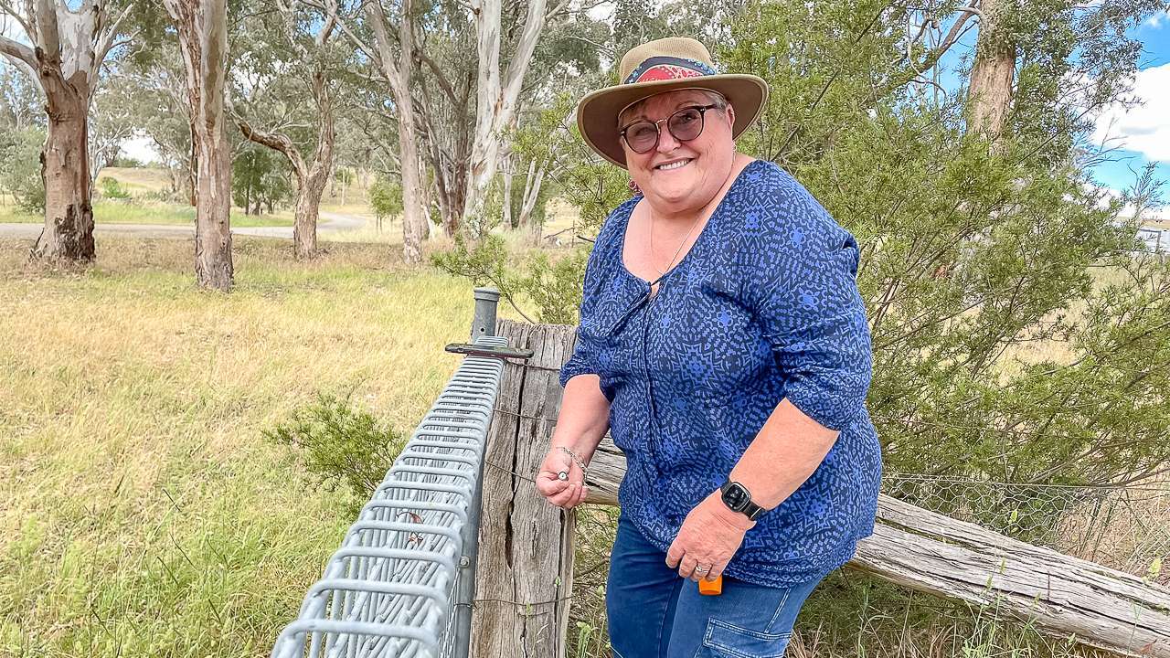
Anyway, you’ll find Barmedman Mineral Pool on Nobbys Road just off the main strip in the village of Barmedman located in The Bland Shire. It lies about 110 km north of Temora and 100 km south of West Wyalong. It’s about 90km from our home in Cootamundra which is why we call in there for a swim a few times every summer.
Originally it formed after an underground stream flooded old gold mine workings, and locals later turned it into a purpose built public pool.
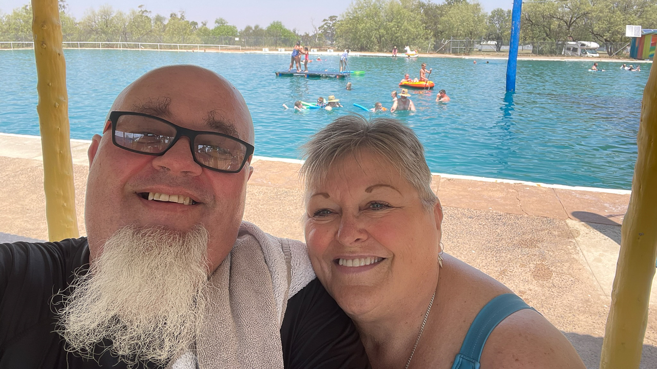
The water is cool and naturally rich in minerals, often compared to a mild Epsom salt style soak. Many visitors say it eases sore muscles and aches after long dusty drives, which is handy for grey nomads and campers. I personally find that the water feels incredibly soft and smooth. I also find that the water is very easy to float in, I could just lie on my back or on my front and bob around all day if I wanted to.
The pool itself is about 100m long and 60m wide making it one of the largest mineral pools in the world. It sits inside a four hectare reserve with grassy lawns, trees and picnic areas so you can rest in the shade while kids run around.
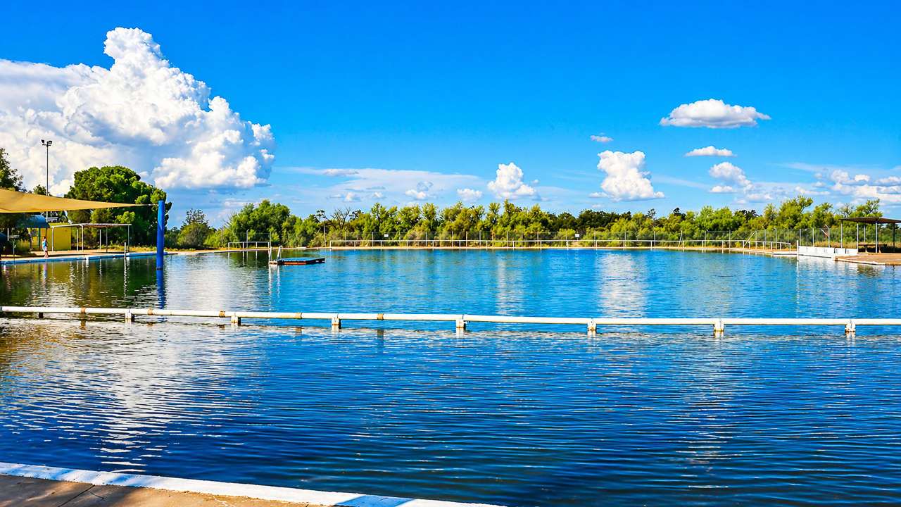
Barmedman Mineral Pool
Opening Hours And Dates
Barmedman Mineral Pool is not open all year. The usual season runs from around October to April, with the pool filled in October and drained in April.
During this season, opening hours are generally daytime only, often from early morning until late afternoon or early evening. Exact daily hours can change, so it is best to check the local Facebook page or the Barmedman community noticeboard before you drive out.
The pool is closed in winter, roughly from May to October so it suits caravanners planning summer or shoulder trips through the Riverina. If you arrive in the coldest months you can still wander around the reserve but you will not be able to swim.
Pool Entry Costs And Facilities
Swimming entry at Barmedman Mineral Pool is effectively free, with no official ticket booth or fixed fee. Users are encouraged to respect the place and its facilities, but there is no swimming charge. Amanda and I always put $5 each in the donation box when we go for a swim. It’s a great facility and we like to think that our donation contributes to it’s upkeep.
Inside the reserve you will find basic but very functional amenities. Change rooms, toilets and barbecues are available to keep day‑visitors comfortable.
There is also a small kiosk that usually opens in the warmer months, selling drinks and simple supplies. Shade is plentiful, and the grassy banks are popular for picnics and family gatherings.
Barmedman Mineral Pool Camping
Barmedman Mineral Pool Camping sits right next to the reserve, making it easy to walk from your van to the water. The site is run by volunteers from the local community which explains the low price and friendly atmosphere.
Camping is available all year, even while the pool is drained in winter. The typical fee is around $10 per vehicle per night, whether you have a caravan, camper trailer or tent.
Facilities are simple but practical. You can expect toilets, cold showers, and sometimes a hot shower you can pay a small coin for, such as $1.
There are bins and barbecues, which helps keep the site tidy given how many road trip travellers stop over. The whole setup is peaceful, with little more than a low fence and a gate to mark the camping area.
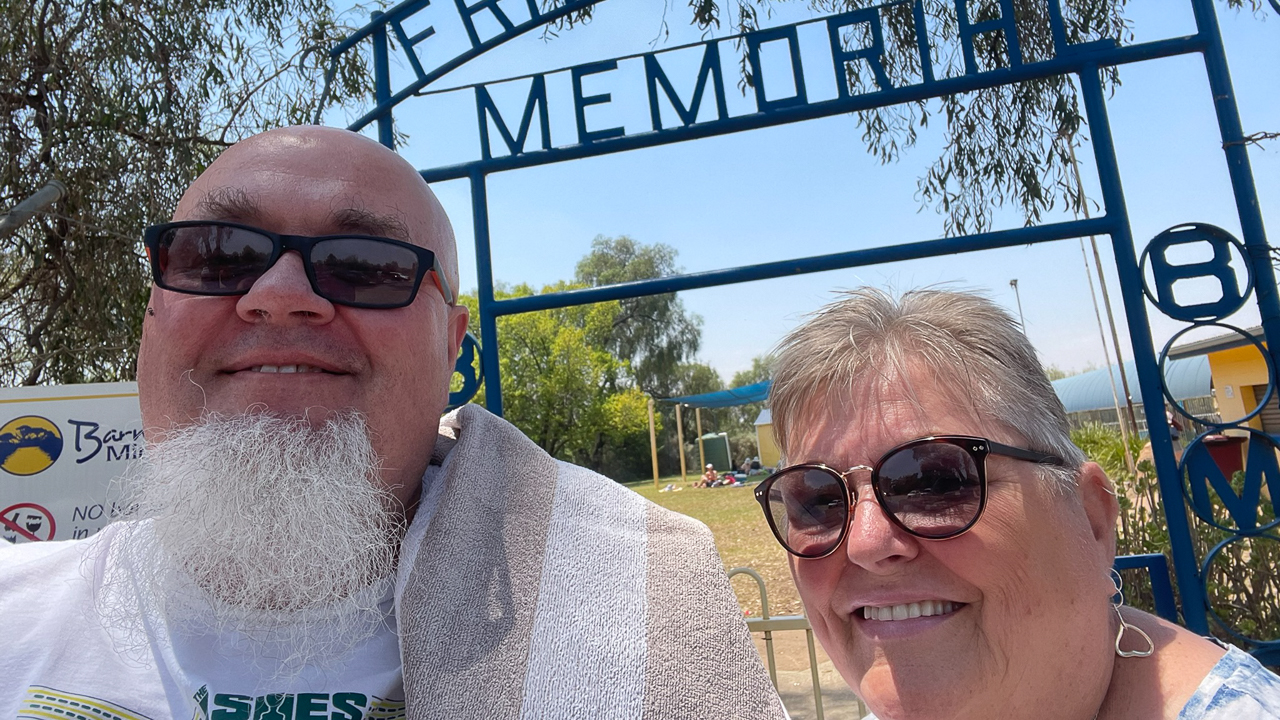
Barmedman Mineral Pool Entry Gates
Barmedman Mineral Pool Donation Camping
Barmedman Mineral Pool Donation Camping is the same site just described, but highlighting the “donation based” feel of the $10 per night fee. The word “donation” reflects that the money supports volunteers who maintain the toilets, showers and grounds.
Because the site is so affordable attracts younger families and budget conscious campers. Volunteers mention that around $10 per vehicle per night helps cover water, power and basic upkeep.
This donation model is common in small country towns, where locals rely on community goodwill rather than big council budgets. In practical terms, you still pay each night but your money is helping keep a rural facility alive rather than lining corporate pockets.
Comparing Barmedman To Other Riverina Stops
Barmedman Mineral Pool and camp sit in a different league from many newer, powered‑site caravan parks. Below is a simple comparison to help you gauge what you gain and what you give up.
| Feature | Barmedman Mineral Pool (Camping + Pool) | Typical Powered Caravan Park (Riverina) |
|---|---|---|
| Nightly camping cost | About 10 AUD per vehicle | Often 30–60 AUD or more per night |
| Pool entry cost | Free | Often included in higher site fee or extra |
| Power hook‑ups | None | Usually available |
| Showers | Basic cold, coin‑hot option | Multiple hot showers included |
| Atmosphere | Quiet, community‑run, rustic | More commercial, busier peak times |
| Seasonal availability | Pool: Oct–Apr; camping: year‑round | Generally year‑round |
Barmedman suits travellers who want low cost a genuine artesian type pool experience. Caravan parks suit those who need electricity, dump points and more structured facilities.
Why Caravanners Keep Coming Back
The $10 camping donation is an easy decision when you are counting coins. You can sleep close to the water, walk straight to the pool in the morning and still be back on the road early if you need to.
It is also pet friendly, at least for camping so long as animals stay out of the main pool area.
Practical Tips For Your Visit
If you are planning a stop at Barmedman Mineral Pool, check the current status on the local Facebook page or the town noticeboard. Different volunteer groups sometimes tweak days or hours, so a quick check can save you a wasted detour.
Bring sun protection, towels, and your own snacks, even if the kiosk is open. The nearest town with full shops is Temora, about 35 – 40 minutes away by car.
Wrapping Up
Barmedman Mineral Pool is one of those quiet unpretentious places that matter more to some caravanners than flashy brochure style parks. It offers a simple, low cost swim and a cheap, clean overnight campsite.
If you are travelling between Temora and West Wyalong and want to stretch your legs, have a swim in the mineral pool and rest for a night, Barmedman is a great stop.
For more information on Australia’s Artesian Bore Baths & Mineral Springs we have a list of all of them including a map.
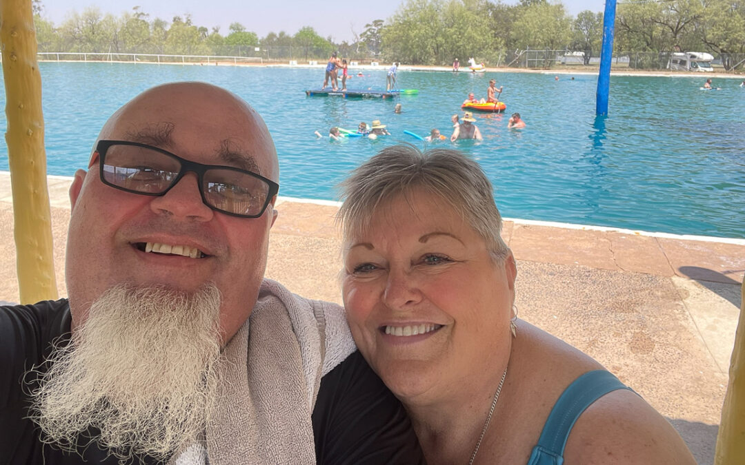
Going For A Swim At The Barmedman Pool On A 44 Degree January Day
Frequently Asked Questions About Barmedman Mineral Pool
Is the Barmedman Mineral Pool ever open in winter?
Are there facilities for campers at Barmedman Mineral Pool?
Do I have to pay to swim in the mineral pool?
How much does it cost to camp at Barmedman Mineral Pool?
Can dogs camp at Barmedman Mineral Pool?
What should I bring for a day trip to Barmedman Mineral Pool?