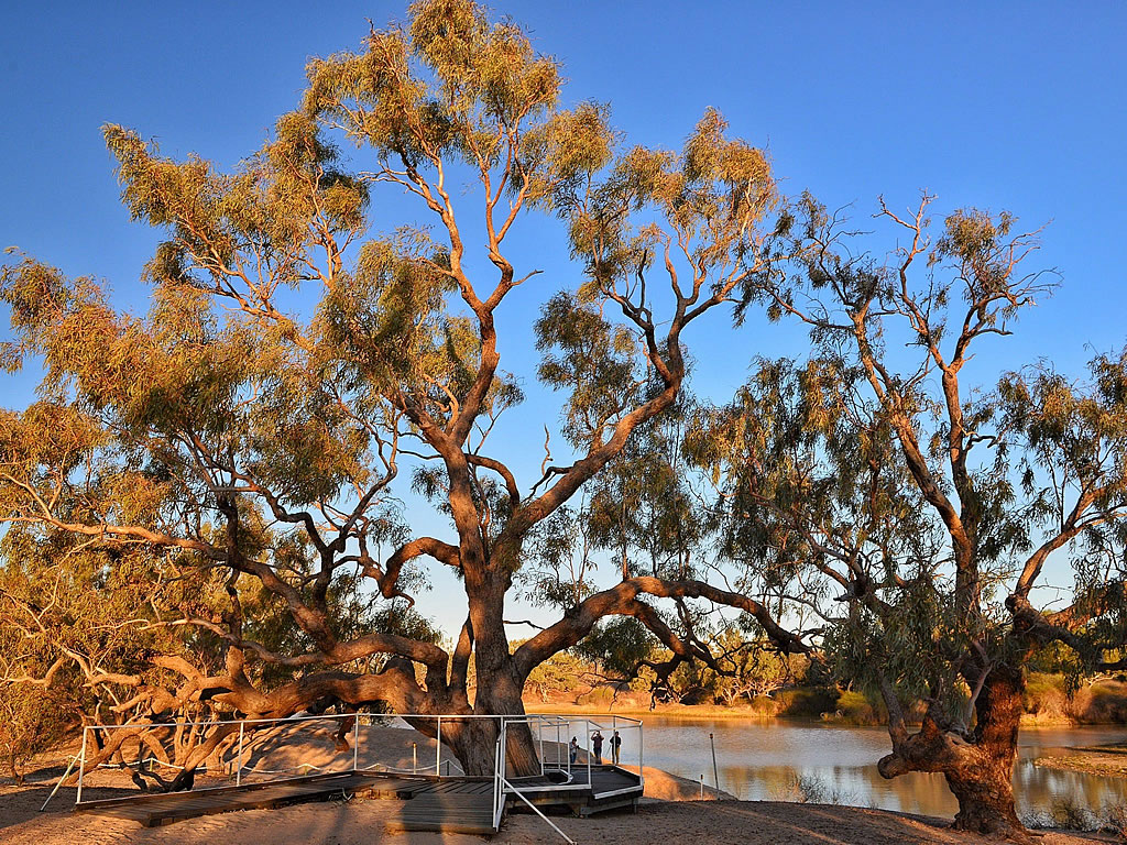
Going Up Big Red At Birdsville To Watch The Sunset
We drove up to the top of Big Red at Birdsville to watch the sunset. Part of the 2019 MARS Enthusiasts National Muster groups adventure to the Dig Tree and Birdsville. What a drive! The view from the top of the sand dune aptly named Big Red is nothing short of incredible. And to experience it as part of a group just made it better. We even witnessed a wedding proposal between a couple of group members!
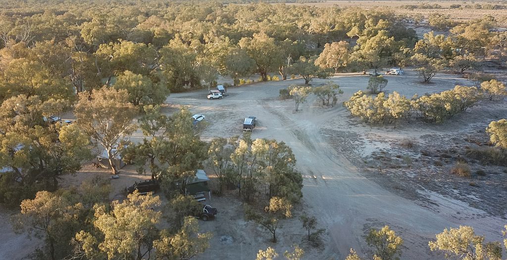
Getting Out To Big Red From Birdsville
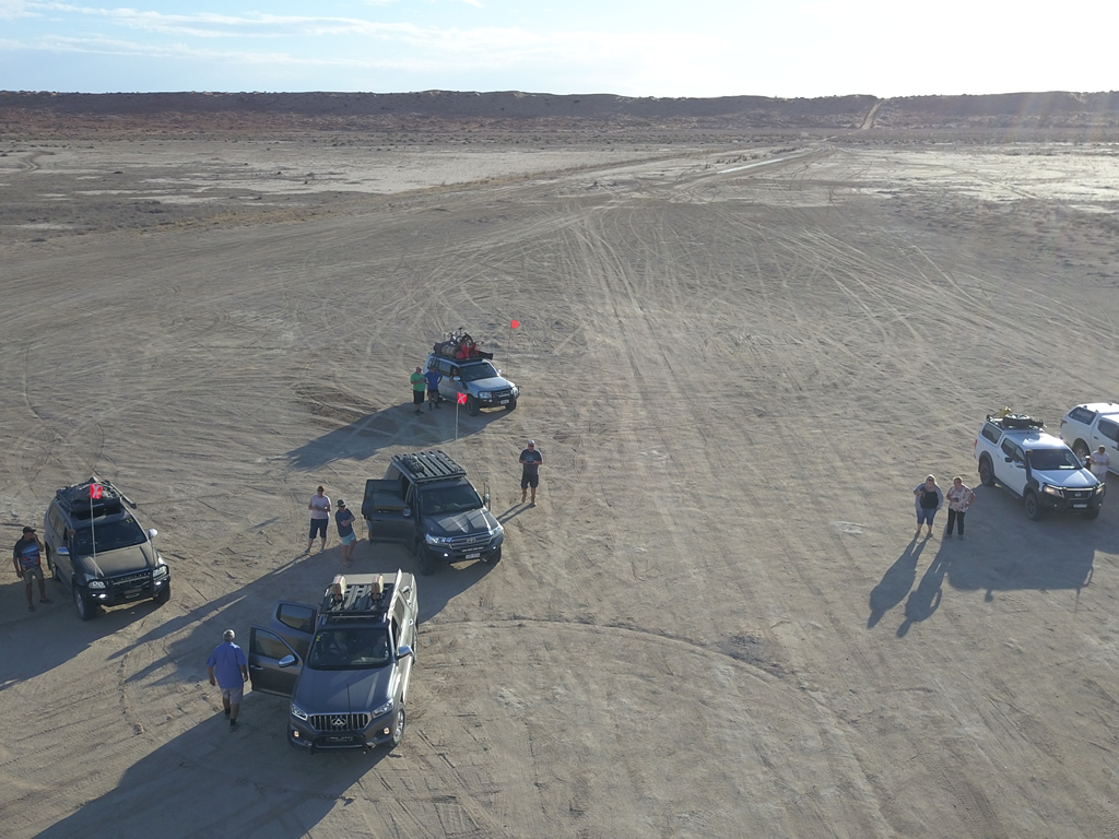
You’ll find Big Red about 40km out of Birdsville right on the edge of the Simpson desert. The road is bitumen in a couple of short sections but mostly dirt. After about 35km you get to Little Red, a slightly smaller sand dune that you need to navigate to enter the Simpson desert. Before heading up over Little Red it’s a good idea to pull over and drop your tyre pressure to something more suitable to sandy desert driving. We went down to 18psi front and rear and it worked well. Once over Little Red you turn right. Then you drive a few more kilometres until you get to the base of Big Red.
Getting Ready To Climb Big Red At Birdsville
Going Up Big Red The Hard Way
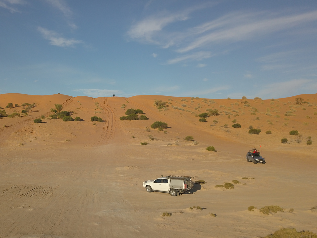
Most of the group members decided to have a crack at getting up Big Red head on. They all made it eventually after more than one attempt in a few cases! The techniques varied. A steady run up and climb to a launching a few kilometres back. Hitting the base of Big Red at warp speed!
Head On Climb Big Red At Birdsville
The Chicken Track
There is an easier way to get up Big Red although it’s still not easy by any stretch of the imagination. Off to the right of the main tracks there is a track that sweeps around through a reverse curve that increases the distance you travel up the dune hence decreasing the steepness of the track. Any decent 4wd with good clearance and tyres (tyres with reduced pressure) will have no problem getting to the top in 4wd high range. Make sure you have some recovery gear, a shovel and a mate in another vehicle to lend you a hand just in case.
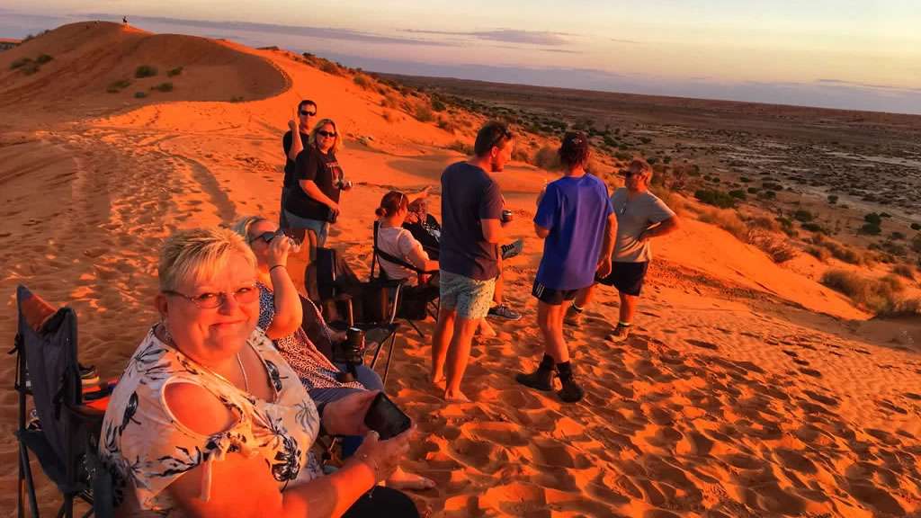
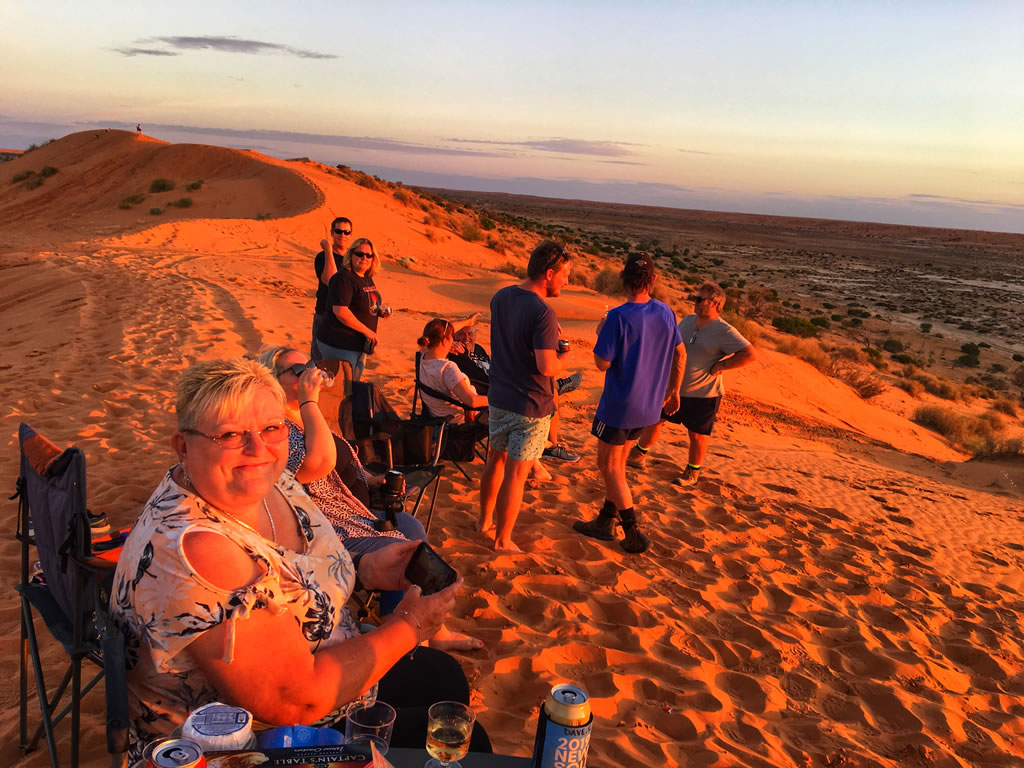
The View From The Top
The view from the top as the sun sets is amazing. Big Red is supposedly only 40m high but when you are up on top it feels like it’s a lot higher than that. The view back towards Birdsville in one direction and the Simpson Desert in the other is something you have to experience. All of us in the group agreed it was one of the most amazing things we’d ever done.
Amanda Sloane On Top Of Big Red Near Birdsville At Sunset
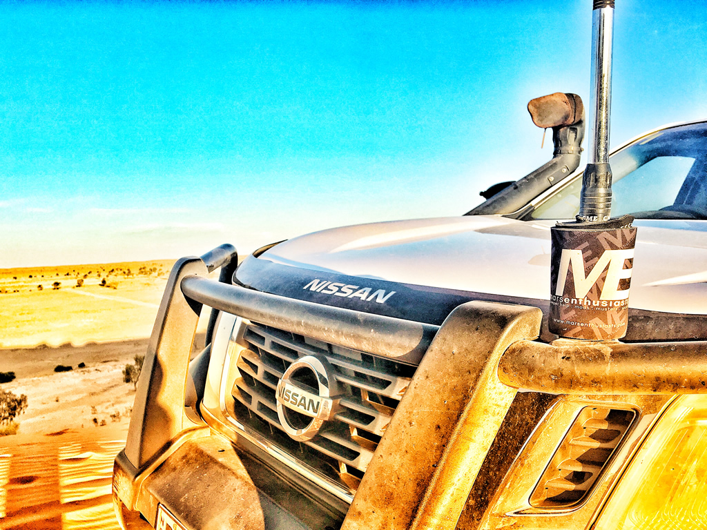
Nissan Navara NP300 Up On Top Of Big Red Birdsville
Conclusion
What an awesome place. If you ever get a chance to get up to Birdsville then go that little bit further and check out Big Red. It’s something you will never forget.
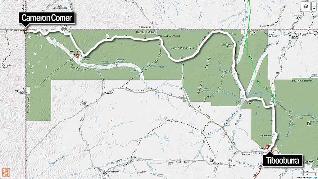
Tibooburra to Cameron Corner via Jump Up Loop Road
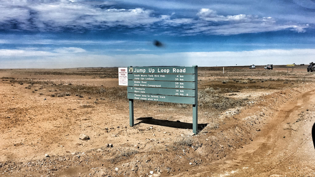
Cameron Corner via Jump Up Hills Loop Road 2019 MARS Enthusiasts National Muster. A day trip via the Jump Up Loop Road out of Tibooburra NSW during our recent 2019 National Muster adventure to the Dig Tree and Birdsville. What a drive! The Jump Up Hills Lookout is spectacular – you have to see it to believe it. The drive heads out north from Tibooburra towards the Warri Gate then 15ks out of town you turn left. You can’t miss the sign.
Don’t tow your caravan along this route as it isn’t suitable. Ignore the advice if you wish but I’m going to leave it here for you. Don’t say I didn’t warn you!
Tibooburra to Cameron Corner via Jump Up Loop Road with the MARS 2019 National Muster Crew
We originally intended travelling out to Cameron Corner and and back via the Main road from Tibooburra. However when we were fuelling up at TJ’s Roadhouse in Tibooburra the lady behind the counter told us that there a nice touring route via the Jump Up Loop Road and she gave us a mud map. After a discussion outside we all agreed that it was worth a crack so off we went. What a fantastic decision!
We headed out to the north and stopped at the Pioneer Park to drop our tyre pressures. After that we carried on along the Silver City Highway towards the Warri Gate for about 15 kilometres until we reached the well signposted turnoff.
The Jump Up Loop Road Turnoff
Jump Ups Lookout
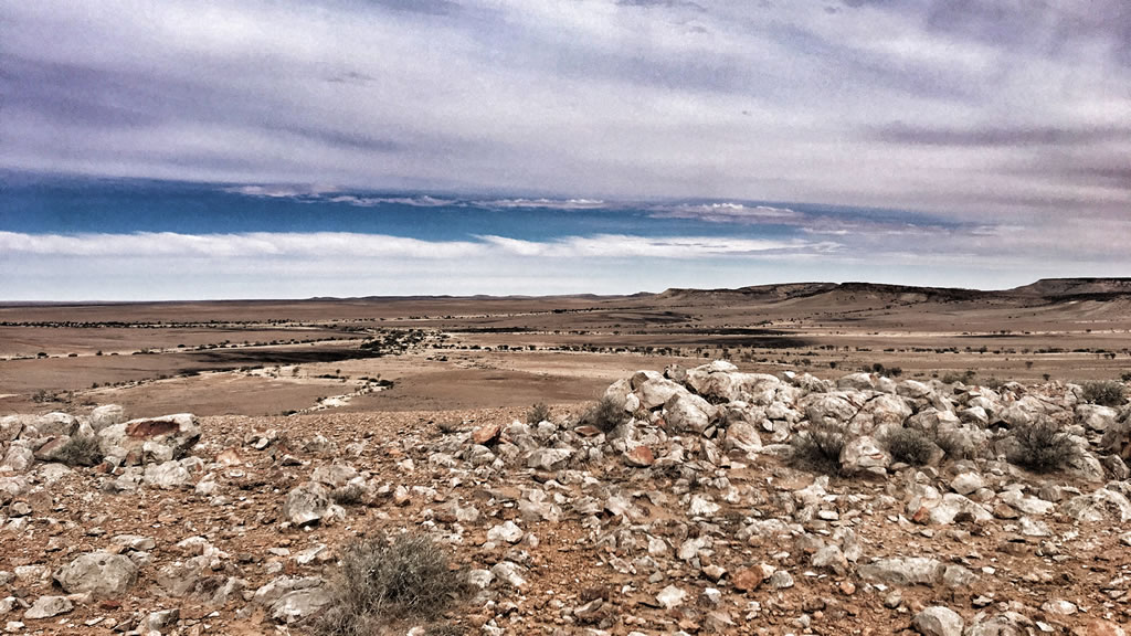
After about an hour or so we came to the lookout. This lookout made the day 100% worthwhile. The views are magnificent. You have to see it to believe it. It’s as dry as a dead dingos’ donger for as far as you can see. And the colours. The colours are spectacular. They range from the whitest of white through to the reddest of red with all shades of brown and purple in between. It’s truly amazing. If you look closely you can see small areas where it looks like some mining has occurred in the past on a small scale. I am guessing it might have been done for the collection of clay to use for some of the road construction.
The Lookout – Very Awesome!
Middle Road
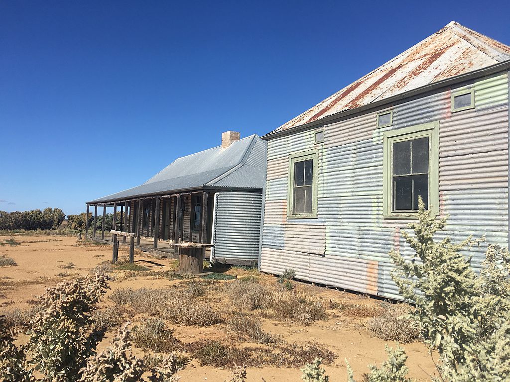
After the lookout we continued on along the Middle Road towards Cameron Corner. We passed a few old falling down homesteads that were pretty cool. I’d love to come back some time and camp near one of the old homesteads and have an explore. Middle Road turned in to a bit of a corrugated goat track in a few places so we just took our time and muddled along. A few vehicles picked up a bit of damage in this section. Nothing major just things rattling loose so as a result made a few short stops for repairs.
Cameron Corner
Eventually we got on to Cameron Corner Road and followed it in to Cameron Corner. The main road is in a bit better condition but it’s still a lot of fun to drive. In sections it traverses flood plains where you can see to the horizon and in other parts it is sand dune country and goes up, down, over and around sand dunes. It keeps you on your toes but it’s well worth the adventure.
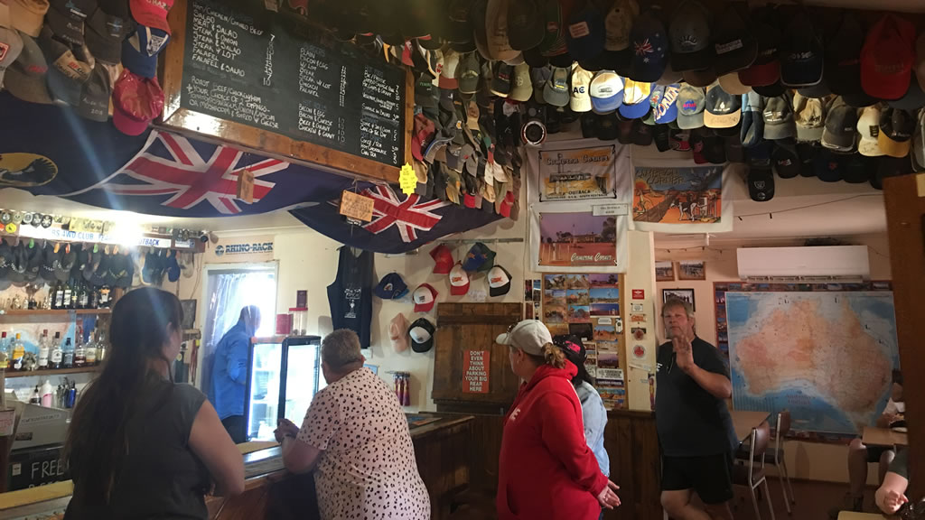
We all arrived safely at Cameron Corner and went in to the store for a look around and to have some late lunch. The store is a great old place and very welcome to arrive at out in the middle of nowhere. They server great food and have a small bar for drinks. The inside is worth stopping and having a good look at. There are probably hundreds of caps and hats stuck to the ceiling, and stickers all over the walls from past adventurers and groups.
Inside the Cameron Corner Store
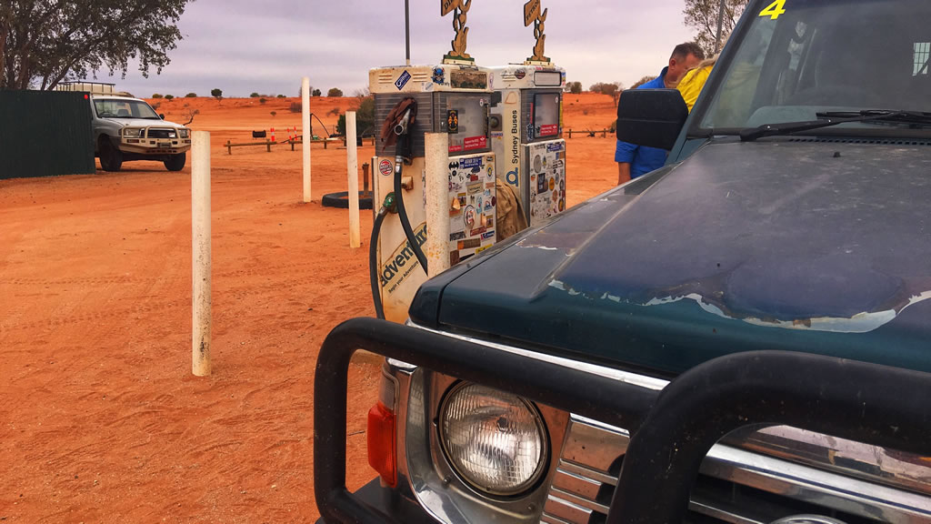
The Corner Store can also sort you out with basic grocery needs and fuel. You can hire some golf clubs and have a round of “Tri-State Golf” at the makeshift 9 hole course. You can also camp at Cameron Corner. They have powered sites, unpowered sites and bush camping available. We’ve camped here before and the views are spectacular and the showers are nice and hot and the toilets are clean. Not much more you need is there?
Fuel Pumps at Cameron Corner – Are They The Most Iconic Fuel Pumps In Australia?
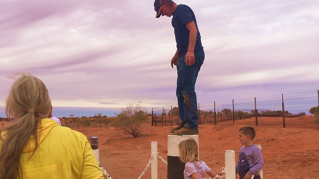
The Famous Cameron Corner Corner Marker
All of us headed across to have a look at the corner marker and to check out the dingo fence. The corner marker really is a special thing. I first remember seeing it on a Leyland Brothers episode about 40 years ago. That very episode is one of the things that made me want to get out and travel the bush so the marker is even more significant to me in particular!
One Of The Crew On Top Of The Corner Marker
After a bit of time at the marker we all piled back in to our vehicles and headed back to Tibooburra along the main road. It was a fun drive back, we saw plenty of kangaroos along the side of the road and a few crossed the road in front of us so that kept us on the lookout.
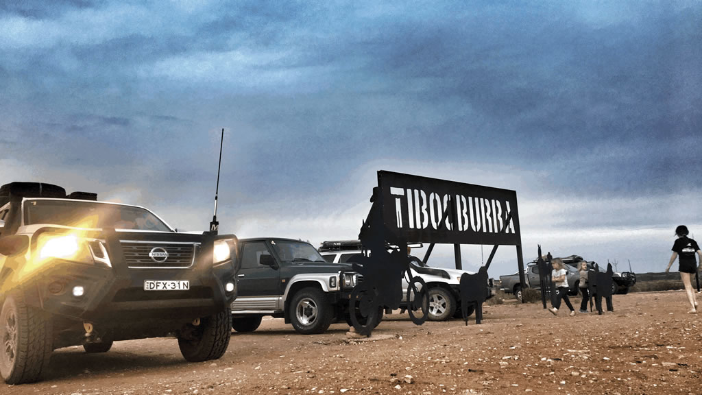
The MARS Enthusiasts Crew Back At Tibooburra In Front Of The Tibooburra Sign
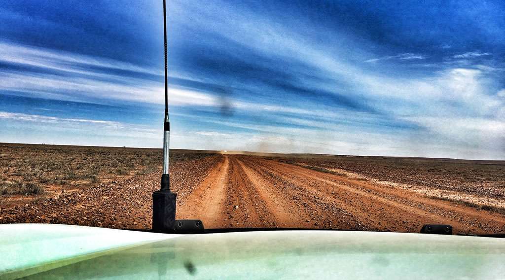
The roads were of varying quality, all dirt and gravel. Some of them were a bit sandy, some were pretty corrugated and some had some fairly large rocks on them that had to be avoided. All up though the roads were pretty good.
All up it was a great day out with a great bunch of people. I really wish we could do it all again tomorrow. If you ever get the chance to do this drive, make sure your vehicle is prepared for the corrugated parts and have a crack. You won’t regret doing it. It’s been one of the most fun and memorable things I have done in a long time.
The Jump Up Loop Road and Middle Roads
The Jump Up Loop Road and Middle Roads are a bit on the rough side in parts and we all copped a few small damages here and there but we made it through safely. If you’re up for a bit of adventure and some incredible scenery it’s definitely worth the effort.
The Jump-up Loop Road takes you through some impressive and harsh country. Types of terrain include desert areas, gibber rock plains and red dune country. The loop is dotted with the occasional tree and small rocky gorge. In some places landscape looks like the surface of the moon. Not that we’ve been to the moon but you know what I mean!
Be warned that this is a remote and harsh area and you will need to be well-prepared with food, water and communication just in case. There is no phone reception here. It’s best to advise someone of your travels and for safety travel with at least one other vehicle. It’s inadvisable to travel this road during the hotter months of the year as temperatures can skyrocket north of 45 degrees for days on end.
The Jump-up Loop Road heads towards the Queensland border and the Silver City Highway. 55km north of Tibooburra you’ll find the Olive Downs campground. You can camp at the Olive Downs camp ground. While camped you can explore the ruins of the derelict Olive Downs station.
Directions
Before leaving Tibooburra make sure you have fuelled up your vehicle as there is no fuel available until you reach Cameron Corner about 150km away. Also air down your vehicles tyres as the roads are corrugated in parts.
Tibooburra To Cameron Corner Jump Up Loop Road Map
Head north out of Tibooburra past the Pioneer Park towards the Warri Gate.
About 15 kilometres out of town you will see a sign for the turnoff to the jump Up Loop Road on your left.
Follow this road for about 45 minutes and you will see the turnoff to the lookout on your left. Go up to the lookout. It is beyond spectacular.
After the lookout continue along the Jump Up Loop Road until you come to the Olive Downs Ruins. Continue until you reach the corner of Middle Road and Jump Up Loop Road. Turn left. This is where you need to hang on to your hat as the road gets a quite corrugated in parts from here on.
Keep going until you reach Binerah Well where the is a T intersection. Turn right and keep driving and you will get to Binerah Downs ruins.
At the Binerah Downs ruins take a left to continue along Middle Road towards Fort Grey.
Turn right at the next junction and follow the signs to Cameron Corner.
All up the drive took our group about four and a half hours from the Pioneer Park in Tibooburra to the Cameron Corner store. This included stopping in at the Jump Up Hills lookout and quite a few short stops to repair minor battle damage to our vehicles.
If You Need a Map
If you visit the roadhouse at Tibooburra and go to the counter and ask they will give you a mud map of the route
The HEMA Explorer app has very good coverage of this area
Vehicle Preparation
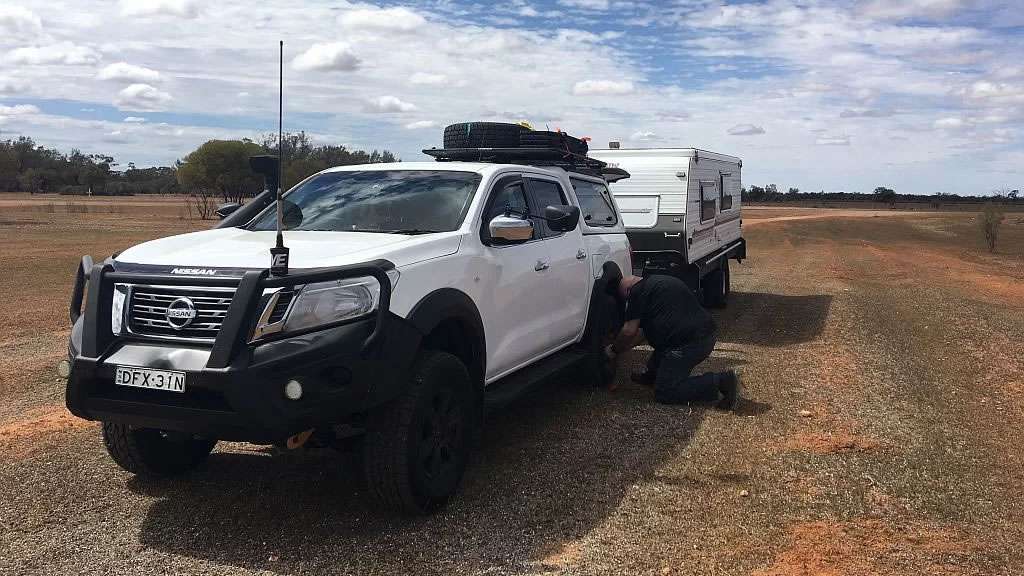
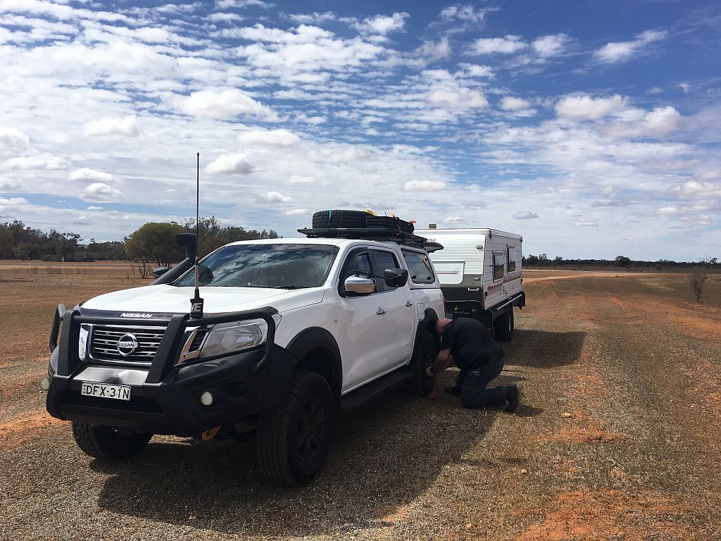
Make sure your vehicle and in particular your tyres are in good condition before attempting this route as it very corrugated and stony in parts. Also go all over everything that is bolted to your car and make 100% certain nuts are done up tight and preferable they have spring washers, Loctite or Nyloc nuts fitted. Examples of the damage we had on the trip are listed below.
Battery hold down bracket came adrift on our vehicle and had to be put back on
Shock absorber mounting bolt fell out on one vehicle resulting in the shock absorber coming apart from the vehicle on one end
A few bullbars came loose
A nudge bar came loose
A few vehicles had driving light mounting brackets break
UHF aerial snapped off on one car
A number plate all but fell off
A winch rattled loose
A fuel pump stopped working. Luckily this vehicle had LPG gas fitted as well so they were able to swap over to LPG to continue back to Tibooburra
Sturt National Park
Sturt National Park encompasses a huge and arid landscape of space and solitude. Starting with the Strezlecki desert rolling red sand dunes to flat topped mesas and 450 million year old granite tors near Tibooburra. A visit to this outback park is genuinely a once in a lifetime experience for anyone who goes there.
A self guided drives or guided tour with one of the tour operators that visit the park is a great way to explore what the park has to offer. For close up views of the landscape go on the short loop walks at Fort Grey or Dead Horse Gully. If you have limited time and can only do one walk check out Mount Wood hills for a walk to the summit. Stunning views of this spectacular landscape make it more than worth your while.
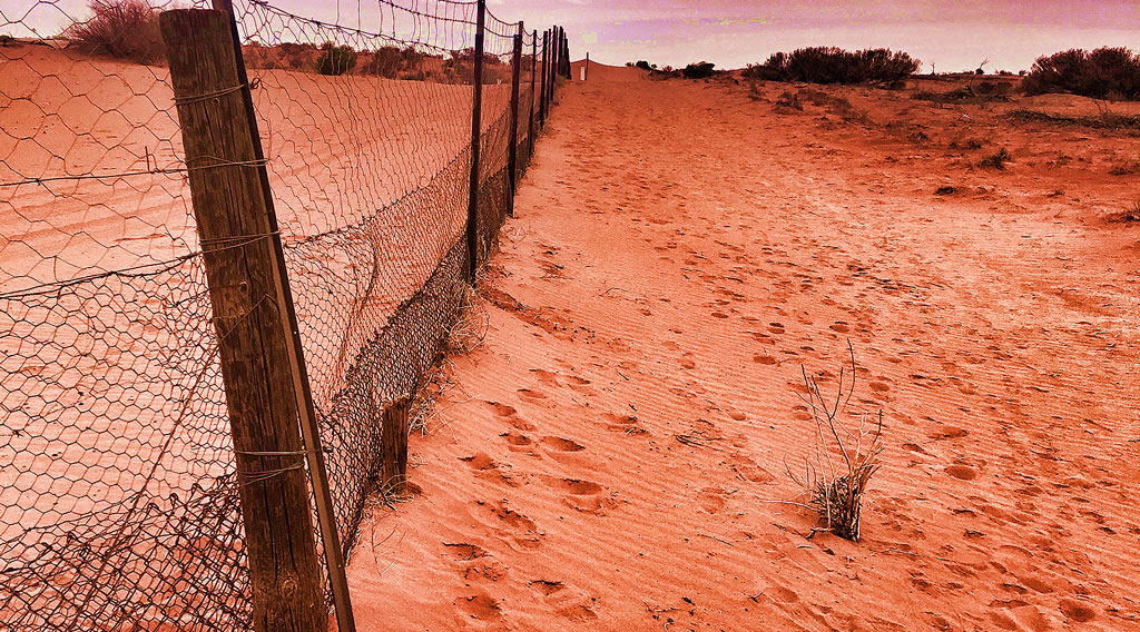
The Dingo Fence
Visit the historic Dingo Fence that runs east to south-west along the eastern third of Australia and along the western and northern boundary of Sturt National Park. The Dingo Fence was originally built in the 1880’s to keep dingoes away from sheep in the southern part of the country. It’s 5,614km long making it the world’s longest fence.
There are four campgrounds in Sturt National Park. They all have sites suitable for caravans and camper trailers as well as the usual barbecue and picnic facilities. Sometimes you can even be lucky enough to have the campground all to yourself although you’ll probably still have share the space with some of the parks’ many kangaroos and birdlife.
About The Jump-Ups
The Jump Ups are ancient landforms. The Jump-Ups are the remains of an ancient mountain range that has been eroded down over millions of years leaving a 150m plateau (Mesa) and the granite strewn plains which form the catchment of Connia Creek. Connia Creek follows south-east into Twelve Mile Creek.
About Cameron Corner
Short History
Charles Sturt on his expedition to find the Australias’ “inland sea” (how’d that go?) was the first European to explore the area now known as “Corner Country”. About twenty years later the “corner” was named after John Cameron who successfully led a party to survey the NSW and Qld borders between 1879 and 1881. On arrival atthe intersection of the South Australian border in September 1880 put a wooden post in. The poost was marked “LAT 29” and “Cameron”. This post can be viewed at the National Park & Wildlife Office in Tibooburra.
Quick Facts
Cameron Corner is located at longitude 141° east and latitude 29°south
Elevation is 112m although it’s so flat it doesn’t seem like it!
The Corner store is in QLD and is in the Bulloo Shire.
The area code for phone calls is 08 (SA)
The Dog Fence follows the SA/NSW and NSW/Qld borders closely and can be seen right behind the corner marker
The best time to visit Cameron Corner is from March to October. Outside of these months it can be unbelievably (dangerously) hot
Time Zones! Three different states with two time zones Australian Eastern Standard Time (AEST) and Australian Central Standard Time (ACST). During summer you get a third because Qld doesn’t have daylight saving – apparently it fades the curtains
Fuel: Petrol and diesel. Not cheap but hey you’re in the middle of nowhere and if you need it you need it!
Food: They do breakfast from 8:00am and then your usual pub style meals at lunch and dinner. Burgers, steaks, schnitzels, chips and that kind of thing.All very nice. They also have a bar area where you can beer and cider. Your typical outback bar but very friendly and with excellent service
Groceries: Basic grocery items such as bread, milk and meat. All dependant of course on when they had their last delivery. Items are all sold frozen
Camping: powered sites $35 per vehicle. Unpowered sites $25 per vehicle. Bush camping $10 per vehicle (includes a $5 donation to Royal Flying Doctors). Male and female toilets and showers
Camp Kitchen: Sink, fire pit with hotplate and a billy post (don’t see them very often these days)
Accommodation: Donga style cabins in single, double and family size. Not five star, hell not even two star but they’re clean and comfortable
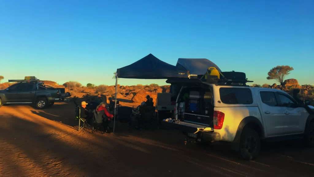
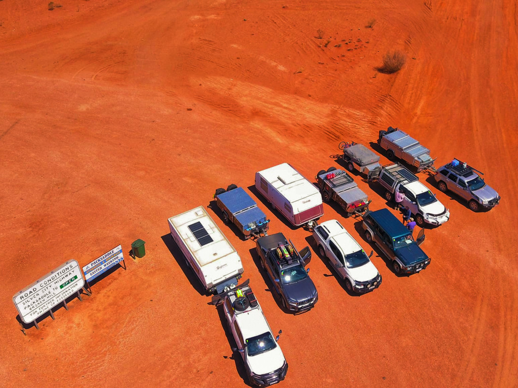
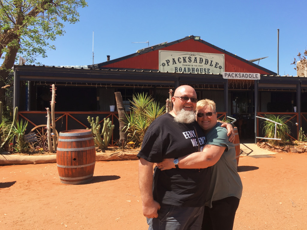
If you want a place to camp at Tiboooburra then you can’t go past the Aboriginal Land Council Camp Site at Tibooburra. What a great camp site. Hot showers and flushing toilets all in an outback setting for only $15 a night. It is an awesome spot to set up camp for a night or two. They have drinking water available and it is good, clean and tastes excellent. We drove to Tibooburra on the Silver City Highway and camped at the Aboriginal Land Council camp site after a stop at Packsaddle for lunch.
MARS Enthusiasts National Muster 2019 Crew Lined Up At Packsaddle
Today we travelled up from Menindee to Tibooburra with mates from the MARS Enthusiasts Group on the Silver City Highway. We left the Burke & Wills camp site at Lake Pamammaroo and headed in to Broken Hill. We had to call in to the Broken Hill Tyre Service 4wdsupacentre there to replace the AGM battery in the van as it had been playing up. Just a shout out to the 4wdsupacentre at Broken Hill for their excellent and very helpful service. They had a battery in stock and wheeled it out to our van for us and even disposed of our old battery for us. Great service from them and it was very much appreciated.
After fuelling up we hit the Silver City Highway and headed north. We stopped in at Packsaddle for some lunch and a few photos. Packsaddle is a great old roadhouse that has been there for over a hundred years. We all stopped in for lunch and had a look around the Packsaddle Roadhouse. Lunch was great, the food there is excellent. Fuel is available at Packsaddle so a few of us topped up before heading on.
Amanda & David Outside of Packsaddle Roadhouse
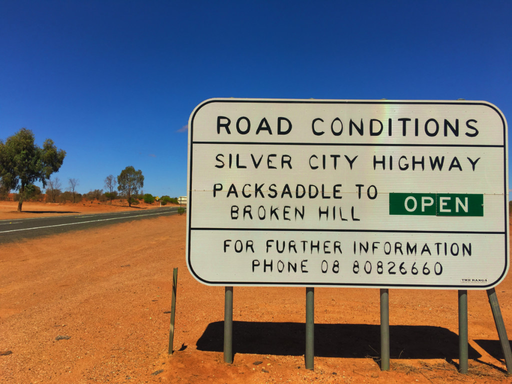
Road Conditions Broken Hill to Tibooburra
The Silver City Highway up from Packsaddle was a lot better than it was eighteen months ago. In fact almost the whole section of road between Packsaddle and Tibooburra has been tarred. There are only a few small sections of dirt left and the sections that are still dirt are currently being prepared for bitumen. I reckon that in the next few months it will be bitumen the whole way from Broken Hill to Tibooburra. It made a welcome change to the way it was when we last went up to Tibooburra from Broken Hill in May 2018.
Packsaddle To Broken Hill Road Conditions Sign
Aboriginal Land Council Camp Site at Tibooburra
What a great camp site. They have hot showers and flushing toilets all in an outback setting for only $15 a night. It really is an awesome spot to set up camp for a night or two. They have drinking water available and it is good, clean and tastes excellent. There is a walk you can do from the Aboriginal Land Council camp site. It leaves the back of the park and loops out and around and works it’s way back to aboriginal burial grounds near the main Tibooburra sign on the way in to town. At the corner where the road heads out to Cameron Corner. It’s a nice easy, interesting walk.
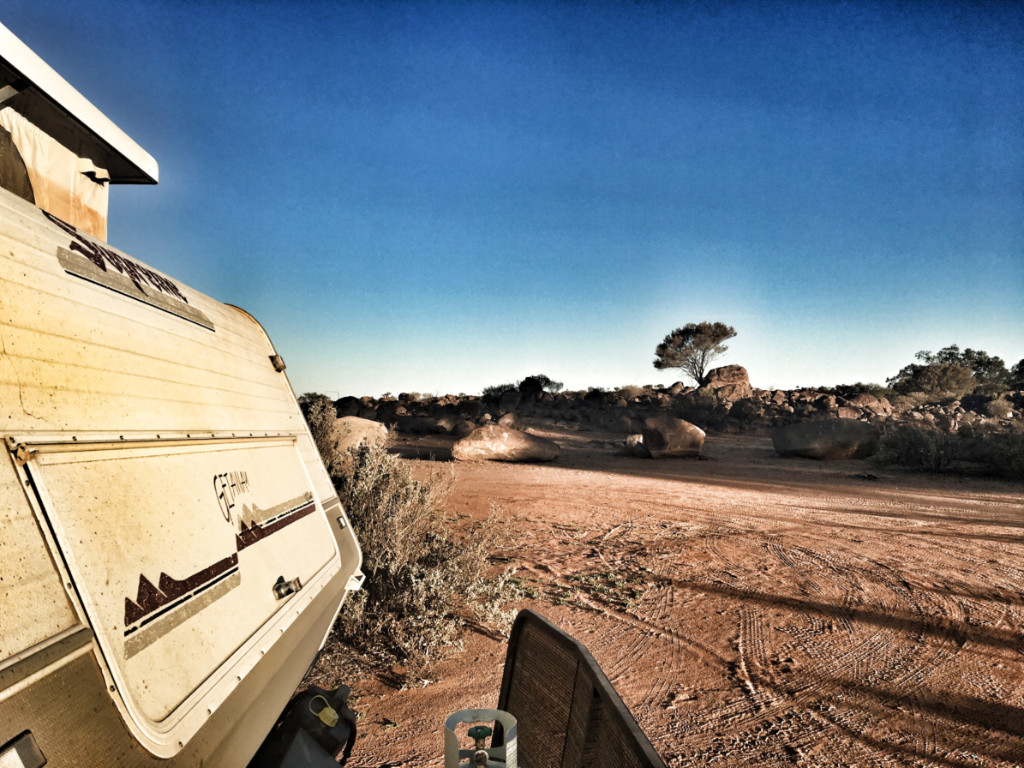
Supreme Getaway Caravan At Aboriginal Land Council Camp Site Tibooburra
Pleasant Evening at the Tibooburra Camp Site
We had a great evening at the Tibooburra camp site sitting around a fire and telling jokes and stories with the friends we travelled up to Tibooburra with. One of our fellow travellers had some firewood that he had brought up from Menindee. We used so we didn’t have to stop on our way to collect any. There is none available for use in and around the camp site so make sure to bring your own.
View From Our Camp Site
A Bit of Information About Tibooburra
Tibooburra is in the far northwest corner of New South Wales. Tibooburra is 335 km north of Broken Hill, 1504 km northwest of Sydney and only 900 km from Adelaide. it’s weird that it’s in NSW and yet it’s 600km closer to Adelaide than Sydney! If you look at Tibooburra on a map and at photographs of it then it seems to be pretty isolated. If you visit Tibooburra you will find that it is a fairly busy place. A lot of travellers coming and going and mine workers coming through most months of the year. It does get a lot quieter during the brutally hot summer months though.
Tibooburra gets it’s name from the ancient granite tors that surround the town. The goldfields of the Tibooburra region were originally known as “The Granites” and were a part of the Albert Goldfields. Gold in Tibooburra was buried beneath deep alluvial mud and required special techniques to mine. Like everywhere on the Albert Goldfields life was tough at “The Granites”.
Iconic Hotels
Of the two hotels The Family Hotel is our favourite, in fact it’s one of our favourite of all outback pubs we have visited. There is a post-office with banking and internet access, supermarket and cafe facilities. The Royal Flying Doctor Service visits each Tuesday for a clinic. A modern roadhouse and local stores provide meal, fuel and basic automotive spares. If you need more more comprehensive vehicle spares of any nature or are in need of a mechanic then Broken Hill is your nearest option 335km to the south.
Sturt National Park
Modern day Tibooburra is home to Sturt National Park, New South Wales police and the Tibooburra Outback School of the Air. The township has two hotels, motel rooms, cabins, caravan park, Aboriginal Land Council run campgrounds and a hostel to accommodate visitors.
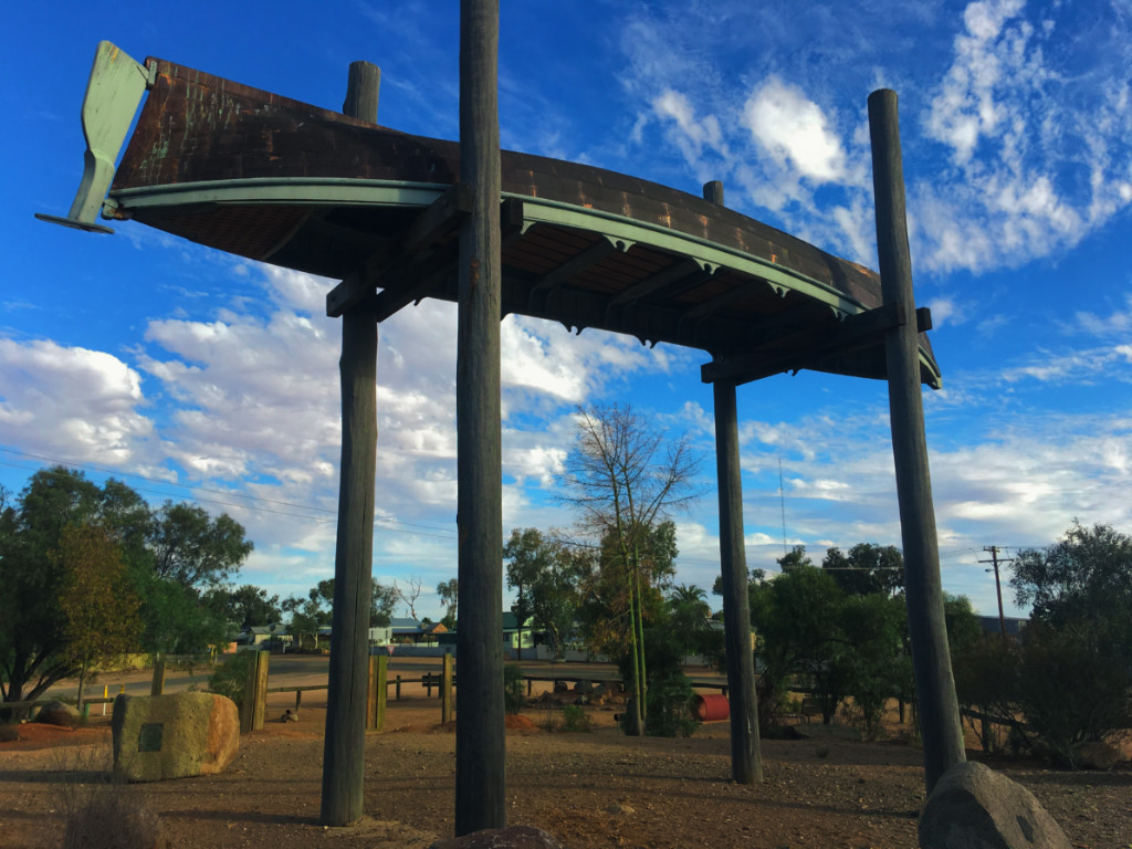
Pioneer Park Tibooburra
There is a fantastic Pioneer Park with a wonderful sculpture of a full-size 27-foot long whaleboat perched on the top of some poles. The whaleboat is a replica of one Charles Sturt hauled across inland Australia. Here on the edge of the huge Sturt National Park you feel as though you are already in the heart of the desert.
Tibooburra is the closest town to the Sturt National Park. Located in the northwest corner of NSW and bordering South Australia to the West and Queensland to the north. Sturt National Park is huge and it provides the visitor with a great insight to outback Australia with ancient eroded mountain ranges and vast gibber plains. The park also provides several vantage points where you can view and get up close to the Dingo Fence.
Things to Do in and Around Tibooburra
The Gorge Loop Road
This loops around Mt Wood and the Mount Wood Hills and covers the outdoor pastoral heritage museum, Mt Wood Homestead and shearers quarters, the Gibber and Mitchell Grass Plains, the Twelve Mile Creek Gorge, and the old pastoral remains at Torrens Bore and Horton Park Station. Wildlife such as emus, kangaroos and wedgetail eagles are commonly sighted.
The Jump-Ups Loop Road
The ancient landforms that are known as the Jump-Ups are the remains of an ancient mountain range that have been eroded down over millions of years leaving the 150m plateau and granite strewn plains which form the catchment of Connia Creek which follows southeast into the Twelve Mile creek.
Cameron Corner
The drive from Tibooburra to Cameron Corner takes the visitor through an ever changing landscape including the Waka Claypan, Fort Grey which was used as a provisions stockade by explorer Charles Sturt for his inland expeditions You then travel on to the Cameron Corner and the worlds longest fence – the 5,000+ km Dog Fence which was constructed to keep roaming Dingos out of the north and west out of the pastoral lands of NSW.
Tibooburra Keeping Place
Located in Briscoe Street the Keeping Place features a display of local photographs, fauna and indigenous artifacts of wood and stone from the Wadigali, Wongkumara and Malyangapa tribes. It is also where you pay your camp site fees for the Aboriginal Land Council camp site. They also have arts and crafts for sale.
Tibooburra Pioneer Park
At the end of the main street is the Tibooburra Pioneer Park which was established in 1999. The main attraction in the park is a full-size whaleboat. This is a replica of the whaleboat Charles Sturt hauled across inland Australia on a wagon with the intention of using it to row around the inland sea he was expecting to discover. The original whaleboat was abandoned at Depot Glen near Milparinka – Milparinka is only about 30 minutes to the south of Tibooburra and is also well worth a visit.
Pioneer Park Tibooburra Replica Sturt Whaleboat
The Church of the Corner
This church was erected in 1963 by the Australian Inland Mission. it is now run by the Uniting Church Frontier services. It is open for use by visiting clergy by prior arrangement. It is a church available to all people of the area.
Golden Gully
Golden Gully next to Dead Horse Gully camping ground is a recreation of mining sites and methods with plaques explaining what is going on. The turnoff is located about 1 km north of Tibooburra.
We travelled up to Menindee from Carrathool via the Cobb Highway and Ivanhoe Menindee Road to meet up with our mates from the MARS Enthusiasts camper trailer group.
We left Carrathool and headed towards Hay where we fuelled up and headed North along the Cobb Highway to Ivanhoe. This bit of the trip is part of what is known as “The Long Paddock”. On the way we stopped off at One Tree Hotel again. It’s a cool place with great history.
One Tree Hotel On The Cobb Highway
The Ivanhoe Menindee Road
We fuelled up at Ivanhoe then hit the Ivanhoe Menindee Road again. We absolutely love this road. The Ivanhoe Menindee Road is an absolute beauty. We have used it heaps of times. It goes from being mild to wild depending on when it’s been last graded and how many unthinking people have driven along it while it was wet. It’s about 200ks long. Slow down getting on and off the short bitumen bits either side of cattle grids as they can have some pretty good drop offs. There are alternate ways you can go to avoid it but we love it so there’s no way we are going out of way to not travel along it.
Dropping Tyre Pressures In Preparation For The Ivanhoe Menindee Road
Burke & Wills Free Camping On Lake Pamammaroo Near Menindee
The campground on Lake Pamammaroo near Menindee is an absolute gem. We’ve been there three or four times now and and it’s awesome. You have your choice of camping on the lake foreshore or on the banks above the river near the weir. There is water available although it is untreated and not fit for drinking and flushing toilets. Loads of bins are provided and they are emptied regularly.
Burke & Wills Free Camping On Lake Pamammaroo Near Menindee
Maidens Hotel Menindee
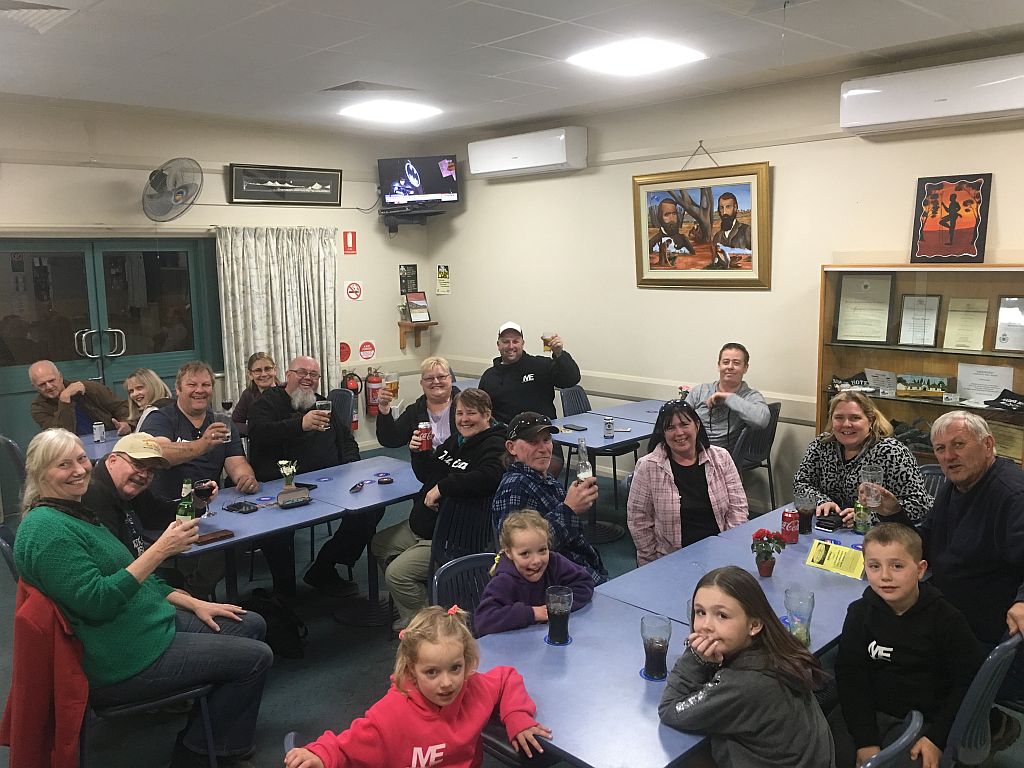
After setting up camp at the Burke & Wills free camp ground on Lake Pamammaroo we all went out for dinner at the Maidens Hotel. It was a good way to end an excellent day and catch up with old friends and a few new ones. The meals were really good. Everyone was really excited about the upcoming trip to the Dig Tree and Birdsille. Back at camp we had a few beers, lit a fire and talked in to the evening.
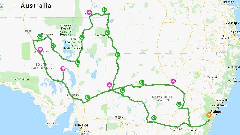
Birdsville Track and Oodnadatta Track Travel Itinerary
Our next big trip is going to be four weeks through outback Australia. We are leaving from Sydney and travelling up to the Dig Tree via Menindee and Tibooburra with a bunch of good friends from the MARS Enthusiasts Camper Trailer Group.
After the Dig Tree we are going up to Birdsville via the Planet Arrabury Road with a stop over at Haddon Corner. At Birdsville we all plan on driving up “Big Red” to watch the sunset. After exploring Birdsville it’s down the Birdsville Track to Farina with a night inbetween at the Mungerranie Hotel.
Burke & Wills Dig Tree
Oodnadatta Track
We are leaving our camper trailer friends at Farina and heading across the famous Oodnadatta Track to William Creek. We’ll be camping at Arckaringa Station for a few nights and having an explore around the Breakaways and the painted Desert. Then it’s on to Coober Pedy. We are then going to check out Woomera and explore around the town and look at all of the leftovers from the rocket range days and then it’son to Roxby Downs. Silverton is our next stop for a few nights and we’ll visit Broken Hill for about the fifth time. Then unfortunately it will be time to head back home.
All up we plan on about 7,000kms and many of them will be on red dirt. We love red dirt. It’s going to be an awesome trip. Please follow us along!
Dig Tree Birdsville Track and Oodnadatta Track Travel Itinerary
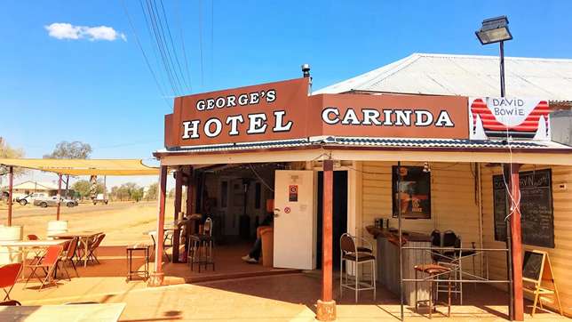
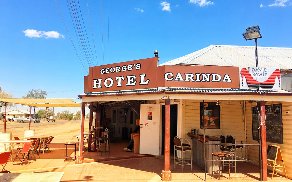
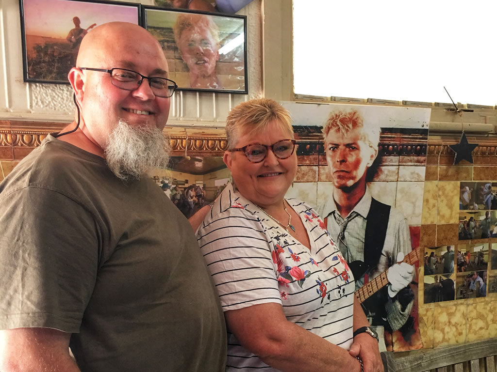
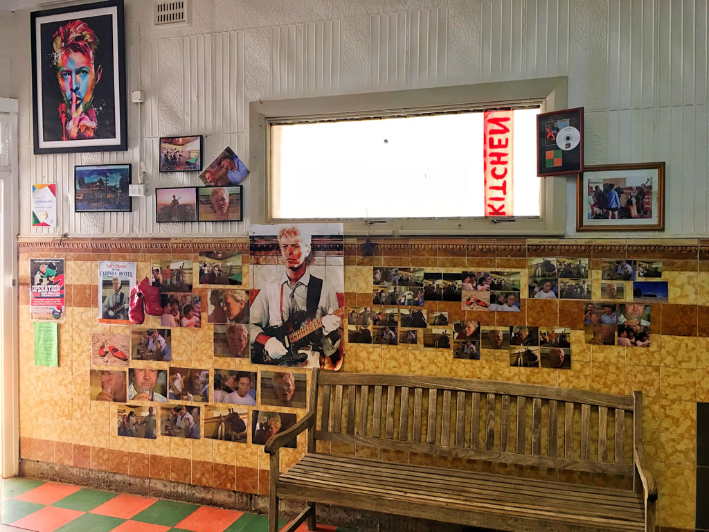
Carinda hotel was used in the David Bowie film clip for Let’s Dance. Amanda and I called in to Carinda Hotel and we absolutely and totally loved the place.
Our Pub Ratings
Vibe90%90%
Architecture50%50%
How Easy Is It To Get To?75%75%
Was The Beer Cold?100%100%
Did We Love It?100%100%
Location Map
About The Carinda Hotel
Years ago I was sitting on the lounge early one Sunday morning watching Rage and the film clip for David Bowies “Let’s Dance” came on and being a lover of both Bowie and country pubs I decided to look up where it was with the view to going there one of these days.
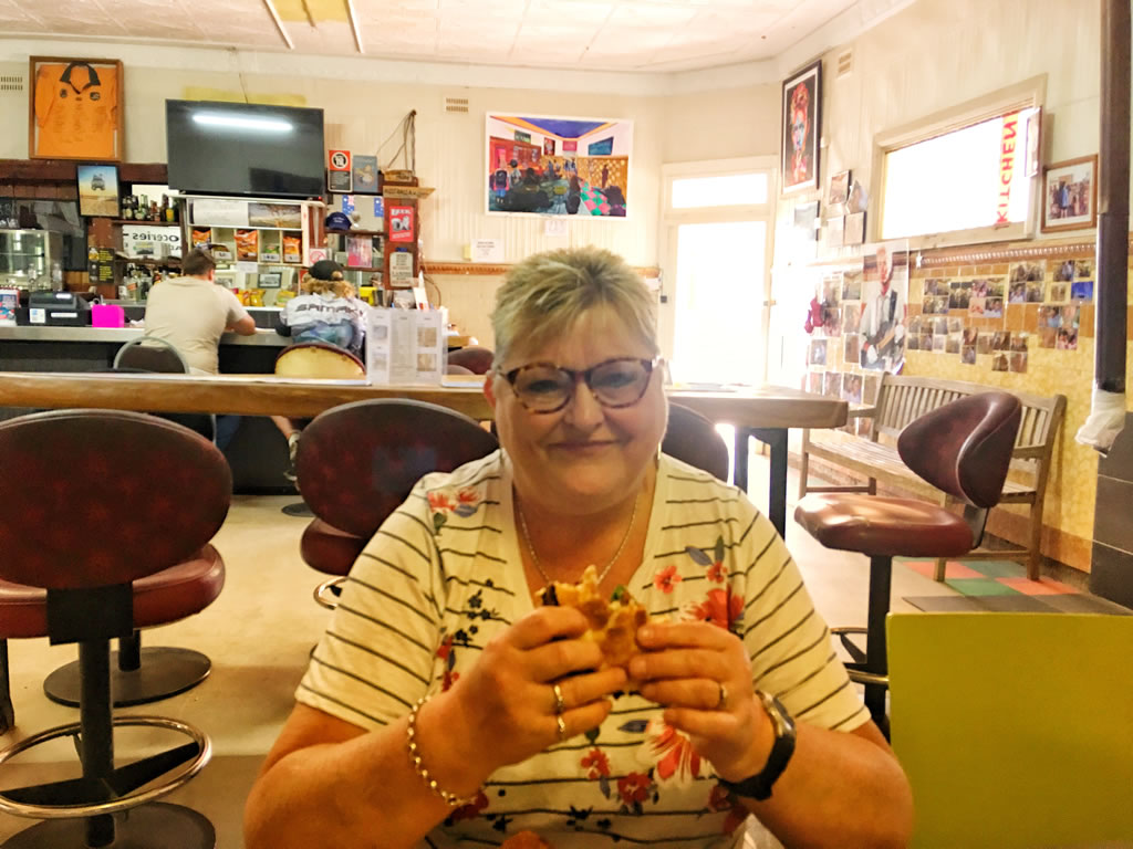
The hotel from the film clip is in a small town called Carinda, about 70ks from Walgett NSW. Amanda and I called in to Carinda Hotel and we loved the place. You could feel the history inside, it’s old, it’s a bit dishevelled but you wouldn’t want to change a single thing about it. Throw the David Bowie history in to the mix and well, just go there and see. I bet you can feel something. I did.
The Carinda Hotel publican Leanne was a lovely lady, very welcoming. The beers were icy cold and the lunch was bloody awesome. You can camp for free out the back of the pub, or if that’s full (pretty unlikely) there’s also free camping down the road at the showground. Well done Carinda and Carinda Hotel, the place is a 10 out of 10.
Let’s Dance Carinda Festival
The small rural town pays an annual tribute to legendary musician David Bowie when it hosts the annual Let’s Dance Carinda Festival over the October long weekend.
Up to 800 people are expected to attend Carinda Hotel for the next Let’s Dance Carinda Festival.
Let’s Dance Carinda Tribute Committee are in the throes of putting together a wonderful time for everyone to enjoy and hopefully lift the morale in the drought-stricken country.
Committee secretary Joy Dare said the inaugural event attracted about 200 people.
“Then there was about 450 people at the second event (in 2017) and this year we’re hoping it builds up to 800 people,” she said.
“People who couldn’t make it last year told us that they were sorry and are hoping to attend this year.”
Free showers, toilets and camping are accessible at the sports ground where the festival takes place. Breakfast will be available with a continuous barbeque during the weekend and meals at night. https://www.facebook.com/Lets-Dance-Carinda-303940966427490/
Carinda Races
Carindas’ biggest event of the year is its picnic race meeting held each July. Carinda and District Race Club has been racing since 1915 and stages a six race meeting every July. Outback racing at its best! All racing enthusiasts please put it in your diary. https://www.facebook.com/carindaraceclub/
Where’s Carinda Hotel?
Carinda Hotel is in the small regional NSW town of Carinda in central NSW about 70ks from Walgett NSW.